
Løvstakken via Manndomsprøven (06.11.2022)

Written by HHauser (Helwig Hauser)

| Start point | Krohnegården (160m) |
|---|---|
| Endpoint | Krohnegården (160m) |
| Characteristic | Hike |
| Duration | 2h 00min |
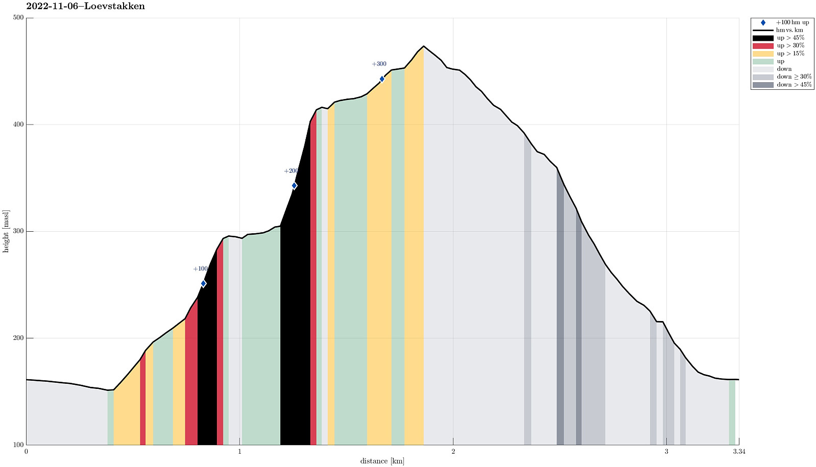
| Distance | 3.3km |
| Vertical meters | 340m |
| GPS |
|
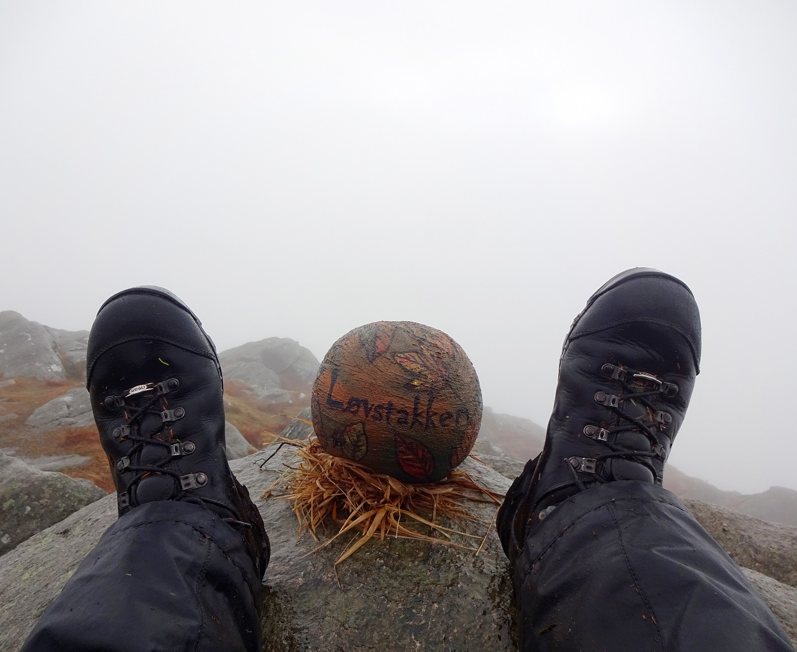
| Ascents | Løvstakken (478m) | 06.11.2022 |
|---|---|---|
| Visits of other PBEs | Krohnegården Sør p-plass (169m) | 06.11.2022 |
| Manndomsprøven (390m) | 06.11.2022 | |
| Nova (388m) | 06.11.2022 |
Trip Summary
Despite of the wet weather, I saw a chance to try out something interesting: Manndomsprøven on Løvstakken (who would have thought?! :-)). In April, 2022, another user of Peakbook, Knut Sverre, described his/their ascent to Løvstakken via Manndomsprøven, a particular place on the southwestern side of Løvstakken. I got inspired already then, but hadn't had the chance to try this route before. To get there, I parked along Krohnegården, northeast of Svartatjørna, and followed first Krohnegården back southwards, passing by Svartatjørna. Once passed the rather steep western side of Nova, I crossed Krohnegården and started my ascent via Bustingen, first. A little northeast of Rosenlundveien, I connected to the trail that leads steeply up to Løvstakken from Rosenlundveien. After following this trail for a short stretch (up to about 300mosl), I deviated from this trail towards the right (in southeastern direction), following a simple trail (or "trail", maybe). Staying roughly at about 300mosl, I soon later arrived at the lower end of the gully, which leads up to Manndomsprøven. Given the wet rock, I probably should have taken an even lower route to get into this gully. Once in the gully, ascending upwards was not too difficult (it's steep, though). Within not too long, I got to the see Manndomsprøven, which essentially is a big rock that blocks the ascent, at least temporarily. For a moment, I contemplated whether it was smart enough to do all this on a very wet day, but then I found out that getting up and above the rock-blockade was not too difficult. Still, I clearly recommend to choose a dry day, when possible. Once on top of the rock, I found out that there is a second, smaller step to take, before ascending further upwards is "straight-forward" again. All in all, no real climbing is necessary to traverse Manndomsprøven, but being not really short is helpful to kind of easily do the required steps upwards. Once up on the ridge, the remainder of this hike was easy, again. I paid Løvstakken a short visit, since I was up there, already, before then heading down, again, this time via Nova.
Photos
Selected photos are available as Google photo album.
Useful Resources
See also the related FB-page Hiking around Bergen, Norway.
Web page WestCoastPeaks.com provides useful information about Løvstakken.


User comments
Manndomsprøven Løvstakken
Written by knutsverre 07.11.2022 19:14Gratulerer med Manndomsprøven, Helwig! Artig variant til Løvstakken! Ikke de letteste forholdene i det været du hadde!
Re: Manndomsprøven Løvstakke
Written by HHauser 07.11.2022 21:46Takk, Knut Sverre, for inspirasjonen! Du er ikke bare virkelig god på å utforske interessante steder i området, du bruker også tid til å dokumentere dem fint (med tekst og bilder), sånt at andre kan følge i dine fotspor -- takk for det, óg!