
Stålet from Ytre Honningsvåg (10.07.2023)

Written by HHauser (Helwig Hauser)

| Start point | Ytre Honningsvåg (20m) |
|---|---|
| Endpoint | Ytre Honningsvåg (20m) |
| Characteristic | Hike |
| Duration | 2h 00min |
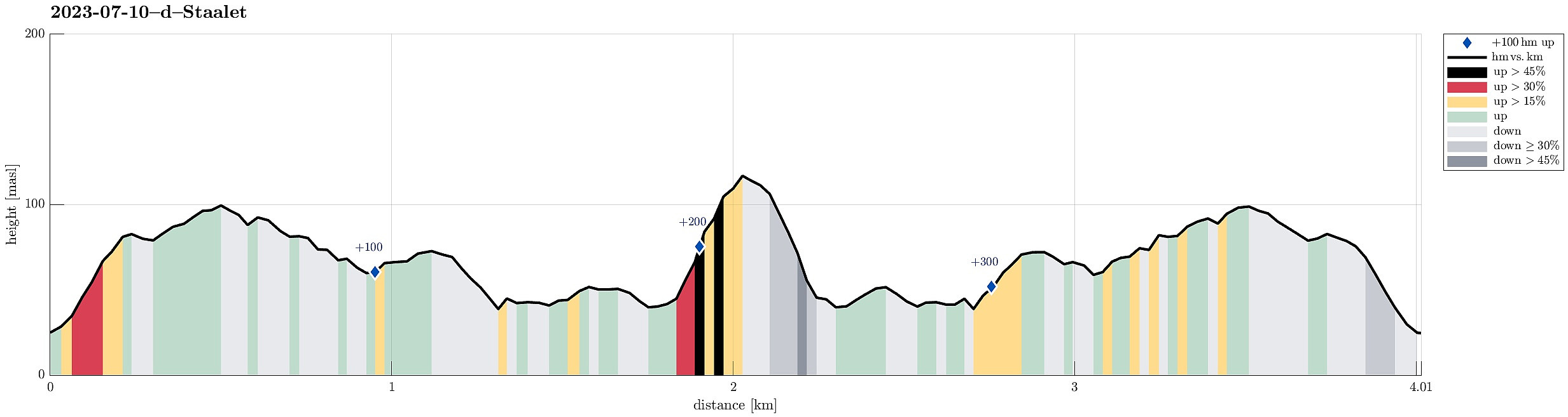
| Distance | 4.0km |
| Vertical meters | 385m |
| GPS |
|
| Ascents | Stålet (122m) | 10.07.2023 |
|---|
Trip Summary
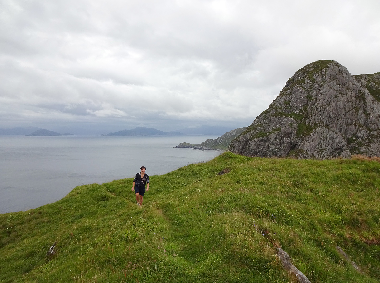
After not seeing much on Vestkapp, we continued to Honningsvågen to make an attempt at Stålet (as far north as you can get on Stadlandet, or so). We found a convenient place to park in Ytre Honningsvåg, right next to the trail head (place for about two cars). From there, we followed a marked trail that extends northwards from Ytre Honningsvåg, traversing the quite steep western slopes of Storebruna, Storeknausen, and Stålsegga at "half height" (or so). While this hike is not long and you also don't have to make many height meters, just the matter of fact that you traverse a relatively steep mountain side (basically all the way out and in), requires a bit of extra care. Also, if the condition should be wet, there may be risks to slip, which could be quite bad in the steepest sections. Last but not least, this hike is maybe not the best choice for anyone, who's afraid of heights. But otherwise :-) this really is a great option to experience the wild north of Stadlandet with many nice views! :-)
Photos
Selected photos are available as Google photo album.
Useful Resources
See also the related FB-page Hiking around Bergen, Norway.
Web page UT.no from the Norwegian Trekking Association recommends about the same hike.


User comments