
Vestkapp on Stadlandet (10.07.2023)

Skrevet av HHauser (Helwig Hauser)

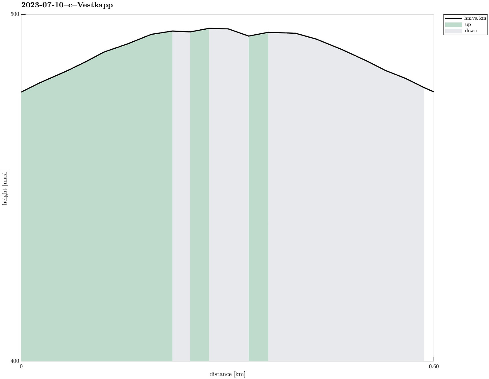
| Startsted | Vestkapp P (475moh) |
|---|---|
| Sluttsted | Vestkapp P (478moh) |
| Turtype | Spasertur |
| Turlengde | 0t 30min |
| Distanse | 0,6km |
| Høydemeter | 20m |
| GPS |
|
| Bestigninger | Kjerringa (497moh) | 10.07.2023 |
|---|
Trip Summary
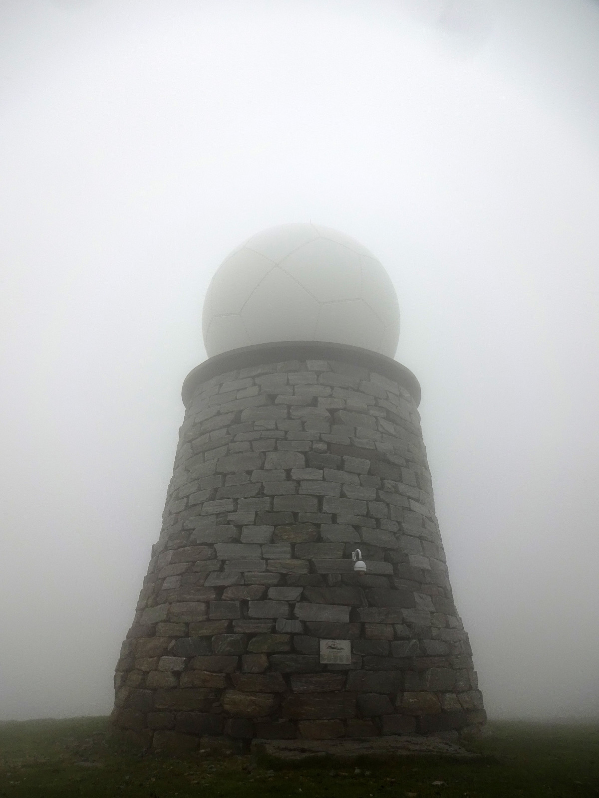
After first paying Vågsøy and Måløy a short visit, we continued to Stadlandet. Our first stop was Vestkapp on Kjerringa in the northwest of Stadlandet. Taking the road up to a parking spot quite close to the actual top, we eventually entered some very thick (and wet) clouds that enshrouded all of the top. Even just a few meters from the massive meteorological radar station on top of Kjerringa we had some difficulties to actually find and see it! :-) Since our views were extremely limited anyway (and it was quite a bit wet, also!), we decided to not stay there for any significant time, but return to our car soon, instead, with our next goal, Stålet, in front of us! :-)
Photos
Selected photos are available as Google photo album.
Useful Resources
See also the related FB-page Hiking around Bergen, Norway.


Kommentarer