
Flobjørn (27.06.2023)

Written by HHauser (Helwig Hauser)

| Start point | Bergsfjordveien (115m) |
|---|---|
| Endpoint | Bergsfjordveien (115m) |
| Characteristic | Hike |
| Duration | 3h 00min |
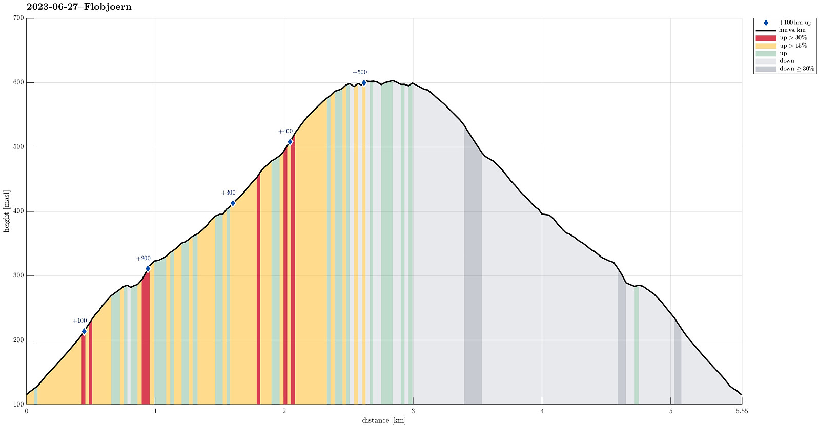
| Distance | 5.6km |
| Vertical meters | 530m |
| GPS |
|
| Ascents | Flobjørn (611m) | 27.06.2023 |
|---|
Trip Summary
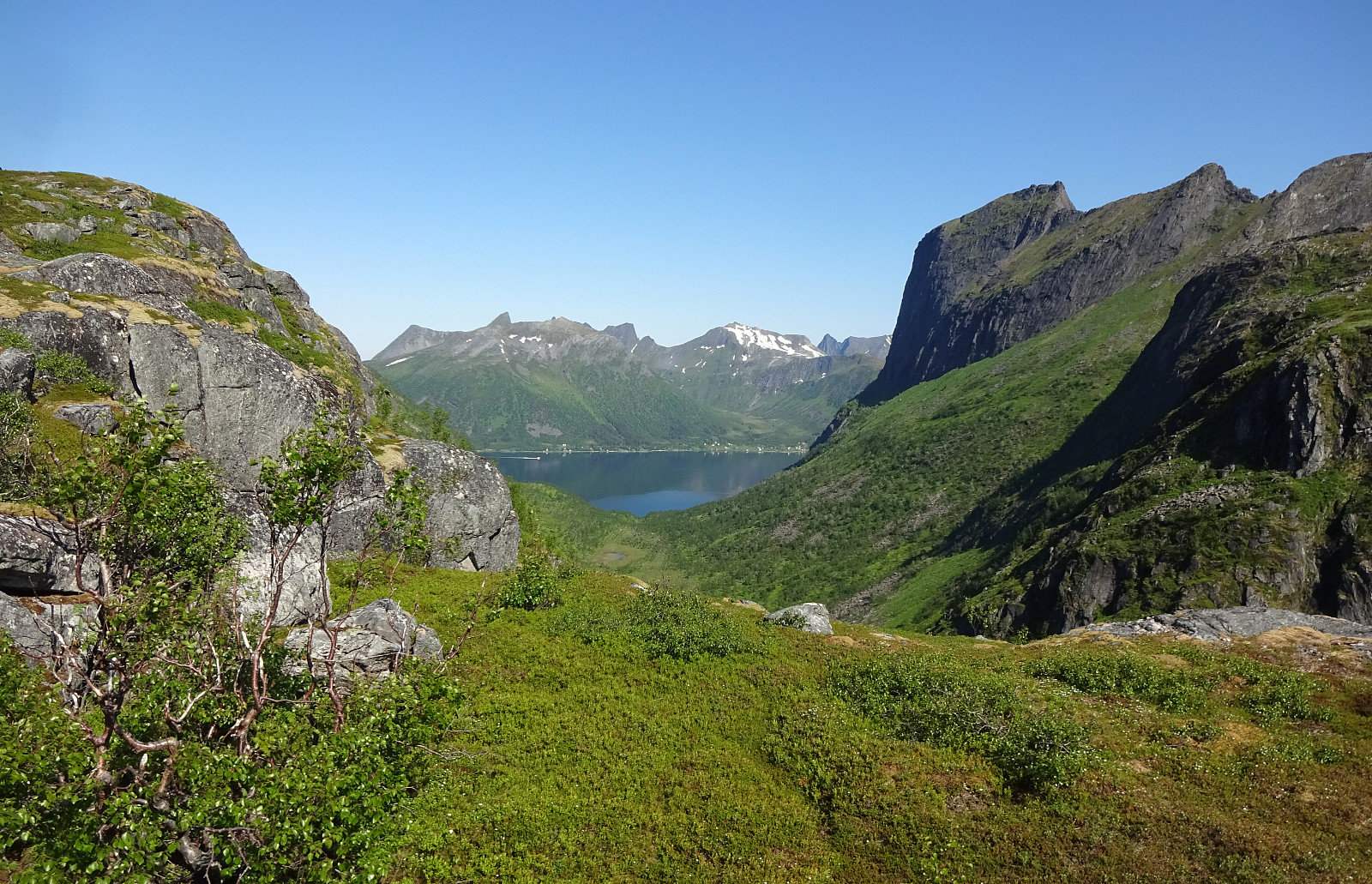
Since we also wanted to hike up Husfjellet in the evening/night, this day, we decided to take it a bit easier during noon-time. Following Bergsfjordveien (through the tunnel to Krokelvvatnet), we drove down Krokelvdalen towards Straumsbotn. Before getting all the way down, however, at about 115masl, we parked next to the road -- right next to the trailhead, also (while there isn't really a parking place, the street is widened there to ease the passing of cars; leaving as much as space as possible, we still found it OK to park there for a few hours). From there, it's then "just" following the marked trail up to Jøvikskaret, first, and then further up to Flobjørn. While this really is a very easy hike, one still gets wonderful views, especially from the top of Flobjørn! After having some nice time up on Flobjørn, we then walked down the same trail to get back to our car.
Photos
Selected photos are available as Google photo album.
Useful Resources
See also the related FB-page Hiking around Bergen, Norway.
Web page UT.no from the Norwegian Trekking Association recommends basically the same hike.


User comments