
Husfjellet and Litjebrusen (27.06.2023)

Skrevet av HHauser (Helwig Hauser)

| Startsted | Skaland (5moh) |
|---|---|
| Sluttsted | Skaland (5moh) |
| Turtype | Fottur |
| Turlengde | 3t 00min |
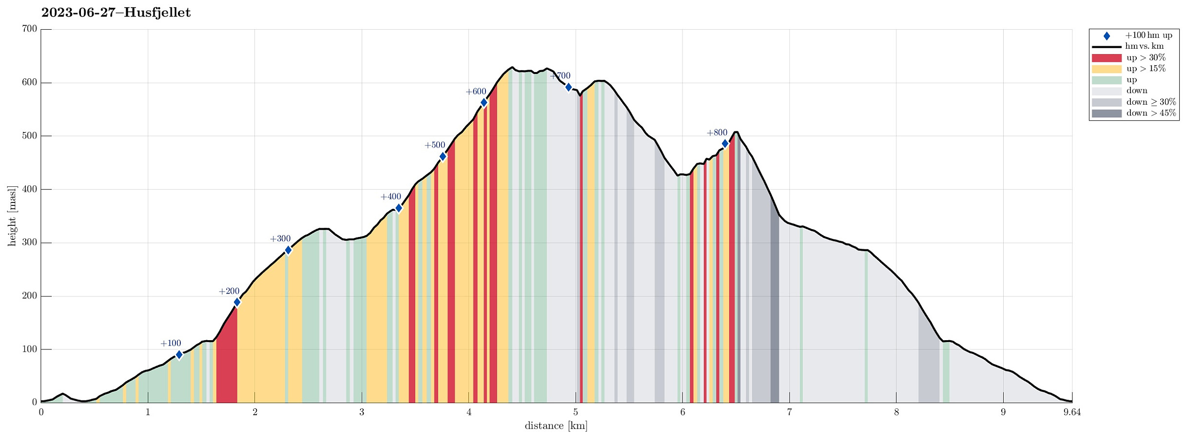
| Distanse | 9,7km |
| Høydemeter | 839m |
| GPS |
|
| Bestigninger | Husfjellet (632moh) | 27.06.2023 |
|---|---|---|
| Litjebrusen (522moh) | 27.06.2023 |
Trip Summary
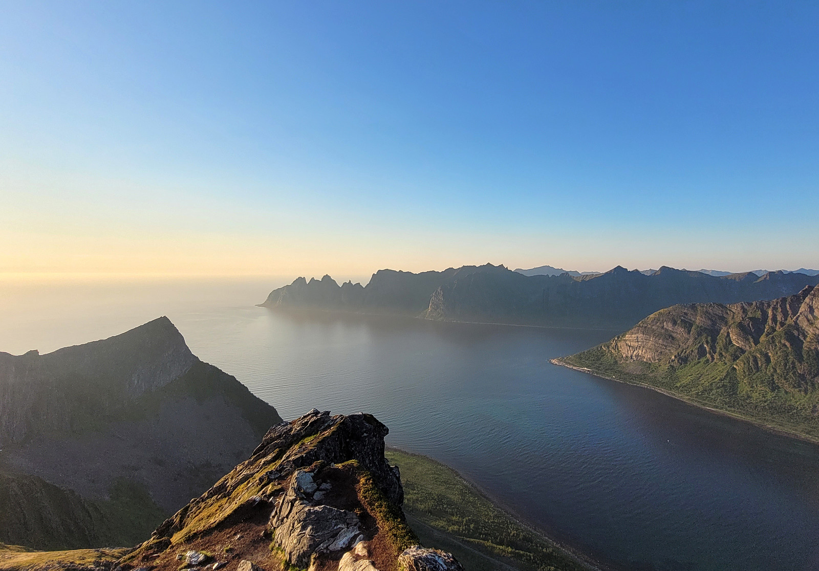
After looking at Husfjellet from Flobjørn, earlier the same day, we followed our plan to hike Husfjellet around midnight, exploiting the time of the year when the sun never sets at these latitudes. We parked near Berg church at Skaland and followed the marked trail up to Husfjellet. Up to about 115masl, this trail follows first a gravel road, before then continuing "straight up" on the western side of Sommardalen. On Sommardalhaugen, at about 325masl, then one can enjoy some nice views, already. The continuation towards the ridge that leads up to Rismåltua, which leads across some wet grounds in the uppermost parts of Sommardalen, has suffered by now from the many visitors that have hiked up here. It really looks that some protection, maybe with wooden planks, or the like, would be good for this part of the trail. Once on harder ground, again, the ascent to Rismåltua, between Litjebrusen (in the east) and Husfjellet (in the north / northwest) is straight-forward and easy. Also the continuation from Rismåltua to Husfjellet is easy and nice. From Husfjellet one can enjoy many wonderful views (in all directions!), especially also in the late sun! Clearly, this was nice to do, also at this time of the day (night). While the first (and marked) top-point on Husfjellet is easy to reach, there are a few additional spots (with amazing views!) that are a bit more exposed. Sure it's good to consciously choose whether to include these spots, or not. :-) After having some good time on the top of Husfjellet, we started our descent by first walking a bit into the direction of Kobben (just far enough to look down to Bøstranda, though). From there, we walked back to Rismåltua. Two of us also wished to include Litjebrusen and thus continued further along the ridge (there's a nice trail, also!). While one easily gets to a nice "pre-top" of Litjebrusen (at about 500masl), it's a bit more exposed to reach the actual top of Litjebrusen (at 522masl). From Litjebrusen, it was then just down the ridge to Ersvikskaret and from there further down via Sommardalen. The vegetation in Sommardalen also appears to be quite fragile -- walking "around" (via Sommardalhaugen, first) and down the main trail is probably the responsible way of descending there. Once back on the main trail, it's then just down the same trail, again...
Photos
Selected photos are available as Google photo album.
Useful Resources
See also the related FB-page Hiking around Bergen, Norway.
Web page UT.no from the Norwegian Trekking Association recommends a similar hike.


Kommentarer