Archiv - Nach Datum
Archiv - Nach Aktivität
-
Andere Tour (3)
- Kayaking (3)
-
Fahrradtour (110)
- Fahrradtour Straße (85)
- Fahrradtour gemischt (25)
-
Fahrzeugtour (9)
- Autotour (9)
-
Fußtour (1884)
- Bergtour (1114)
- Jogging (1)
- Spaziergang (59)
- Wanderung (710)
-
Skitour (116)
- Langlauf (47)
- Tourenskilauf (69)
Gesammelte Listen
-
Utvalgte topper og turmål i Bergen
(348/349)
 99%
99% -
Alle topper i Bergen
(391/398)
98%
-
Voss ≥ 100m pf.
(96/98)
97%
-
Opptur Hordaland
(144/159)
90%
-
Stasjoner på Bergensbanen
(33/40)
82%
-
Ulvik ≥ 100m pf.
(28/38)
73%
-
Hordaland ≥ 100m pf.
(622/863)
72%
-
Mjølfjell PF > 100m
(21/31)
67%
-
Jondal ≥ 100m pf.
(15/23)
65%
-
Dagsturhyttene i Vestland
(36/61)
59%
-
Sunnhordland PF >= 100m
(105/186)
56%
-
Hordaland: Hardanger PF>=100m
(194/359)
54%
-
DNT-hytter i Hordaland
(23/45)
51%
-
Kvinnherad ≥ 100m pf.
(40/79)
50%
-
Eidfjord ≥ 100m pf.
(13/42)
30%
-
Sogndal ≥ 100m pf.
(23/81)
28%
-
Gulen ≥ 100m pf.
(15/54)
27%
-
Vik i Sogn ≥ 100m pf.
(10/46)
21%
-
Sogn - Sør for Sognefjorden PF>=100m
(31/159)
19%
-
DNT-hytter i Sogn og Fjordane
(8/47)
17%

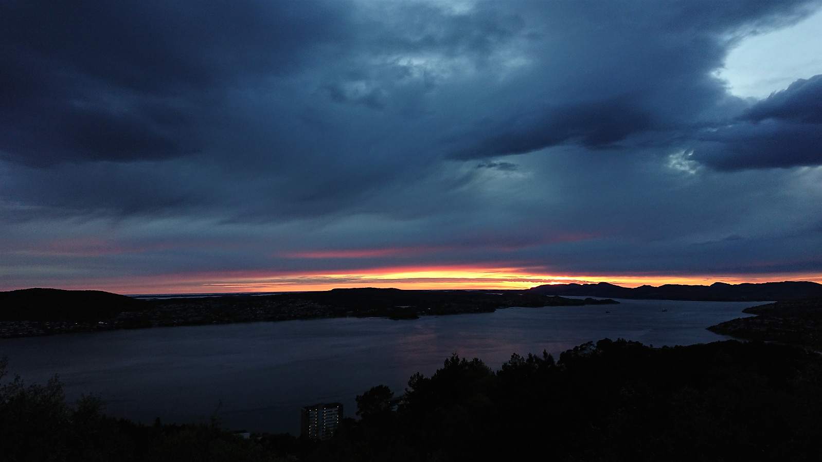
Munkebotn and Ørneberget
- Datum:
- 03.06.2021
- Tourcharakter:
- Bergtour
- Tourlänge:
- 1:45h
- Entfernung:
- 8,5km
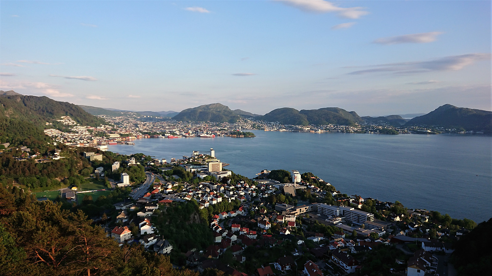 Local evening hike.
Ørneberget, Rognåsen and Håmanen
- Datum:
- 02.06.2021
- Tourcharakter:
- Bergtour
- Tourlänge:
- 2:27h
- Entfernung:
- 7,6km
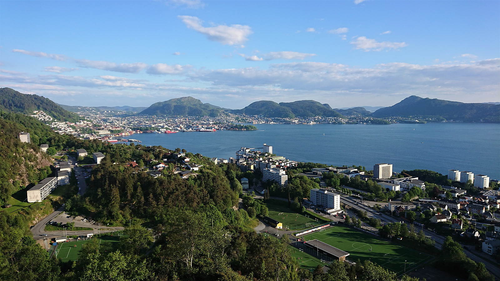 Local evening hike.
Ørneberget and Ørneberget NV
- Datum:
- 27.05.2021
- Tourcharakter:
- Bergtour
- Tourlänge:
- 0:56h
- Entfernung:
- 4,1km
 Short local evening hike.
Ørneberget and Rognåsen
- Datum:
- 26.05.2021
- Tourcharakter:
- Bergtour
- Tourlänge:
- 1:53h
- Entfernung:
- 5,9km
 Short local evening hike.
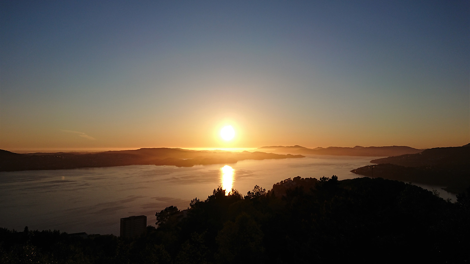
Ørneberget and Ørneberget NV
- Datum:
- 25.05.2021
- Tourcharakter:
- Bergtour
- Tourlänge:
- 1:28h
- Entfernung:
- 3,6km
 Short local late evening hike with a longer break at Ørneberget NV to catch the sunset.
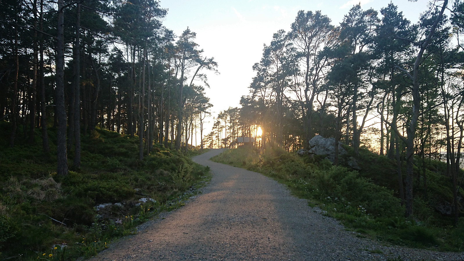
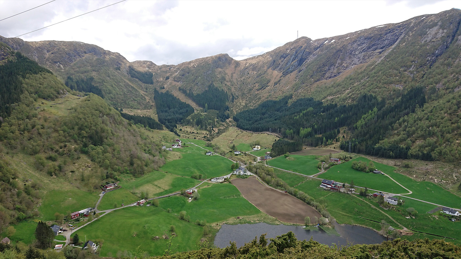
Træshovden and Svartaberget
- Datum:
- 20.05.2021
- Tourcharakter:
- Bergtour
- Tourlänge:
- 1:31h
- Entfernung:
- 4,5km
 Short evening hike with the main goal of visiting Træshovden . Instead of taking the most direct route to the summit, I first followed a trail along the ridge west of Ravnestølen, which later connected with the main trail to the summit. Overall relatively limited views from this minor detour, except for at the start when one could look back at Svartaberget and Lyderhorn . There was also one spot with good views towards the west, which is more than can be said of the summit of Træshovden.
After returning to Ravnestølen, I made a revisit of Svartaberget, given that the views on my previous visit had been far from optimal. Today there were close to no clouds and I could fully enjoy the spectacular panoramic views! From the summit, I followed a trail towards the northern starting point of Knappetunnelen, passing by two of the >>>
Short evening hike with the main goal of visiting Træshovden . Instead of taking the most direct route to the summit, I first followed a trail along the ridge west of Ravnestølen, which later connected with the main trail to the summit. Overall relatively limited views from this minor detour, except for at the start when one could look back at Svartaberget and Lyderhorn . There was also one spot with good views towards the west, which is more than can be said of the summit of Træshovden.
After returning to Ravnestølen, I made a revisit of Svartaberget, given that the views on my previous visit had been far from optimal. Today there were close to no clouds and I could fully enjoy the spectacular panoramic views! From the summit, I followed a trail towards the northern starting point of Knappetunnelen, passing by two of the >>>
Svelihovden and Såbotshaugen
- Datum:
- 18.05.2021
- Tourcharakter:
- Bergtour
- Tourlänge:
- 2:44h
- Entfernung:
- 7,9km
 We parked at Kvamsvegen P-plass and from there followed the gravel road up to Kvamsstølen. Here we passed through a gate and continued northwest on what was most likely the old road to Kvamsstølen. At Høgaleitet, southeast of the unnamed 243 hill, we turned west and followed a tractor road northwest towards the trail to Norhytten . However, we got fooled by the trail indicated on the map and continued too far along the tractor road. Instead of retracing our steps to locate the missed exit, we went for a shortcut following a deer track through the semi-dense vegetation, and had to climb a fence.
When walking south along the fence we soon came across the gate we should have passed through, with clear trails in both directions. I took the short detour back through the gate to figure out where we had missed our exit. The >>>
We parked at Kvamsvegen P-plass and from there followed the gravel road up to Kvamsstølen. Here we passed through a gate and continued northwest on what was most likely the old road to Kvamsstølen. At Høgaleitet, southeast of the unnamed 243 hill, we turned west and followed a tractor road northwest towards the trail to Norhytten . However, we got fooled by the trail indicated on the map and continued too far along the tractor road. Instead of retracing our steps to locate the missed exit, we went for a shortcut following a deer track through the semi-dense vegetation, and had to climb a fence.
When walking south along the fence we soon came across the gate we should have passed through, with clear trails in both directions. I took the short detour back through the gate to figure out where we had missed our exit. The >>>
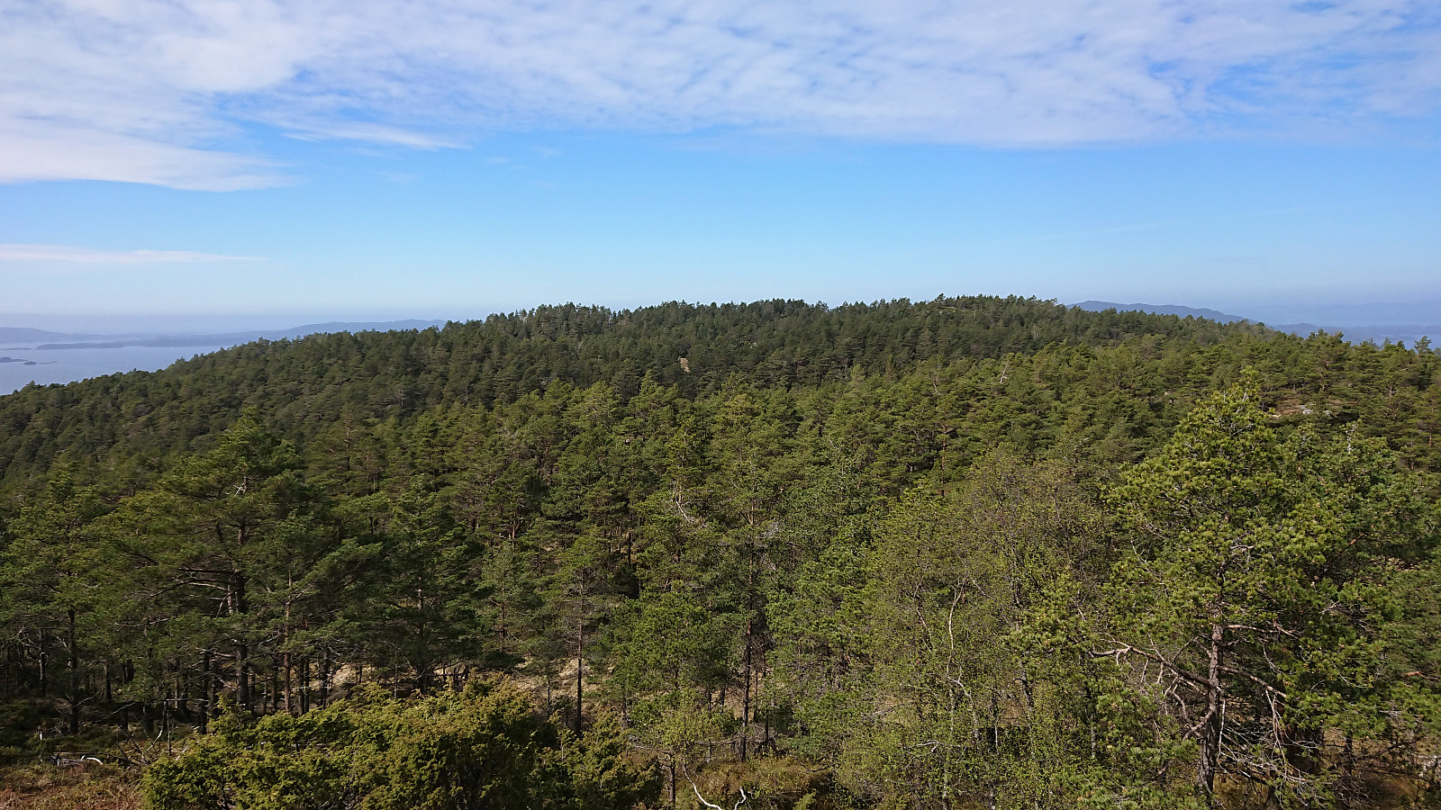
Kistehaugen, Høgehaugen and Klubben
- Datum:
- 16.05.2021
- Tourcharakter:
- Bergtour
- Tourlänge:
- 2:41h
- Entfernung:
- 11,3km
 Another hike in the footsteps of Kjell51 (Kjell Øijorden) . This time exploring the small hills west of Gaupåsvatnet. I started by taking the bus and getting off at the stop called Spåkevegen. From there I easily located the old road taking me up towards Lyskasterbatteriet på Gaupåsen . On the way there I made a short off-trail visit of Kistehaugen to the south, which included a bit of backtracking as I realized too late that I ought to head there first, but was otherwise straightforward. Kistehaugen even included its own trig marker, however the views were very limited.
Next up was Lyskasterbatteriet. An interesting location with the remains of old military installations, and with fitting live sound effects from the shooting range just north of Arnavegen. From there I continued towards Høgehaugen on a surprisingly good trail, albeit with limited views. The trail passed >>>
Another hike in the footsteps of Kjell51 (Kjell Øijorden) . This time exploring the small hills west of Gaupåsvatnet. I started by taking the bus and getting off at the stop called Spåkevegen. From there I easily located the old road taking me up towards Lyskasterbatteriet på Gaupåsen . On the way there I made a short off-trail visit of Kistehaugen to the south, which included a bit of backtracking as I realized too late that I ought to head there first, but was otherwise straightforward. Kistehaugen even included its own trig marker, however the views were very limited.
Next up was Lyskasterbatteriet. An interesting location with the remains of old military installations, and with fitting live sound effects from the shooting range just north of Arnavegen. From there I continued towards Høgehaugen on a surprisingly good trail, albeit with limited views. The trail passed >>>
Lauvåsen from Lønborg
- Datum:
- 15.05.2021
- Tourcharakter:
- Bergtour
- Tourlänge:
- 3:18h
- Entfernung:
- 13,6km
 After Kjell51 (Kjell Øijorden) 's recent "discovery" of Lauvåsen , I of course had to make a visit. I started by walking along the roads from Lønborg to the unmarked trailhead right next to Vinddalsveien P-lomme . The trail was initially a bit weak, but soon it was easy enough to follow. I think I missed an exit somewhere though, as the trail I was on did not head towards the summit. I therefore made an off-trail shortcut and soon reconnected with a trail that took me all the way to the summit, which provided nice views, especially west across Jordalsvatnet and Eidsvåg.
From the summit, I continued along the trail to the overhead power line to the south, where there was an excellent overview of Jordalen. Here I noticed that the trail continued east, and I saw an opportunity for an alternative route back to the road. Shortly I reached >>>
After Kjell51 (Kjell Øijorden) 's recent "discovery" of Lauvåsen , I of course had to make a visit. I started by walking along the roads from Lønborg to the unmarked trailhead right next to Vinddalsveien P-lomme . The trail was initially a bit weak, but soon it was easy enough to follow. I think I missed an exit somewhere though, as the trail I was on did not head towards the summit. I therefore made an off-trail shortcut and soon reconnected with a trail that took me all the way to the summit, which provided nice views, especially west across Jordalsvatnet and Eidsvåg.
From the summit, I continued along the trail to the overhead power line to the south, where there was an excellent overview of Jordalen. Here I noticed that the trail continued east, and I saw an opportunity for an alternative route back to the road. Shortly I reached >>>
Nesevarden, Kleppavarden and Hovåsen from Kongsviktjørna
- Datum:
- 13.05.2021
- Tourcharakter:
- Bergtour
- Tourlänge:
- 1:51h
- Entfernung:
- 5,1km
 After finally arriving at the marked trailhead next to Kongsviktjørna, I left my bike behind (see separate report for the cycling here: Cycling: Neshamn ) and continued on foot along a very nice marked trail. It therefore did not take long before I arrived at Nesevarden , which provided very nice views, especially towards the south. The marked trail continued north/northwest to Kleppavarden , but the trail markers were here further apart and the trail quality also dropped a bit, with a several wet areas that had to be crossed. The summit of Kleppavarden was still reached without any issues. Limited views from the large cairn, but if moving just north of the summit pretty good view across Reksteren could be obtained, although today slightly reduced due to a haze left over from the low-hanging clouds earlier in the day.
After a quick >>>
After finally arriving at the marked trailhead next to Kongsviktjørna, I left my bike behind (see separate report for the cycling here: Cycling: Neshamn ) and continued on foot along a very nice marked trail. It therefore did not take long before I arrived at Nesevarden , which provided very nice views, especially towards the south. The marked trail continued north/northwest to Kleppavarden , but the trail markers were here further apart and the trail quality also dropped a bit, with a several wet areas that had to be crossed. The summit of Kleppavarden was still reached without any issues. Limited views from the large cairn, but if moving just north of the summit pretty good view across Reksteren could be obtained, although today slightly reduced due to a haze left over from the low-hanging clouds earlier in the day.
After a quick >>>
