
Kattnakken (15.04.2008)

Skrevet av HHauser (Helwig Hauser)

| Startsted | E39 (40moh) |
|---|---|
| Sluttsted | E39 (40moh) |
| Turtype | Fjelltur |
| Turlengde | 3t 00min |
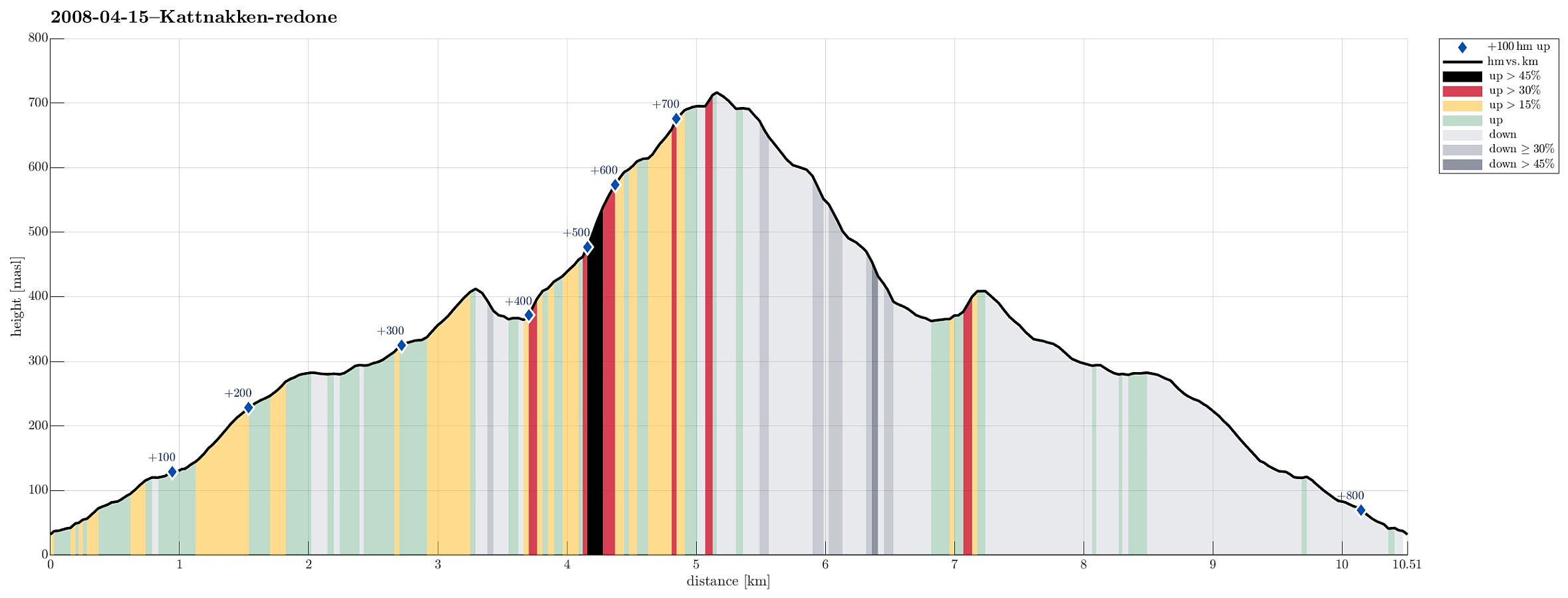
| Distanse | 10,5km |
| Høydemeter | 798m |
| GPS |
|
| Bestigninger | Kattnakken (723moh) | 15.04.2008 |
|---|---|---|
| Andre besøkte PBE'er | Børtveit bom parkering (85moh) | 15.04.2008 |
Note that this track has been created a posteriori, i.e., from memory, not automatically recorded.
Trip Summary
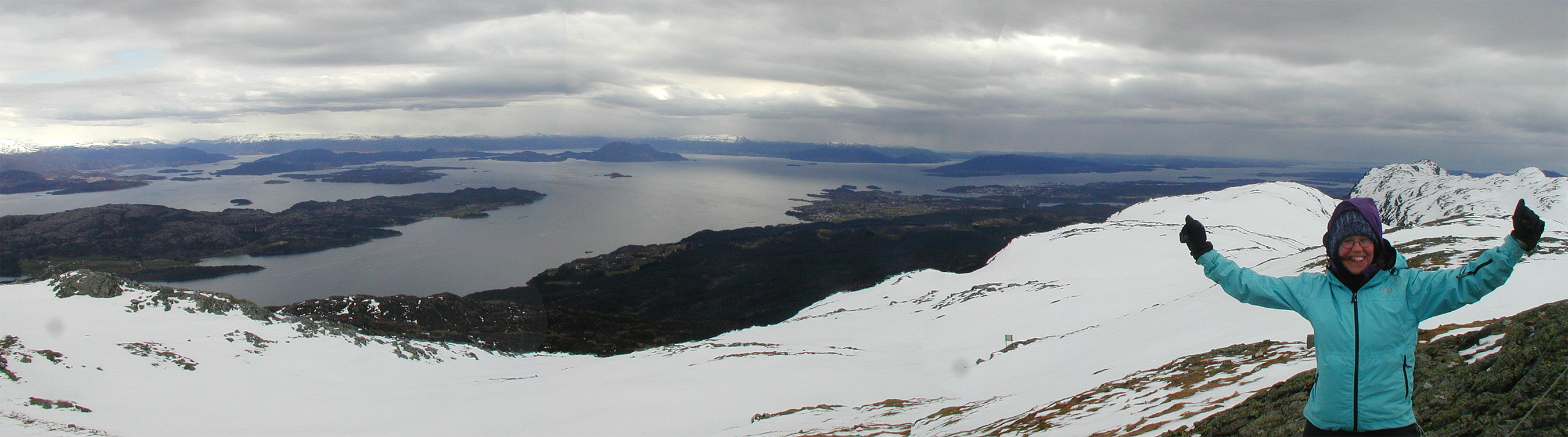
Wonderful tour with quite a bit of snow up and down Kattnakken on Stord.


Kommentarer