
Exploring Suomenlinna south of Helsinki (12.07.2025)

Skrevet av HHauser (Helwig Hauser)

| Startsted | Suomenlinna ferry-quay (1moh) |
|---|---|
| Sluttsted | Suomenlinna ferry-quay (1moh) |
| Turtype | Spasertur |
| Turlengde | 2t 30min |
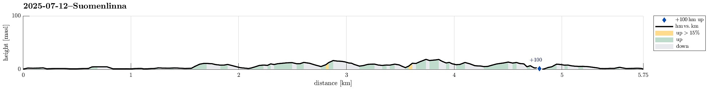
| Distanse | 5,8km |
| Høydemeter | 115m |
| GPS |
|
| Andre besøkte PBE'er | Suomenlinna (10moh) | 12.07.2025 |
|---|---|---|
| Suomenlinna ferry-quay (0moh) | 12.07.2025 |
Trip Summary
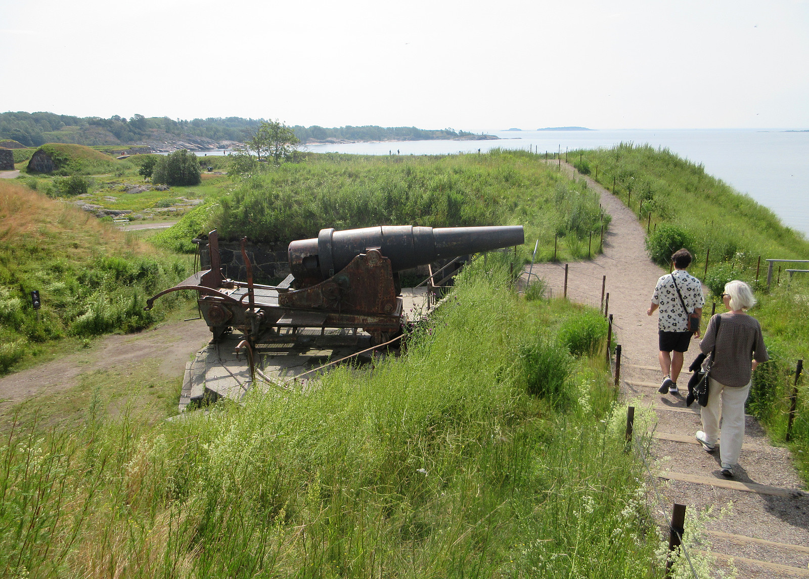
Our travel itinerary included about 24 hours in Helsinki before the follow-up flight further west. Exploiting our massive time confusion -- 6 am in Helsinki was like noon-time in Tokyo, after all -- we headed straight for the city center of Helsinki and from their, using the public ferry, to Suomenlinna, i.e., an island a bit south of the center of Helsinki, which previously was fortified massively. Today, quite a few visit this island, apparently, to see these fortifications. Before mostly following the "main-trail" across the island, we included a short detour to Pikku-Musta and Länsi-Musta, also. At the southern-most part of Suomenlinna, we then made a round around the fortifications before head back to the ferry quay where we had arrived earlier.
Photos
Selected photos are available as Google photo album.
Useful Resources
See also the related FB-page Hiking around Bergen, Norway.


Kommentarer