
Mixed excursion to Frotveit (31.05.2025)

Skrevet av HHauser (Helwig Hauser)

| Startsted | Varden (45moh) |
|---|---|
| Sluttsted | Varden (45moh) |
| Turtype | Blandet sykling |
| Turlengde | 5t 00min |
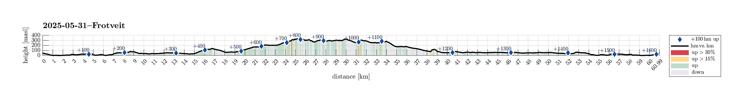
| Distanse | 61,0km |
| Høydemeter | 1621m |
| GPS |
|
| Bestigninger | Meåsen (311moh) | 31.05.2025 |
|---|---|---|
| Tempelet (123moh) | 31.05.2025 | |
| Ytstafjellet (332moh) | 31.05.2025 | |
| Øvsttuntoppen (148moh) | 31.05.2025 | |
| Andre besøkte PBE'er | Birkehaug (privat) (281moh) | 31.05.2025 |
| Frotveit p-plass (kr) (256moh) | 31.05.2025 | |
| Hardyhytten (ruin) (277moh) | 31.05.2025 | |
| Linken (297moh) | 31.05.2025 | |
| Myrdal parkering (80moh) | 31.05.2025 | |
| Siljustøl parkering (64moh) | 31.05.2025 | |
| St. Hanshaug søyle (127moh) | 31.05.2025 | |
| Stendafjellet p-plass (59moh) | 31.05.2025 | |
| Straume bro (5moh) | 31.05.2025 | |
| Totland p-plass (287moh) | 31.05.2025 | |
| Utledalen p-plass (170moh) | 31.05.2025 | |
| Wallhall (privat) (303moh) | 31.05.2025 |
Trip Summary
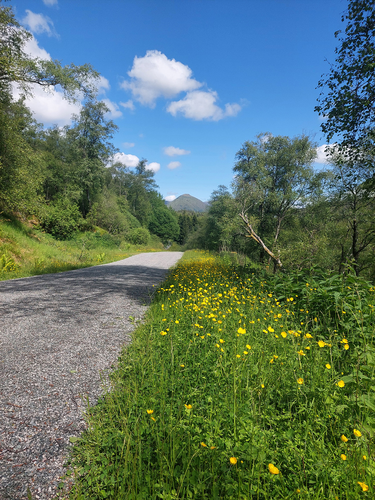
Given the nice Saturday, it was just to get some fresh air! I took my bike and started in southern direction. After passing Steinsvik, I then connected to Lagunen. My attempt to continue further towards Nesttun from there, was inhibited by some road work, making me cycle around Apeltunvatnet, instead. From Nesttun, I then connected to Øvsttun, where I explored the highest point. Thereafter, my goal was to bike up to Totland to do some more exploration. I left my bike at the parking lot at the end of Totlandsvegen and ascended to the hill in the west of it. Once up there, I decided that I could simply traverse the heights in order to get via Kollifjellet tp Ytstafjellet. After doing that, I returned via the forest road that apparently is used as a skiing track in winter. Once down to Wallhall, I walked around Kollifjellet in order to look at Linken and Hardyhytten. While Linken is clearly in very good shape, Hardyhytten has had its best days a long time ago -- falling into pieces, as it seems. I then reconnected with Totlandsvegen, which was a bit steep at the very end. Once back to my bike, I continued towards Bontveitvegen, using a nice gravel road that also is used as skiing track in winter. As soon as I was down to Bontveitvegen, I parked my bike again in order to include a short excursion over Meåsen. My idea had been to first get up to the saddle in the south of Meåsen, but crossing the waters between the road and the hillside was a bit more tricky than first thought. After a bit of back and forth, however, I found a way and then getting up to the saddle was actually straight forward (almost like stepping on a previously used trail). Crossing over Meåsen (in northwards direction) was then straight forward and easy. I first thought to descend right back to where my bike waited, but then avoided the areas with several horses and instead used the road from Frotveit. Soon I was back on my bike and then chose to bike down the valley via Hestabotshaugen (parallel to the main road). All this went pretty well and soon I was down at Kalandsvatnet. Before getting all the way down to Osvegen, however, I included a short detour up to Tempelet, enjoying some nice views over Kalandsvatnet from up there. To get back, I decided to make a round around Kalandsvatnet via Kismul using the abandoned tracks of the train there. All in all, a nice excursion on a nice day! :-)
Photos
Selected photos are available as Google photo album.
Useful Resources
See also the related FB-page Hiking around Bergen, Norway.


Kommentarer