
Hånipa from Reigstad (19.04.2025)

Skrevet av HHauser (Helwig Hauser)

| Startsted | Reigstad (55moh) |
|---|---|
| Sluttsted | Reigstad (55moh) |
| Turtype | Fjelltur |
| Turlengde | 2t 30min |
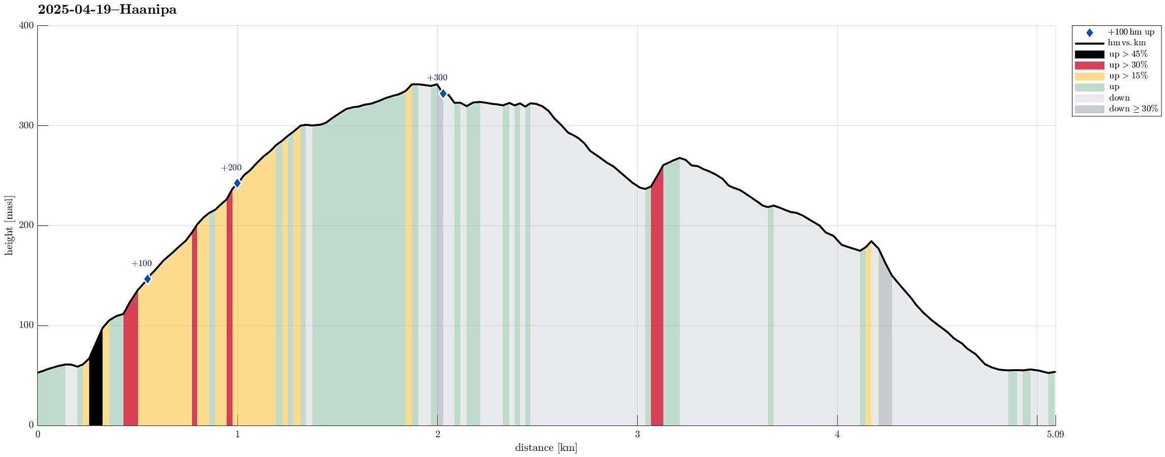
| Distanse | 5,1km |
| Høydemeter | 380m |
| GPS |
|
| Bestigninger | Hånipa (346moh) | 19.04.2025 |
|---|
Trip Summary
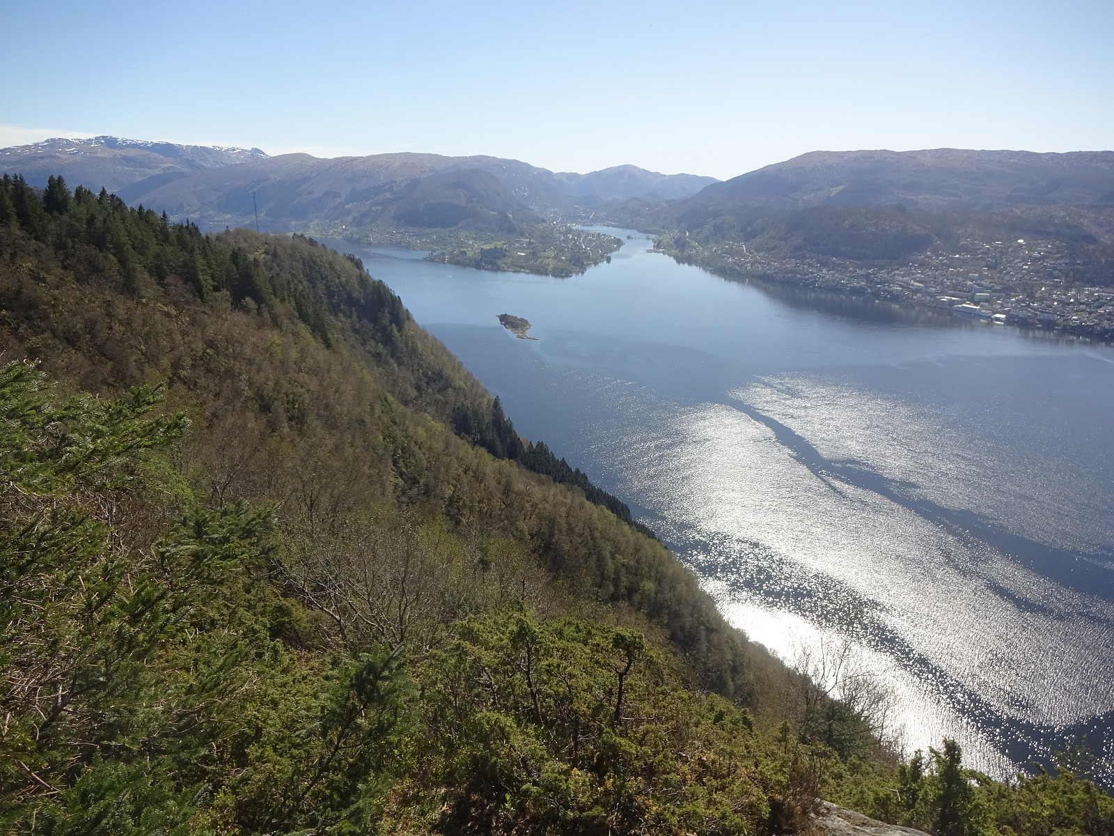
After taking the ferry from Breistein to Valestrand on Osterøy, we drove a bit further southwards and parked near Reigstad. We then followed the main trail across the northern ridge of Reigstadfjellet southwards to get up to Hånipa. We then continued along the high ridge, high above Sørfjorden, a bit more southwards, before turning left and descending into Reigstaddalen, following the main trail. Due to some major forest works, which had impacted the forest road through Reigstaddalen significantly, we then decided to follow Geitryggen instead of staying in the valley for getting back. About half way down, however, we still connected back with the forest road through Reigstaddalen. Somehow, without fully sinking into all the mud, we still made it back down and back to the car! :-) All in all, we much enjoyed the beautiful spring day!
Photos
Selected photos are available as Google photo album.
Useful Resources
See also the related FB-page Hiking around Bergen, Norway.
Petter Bjørstad has a useful page about Erstadfjellet and also web page WestCoastPeaks.com provides useful information about Stemmeseggi, Erstadfjellet, and Hånipa.
Web page UT.no from the Norwegian Trekking Association recommends a similar hike.


Kommentarer