
Rax from Preiner Gscheid (15.07.2024)

Skrevet av HHauser (Helwig Hauser)

| Startsted | Preiner Gscheid (1070moh) |
|---|---|
| Sluttsted | Preiner Gscheid (1070moh) |
| Turtype | Fottur |
| Turlengde | 6t 30min |
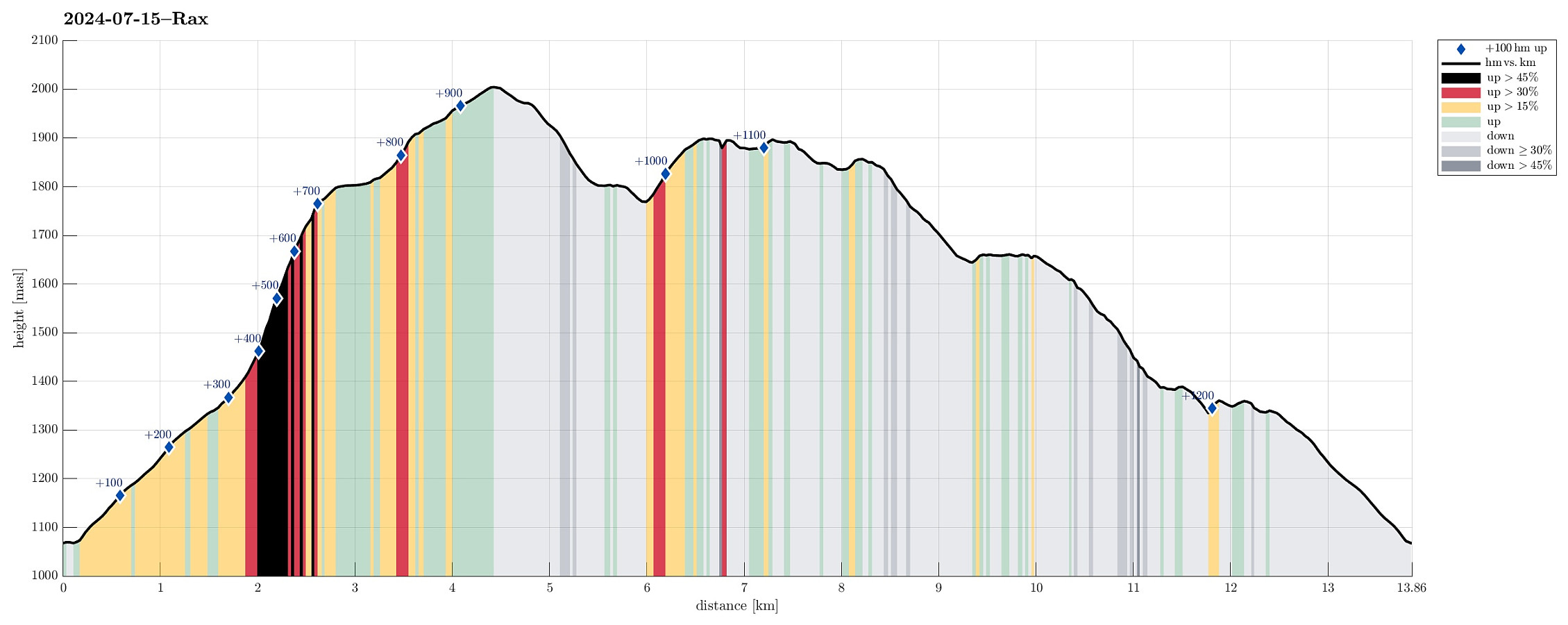
| Distanse | 13,9km |
| Høydemeter | 1235m |
| GPS |
|
| Bestigninger | Heukuppe (2007moh) | 15.07.2024 |
|---|---|---|
| Andre besøkte PBE'er | Karl-Ludwig-Haus (1804moh) | 15.07.2024 |
| Neue Seehütte (1643moh) | 15.07.2024 | |
| Predigtstuhl (1899moh) | 15.07.2024 | |
| Preiner Gscheid parking (1070moh) | 15.07.2024 | |
| Raxkircherl (1808moh) | 15.07.2024 | |
| Waxriegelhaus (1361moh) | 15.07.2024 |
Trip Summary
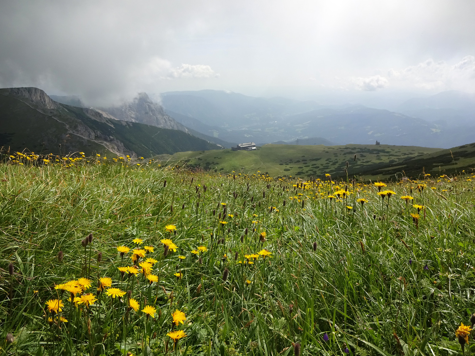
The weather looked promising (fine enough) to attempt the Rax, south of Wien. Starting early, we arrived at Preiner Gscheid (about 1070 masl) at about 8h30 in the morning. To make height meters quickly, we ascended (mostly northwards) along the skiing track that comes down in parallel to Rettenbach (in the northeast). At about 1340 masl (just a short distance from Waxrieglhaus in the east), we then entered Karlgraben in order to ascend (steeply) to Karl-Ludwig-Haus. We arrived at the Rax-heights at Thörl, before then walking over to Karl-Ludwig-Haus. From there, it's an easy stroll to Raxkircherl at Wetterkogel. Further upwards, we continued to Heukuppe via Schneegrubensattel. From there, we then returned to Karl-Ludwig-Haus, where we enjoyed a nice break with something to eat and drink. Instead of descending similarly to where we had come up, first, we then decided to also visit Predigtstuhl to enjoy some great views from there. Via Trinksteinsattel, we then descended to Neue Seehütte in the northeast of Predigtstuhl. Following the Göbl-Kühn-Steig, we then aimed at Waxrieglhaus. Only very shortly before reaching Waxrieglsteig, however, we got mislead down Bachleitensteig (instead of continuing "straight"). Only some 30 height meters further down, we understood our "mistake", where the Wiener Alpenbogen crossed our trail. Following this Wiener Alpenbogen (towards the west), brough us to Waxrieglhaus without any difficulties. After another short break at Waxrieglhaus, we then crossed Rettenbach to get "back" to the skiing track, which we had stepped up earlier in the morning. To get back to the car, we just descended again along this skiing track. All in all, this hike across Rax was really very nice and indeed the weather did not disappoint us! :-)
Photos
Selected photos are available as Google photo album.
Useful Resources
See also the related FB-page Hiking around Bergen, Norway.


Kommentarer