
Ascending Ras Bwahit (25.11.2018)


Skrevet av Solan (Atle Solholm)

| Startsted | Chenneck Camp (3620moh) |
|---|---|
| Sluttsted | Chenneck Camp (3620moh) |
| Turtype | Fjelltur |
| Turlengde | 3t 46min |
| Distanse | 8,9km |
| Høydemeter | 5891m |
| GPS |
|
| Bestigninger | Bwahit (4430moh) | 25.11.2018 |
|---|---|---|
| Andre besøkte PBE'er | Chennek (3625moh) | 25.11.2018 |
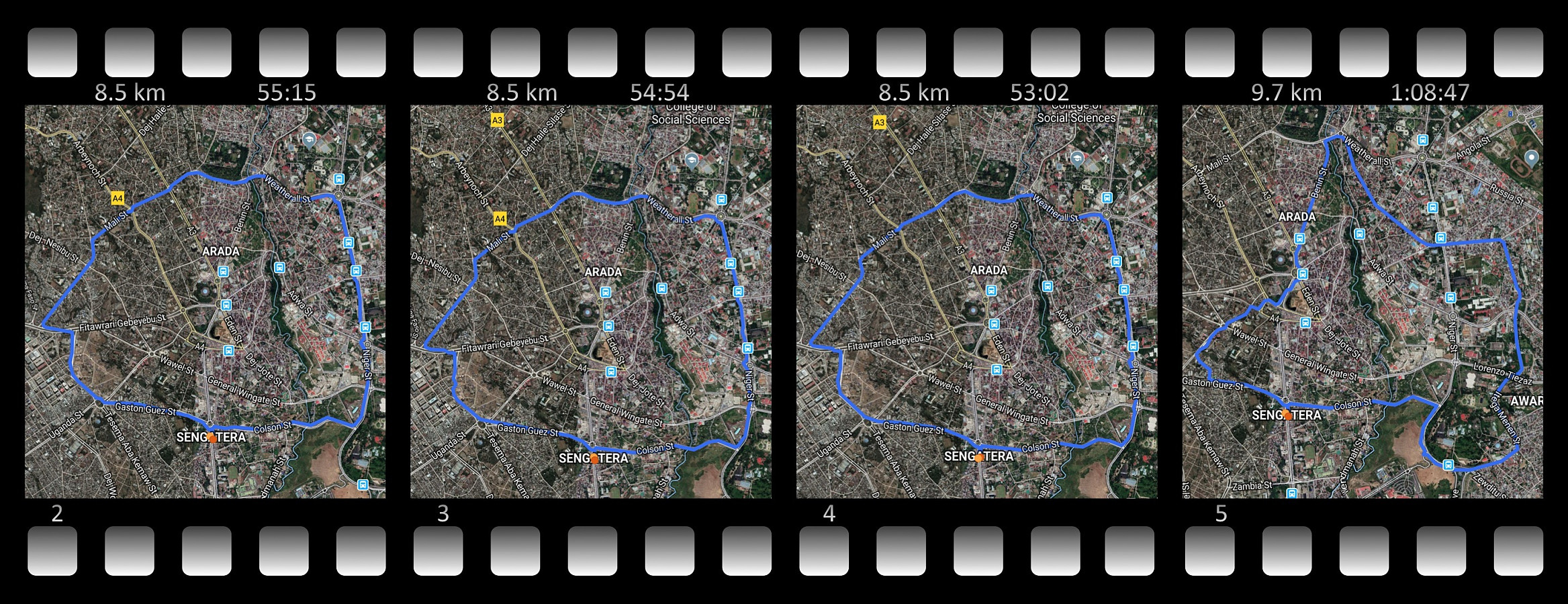
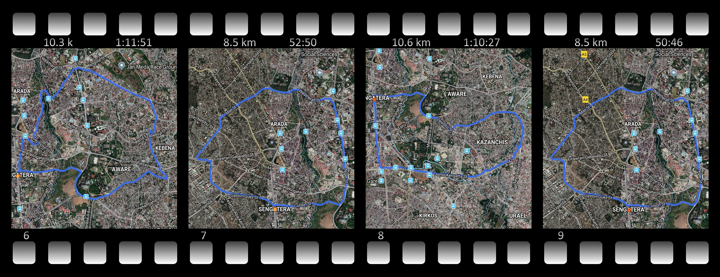
Starting out from Chenneck Camp (3620 m.a.m.s.l.), I climbed Ras Bwahit (4430 m.a.m.s.l.), the third highest mountain in Ethiopia, in only about one and an half hour, and I have to say I am a little bit proud of that. The key to be able to perform well in high elevation areas without getting altitude sickness or extreme shortness of breath, however, is acclimatization. Had I arrived in the Simien Mountains directly from home (where we live at about sea level), I would not have been able to do this 800 meters climb that rapidly. In connection with my work, however, I had just spent two and a half weeks in Addis Ababa (2400 m.a.m.s.l.) prior to heading north for the Simien Mountains. While in Addis, I had gone running between 6 and 7 in the morning about every second day (Images 2-9); and on my only day off duty while there, I had even climbed Wochecha (3390 m.a.m.s.l.), a mountain in the outskirts of Addis, just to allow myself to get adapted to such altitudes (See separate upload here on PeakBook).
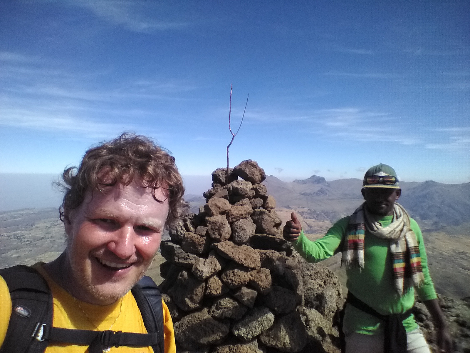
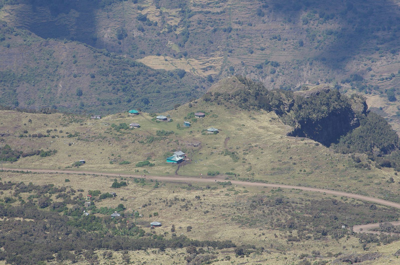
At the time of our ascent on Bwahit, I had allready been 4 days in the Simien Mountains, ascending Mount Gogo and Mount Inantye (see previously uploaded trip). We had spent a lot of time along with our guide Tadlo and the ranger that accompanied us, as well as with the chef and the "dishwasher" that we had hired. My wife was still suffering quite severely from altitude sickness, hence she decided to remain in Chenneck camp while we did the ascent. I had spoken to the chef, who promised me he would look after my wife, and then I set out with Tadlo and the ranger.
Tadlo had in advance told me that this climb was going to take 4 hours for the ascent, and two hours for the descent. I didn't believe him, as I considered 4 hours to be far beyond what you need two climb 800 meters even at this altitude, so I had protested, saying "3 hours up, and 1 1/2 hour down". So as we set off in the morning, I pushed on a little bit, quite from the start, in order to prove I was right. After about 20 minutes of fast walking, Tadlo said to me: "Atle, not so fast, we have plenty of time!" I knew he was worried that I might acquire altitude sickness; the mountain guides are trained to keep tourists from setting out at too high pace, in order that they may avoid altitude sickness. I knew for sure that I was by now well adapted to the altitude, however, and I didn't have the slightest symptom of altitude sickness; so I just pretended to slow down for half a minute or so, and then I pushed on again...
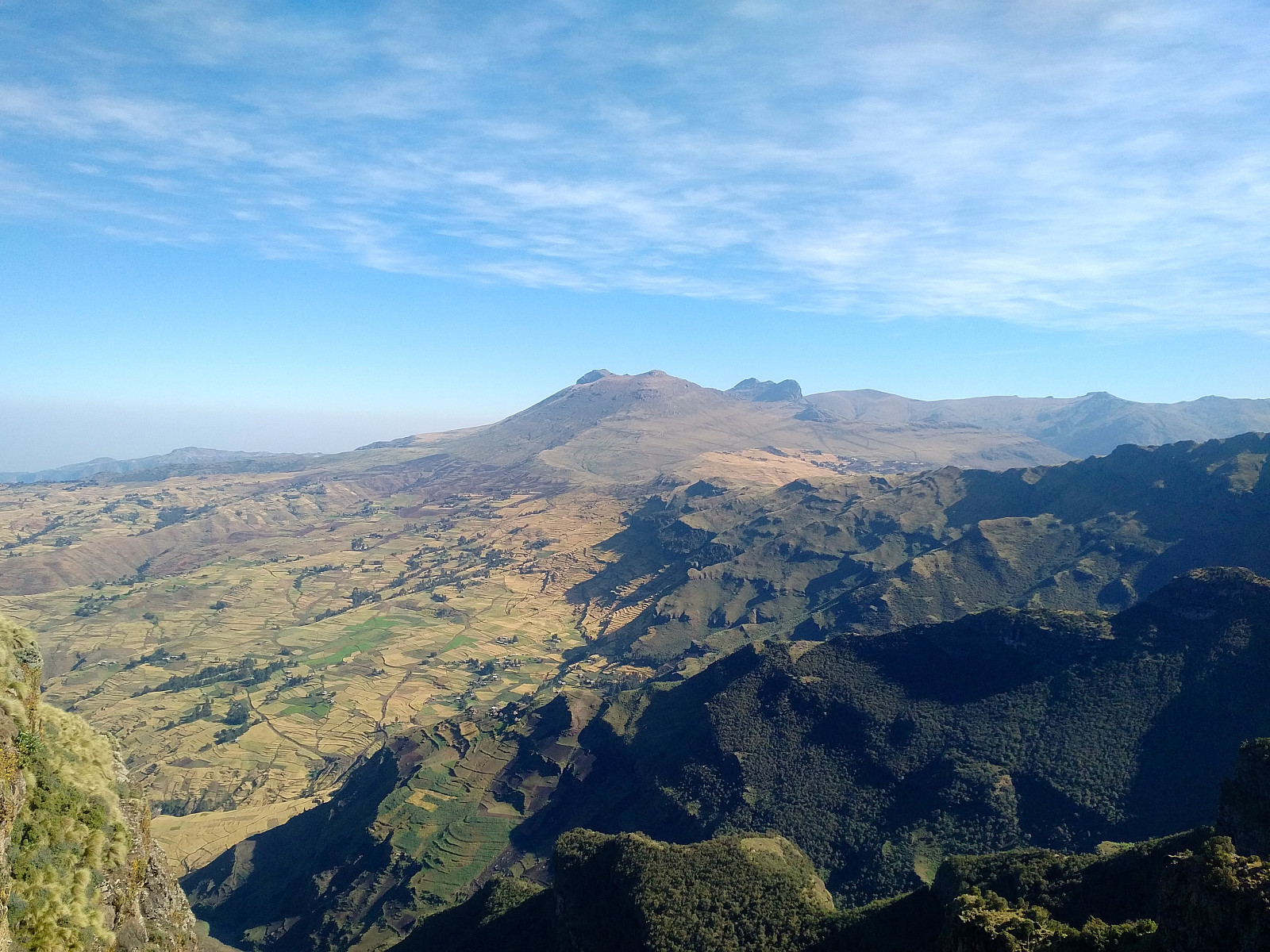
We stopped at two or three viewpoints to look at the view towards a slightly lower area north of the Bwahit mountain range. The view was very much similar to what we had encountered on the days prior to reaching Chenneck Camp, however, and I therefore saw no point in spending too much time on these viewpoints. I just shot a few photos, and then we went on hiking. We passed three or four groups of tourist with their guides and rangers as we made our way up towards the summit. I've frequently been overtaken by others while mountain hiking, but on this particular day I seemed to outrun everybody else; which was kind of fun, and also gave a good feeling. As we were approaching the Bwahit summit, the sun was coming higher up in the sky. It's easy to get a sun-burn at these altitudes, especially for someone with my Norwegian skin, and so we stopped for a few minutes for me to put on a sun protection lotion, and then we continued to the top. For about the last ten minutes of the climb there was ice on the stones and many places on the path, so we had to be a little bit careful with our steps. Nevertheless, we reached the Bwahit summit 1 hour and 33 minutes after we set out from Chenneck Camp; despite the fact that my Endomondo app shows we were standing still for about 9 minutes at the time I was putting on solar protection. I am, as previously stated, a little bit proud of that climb, but again, the key to great achievements at this elevation is acclimatization to the altitude, and not so much the amount of exercise prior to your arrival in the altitude area.
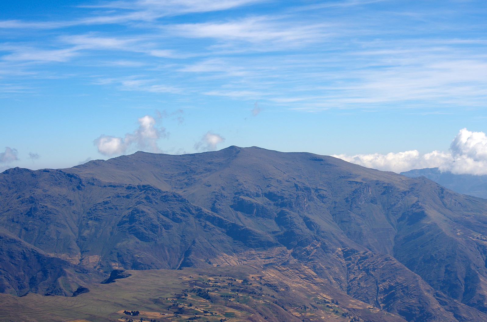
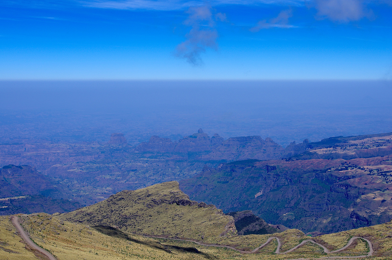
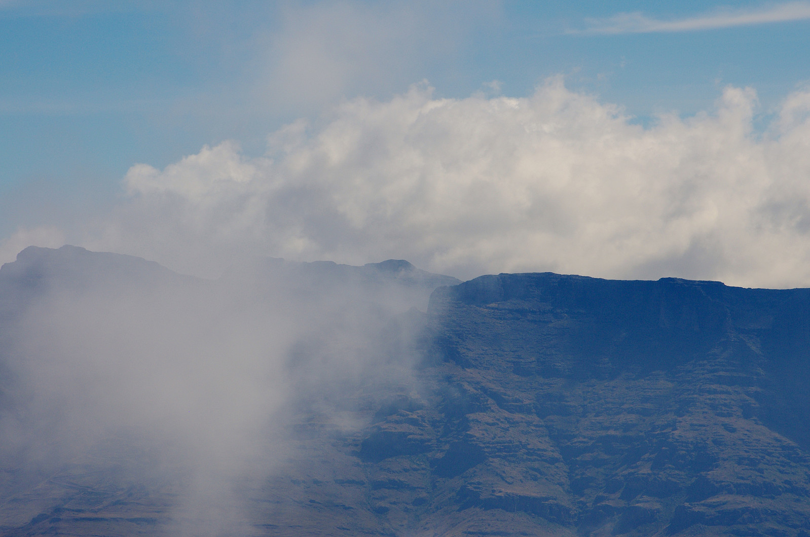
From the summit of Bwahit the view was stunning. Bwahit, with its altitude of 4430 m.a.m.s.l. is the third highest mountain in Ethiopia. The view towards Kidis Yared (4453 m.a.m.s.l.), the second highest mountain in Ethiopia was unobstructed (Image 12). The view towards Ras Dashen (4533 m.a.m.s.l.), however, was partly obstructed by clouds (Image 13), but as the clouds were steadily on the move, we got a short glimpse of the mountain every now and then.
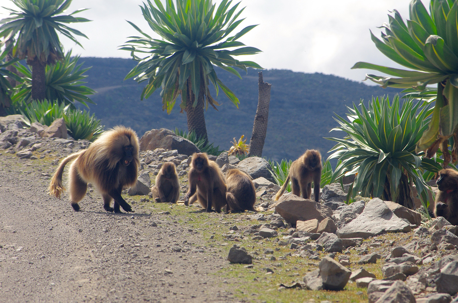
We chose another route back down to Chenneck Camp. Tourists usually go back down by the same route as they ascend, but I managed to talk Tadlo and the ranger into joining me on a different route for the descent. We followed a mountain edge that was running in a westward direction, and eventually passing just above the camp; and this proved to be a good choice. There is a road winding it's way upwards on the north side of Bwahit, which then slings around the west and south side of the mountain and then down into the valley between Bwahit and Ras Dashen on the east side of Bwahit. As we came down to where we had to cross this road, we encountered a large flock of Gelada monkeys, a species endogenous to the Simien Mountains.

A little bit later, we arrived at a point just above Chenneck Camp, and from there we started descending towards the camp through a beautiful valley, that had within it a little creek surrounded by small trees; with the creek as well as the vegetation gradually becoming larger and more bountiful as we were loosing altitude. As we were approaching the camp, the creek had become a little river, and its clear water was looking quite tempting. I knew, however, from one of our previous days in the camp, when I went up to this creek to have a bath, that the water of this little river is just as cold as the waters of the mountain rivers back home in Norway; so I managed to resist the temptation to have another bath at this time.


Kommentarer