
Skagen and Veten from Vikaleitet (29.10.2016)

Skrevet av hbar (Harald Barsnes)

| Startsted | Vikaleitet (185moh) |
|---|---|
| Sluttsted | Tertneskrysset (75moh) |
| Turtype | Fjelltur |
| Turlengde | 3t 43min |
| Distanse | 12,7km |
| Høydemeter | 568m |
| GPS |
|
| Bestigninger | Skagen (342moh) | 29.10.2016 |
|---|---|---|
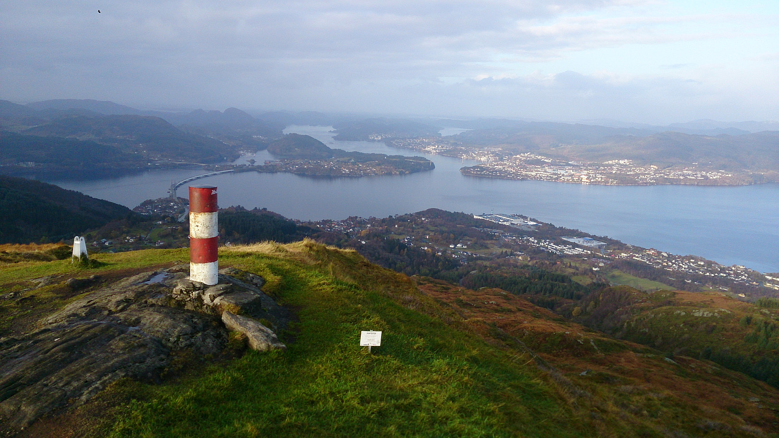
| Storsåta ved Veten i Åsane (369moh) | 29.10.2016 | |
| Veten i Åsane (486moh) | 29.10.2016 | |
| Andre besøkte PBE'er | Dalabygda stengt p-plass (90moh) | 29.10.2016 |
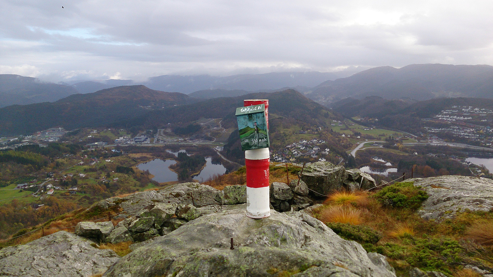
| Skagen søyle (339moh) | 29.10.2016 |
Skagen and Veten from Vikaleitet
Started by taking the bus to Vikaleitet and walking up Sæterstølsvegen (note that the GPS tracking was not turned on until 10-15 min into the hike). From Sæterstøl I easily located the trail towards Veten and followed it until I found a smaller trail in the direction of Skagen. Even though it is not a very high peak, it did provide some nice views.
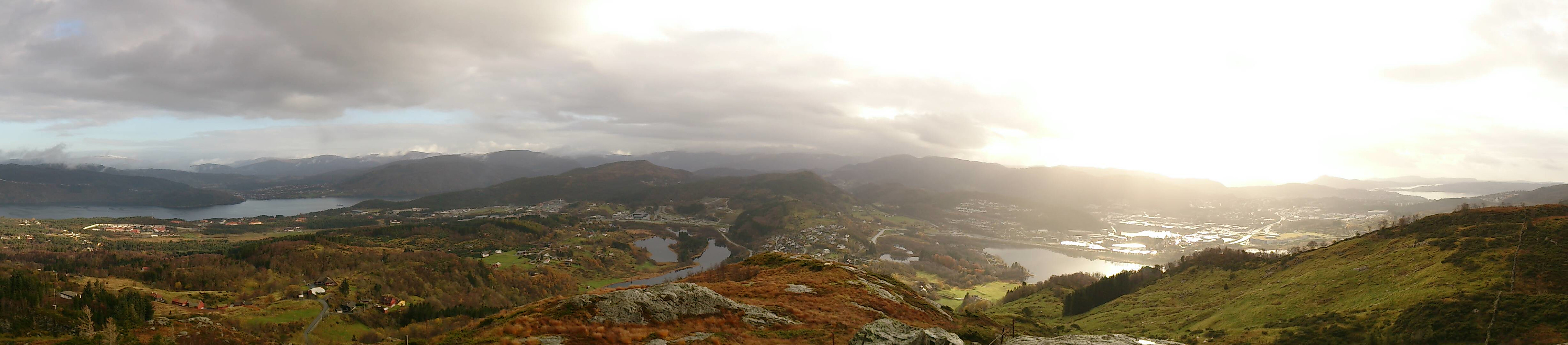
From Skagen I continued onwards to Veten and after a short break at the top, I decided to go via Storsåta (a smaller peak to the west of Veten). I did not locate a trail to the summit of Storsåta, but it was not too difficult to reach. However, it was not really worth it as the views were pretty poor. It got a bit better when walking 50 meters or so northeast through the trees at the summit, but still not a summit I can really recommend.
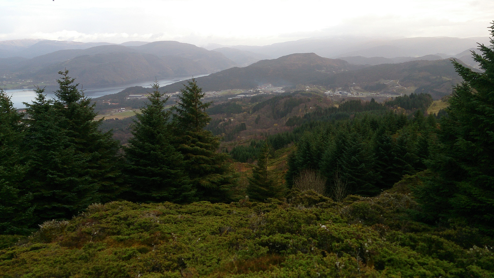
I returned to the trail and followed it back to where I had started the hike, where I decided to extend the hike with an extra detour around Langavatnet via Melingen and onwards to Tertneskrysset before finally catching a bus home. The first part of this addition can be recommended as it follows a nice gravel road, while the latter was mainly included as a way of getting to a bus stop where I didn't have to wait too long for a bus to arrive.
| Starttidspunkt | 29.10.2016 11:52 (UTC+01:00) |
| Sluttidspunkt | 29.10.2016 15:35 (UTC+01:00) |
| Totaltid | 3t 43min |
| Bevegelsestid | 3t 27min |
| Pausetid | 0t 15min |
| Snittfart totalt | 3,4km/t |
| Snittfart bevegelsestid | 3,7km/t |
| Distanse | 12,7km |
| Høydemeter | 568m |


Kommentarer
Storsåta ved Veten i Åsane
Skrevet av hbar 17.04.2017 01:34Great! And yes, I completely agree that the misnamed Storsåta (ved Veten i Åsane) can easily be skipped without missing much. :)
Nice inspiration! :-)
Skrevet av HHauser 14.04.2017 03:24You inspired me to a similar hike: https://peakbook.org/HHauser/tour/205821/Veten+i+%C3%85sane+via+Skagen.html -- thanks! :-)