
Fyllingsdalen Walk (27.12.2011)

Skrevet av HHauser (Helwig Hauser)

| Startsted | Einerhaugen (45moh) |
|---|---|
| Sluttsted | Oasen (45moh) |
| Turtype | Løpetur |
| Turlengde | 1t 45min |
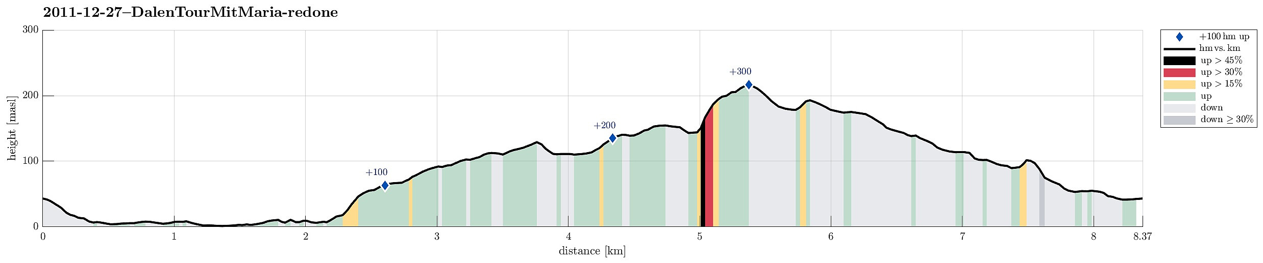
| Distanse | 8,4km |
| Høydemeter | 341m |
| GPS |
|
| Bestigninger | Benshaugen (107moh) | 27.12.2011 |
|---|---|---|
| Andre besøkte PBE'er | Bøneshallen p-plass (110moh) | 27.12.2011 |

Note that this track has been created a posteriori, i.e., from memory, not automatically recorded.
Trip Summary
Nice after-xMas walk through parts of Fyllingsdalen


Kommentarer