Arkiv - dato
Arkiv - aktivitet
-
Annen tur (5)
- Ekspedisjon (5)
-
Annen vintertur (5)
- Trugetur (5)
- Fottur (507)
-
Klatring (43)
- Alpin klatring (31)
- Isklatring (3)
- Miksklatring (1)
- Sportsklatring (3)
- Via ferrata (1)
-
Skitur (449)
- Fjellskitur (4)
- Langrennstur (2)
- Randonnée/Telemark (441)
"Peakbookvenner"


Stampen
- Dato:
- 22.03.2013
- Turtype:
- Fjellskitur
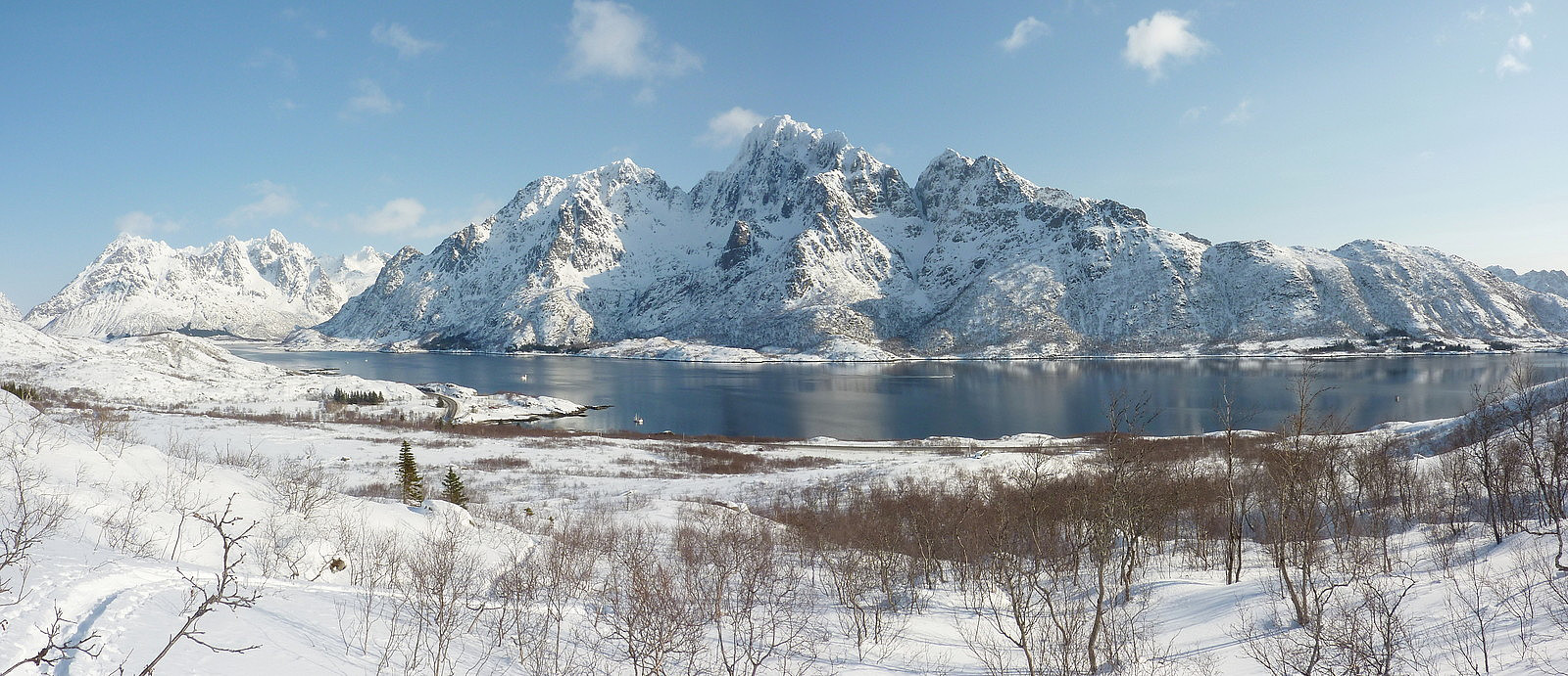 My first trip of Camp Lofoten with Aline and Siv. We'd expected to be taking a trip to Sautinden, but as things happened we ended up on Stampen instead. The meet-up with the ret of our group and the guides was at 9.00 by the Henningsvær Bryggehotell and the drive to the starting point for the ascent was a scenic 40-minute drive down the E10. And we couldn't have asked for a better welcome with the blue skies and sunshine we got, even if the forecast did hint that it wouldn't be staying like this for very long! The group was around 9 or 10 including our guide Sverre, and we used the first hour or so using the avalanche transceivers in search mode. For us and perhaps one or two others in the group, the practice wasn't new but served as good revision on what we had already learnt on the skredkurs >>>
Breitinden (Ringvassøya)
- Dato:
- 20.03.2013
- Turtype:
- Randonnée/Telemark
- Distanse:
- 14,0km
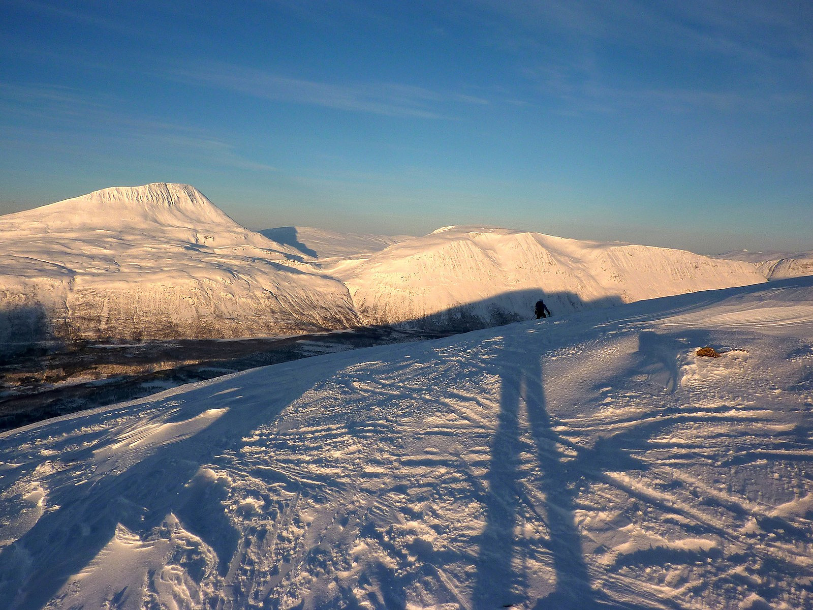
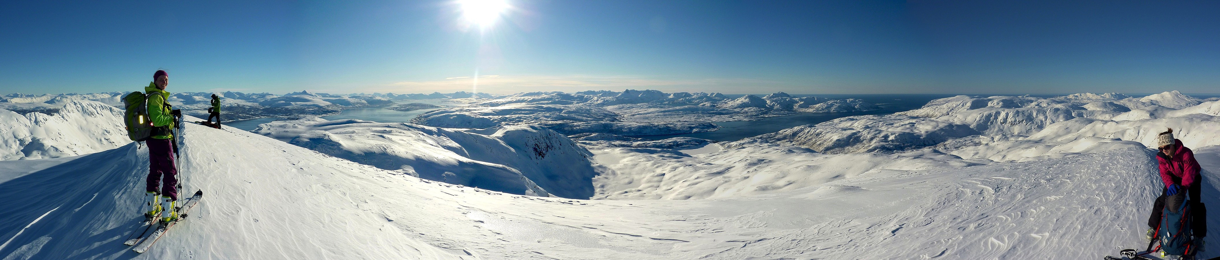 I dag ble det en jentetur til Breitinden på Ringvassøya med både Kristin og Aline. Det var flott å ha Aline med på tur igjen, spesielt fordi det hadde blitt nesten to måneder siden vår siste tur sammen. Strålende sol, lite vind og et nytt fjell som turmål gjorde at vi følte oss veldig spent på å komme oss ut på tur så fort som mulig. Heldigvis var reisen til utgangspunktet ved Simavika bare en halv time bilkjøring fra Tromsø. Dro relativt tidlig fra Tromsø omtrent kl.9.30, så var det kl.10.15 da vi begynte turen.
Vi visste at turen skulle bli enkel med en jevn, slak stigning nesten hele ruten oppover. Vi valgte å bruke veien som gikk inn i Ytredalen og det var et par kilometer før vi tok av til høyre (sør) siden av dalen og begynte å få spist noen høydemetre gjennom >>>
I dag ble det en jentetur til Breitinden på Ringvassøya med både Kristin og Aline. Det var flott å ha Aline med på tur igjen, spesielt fordi det hadde blitt nesten to måneder siden vår siste tur sammen. Strålende sol, lite vind og et nytt fjell som turmål gjorde at vi følte oss veldig spent på å komme oss ut på tur så fort som mulig. Heldigvis var reisen til utgangspunktet ved Simavika bare en halv time bilkjøring fra Tromsø. Dro relativt tidlig fra Tromsø omtrent kl.9.30, så var det kl.10.15 da vi begynte turen.
Vi visste at turen skulle bli enkel med en jevn, slak stigning nesten hele ruten oppover. Vi valgte å bruke veien som gikk inn i Ytredalen og det var et par kilometer før vi tok av til høyre (sør) siden av dalen og begynte å få spist noen høydemetre gjennom >>>
Nonstindtraversen med FSG
- Dato:
- 16.03.2013
- Turtype:
- Randonnée/Telemark
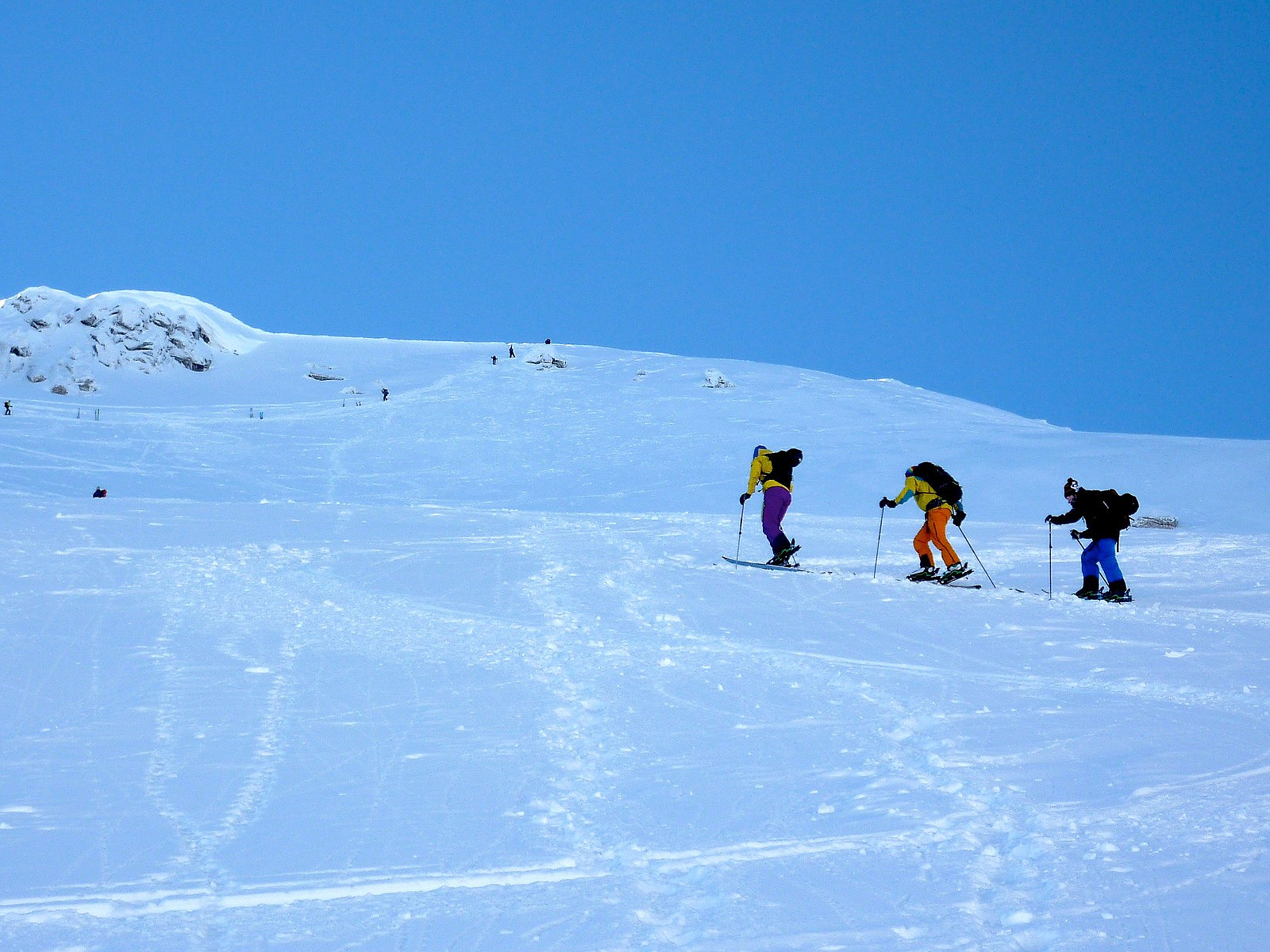
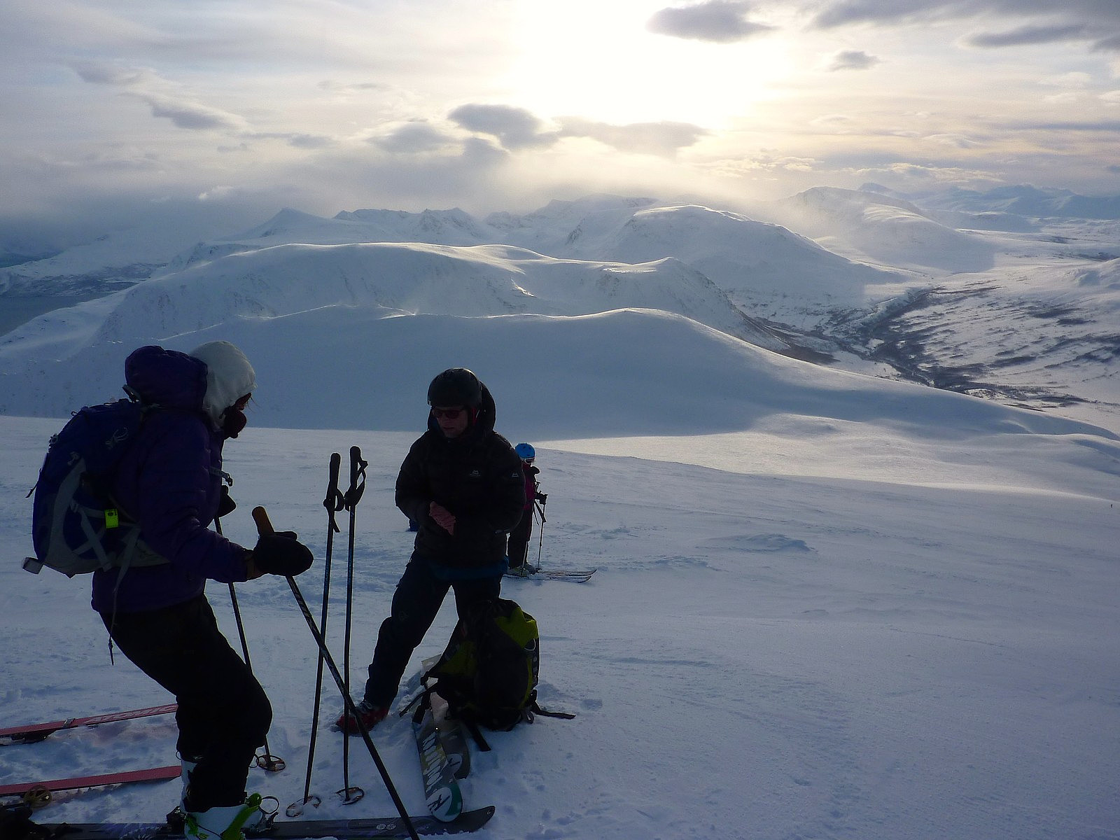
 After what had seemed like a long time since my last trip with the fjellsportgruppa, it was finally time for another fellestur. This time the objective was a traverse of Nonstinden. And now that I had built up a little toppturing experience with half a dozen or so ski trips since investing in a pair of randonee skis two months earlier, I was under the (perhaps false) belief that my skiing had graduated to a level of proficiency to potentially keep up with a group of Norwegian ski-masters. While the group actually turned out to be a rather international mixture of Norwegian, Swedish, Polish and British, it turned out that I had overestimated my ability to steer a pair of planks on my feet downhill. Nevertheless, my uphill skiing abilities seem not to present any problem at all, apart from causing >>>
Skitntinden
- Dato:
- 03.03.2013
- Turtype:
- Fottur
- Turlengde:
- 4:30t
- Distanse:
- 9,0km
 Skitntinden er antakeligvis en av de mest populære skifjell i nærområdet av Tromsø, eller dette er inntrykk jeg har fått så langt. Da kan du si at det er ikke så vanlig å se turfolk tar med stegjern og isøks istedenfor ski på vinterstid. Kanskje det er noe av en forbrytelse når man besøker et kjent skifjell uten å stå på ski....
Derimot, etter vår tur til Ullstinden dagen før, hadde jeg lite lyst til å kjøre skiene mine på isete snø og selv om vi visste at snøforholdene kan være helt annerledes på andre fjell, bestemte vi oss for å få en ulik type tur i dag. Med tanker på at vi ville få enda mer is på sørsider av fjellene (pga hovedvindretningen de siste par dagene), trodde vi at Skitntinden kunne bli et godt turmål for en fottur. I tillegg hadde Skitntinden vært >>>
Skitntinden er antakeligvis en av de mest populære skifjell i nærområdet av Tromsø, eller dette er inntrykk jeg har fått så langt. Da kan du si at det er ikke så vanlig å se turfolk tar med stegjern og isøks istedenfor ski på vinterstid. Kanskje det er noe av en forbrytelse når man besøker et kjent skifjell uten å stå på ski....
Derimot, etter vår tur til Ullstinden dagen før, hadde jeg lite lyst til å kjøre skiene mine på isete snø og selv om vi visste at snøforholdene kan være helt annerledes på andre fjell, bestemte vi oss for å få en ulik type tur i dag. Med tanker på at vi ville få enda mer is på sørsider av fjellene (pga hovedvindretningen de siste par dagene), trodde vi at Skitntinden kunne bli et godt turmål for en fottur. I tillegg hadde Skitntinden vært >>>
Ullstinden, nok en gang
- Dato:
- 02.03.2013
- Turtype:
- Randonnée/Telemark
- Distanse:
- 9,0km
 Turned out to be a bit of a mixed day. I met with Kristin at 10.00 and the plan was to drive to Kastnes, a little way from Oldervik and ski up Stortuva. It is known to be a little-visited top, and I thought the route looked like quite a nice one to try out. But first of all we had to actually get to Oldervik, which was something of a nightmare to drive. After a week of rain and windy weather, the road between Tønsnes and Skittenelv had masses of what can only be described as hard icy potholes (maybe there is a special word in Norwegian which I don't actually know) along the way. My car was not impressed. And being a front-wheel drive it was not really built to deal with awful road surfaces like that. So we had to literally stop every time before driving carefully over those patches and it >>>
Helvellyn
- Dato:
- 17.02.2013
- Turtype:
- Fjelltur
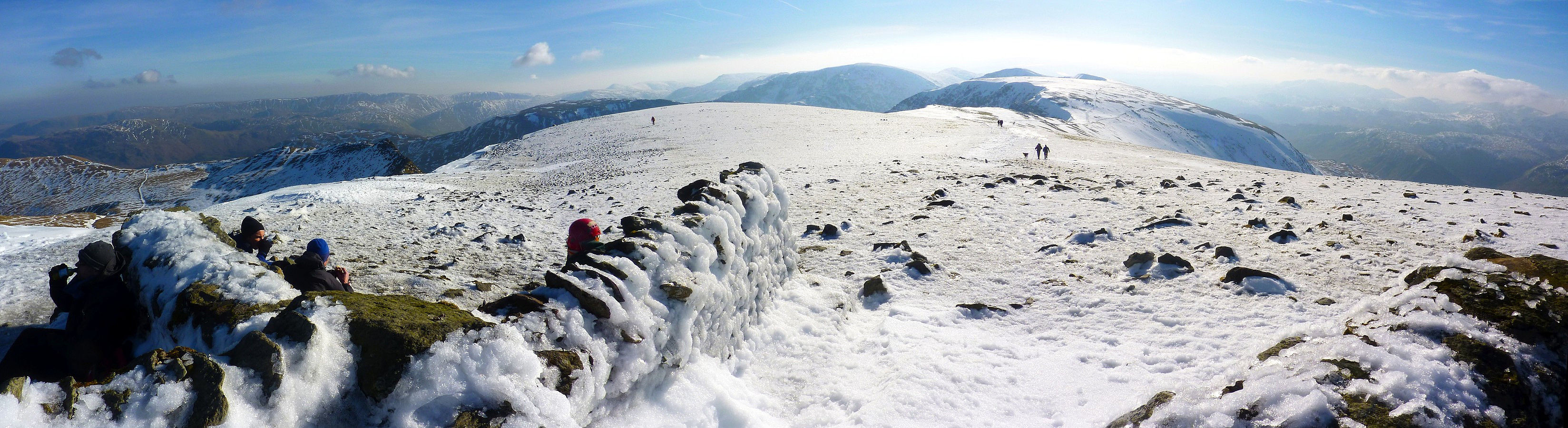 Since I had to catch a train from Windermere in the afternoon, I decided just to take a short morning trip along a route I knew well, beginning in Grasmere and passing over the tops of Dollywagon Pike, Nethermost Pike and Helvellyn.
I had a plan to descend back down to Swirls and walk through the forest back to Grasmere but in the end I decided to be lazy and get a bus back to the village instead. Had really nice weather - blue skies, sunshine and it was not cold. Well, that's not exactly true. It wasn't cold in the start of the day when I was walking up Tongue Gill, but by the time I reached Grisedale Hause, there was a massive strong wind coming up from the south, and that made it pretty difficult to walk at times.
Thought there might be a bit of shelter behind one of the walls on Helvellyn's >>>
Since I had to catch a train from Windermere in the afternoon, I decided just to take a short morning trip along a route I knew well, beginning in Grasmere and passing over the tops of Dollywagon Pike, Nethermost Pike and Helvellyn.
I had a plan to descend back down to Swirls and walk through the forest back to Grasmere but in the end I decided to be lazy and get a bus back to the village instead. Had really nice weather - blue skies, sunshine and it was not cold. Well, that's not exactly true. It wasn't cold in the start of the day when I was walking up Tongue Gill, but by the time I reached Grisedale Hause, there was a massive strong wind coming up from the south, and that made it pretty difficult to walk at times.
Thought there might be a bit of shelter behind one of the walls on Helvellyn's >>>
Spidean a'Choire Leith (George)
- Dato:
- 12.02.2013
- Turtype:
- Alpin klatring
- Turlengde:
- 8:00t
- Distanse:
- 8,0km
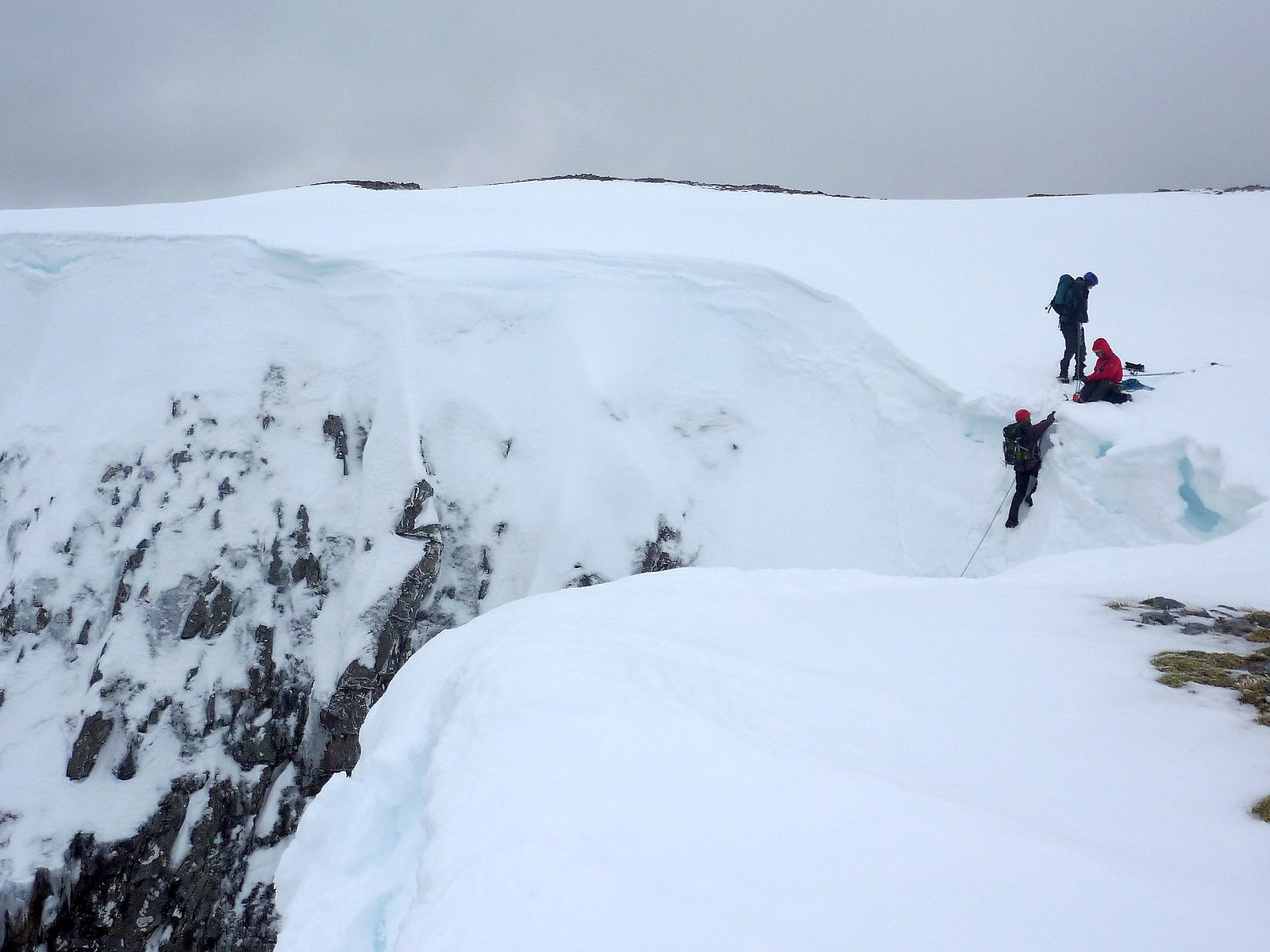
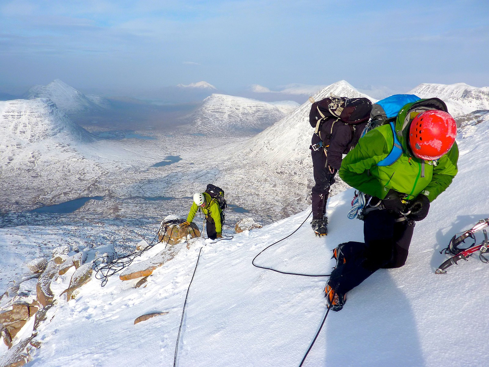 Third day of our climbing course up in the northwest highlands, and also supposedly the final day of settled, beautiful weather before rain was going to set in. So to make the most of this, and the excellent snow and ice conditions we'd experienced so far, it was decided that we would head towards Torridon and attempt one of the 'classic' routes called George, which is located in Coire Dubh Mor on the northern side of Liathach.
Since the route was 4-5 pitches long and the drive from Strathcarron would take around 45 minutes it also meant having to drag ourselves out of bed for another early start. But it would probably be worth the effort as the previous two days' trips had proved! So at 7am we were out of the cottage and bundled once again into Ken's van. It felt pretty mild outside, still >>>
Third day of our climbing course up in the northwest highlands, and also supposedly the final day of settled, beautiful weather before rain was going to set in. So to make the most of this, and the excellent snow and ice conditions we'd experienced so far, it was decided that we would head towards Torridon and attempt one of the 'classic' routes called George, which is located in Coire Dubh Mor on the northern side of Liathach.
Since the route was 4-5 pitches long and the drive from Strathcarron would take around 45 minutes it also meant having to drag ourselves out of bed for another early start. But it would probably be worth the effort as the previous two days' trips had proved! So at 7am we were out of the cottage and bundled once again into Ken's van. It felt pretty mild outside, still >>>
Sgorr Ruadh (Post Box Gully)
- Dato:
- 11.02.2013
- Turtype:
- Alpintur
- Distanse:
- 14,0km
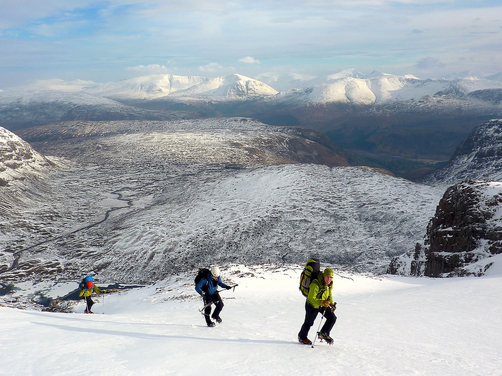 After out first day out climbing Access Gully on Fuar Tholl, we had a small discussion about whether to go somewhere with a long walk-in, or a shorter walk-in for our second day of climbing. As things turned out we ended up heading for Sgorr Ruadh which was the longer walk-in option. I was secretly happy about that. The mountain itself was located in the same valley as Fuar Tholl, but slightly more to the north-west.
To get to Post Box Gully, which was on the north side of the mountain, we first had to walk 6 to 7km from Achnashellach along the river Lair, with Beinn Liath Mor to our right and Sgorr Ruadh to our left. It was not too taxing, rising gradually from Achnashellach. On the other hand, with all our climbing equipment loaded onto our backs it was no walk in the park either, especially >>>
After out first day out climbing Access Gully on Fuar Tholl, we had a small discussion about whether to go somewhere with a long walk-in, or a shorter walk-in for our second day of climbing. As things turned out we ended up heading for Sgorr Ruadh which was the longer walk-in option. I was secretly happy about that. The mountain itself was located in the same valley as Fuar Tholl, but slightly more to the north-west.
To get to Post Box Gully, which was on the north side of the mountain, we first had to walk 6 to 7km from Achnashellach along the river Lair, with Beinn Liath Mor to our right and Sgorr Ruadh to our left. It was not too taxing, rising gradually from Achnashellach. On the other hand, with all our climbing equipment loaded onto our backs it was no walk in the park either, especially >>>
Fuar Tholl (Access Gully)
- Dato:
- 10.02.2013
- Turtype:
- Alpintur
 Today’s objective (today being the first day of a 5-day winter climbing course) was an ascent of Fuar Tholl via Access Gully. Fuar Tholl is one of the mountains more local to Strathcarron, where we were staying and only about 5 minutes drive down the road. On the course with me were 2 other guys, Ryan and Alex and our instructor Ken who I will best remember as being cheerful and enthusiastic with a natural walking pace which seemed to match his enthusiasm for instructing. We had what was deemed to be a ‘late’ start by leaving the lodge at 8.00. If that was supposed to be late, I expected the rest of the week to be a struggle……. Nevertheless, everyone managed to be ready with the kit sorted out on time, and we were soon heading swiftly up the lower south-eastern slopes of the mountain >>>
Fagerfjellet
- Dato:
- 06.02.2013
- Turtype:
- Randonnée/Telemark
- Turlengde:
- 3:30t
 Jeg og Kristin tok denne korte turen til Fagerfjellet som en formiddagstur. Jeg hentet Kristin fra Lauksletta kl.8.30 og vi kjørte til parkeringsplassen (egentlig en bussholdeplass) ved siden av veien litt utenfor Fagernes. Snøen var myk og lett å gå opp til vi nådde tregrensen. Deretter var det avblåst på mesteparten av fjellet, og så var snøoverflaten ikke jevn. Det ble litt bedre i høyden, men da vi kom til varden var det bare isete snø. Derimot var det flotte utsikt mot sør langs hele Lavangsdalen. Med sola i ansiktene våre, var det nesten vårstemning. Toppen var vindstille og Hamperokken sin profil var fantastisk å stirre på :-)
Vi brukte omtrent 20 minutter på toppen siden det føltes så varmt og utsikt var så nydelig. Vi hadde tid å slappe av, drikke cappuccino og >>>
Jeg og Kristin tok denne korte turen til Fagerfjellet som en formiddagstur. Jeg hentet Kristin fra Lauksletta kl.8.30 og vi kjørte til parkeringsplassen (egentlig en bussholdeplass) ved siden av veien litt utenfor Fagernes. Snøen var myk og lett å gå opp til vi nådde tregrensen. Deretter var det avblåst på mesteparten av fjellet, og så var snøoverflaten ikke jevn. Det ble litt bedre i høyden, men da vi kom til varden var det bare isete snø. Derimot var det flotte utsikt mot sør langs hele Lavangsdalen. Med sola i ansiktene våre, var det nesten vårstemning. Toppen var vindstille og Hamperokken sin profil var fantastisk å stirre på :-)
Vi brukte omtrent 20 minutter på toppen siden det føltes så varmt og utsikt var så nydelig. Vi hadde tid å slappe av, drikke cappuccino og >>>

