Arkiv - dato
Arkiv - aktivitet
-
Annen tur (3)
- Kajakkpadling (3)
- Fottur (1884)
-
Kjøretur (9)
- Biltur (9)
-
Skitur (116)
- Fjellskitur (69)
- Langrennstur (47)
-
Sykkeltur (110)
- Blandet sykling (25)
- Gatesykling (85)
Lister jeg samler etter
-
Utvalgte topper og turmål i Bergen
(348/349)
 99%
99% -
Alle topper i Bergen
(391/398)
98%
-
Voss ≥ 100m pf.
(96/98)
97%
-
Opptur Hordaland
(144/159)
90%
-
Stasjoner på Bergensbanen
(33/40)
82%
-
Ulvik ≥ 100m pf.
(28/38)
73%
-
Hordaland ≥ 100m pf.
(622/863)
72%
-
Mjølfjell PF > 100m
(21/31)
67%
-
Jondal ≥ 100m pf.
(15/23)
65%
-
Dagsturhyttene i Vestland
(36/61)
59%
-
Sunnhordland PF >= 100m
(105/186)
56%
-
Hordaland: Hardanger PF>=100m
(194/359)
54%
-
DNT-hytter i Hordaland
(23/45)
51%
-
Kvinnherad ≥ 100m pf.
(40/79)
50%
-
Eidfjord ≥ 100m pf.
(13/42)
30%
-
Sogndal ≥ 100m pf.
(23/81)
28%
-
Gulen ≥ 100m pf.
(15/54)
27%
-
Vik i Sogn ≥ 100m pf.
(10/46)
21%
-
Sogn - Sør for Sognefjorden PF>=100m
(31/159)
19%
-
DNT-hytter i Sogn og Fjordane
(8/47)
17%

Rundemanen from Starefossen
- Dato:
- 15.10.2023
- Turtype:
- Fjelltur
- Turlengde:
- 3:28t
- Distanse:
- 15,2km
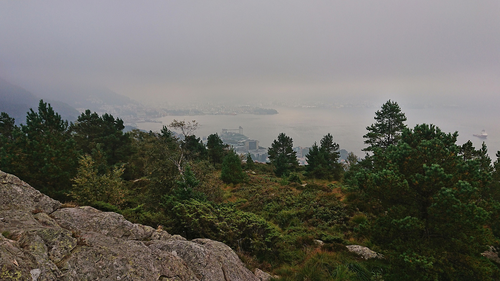
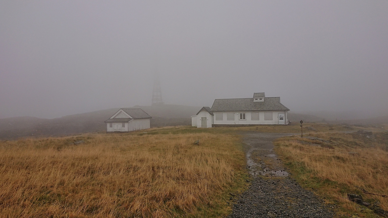 A wet and windy Sunday hike from Starefossen to Lønborg via Rundemanen with the main objective of visiting a small unnamed hill east of Store Tindevatnet that had been added as its own PB-element a while ago. The small hill was right next to the trail and could thus easily be reached but did not provide any unique views or other distinguishing features.
Ørneberget and Furukammen
- Dato:
- 12.10.2023
- Turtype:
- Fjelltur
- Turlengde:
- 0:54t
- Distanse:
- 4,0km
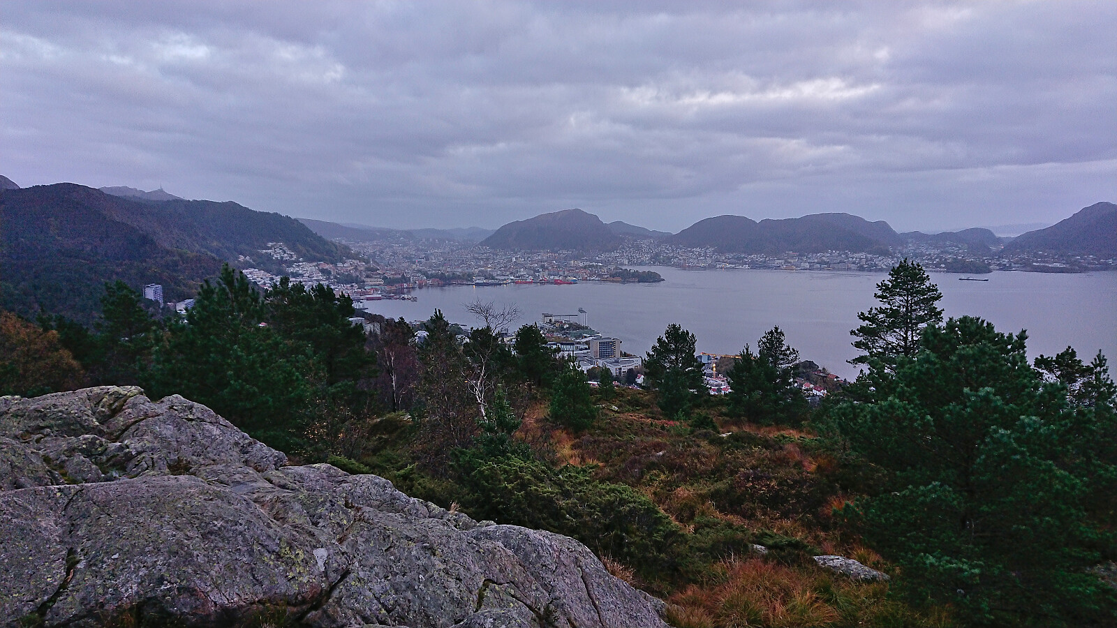 Short local evening hike.
Skjervsfossen and Olavstølsnuten
- Dato:
- 01.10.2023
- Turtype:
- Fjelltur
- Turlengde:
- 5:31t
- Distanse:
- 19,9km
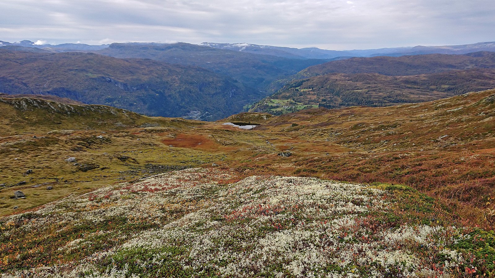 I started by taking the train to Voss and then the bus towards Granvin. The plan was to get off at Moo and start hiking from there. But even though both the online timetable and the information screen on the bus indicated that this should be ok, the bus driver had other ideas and was almost on his way into Tunsbergtunnelen before I managed to press the stop button just in time to get off at the final stop before the tunnel. (The same thing happened last year as well , hence it is probably a good idea to ask the driver in advance whether the bus is going through the tunnel or not.)
After crossing the main road I continued northeast along a separate walking and cycling path that I later learned was the old route of the decommissioned Hardangerbanen , a local train route from Granvin to Voss. The walking and cycling path however ended >>>
I started by taking the train to Voss and then the bus towards Granvin. The plan was to get off at Moo and start hiking from there. But even though both the online timetable and the information screen on the bus indicated that this should be ok, the bus driver had other ideas and was almost on his way into Tunsbergtunnelen before I managed to press the stop button just in time to get off at the final stop before the tunnel. (The same thing happened last year as well , hence it is probably a good idea to ask the driver in advance whether the bus is going through the tunnel or not.)
After crossing the main road I continued northeast along a separate walking and cycling path that I later learned was the old route of the decommissioned Hardangerbanen , a local train route from Granvin to Voss. The walking and cycling path however ended >>>
Byrseteggi from Bjørgum to Gjerdåker
- Dato:
- 24.09.2023
- Turtype:
- Fjelltur
- Turlengde:
- 6:12t
- Distanse:
- 24,6km
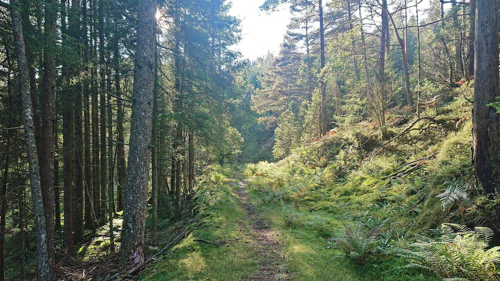
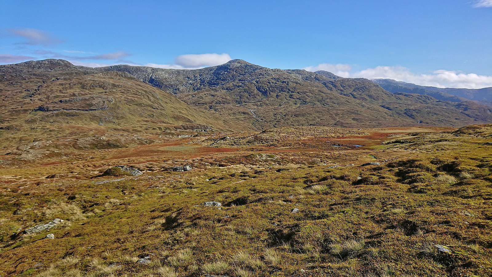 Started by taking the train to Voss where I switched to bus and continued southeast in the direction of Granvin and getting off at the bus stop called Bjørgum. From there I followed the roads up to Fennastølen for the real start of the hike. The weather had gradually improved during the ascent, such that when I started the final off-trail ascent to Byrseteggi most of the clouds had disappeared and I could fully enjoy the beautiful fall colors.
The map indicated a trail heading north from Fennastølen but I failed to find any traces of such a trail. However, the final ascent was still straightforward and it did not take long before I arrived at the summit of Byrseteggi. It provided excellent panoramic views, and a great overview of Horndalsnuten and the rest of Raundalsryggen to the northeast/east. Even though the >>>
Started by taking the train to Voss where I switched to bus and continued southeast in the direction of Granvin and getting off at the bus stop called Bjørgum. From there I followed the roads up to Fennastølen for the real start of the hike. The weather had gradually improved during the ascent, such that when I started the final off-trail ascent to Byrseteggi most of the clouds had disappeared and I could fully enjoy the beautiful fall colors.
The map indicated a trail heading north from Fennastølen but I failed to find any traces of such a trail. However, the final ascent was still straightforward and it did not take long before I arrived at the summit of Byrseteggi. It provided excellent panoramic views, and a great overview of Horndalsnuten and the rest of Raundalsryggen to the northeast/east. Even though the >>>
Ørneberget and Hellen festning
- Dato:
- 21.09.2023
- Turtype:
- Fjelltur
- Turlengde:
- 1:08t
- Distanse:
- 4,7km
 Short local evening hike.
Hovdafjellet, Vardafjellet, Selsåsåsen and Børshovda
- Dato:
- 17.09.2023
- Turtype:
- Fjelltur
- Turlengde:
- 6:49t
- Distanse:
- 24,1km
 Ever since my visit of Storås at the end of April, the plans had been ready for a return to Sveio to ascend the four remaining summits on the Sveio ≥ 100m pf. list . Other hikes had however gotten the priority since then but now it was finally time. I started by taking the express bus (and ferry) from Bergen to Sveio where I got off at the stop called Liavegen. From there I followed the smaller roads east towards the first goal of the day: Hovdafjellet .
Very limited traffic, which was important given the lack of sidewalks, and great views along the way made this first transportation stage more enjoyable than expected. Upon approaching Hovdafjellet I followed the road until the final house west of the summit. Here I passed through a gate and followed various animal tracks to reach the summit without any issues (except for a barking dog that thankfully >>>
Ever since my visit of Storås at the end of April, the plans had been ready for a return to Sveio to ascend the four remaining summits on the Sveio ≥ 100m pf. list . Other hikes had however gotten the priority since then but now it was finally time. I started by taking the express bus (and ferry) from Bergen to Sveio where I got off at the stop called Liavegen. From there I followed the smaller roads east towards the first goal of the day: Hovdafjellet .
Very limited traffic, which was important given the lack of sidewalks, and great views along the way made this first transportation stage more enjoyable than expected. Upon approaching Hovdafjellet I followed the road until the final house west of the summit. Here I passed through a gate and followed various animal tracks to reach the summit without any issues (except for a barking dog that thankfully >>>
Kleppaksla, Storevarden, Vetenbua and Førdesveten
- Dato:
- 13.09.2023
- Turtype:
- Fjelltur
- Turlengde:
- 2:30t
- Distanse:
- 6,9km
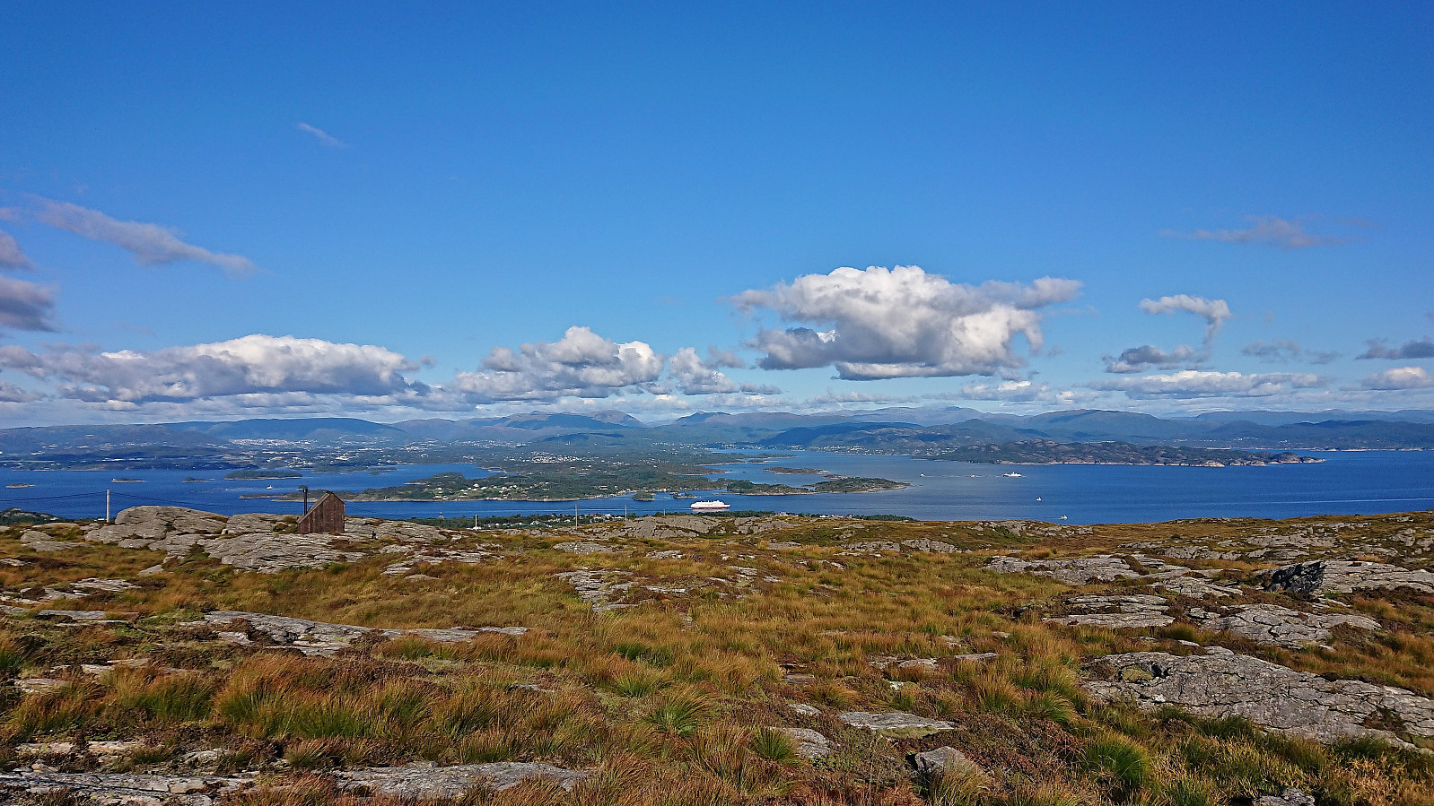 I left work early to take advantage of the great weather for a revisit of Førdesveten , mainly due to the recently opened dagsturhytte right next to the summit. After taking the bus from the city center, and switching buses at Skogskiftet terminal, I got off at Kleppe from where I followed a nice trail northwest. There was a sign at the trailhead but the trail itself was unmarked, except for the occasional small cairn later on, however the trail was easy to follow and I soon arrived at Kleppaksla . At Kleppaksla there was a visitor register just south of the highest point and excellent views in all directions.
From Kleppaksla I continued northeast along the trail until reaching the crossroads south of Førdesveten where I decided to make a short detour to Storevarden before returning and completing the final climb to the summit. The new >>>
I left work early to take advantage of the great weather for a revisit of Førdesveten , mainly due to the recently opened dagsturhytte right next to the summit. After taking the bus from the city center, and switching buses at Skogskiftet terminal, I got off at Kleppe from where I followed a nice trail northwest. There was a sign at the trailhead but the trail itself was unmarked, except for the occasional small cairn later on, however the trail was easy to follow and I soon arrived at Kleppaksla . At Kleppaksla there was a visitor register just south of the highest point and excellent views in all directions.
From Kleppaksla I continued northeast along the trail until reaching the crossroads south of Førdesveten where I decided to make a short detour to Storevarden before returning and completing the final climb to the summit. The new >>>
Ørneberget NV and Hellen festning
- Dato:
- 12.09.2023
- Turtype:
- Fjelltur
- Turlengde:
- 0:51t
- Distanse:
- 3,6km
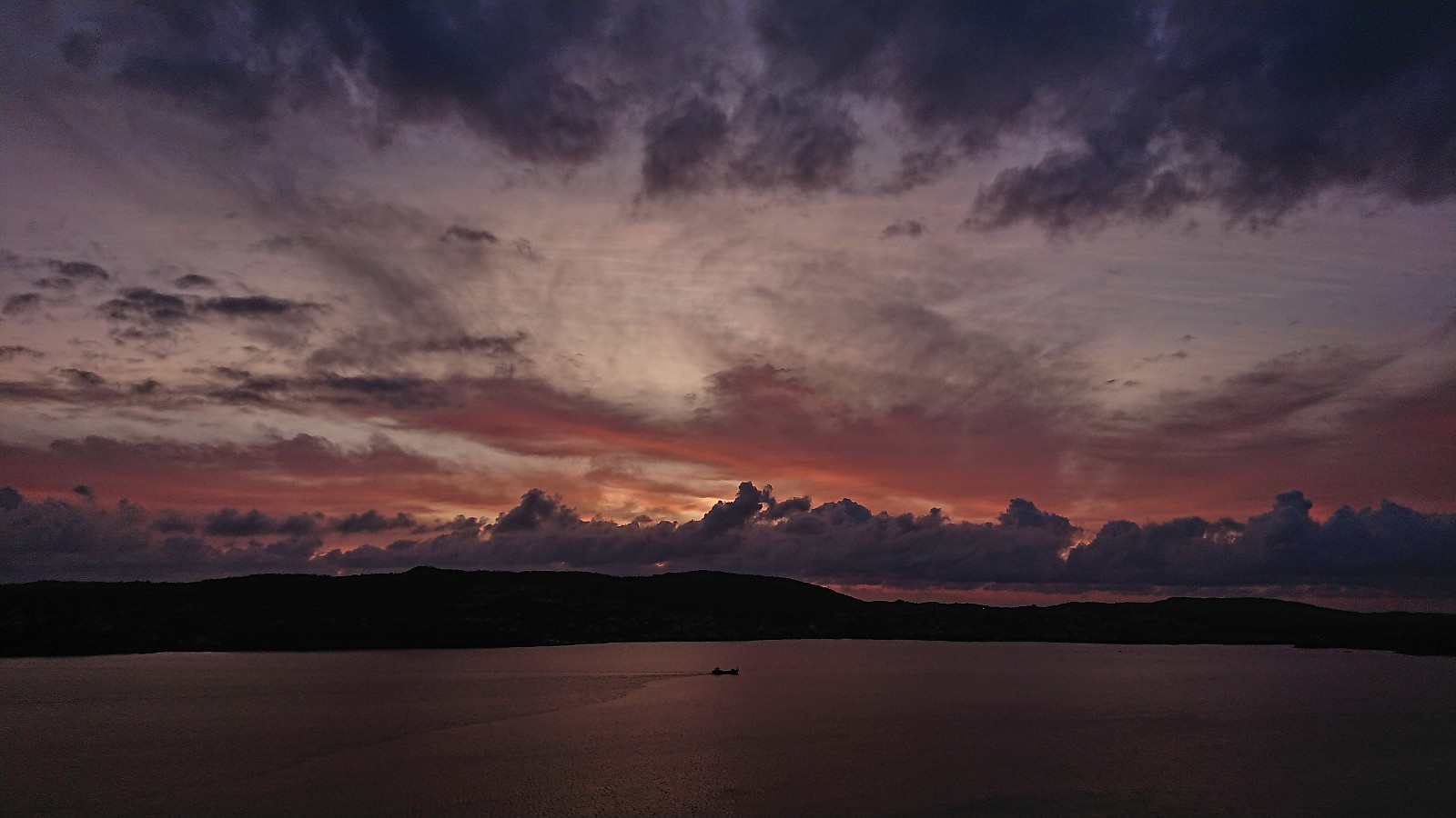
 Short local evening hike just before sunset.
Ørneberget and Hellen festning
- Dato:
- 09.09.2023
- Turtype:
- Fjelltur
- Turlengde:
- 1:04t
- Distanse:
- 4,8km
 Short local Saturday hike on a day with limited views due to low-hanging clouds/fog.
Hauggjelsvarden and Ulriken Vest from Sædalen
- Dato:
- 06.09.2023
- Turtype:
- Fjelltur
- Turlengde:
- 4:15t
- Distanse:
- 11,9km
 Hike after work with a colleague taking part in Stolpejakten (hence the odd detour after leaving Hauggjelsvarden ).
