Arkiv - dato
Arkiv - aktivitet
-
Annen tur (1)
- Kajakkpadling (1)
-
Annen vintertur (4)
- Trugetur (4)
- Fottur (740)
-
Skitur (4)
- Fjellskitur (4)
-
Sykkeltur (137)
- Blandet sykling (51)
- Gatesykling (9)
Arkiv - Etter geografi
"Peakbookvenner"


Lister jeg samler etter
-
Bergen ≥ 50m pf. og ≥ 100 m.o.h.
(87/89)
 97%
97% -
Most dominating tops of the Bergen peninsula
(68/75)
90%
-
Utvalgte topper og turmål i Bergen
(316/350)
90%
-
Alle topper i Bergen
(357/398)
89%
-
Opptur Bergen
(100/113)
88%
-
De syv fjell rundt Bergen
(6/7)
85%
-
Sund ≥ 50m pf.
(14/18)
77%
-
Os ≥ 50m pf.
(25/34)
73%
-
Søyler (fastmerker) i Bergen
(68/100)
68%
-
Fjell ≥ 50m pf.
(21/32)
65%

Around Spelhaugen in the snow
- Dato:
- 27.12.2015
- Turtype:
- Fjelltur
- Turlengde:
- 1:30t
- Distanse:
- 5,0km
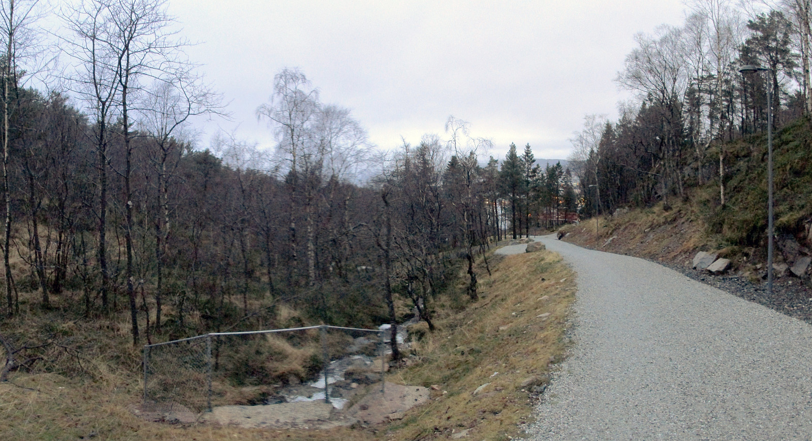
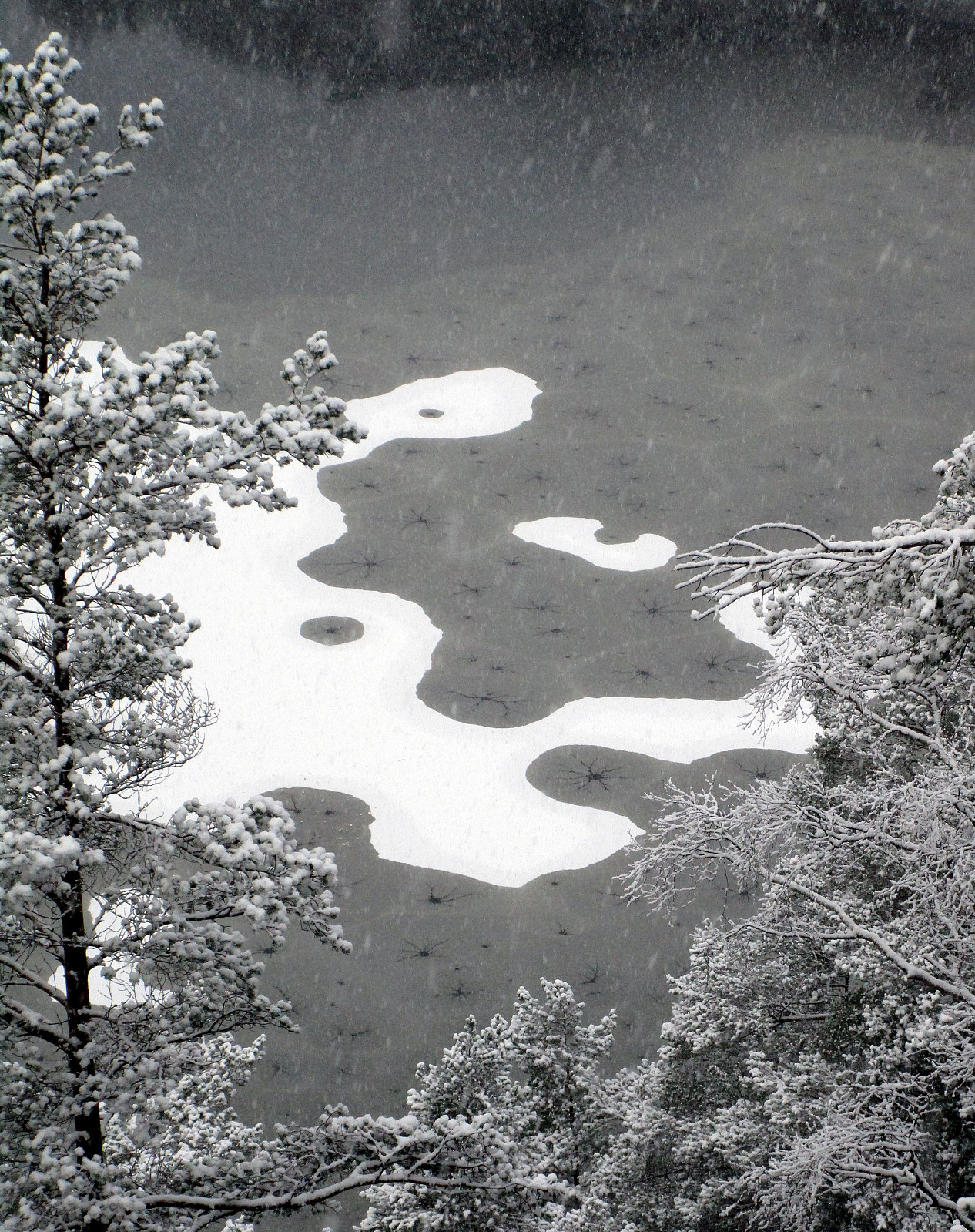 We started from Ørnahaugen and descended along a small path towards Lauvåstjørna, first. Instead of walking further on Barliveien (towards Spelhaugen), we turned right and took a pedestrians path up towards Løvåsbakken. Before getting down, in between the blocks, there, we turned left and passed by the blocks on their backside. When coming to a simple street, we turned left and followed this street up to a parking place between the trees. From there, we went in western direction, up and down (on Lurane), before turning a bit more nothwards. There, we connected to a major path, which leads us down towards the very end of Spelhaugen. Instead of walking down to the parking place, we stepped down a steep slope and came to this gravel road, which connects Spelhaugen and Tennebekktjørna. >>>
Borga
- Dato:
- 26.12.2015
- Turtype:
- Fjelltur
- Turlengde:
- 4:30t
- Distanse:
- 12,9km
 We followed E16 until the exit to Gaupås, continuing first in southeastern direction along Gaupåsvegen, before turning right, following Kvamsvegen for a short part, connecting to Haugland. There, we parked near Haugland school and started walking from there. First, we approached a farm in a place called Botn. Originally, we had planned to find the path that would lead next to Nedste and Øvste Åreina, conneting to a path that should have brought us up Vardegga. For that, however, we should have taken the slightly more northern path up Botn. Instead, we got into Kløvedet and then to Langedalsrustene---the path that we first had thought to take back down. Accepting that we had changed the orientation of our hike, we continued to the ridge that would eventually bring us to Borga, far >>>
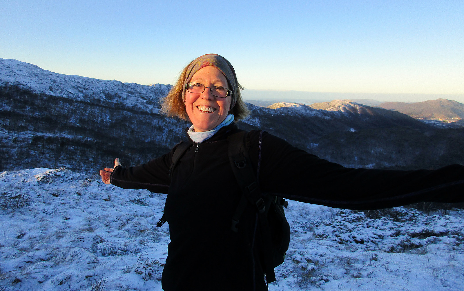
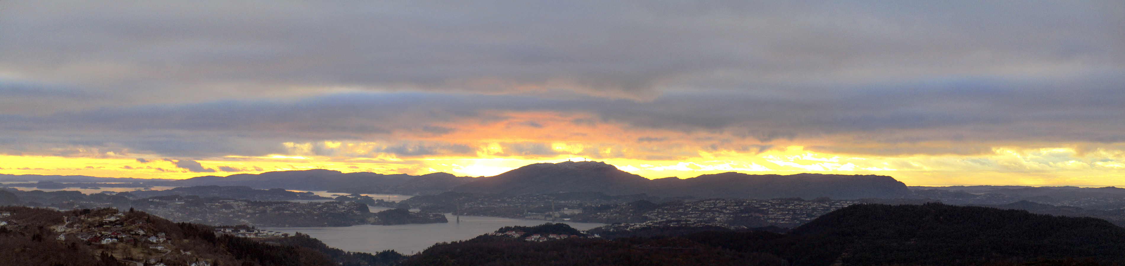
Pyttane in windy weather
- Dato:
- 25.12.2015
- Turtype:
- Fjelltur
- Turlengde:
- 1:45t
- Distanse:
- 5,9km
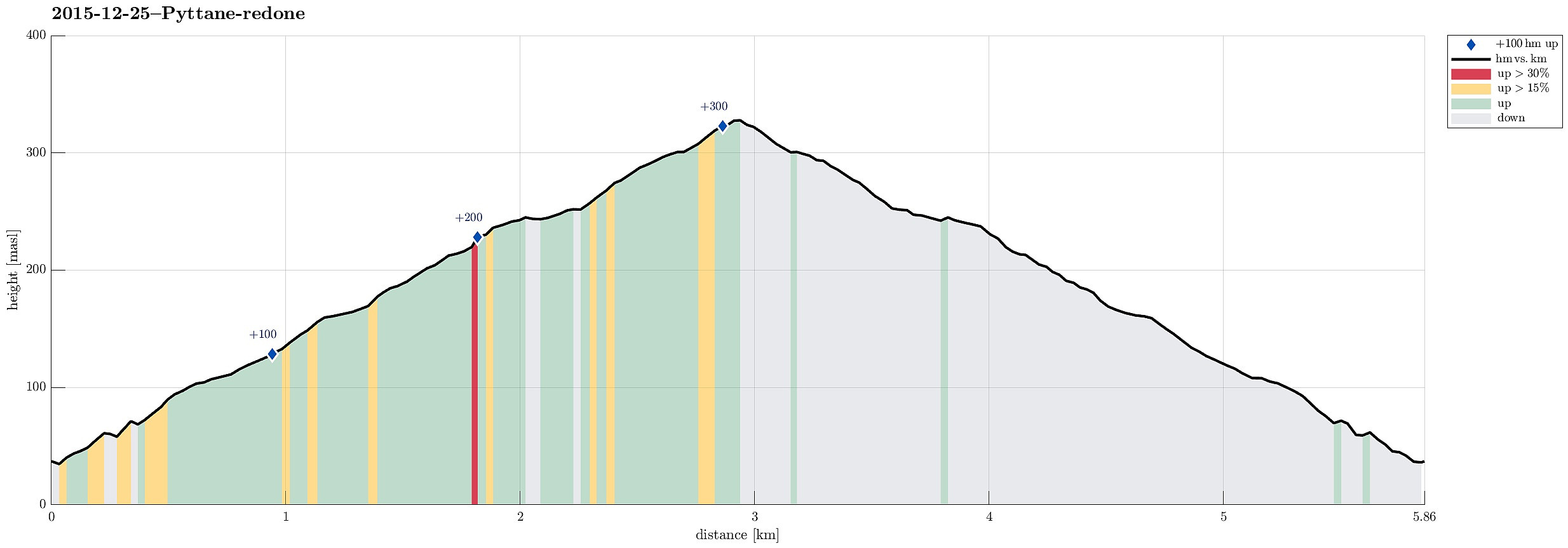 Refreshing walk up and down Pyttane with all sorts of weather! :-)
Web page WestCoastPeaks.com provides useful information about Liatårnet
and also Petter Bjørstad has a useful page about Liatårnet .
Refreshing walk up and down Pyttane with all sorts of weather! :-)
Web page WestCoastPeaks.com provides useful information about Liatårnet
and also Petter Bjørstad has a useful page about Liatårnet .
New Løvstien (again)
- Dato:
- 24.12.2015
- Turtype:
- Spasertur
- Turlengde:
- 1:30t
- Distanse:
- 5,2km
 We parked along the road Klauvsteinen and walked from there---first along Klauvsteinen, before then takinng a pedestrians path up to Øvre Riplegården. After walking over the saddle (on Øvre Riplegården), we continued to the newest section of Løvstien. We then followed Løvstien down and towards Bergen, turning around the mountain along with the path. Before Løvstien gets all the way down, connecting to Løvstakkveien, some new paths lead up to a vantage spot called Skillingsbollen. The way back from there followed then basically the same as for getting there.
New Løvstien
- Dato:
- 19.12.2015
- Turtype:
- Spasertur
- Turlengde:
- 0:45t
- Distanse:
- 3,8km
 We parked along the road Klauvsteinen and walked from there (first along Klauvsteinen, before then takinng a pedestrians path up to Øvre Riplegården). After walking over the saddle (on Øvre Riplegården), we found the entry point to the newest section of Løvstien. We then followed Løvstien down and towards Bergen, turning around the mountain along with the path. A lot of efforts have been put into making this path a nice one, really! :-) At a vantage point (above St. Markus kirke), we then turned around and walked back. Given the very wet weather, this was at least a short walk to get some fresh air. :-)
The city of Bergen writes about the opening .
We parked along the road Klauvsteinen and walked from there (first along Klauvsteinen, before then takinng a pedestrians path up to Øvre Riplegården). After walking over the saddle (on Øvre Riplegården), we found the entry point to the newest section of Løvstien. We then followed Løvstien down and towards Bergen, turning around the mountain along with the path. A lot of efforts have been put into making this path a nice one, really! :-) At a vantage point (above St. Markus kirke), we then turned around and walked back. Given the very wet weather, this was at least a short walk to get some fresh air. :-)
The city of Bergen writes about the opening .
Storevarden and Kolbeinsvarden
- Dato:
- 13.12.2015
- Turtype:
- Fjelltur
- Turlengde:
- 1:15t
- Distanse:
- 4,9km
 We parked near Erdal church on the east of Askøy, a few kilometers north of Kleppestø. From there, we first followed a road, Svartedalsvegen. Right after two U-turns, a small road departs to the right, leading to a few houses (two?) that are "kind of hidden" in a small valley. We passed the houses (in the valley), searching for a good spot to ascend to Storevardsbrekka, i.e., another road much higher up that is servicing houses that are built high up the hillside. We found a way to get up there, but it was comparably wild and not recommended. Back on the street (now Storevardsbrekka), we followed it until the end from where a path leads on the remaining few meters up to Storevarden. From there, we followed a path northwards, passing by Langafjellet and connecting to the main >>>
Storhovden in Kanadaskogen
- Dato:
- 12.12.2015
- Turtype:
- Fottur
- Turlengde:
- 1:30t
- Distanse:
- 7,1km
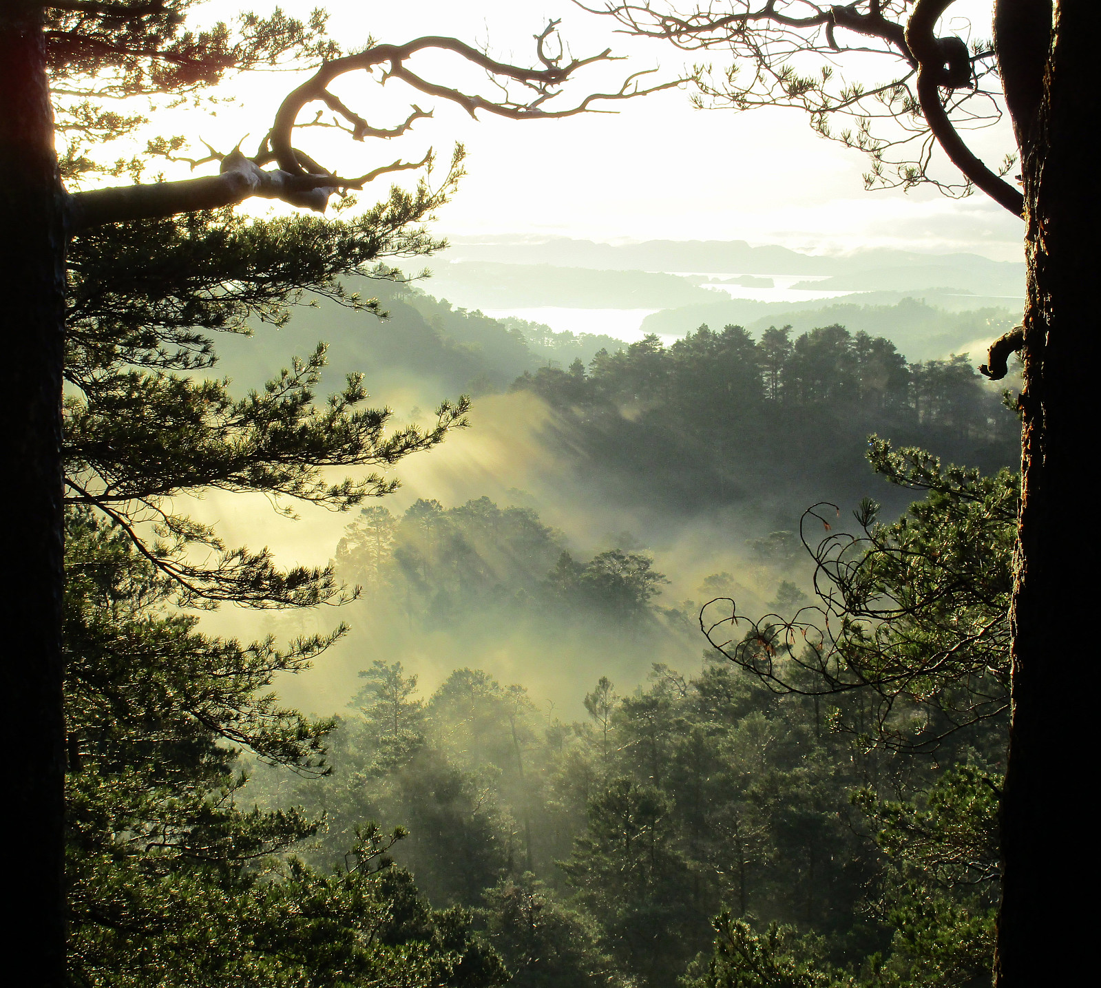 We started from Varden, entering Kanadaskogen near Hesjaholten. From there, we mostly followed small paths---if paths at all---approaching and ascending to Storhovden. Back, we first descended a little wilder from Storhovden than what would have been necessary---not recommended, actually. We then connected back to Syningen and from there we reached Stora Krokatjørna on a nice path. From there, we connected back to Hesjaholten, passing by Litla Krokatjørna, also.
Selected photos are available as Google+ photo album .
We started from Varden, entering Kanadaskogen near Hesjaholten. From there, we mostly followed small paths---if paths at all---approaching and ascending to Storhovden. Back, we first descended a little wilder from Storhovden than what would have been necessary---not recommended, actually. We then connected back to Syningen and from there we reached Stora Krokatjørna on a nice path. From there, we connected back to Hesjaholten, passing by Litla Krokatjørna, also.
Selected photos are available as Google+ photo album .
Around Spåkevatnet
- Dato:
- 06.12.2015
- Turtype:
- Fjelltur
- Turlengde:
- 2:30t
- Distanse:
- 8,6km
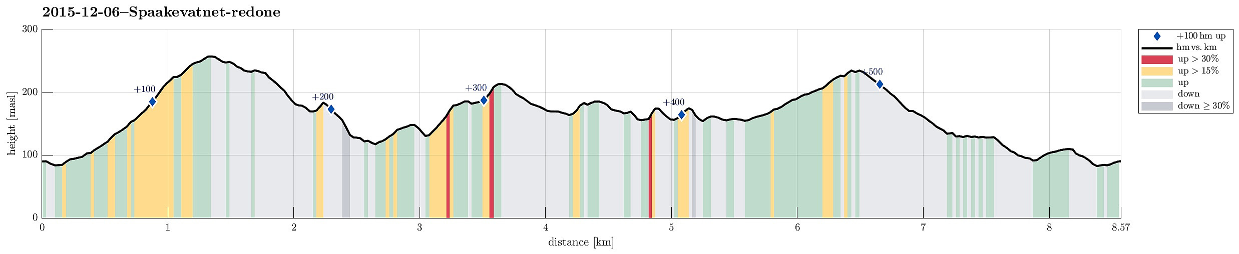 We parked near Arna Stadion and crossed Spåkelva where the sports flat covers a part of it in the southwest. A few meters up from there and we came to Spåkevegen, which lead us a short bit towards south, along Spåkelva, before a sign helps to find the ascent to Beitelen (departing from Spåkevegen to the right). A well visible path leads up a gentle ridge that leads to a small top just underneath Beitelen---from there, one enjoys a good overview over Spåkevatnet. From there, it's only a few meters to the top of Beitelen---actually, one first gets to a saddle and if one really needs to visit the very top of Beitelen (not that great, however), then one would first turn right at this saddle. We reached the top quickly, mostly in order to see, whether there would be nice views northwards >>>
Lyderhorn
- Dato:
- 28.11.2015
- Turtype:
- Fjelltur
- Turlengde:
- 1:15t
- Distanse:
- 3,5km
 We parked near Kjøkkelvik school and started our ascent of Lyderhorn via Lyderhornslien. While the main path up Lyderhorn (from there) departs from the road already in one of the lower turns, we aimed for a less used, small path that departs from Lyderhornslien at this road's very end---right next to the building blocks on top (pass by the larger building blocks, heading north, for a few meters until you see wooden stairs leading up right behind one of the blocks). From there, it's straight-forward to follow the path upwards. Before getting to the top of Lyderhorn, one meets a more frequented path that leads to the top from the northern side. In half an hour, we reached the top and enjoyed some strong November weather impressions there. We basically returned on the same path down, avoiding >>>
Krånipa, Holdhusfjellet, and Raudfjellet
- Dato:
- 22.11.2015
- Turtype:
- Fjelltur
- Turlengde:
- 3:00t
- Distanse:
- 10,6km
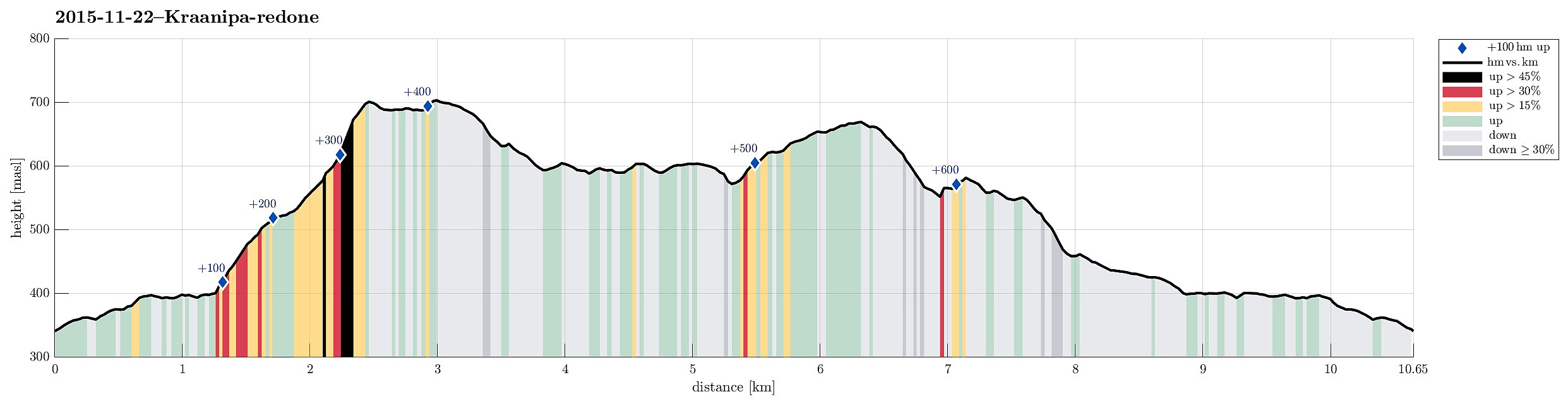 I parked on a convenient parking spot (for several cars!) at Nordre Skulstad, not far from where the paved road ends (one could, probably, drive all the way up to the dam, but it's not far from there anyway). From there, I first walked up to the dam (on a gravel road), before I turned right, southwards, and there crossed the stream that comes down from Skulstadvatnet on a bridge right underneath the dam. On the other side, another gravel road winds along Skulstadvatnet towards Kråaustebotn. I followed this road until it turns "too much" left (in northeastern direction)---there, I decided to leave the road, using one of the minor ridges that run down from Krånipa towards Kråaustebotn in northern direction, aiming for the ridge that would bring me up to Krånipa. On the frozen >>>
