Arkiv - dato
Siste turer
2025
(10)
Februar
(2)
August
(7)
November
(1)
2024
(9)
April
(1)
Mai
(2)
Juli
(2)
August
(3)
September
(1)
2023
(16)
April
(1)
Juni
(1)
Juli
(4)
August
(4)
September
(3)
Oktober
(3)
2022
(21)
Mars
(2)
April
(1)
Mai
(3)
Juni
(1)
Juli
(1)
August
(1)
September
(4)
Oktober
(5)
November
(3)
2021
(33)
Mars
(3)
Mai
(4)
Juni
(2)
Juli
(8)
August
(10)
September
(4)
Oktober
(1)
November
(1)
2020
(26)
April
(3)
Mai
(1)
Juni
(6)
Juli
(5)
August
(6)
September
(1)
Oktober
(2)
November
(1)
Desember
(1)
2019
(51)
Mars
(2)
April
(7)
Mai
(7)
Juni
(7)
Juli
(10)
August
(3)
September
(6)
Oktober
(9)
2018
(63)
Februar
(1)
Mars
(2)
April
(4)
Mai
(11)
Juni
(12)
Juli
(10)
August
(11)
September
(5)
Oktober
(6)
November
(1)
2017
(63)
Januar
(3)
Februar
(1)
Mars
(1)
April
(3)
Mai
(8)
Juni
(10)
Juli
(15)
August
(8)
September
(8)
Oktober
(3)
November
(3)
2016
(56)
Januar
(1)
April
(1)
Mai
(7)
Juni
(3)
Juli
(9)
August
(9)
September
(12)
Oktober
(12)
Desember
(2)
2015
(76)
Februar
(1)
April
(5)
Mai
(18)
Juni
(12)
Juli
(9)
August
(16)
September
(4)
Oktober
(2)
November
(9)
2014
(35)
April
(2)
Mai
(9)
Juni
(8)
Juli
(6)
August
(3)
September
(4)
Oktober
(3)
2013
(15)
Februar
(1)
Mars
(3)
Mai
(5)
Juni
(4)
Juli
(1)
Oktober
(1)
2012
(3)
Februar
(1)
Mars
(1)
Mai
(1)
2011
(1)
Juni
(1)
2000
(1)
Februar
(1)
1991
(1)
Februar
(1)
1990
(1)
Januar
(1)
1989
(1)
Februar
(1)
1988
(3)
April
(3)
1987
(1)
August
(1)
1985
(6)
Januar
(1)
April
(3)
Mai
(1)
Juni
(1)
1982
(3)
Februar
(1)
Mars
(1)
Juli
(1)
1980
(1)
Juni
(1)
1975
(3)
April
(1)
Juni
(2)
1961
(1)
Februar
(1)
Arkiv - aktivitet
Annen tur
(2)
Ekspedisjon
(2)
Annen vintertur
(4)
Trugetur
(4)
Fottur
(220)
Fjelltur
(161)
Fottur
(44)
Løpetur
(1)
Spasertur
(1)
Skitur
(2)
Langrennstur
(2)
Arkiv - Etter geografi
-
Europa
(485)
+
Norge
(454)
+
Norge fastland
(439)
•
Dovrefjell
(20)
+
Innlandet
(19)
+
Hedmark
(2)
•
Folldal
(1)
•
Os i Hedmark
(1)
•
Tolga
(1)
+
Oppland
(18)
•
Dovre
(7)
•
Lesja
(3)
•
Lom
(2)
+
Valdres
(5)
•
Nord-Aurdal
(1)
•
Sør-Aurdal
(1)
•
Vang
(3)
•
Øystre Slidre
(2)
•
Vågå
(1)
+
Jotunheimen
(3)
•
Gjendealpene
(1)
•
Nordøst-Jotunheimen
(3)
+
Møre og Romsdal
(288)
+
Nordmøre
(271)
•
Aure
(8)
•
Averøy
(18)
•
Gjemnes
(63)
•
Hustadvika
(40)
•
Kristiansund
(73)
•
Smøla
(1)
•
Sunndal
(30)
•
Surnadal
(12)
•
Tingvoll
(44)
+
Romsdal
(21)
•
Molde
(16)
•
Rauma
(5)
+
Sunnmøre
(1)
•
Ålesund
(1)
+
Nordland
(1)
+
Helgeland
(1)
•
Rana
(1)
•
Oslomarka
(1)
•
Sunndalsfjella
(15)
•
Trollheimen
(42)
+
Troms og Finnmark
(2)
+
Troms
(2)
•
Karlsøy
(1)
•
Senja
(1)
+
Trøndelag
(128)
•
Frøya
(1)
•
Heim
(2)
•
Hitra
(1)
•
Oppdal
(111)
•
Rennebu
(9)
•
Røros
(2)
•
Trondheim
(1)
•
Tydal
(2)
+
Viken
(8)
+
Akershus
(1)
•
Bærum
(1)
+
Buskerud
(7)
+
Hallingdal
(5)
•
Hemsedal
(2)
•
Nesbyen
(3)
•
Nore og Uvdal
(2)
+
Spania
(3)
•
Catalonia
(3)
+
Storbritannia
(28)
+
England
(2)
+
North West England
(2)
+
Cumbria
(2)
+
The Lake District
(2)
•
Lake District - Central & Western Fells
(1)
•
Lake District - Eastern Fells
(1)
•
Lake District - Southern Fells
(1)
+
Skottland
(26)
•
Argyll and Bute
(9)
•
Carrick and Galloway
(2)
•
Central Scotland from Dumbarton to Montrose
(4)
•
Clackmannanshire
(1)
•
Dumfries and Galloway
(2)
•
Fife
(2)
•
Fort William to Loch Treig and Loch Leven
(3)
•
Galloway Hills
(2)
•
Glen Etive to Glen Lochy
(2)
•
Glen Lyon to Glen Dochart and Loch Tay
(1)
•
Highland
(8)
•
Inveraray to Crianlarich
(3)
•
Islay
(1)
•
Loch Duich to Cannich
(1)
•
Loch Fyne to Bute and the Firth of Clyde
(1)
•
Loch Lomond to Strathyre
(1)
•
Loch Rannoch to Glen Lyon
(3)
•
North Skye and Raasay
(4)
•
Ochil Hills
(2)
•
Perth and Kinross
(2)
•
Skye
(4)
•
Stirling
(3)
"Peakbookvenner"
raymond_grimstad
Kjellbjdahl
MonaS
opps
Birgit
otto
JoSo
BjørnF
Lister jeg samler etter
Averøy ≥ 100m pf.
100%
(11/11)
Vis alle lister jeg samler etter
Favoritturer
Kaldfonna
Trollhøtta NV
The Cobbler
Jørenvågsalen med flere
Gjevilvasskamman
Facebook
«
1
2
3
4
5
6
7
8
9
10
>
»
Reinstinden
Dato:
30.08.2025
Turtype:
Fjelltur
Distanse:
9,0
km
© Erling T Dahl
Kart
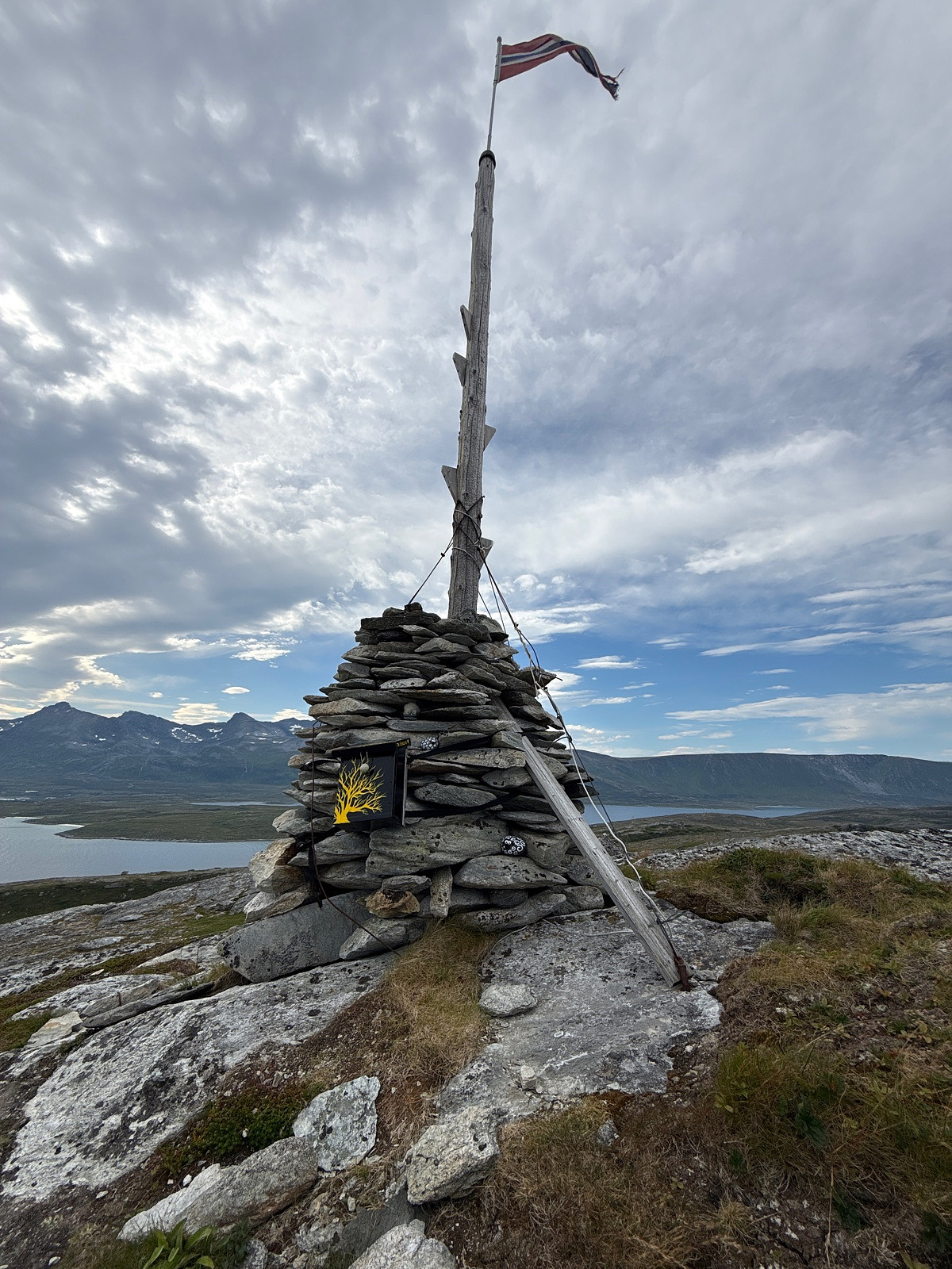
Fisketjernnuten
Dato:
17.08.2025
Turtype:
Fjelltur
Distanse:
2,9
km
© Erling T Dahl
Kart
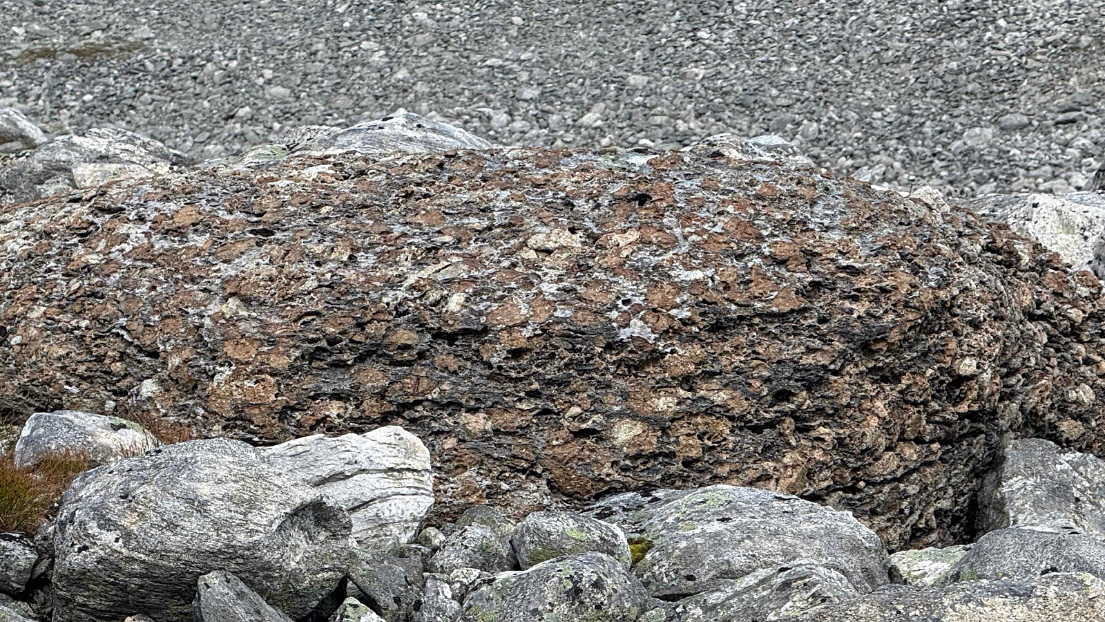
Makalausfjellet
Dato:
15.08.2025
Distanse:
5,2
km
© Erling T Dahl
Kart
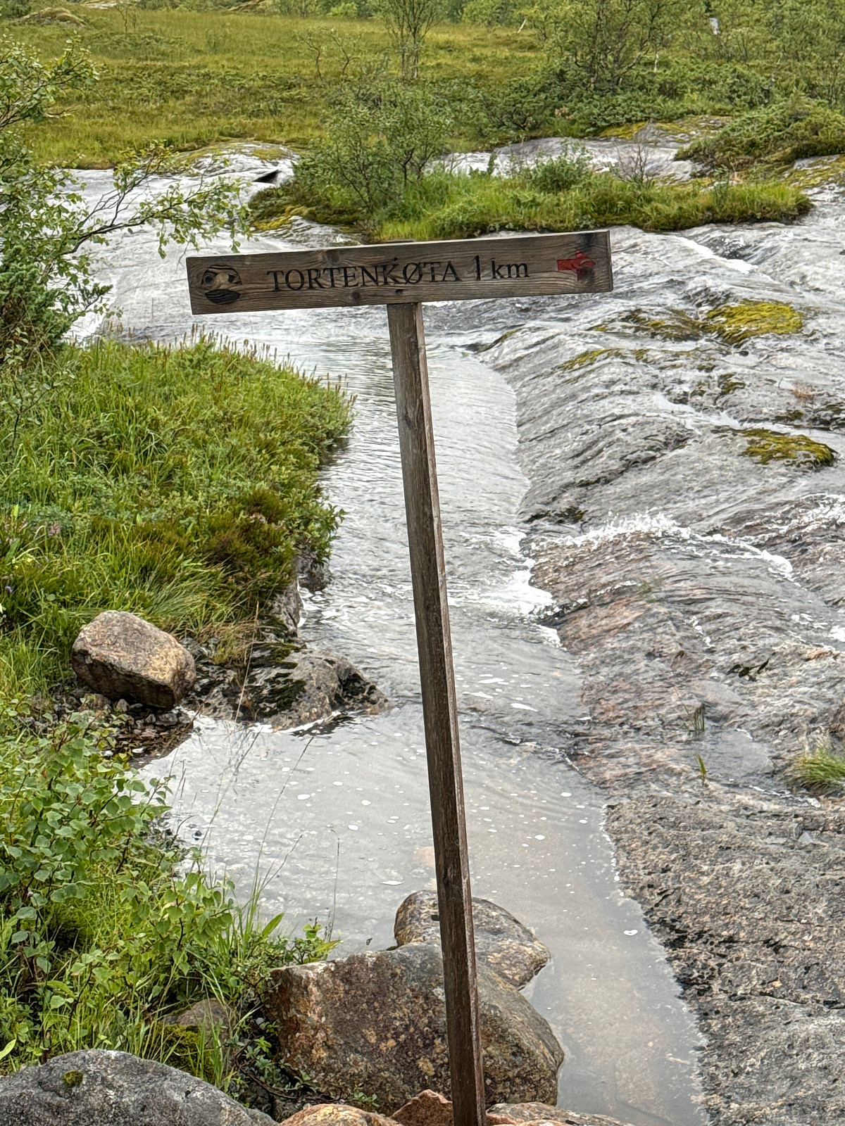
Tortenkøta
Dato:
11.08.2025
Turtype:
Fottur
Distanse:
2,2
km
© Erling T Dahl
Gøy
Kart
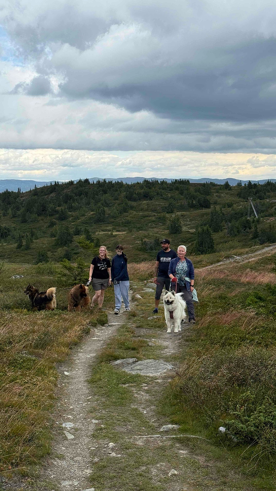
Segla
Dato:
08.08.2025
Turtype:
Fjelltur
Distanse:
4,5
km
© Erling T Dahl
Kart
Store Skorøy - div
Dato:
05.08.2025
Turtype:
Ekspedisjon
Distanse:
37,7
km
© Erling T Dahl
Kart
Skørsnøse
Dato:
23.02.2025
Turtype:
Trugetur
Distanse:
5,4
km
© Erling T Dahl
Kart
Vardhovdtinden
Dato:
22.02.2025
Turtype:
Trugetur
Distanse:
14,0
km
Kart
Lebergsfjellet
Dato:
01.09.2024
Turtype:
Fjelltur
Distanse:
5,3
km
© Erling T Dahl
Gjørmete. Kjedelig tur
Kart
Bruhøa - Oppdal - Tur
Dato:
23.08.2024
Distanse:
4,0
km
© Erling T Dahl
Kart
«
1
2
3
4
5
6
7
8
9
10
>
»
Logg inn
Språk
Mine turer
Mitt kart
Mine bilder
Min statistikk
Om meg