
Katrin (07.08.2014)

Written by HHauser (Helwig Hauser)

| Start point | Bad Ischl (470m) |
|---|---|
| Endpoint | Bad Ischl (470m) |
| Characteristic | Hillwalk |
| Duration | 3h 00min |
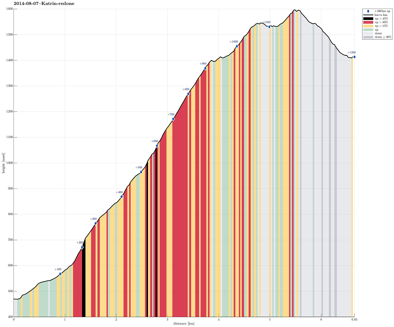
| Distance | 6.6km |
| Vertical meters | 1,198m |
| GPS |
|
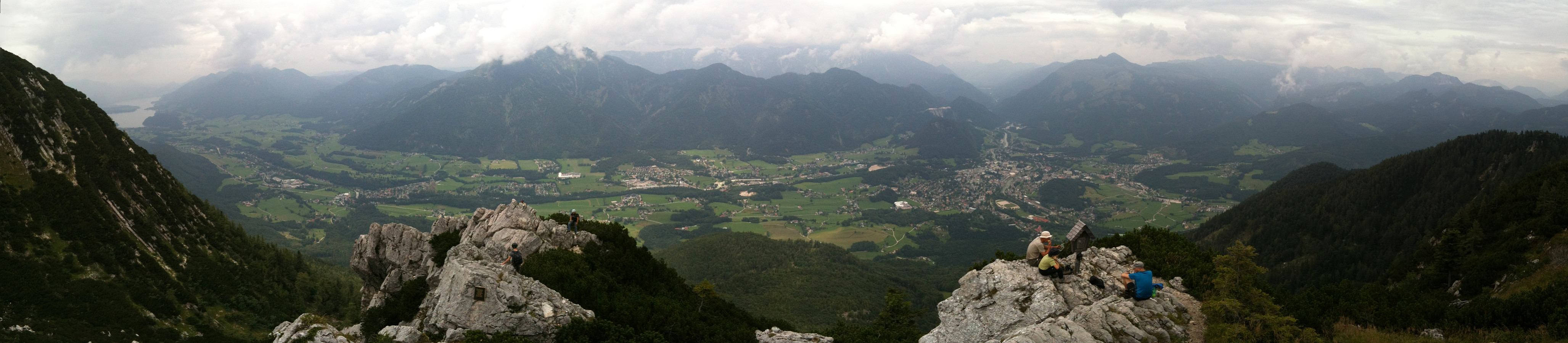
| Ascents | Elferkogel (1,601m) | 07.08.2014 |
|---|---|---|
| Visits of other PBEs | Katrin-Kreuz (1,542m) | 07.08.2014 |
| Katrinseilbahn (480m) | 07.08.2014 |
Note that this track has been created a posteriori, i.e., from memory, not automatically recorded.
Trip Summary
Up from Bad Ischl (where the cable car starts, at 470m, via Bildweg) to Katrinalm (1413m), which is a nice, steep hike up (about 1000m up) and then -- after some nice rest with served food and drinks -- quickly up to Katrin-Kreuz (1542m) and Elferkogel (1601m). Down, then, very comfortably with the cable car. :-)


User comments