
Sydpolen (23.08.2013)

Written by HHauser (Helwig Hauser)

| Start point | Parking place at the end of Haugsdalen (95m) |
|---|---|
| Endpoint | Parking place at the end of Haugsdalen (95m) |
| Characteristic | Hillwalk |
| Duration | 3h 00min |
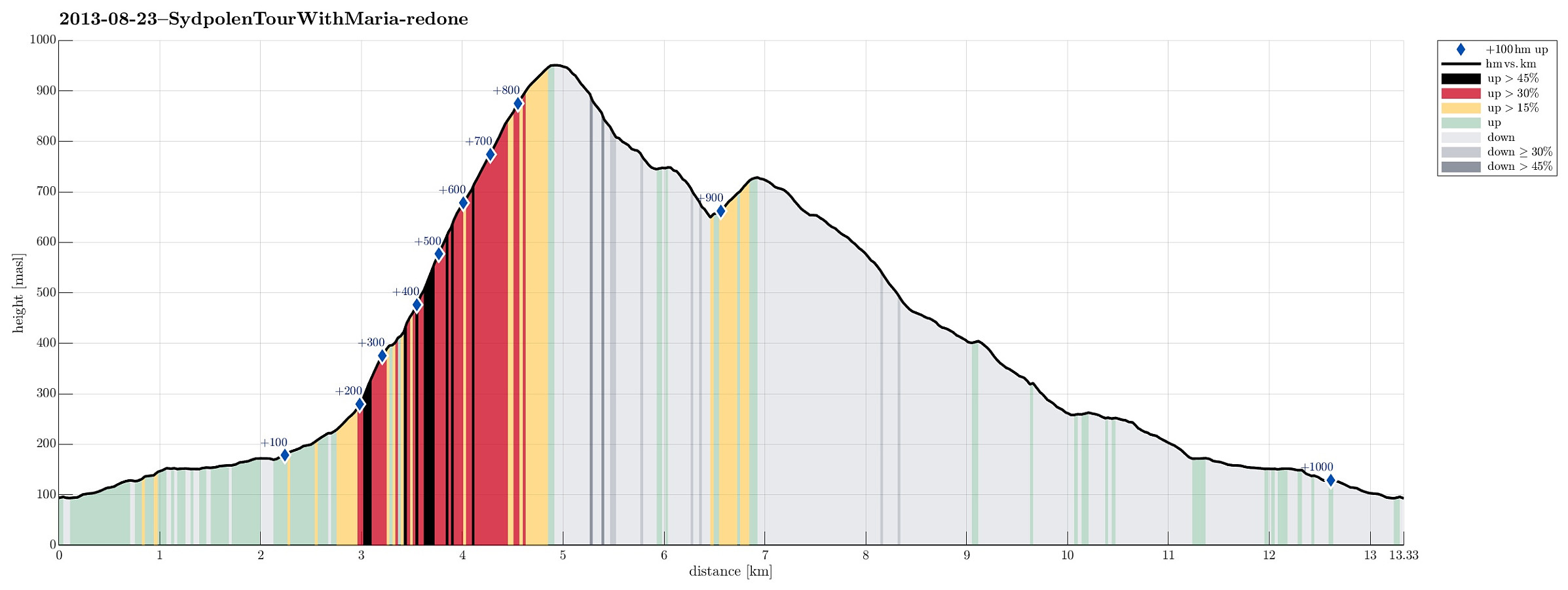
| Distance | 13.3km |
| Vertical meters | 1,004m |
| GPS |
|
| Ascents | Sydpolen (952m) | 23.08.2013 |
|---|---|---|
| Toro (733m) | 23.08.2013 | |
| Visits of other PBEs | Hausdalen parkering (94m) | 23.08.2013 |
Note that this track has been created a posteriori, i.e., from memory, not automatically recorded.
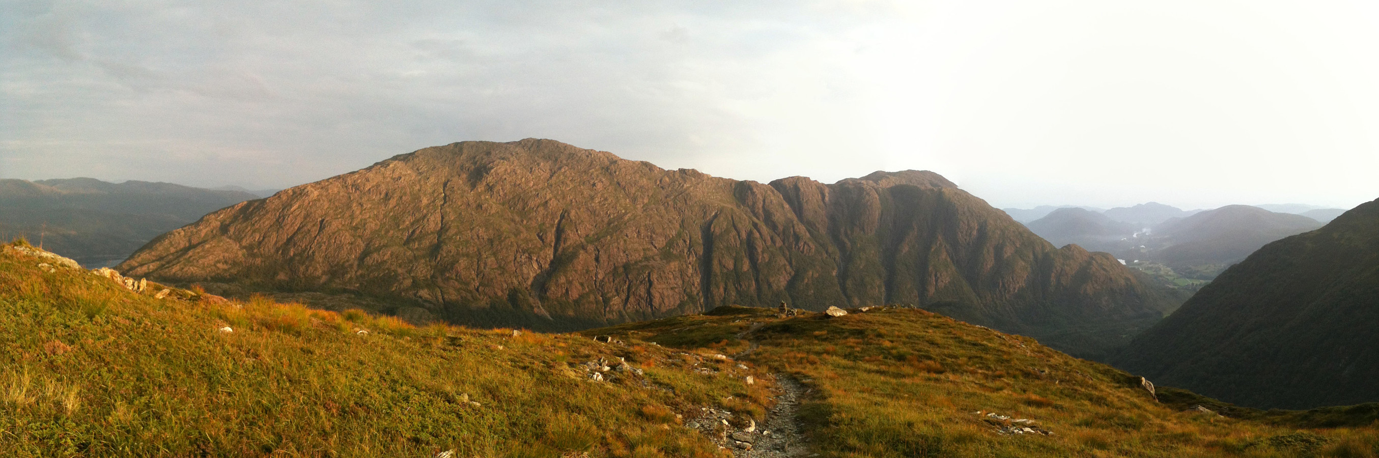
Trip Summary
Great quick evening walk from Brekkjedalen, up Sydpolen and then down again (via Toro) -- great walk-out in fantastic nature! :-)
Photos
Selected photos are available as Google photo album.
Useful Resources
Web page WestCoastPeaks.com provides useful information about S. Gullfjellstoppen (Sydpolen)
and also Petter Bjørstad has a useful page about Sydpolen.


User comments