
Záruby and Havranica from Smolenice castle (27.04.2026)

Written by HHauser (Helwig Hauser)

| Start point | Smolenice castle (300m) |
|---|---|
| Endpoint | Smolenice castle (300m) |
| Characteristic | Hike |
| Duration | 2h 15min |
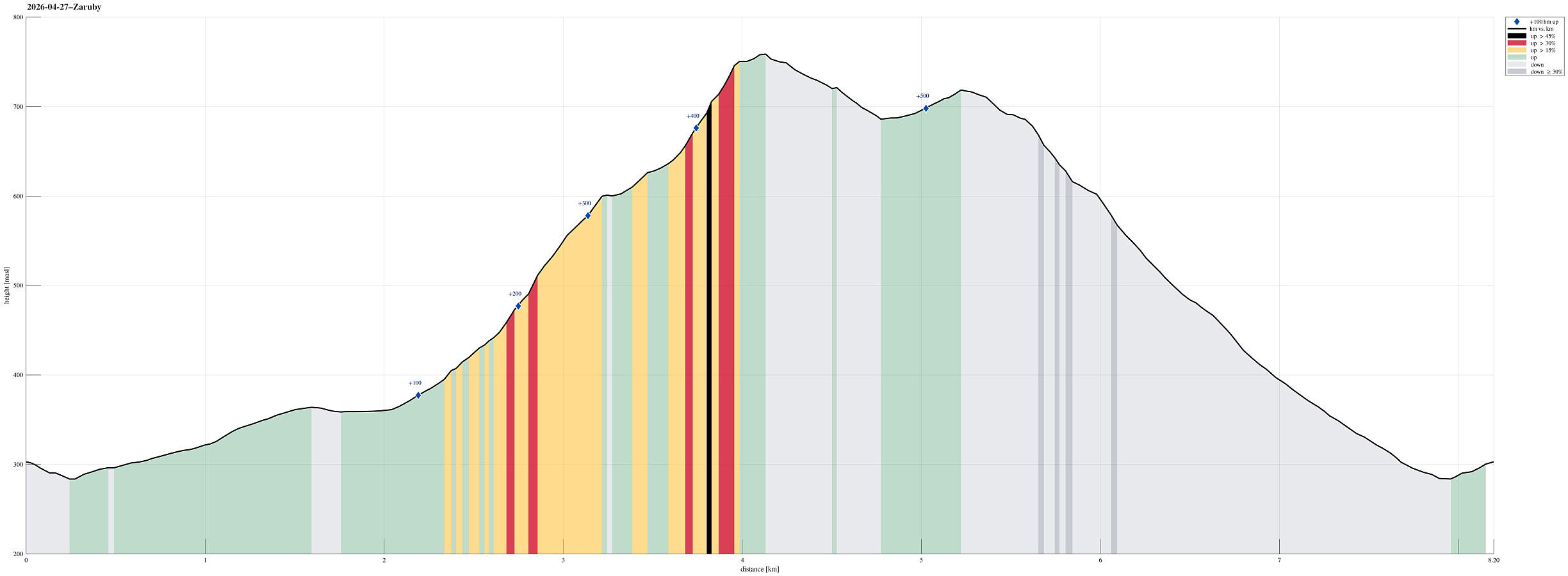
| Distance | 8.2km |
| Vertical meters | 540m |
| GPS |
|
| Ascents | Záruby (768m) | 27.04.2026 |
|---|---|---|
| Visits of other PBEs | Smolenický castle (300m) | 27.04.2026 |
Trip Summary
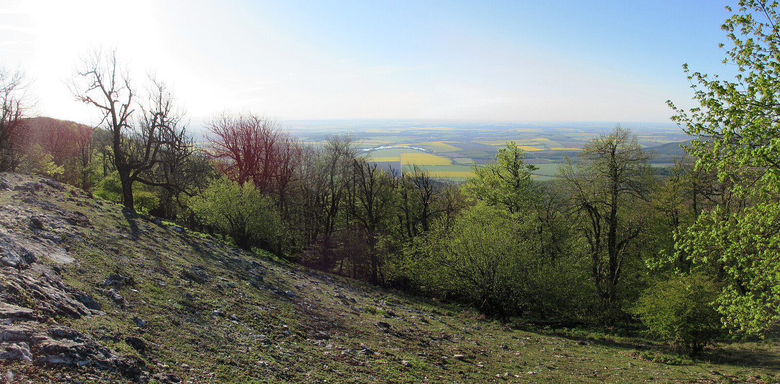
Before breakfast, I woke up early and decided that the day was simply to nice to not get out and attempt a walk or hike. Heading westwards and into the Carpartian mountains right next to Smolenice, I first followed a nice forest road with a gentle inclination. Near the first saddle, I then decided that I could try to reach Záruby, a bit further in the northwest. The trail there was nice (and steep), but within a bit more than one hour, after departing from the castle, I found myself on top of the east-west oriented ridge, right east of the top of Záruby. After quickly visiting the very top, I then followed the ridge "back" (in eastward direction) to also include Havranica on my way back. After stepping over Havranica, I found a nice vista point with a great view towards the southeast. From Havrania skala, it then was back down through the forest and well within breakfast time I had made it back. What a great way to start the day! :-)
Photos
Selected photos are available as Google photo album.
Useful Resources
See also the related FB-page Hiking around Bergen, Norway.


User comments