
Skiing Bildøybakken (14.02.2026)

Written by HHauser (Helwig Hauser)

| Start point | Bildøybakken (40m) |
|---|---|
| Endpoint | Bildøybakken (40m) |
| Characteristic | Backcountry skiing |
| Duration | 2h 00min |
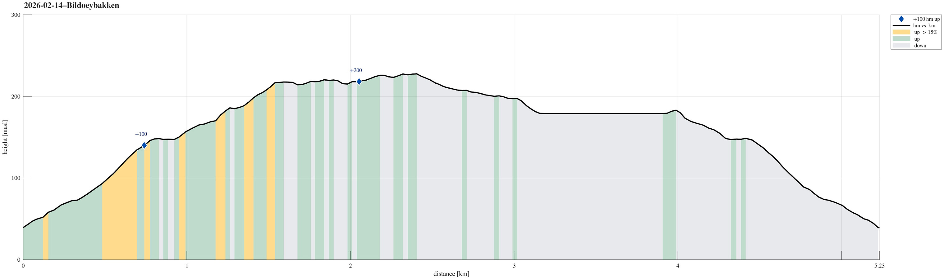
| Distance | 5.2km |
| Vertical meters | 223m |
| GPS |
|
| Ascents | Vardafjell (231m) | 14.02.2026 |
|---|
Note that this track has been created from memory, i.e., it was not recorded automatically.
Trip Summary
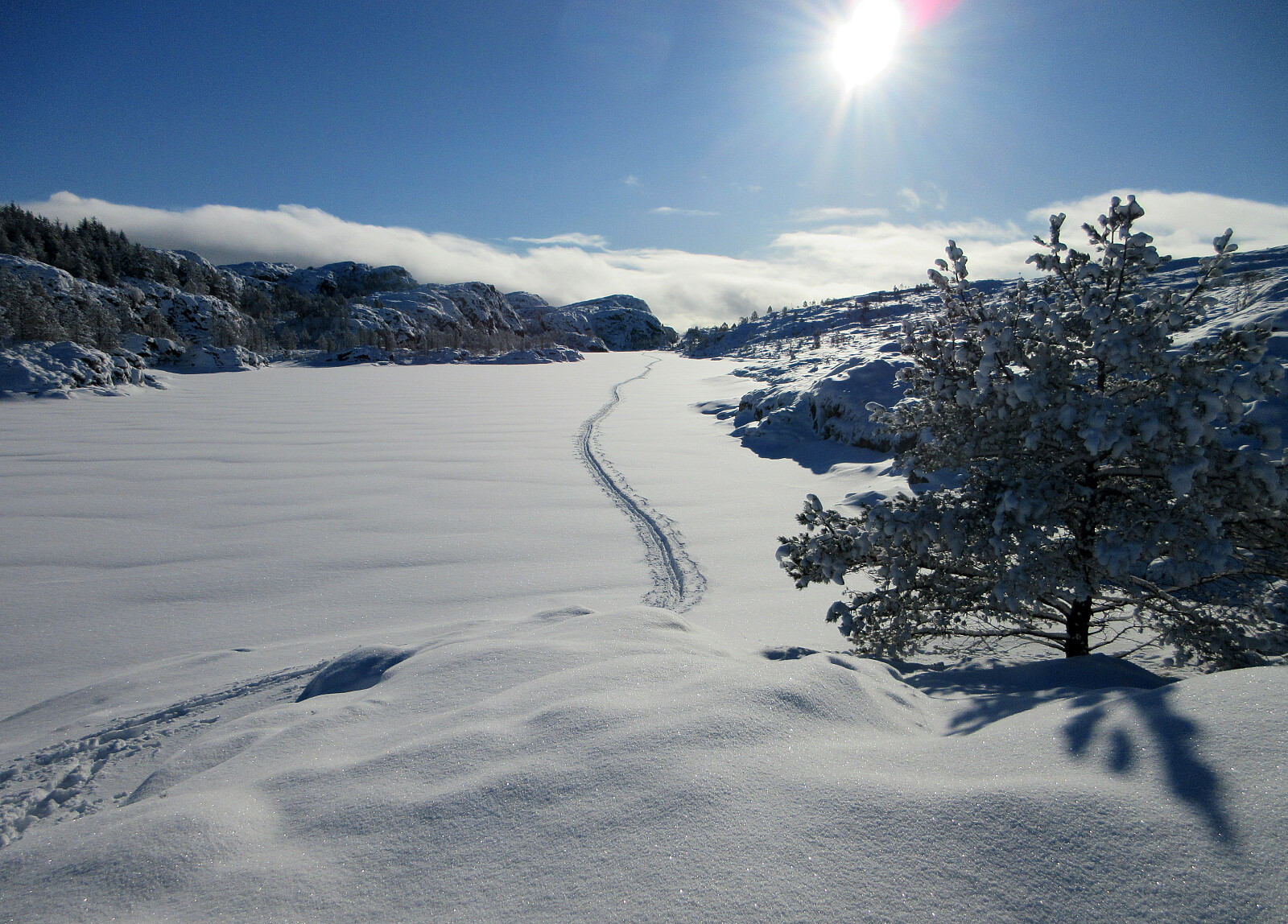
With new snow outside, we decided to take our skies and head towards Bildøybakken for an excursion into the snow. We parked at the lower end of the road which leads up to the dam of Bildøyvatnet, then following this road up to the dam. From there, we then ascended to Bildøyfjellet. Then, we continued across the heights of Bildøybakken (southwards to Vardafjellet). We then decided to connect to the southern end of Bildøyvatnet in order to cross it (on skies) south-to-north. This worked just fine and it did not take us all to long before we were back where we had started the afternoon.
Photos
Selected photos are available as Google photo album.
Useful Resources
See also the related FB-page Hiking around Bergen, Norway.


User comments