
Storhovden and Svartaberget from Varden (02.01.2026)

Written by HHauser (Helwig Hauser)

| Start point | Varden (45m) |
|---|---|
| Endpoint | Varden (45m) |
| Characteristic | Hillwalk |
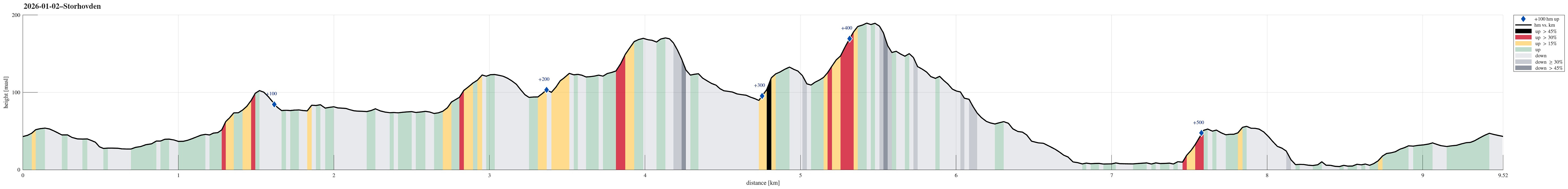
| Duration | 3h 00min |
| Distance | 9.5km |
| Vertical meters | 591m |
| GPS |
|
| Ascents | Hesjaholten (106m) | 02.01.2026 |
|---|---|---|
| Langaheia (130m) | 02.01.2026 | |
| Storhovden (174m) | 02.01.2026 | |
| Svartaberget (194m) | 02.01.2026 | |
| Visits of other PBEs | Myratjørnafossen (7m) | 02.01.2026 |
| Storhovden utsiktspunkt (172m) | 02.01.2026 | |
| Tjørnahuk (91m) | 02.01.2026 | |
| Øst for Elvareidet (60m) | 02.01.2026 |
Trip Summary
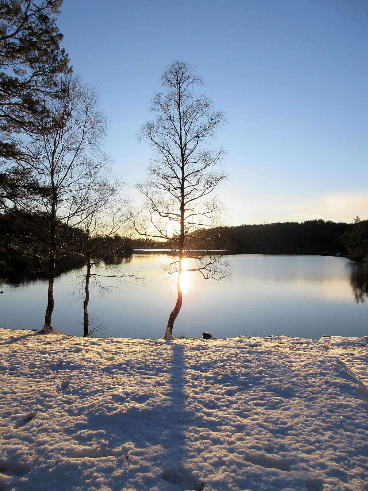
We started northwards from Varden, crossing the soccer fields to get closer to Kanadaskogen near Hesjaholten. After paying Hesjaholten a short visit, we continued further towards Krokatjørna. This time, we decided to cross over Langaheia from the south, before connecting to Storhovden via Spelhaugen. Since the day was indeed very nice, we then decided to also include Svartaberget via Storamyra where it was nice to also look up to TOBRIK. On Svartaberget, we then enjoyed a really nice winter view towards the west before starting our walk back southwards. After passing by Bjørndalsvatnet and Gjeddevatnet, we arrived back at Varden with good satisfaction about the very nice day!
Photos
Selected photos are available as Google photo album.
Useful Resources
See also the related FB-page Hiking around Bergen, Norway.


User comments