
Ötscher via Rauher Kamm from Lackenhof (21.09.2025)

Written by HHauser (Helwig Hauser)

| Start point | Lackenhof / Weitental (840m) |
|---|---|
| Endpoint | Lackenhof / Weitental (840m) |
| Characteristic | Hike |
| Duration | 6h 00min |
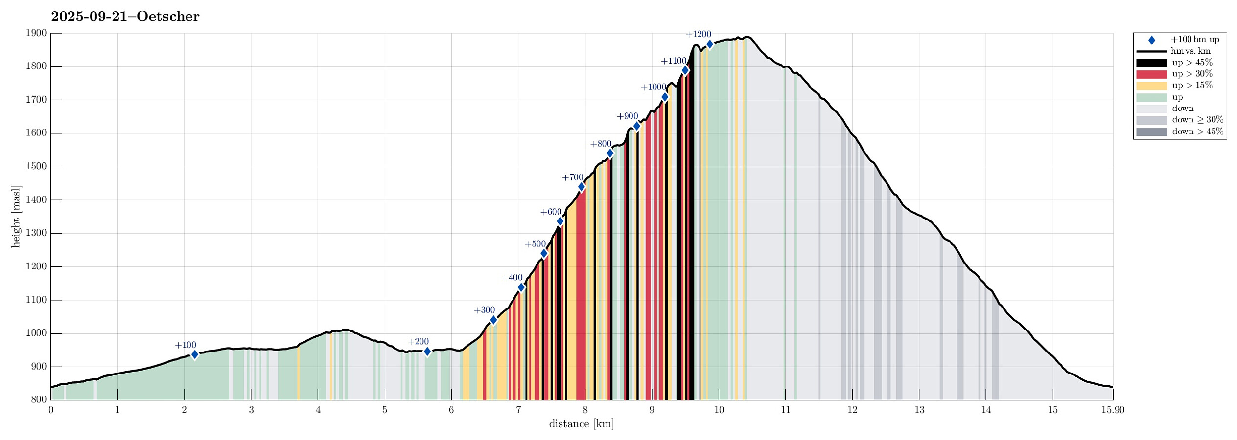
| Distance | 15.9km |
| Vertical meters | 1,248m |
| GPS |
|
| Ascents | Ötscher (1,893m) | 21.09.2025 |
|---|---|---|
| Visits of other PBEs | Wintertal / Lackenhof (842m) | 21.09.2025 |
| Ötscherschutzhaus (1,417m) | 21.09.2025 |
Trip Summary
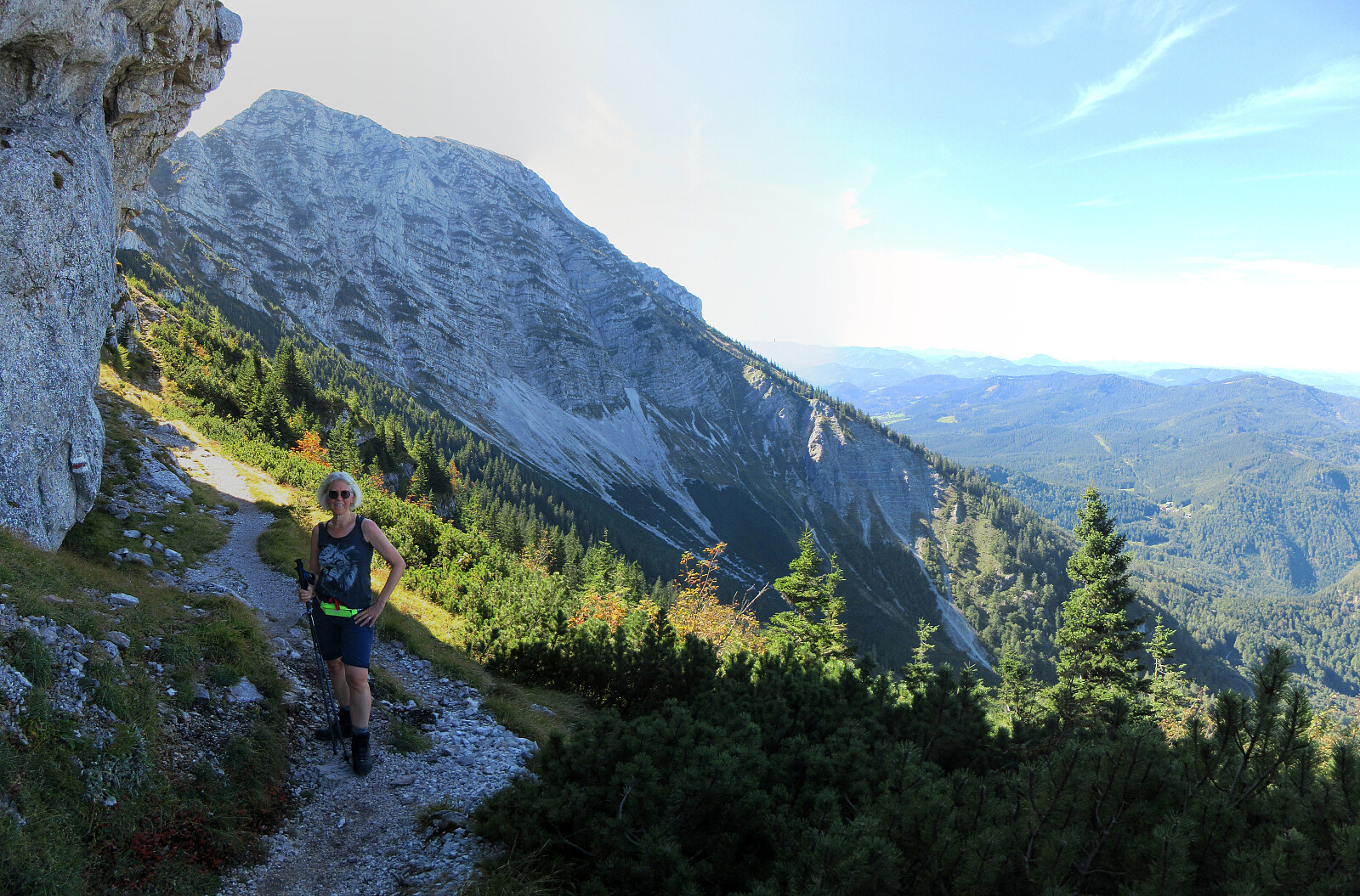
After spending the night involuntarily at an airport hotel in Amsterdam, we got to Vienna early on this Sunday, expecting a nice day. We thus rushed to get into the mountains, driving to Lackenhof in the southwest of Vienna. Our plan was to make a nice hiking round up and down Ötscher, using its northeastern ridge (Rauher Kamm) as the ascent route, while then descending via the Ötscherschutzhaus in the southwest of the mountain. Once in Lackenhof, we aimed at the large parking lot in Weitental to leave the car behind -- just to find that it was completely full with cars (while the combination of Sunday with nice weather and our relatively late arrival could have let us anticipate this situation, we had not). Luckily, one parking place got freed up only minutes after our arrival, letting us start our hike without much delay. Since it already was early afternoon (and late September, also), we thought that we should rather aim at some decent hiking pace to avoid any awkward situation late due to limited daylight. Our challenge was to first get to the point where we would start our ascent via Rauher Kamm for real, more than 6km away from the parking lot! While this first stretch was mostly level (more or less), it still meant to first cover 6+ kilometers to Bärenlacken, passing by Ötscherwiese and Raneck, taking some time even when walking as fast as possible. From Bärenlacken, then, we quickly made progress with our ascent, hiking about 500 height meters quite steeply upwards through the forest. This brought us up to the ridge (Rauher Kamm), which we then followed towards the top of Ötscher. While it clearly is possible to "simply hike" this route without any need to climb for real (every now and then, however, the use of hands helps), one is better not afraid of heights up there (it's rather steeply down on both sides at times). We weren't the only ones, who enjoyed this route up to Ötscher on this nice day, and we also passed by one hiker, who apparently did not manage to traverse some of the slightly more exposed stretches, having to return instead of making it all to the top (this, if possible, is a situation that really should be avoided as it usually is easier to ascend than to descend, especially when the circumstances are non-trivial). After a nice traverse of Rauher Kamm, we soon arrived at the top of Ötscher, enjoying some great views from up there. After a short break on the top, we then continued to make it back down before the waning of daylight. At the Ötscherschutzhaus, we enjoyed a glass of refreshment each. From there, we then continued, first to Riffelsattel a bit further south, and then back down the valley of Riffelbach to get back to the parking lot. Night had not yet fallen and we were highly satisfied that we had managed this nice hike, especially also given the fact that we had slept in Amsterdam the preceeding night! :-)
Photos
Selected photos are available as Google photo album.
Useful Resources
See also the related FB-page Hiking around Bergen, Norway.


User comments