
Round around Vinddalsvatnet (30.03.2025)

Written by HHauser (Helwig Hauser)

| Start point | Søfteland (55m) |
|---|---|
| Endpoint | Søfteland (55m) |
| Characteristic | Hillwalk |
| Duration | 3h 00min |
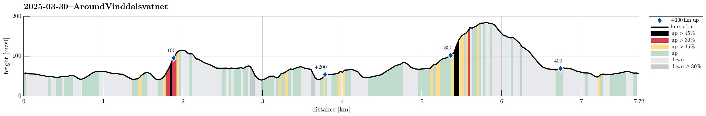
| Distance | 7.7km |
| Vertical meters | 423m |
| GPS |
|
| Ascents | Galtåsen (118m) | 30.03.2025 |
|---|---|---|
| Søftelandsfjellet (191m) | 30.03.2025 | |
| Visits of other PBEs | Gamle Torve bro (39m) | 30.03.2025 |
Trip Summary
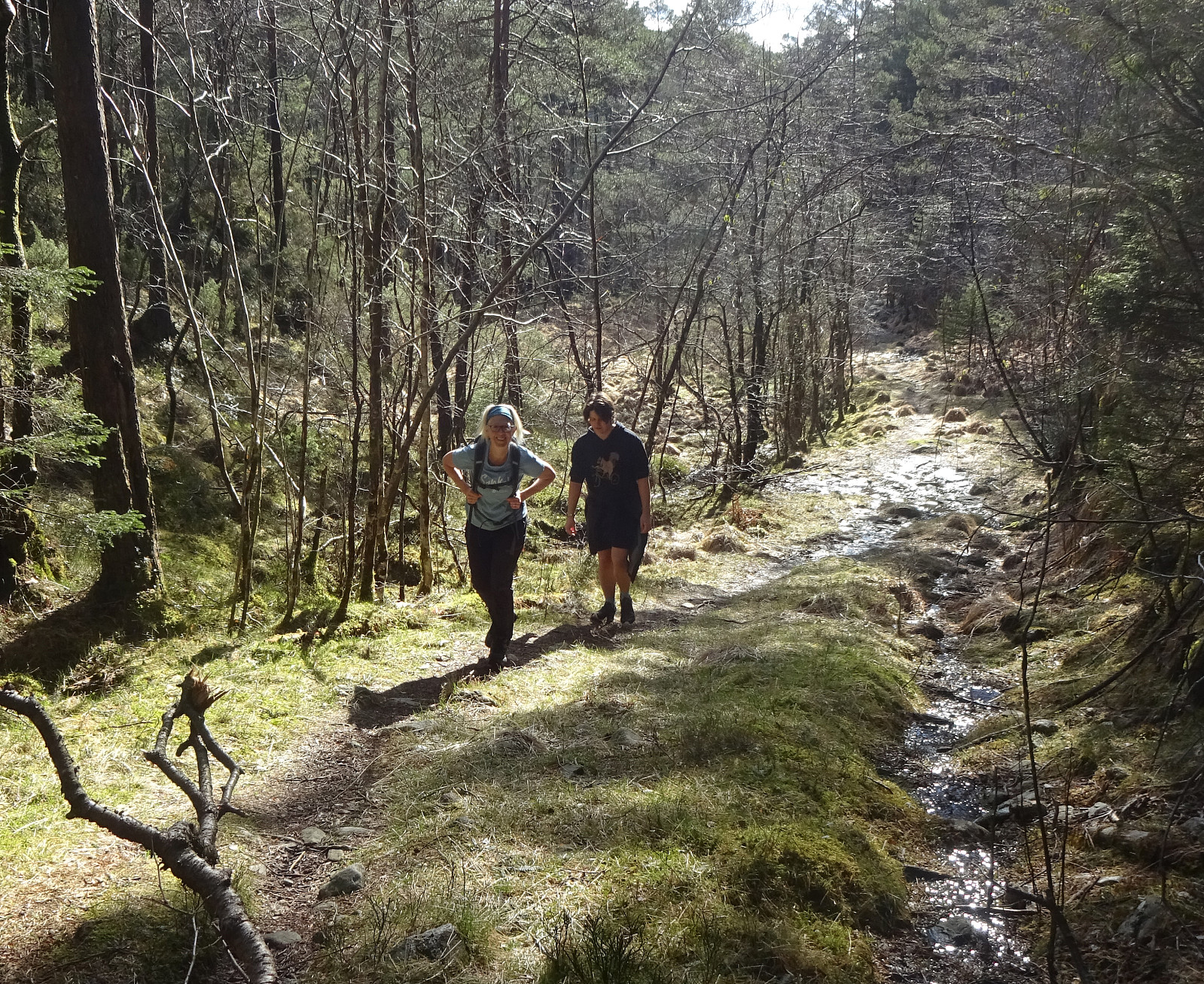
We started in Søfteland, heading for Gamlevegen. Our first goal was to have a look a this old stone bridge (gamle Torve bro), which -- apparently -- once was part of the old Postal route to Stavanger. This bridge seems to be in a pretty bad condition, hold together by some improvised support structure, these days. We then continued further southwards (following, if not mistaken, the former Postal route). After passing by Gåsakilen (on its western side), we left the "main route" to include Galtåsen "on the way". Since we approached it from the North, this ascent was a bit steep at times (but fully doable). From Galtåsen, we then continued in southwestern direction, eventually "ending up" on a nice forest road. But instead of stepping out and onto Byvegen, we found a minor trail "in parallel" to Vinddalsvatnet. This brought us into a nice, short valley that slopes down to Vinddalsvatnet. From there, we then followed a forest road that surrounds Vinddalshaugane. Near to the junction with another forest road, we found a trail that lead down to Kvernavika and from there "back up" on the other side. This way, we conveniently connected to the northwestern side of Vinddalsvatnet, ready for our walk back towards Søfteland. After passing by Kvernatjørna (in the west of Vinddalsvatnet), we then found the trail that leads to Søfteland. After following this trail up to Storemyrane, we then entered Spondalen instead of following the trail further to Søfteland. To our surprise, we found a simple forest road also in Spondalen. After first walking up Spondalen for a bit, we then took a steep but nice chance to ascent further upwards in order to also include Søftelandsfjellet. From Søftelandsfjellet, which not really has any mentionable peak, we could look down into Langedalen on the other side. After crossing over Søftelandsfjellet, we quickly found another forest road, which we then followed down to Søfteland. All in all, a nice hill walk in some nice weather! :-)
Photos
Selected photos are available as Google photo album.
Useful Resources
See also the related FB-page Hiking around Bergen, Norway.


User comments