
Nice round around Korsneset (08.12.2024)

Written by HHauser (Helwig Hauser)

| Start point | Korsneset P (35m) |
|---|---|
| Endpoint | Korsneset P (35m) |
| Characteristic | Hike |
| Duration | 2h 30min |
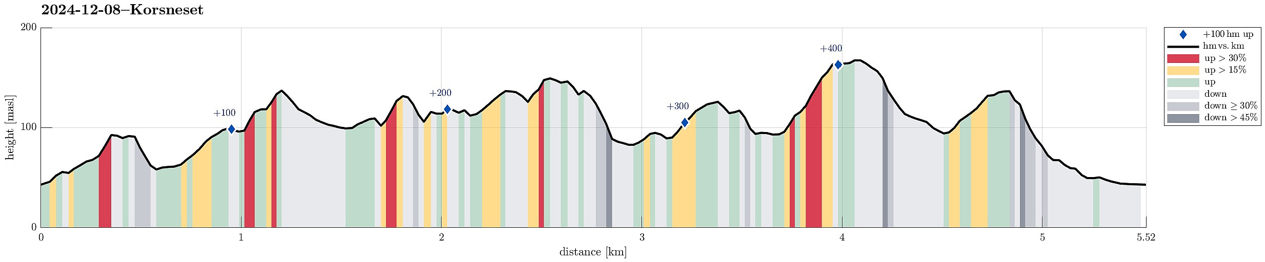
| Distance | 5.5km |
| Vertical meters | 456m |
| GPS |
|
| Ascents | Hendershaugen (98m) | 08.12.2024 |
|---|---|---|
| Kjetilsfjellet (140m) | 08.12.2024 | |
| Leirvågfjellet i Fana (153m) | 08.12.2024 | |
| Moldstigahaugen (136m) | 08.12.2024 | |
| Nonkletten (141m) | 08.12.2024 | |
| Ramnaberget (129m) | 08.12.2024 | |
| Veten i Fana (172m) | 08.12.2024 | |
| Visits of other PBEs | Korsneset p-plass (35m) | 08.12.2024 |
Trip Summary
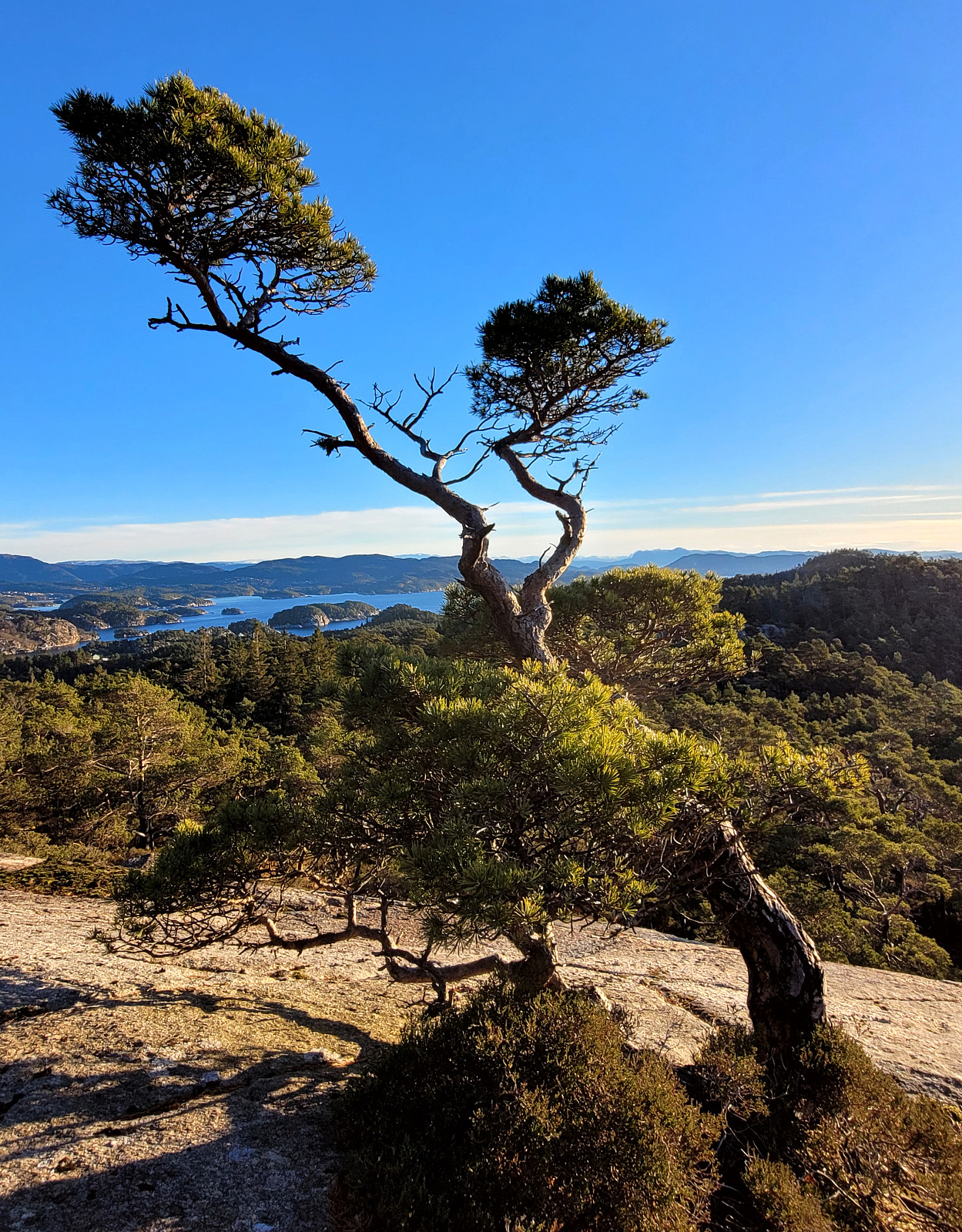
The weather was looking good for this Sunday and so we aimed at getting some fresh air around our heads. We headed via Fana to Korsneset and parked at the parking place right at the entry to the military area. Our first goal was Hendershaugen in the south of the road. To get there, we first walked the road back a few meters, before then heading towards the top of Hendershaugen along the outer rim of the military area. Even though Hendershaugen is not very high, it's still nice to get up there and enjoy some nice views. From Henderhaugen, we then headed northwards. More or less right where we stepped out of the forest and onto Korsnesvegen, we decided to continue northwards via the eastern heights of Korsneset (instead of walking back to the parking place). Within a few minutes, we were up at the saddle, where we left the trail in order to ascend to Nonkletten via its western heights. At some places during this ascent, one can enjoy some nice views. From Nonkletten, we then followed a trail further northwards. Since we already were there, we then visited the top of Moldstigahaugen, also. Next, we aimed at Leirvågfjellet, even further north. We did not really find any trail, but making it to Leirvågfjellet was not all too wild, nonetheless. At Leirvågfjellet, we enjoyed more nice views (and some sun). We then found a way to descend from Leirvågfjellet towards the saddle of Korsnesvegen, avoiding the steepest sections. Next, we wished to visit Ramnaberget in the north of Veten. Crossing the terrian to get there was a bit wet, but worked out fine. While Ramnaberget is mostly covered by trees, we still found one place with nice views towards the northwest. From Ramnaberget, we then started our return-hike. The next goal was Veten and to get up there, we needed to start in the very northeast of it (the north side of Veten is very steep, including lots of cliffs). Once there, we then used a proper trail to get to the top of Veten. After enjoying some nice views from Veten, we then continued along the trail which leads back down to Korsnesvegen after first leading down from Veten in southern direction. Before making it all the way down to Korsnesvegen, though, we used the last saddle to get over to the northeastern ridge of Kjetilsfjellet. Even though there's not really a trail up Kjetilsfjellet, it's neither difficult to follow this ridge all the way up. Once on the top of Kjetilsfjellet, we either could have stepped back down the same ridge that we had come up, or continue off-trail further southwards. Doing the latter, we made it quickly down to Tjukkekjerret from where we swiftly connected to Korsnesvegen again. Walking back to the car was then just a matter of a few minutes. All in all, we returned well refreshed and very satisfied with this hike.
Photos
Selected photos are available as Google photo album.
Useful Resources
See also the related FB-page Hiking around Bergen, Norway.
Petter Bjørstad has a useful page about Veten and also web page WestCoastPeaks.com provides useful information about Veten.
Web page UT.no from the Norwegian Trekking Association also recommends a hike to Veten.


User comments