
Exploring some hills near Vadmyra (01.06.2024)

Written by HHauser (Helwig Hauser)

| Start point | Varden (45m) |
|---|---|
| Endpoint | Varden (45m) |
| Characteristic | Bike trip - mixed |
| Duration | 3h 00min |
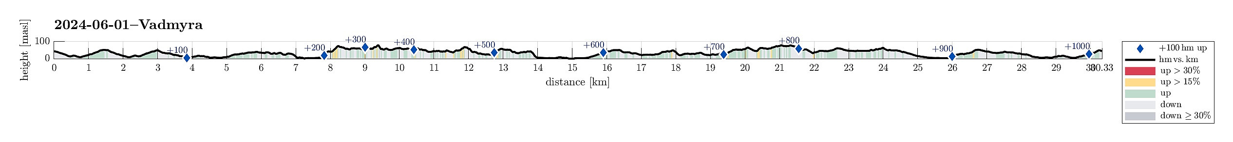
| Distance | 30.4km |
| Vertical meters | 1,023m |
| GPS |
|
| Ascents | Hetlevikåsen (75m) | 01.06.2024 |
|---|---|---|
| Vadmyra (72m) | 01.06.2024 | |
| Høyvikåsen (81m) | 01.06.2024 | |
| Penesskjenet (67m) | 01.06.2024 | |
| Visits of other PBEs | Hetlevikstraumen bro (3m) | 01.06.2024 |
| Sælen kirke p-plass (15m) | 01.06.2024 | |
| Vassenden skole (tuft) (29m) | 01.06.2024 |
Trip Summary
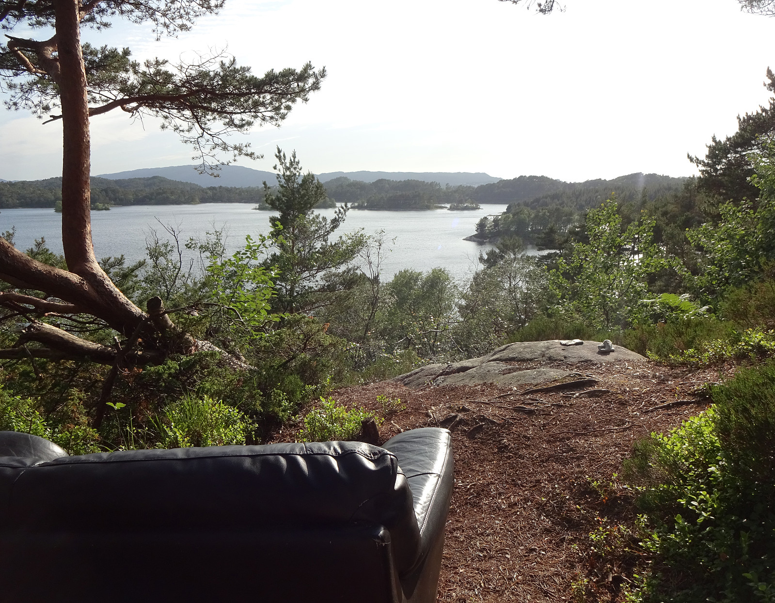
After a relatively calm day, there were still a couple of hours to spend outside. The plan was to explore the area around Vadmyra between Storavatnet in the west and Loddefjord in the east. I took the bike along Bjørgeveien and then via Bjørndalsbrotet across Hetlevikstraumen to leave it at Haakonsvernveien, south of Hetlevikåsen. I found a trail that leads up into the direction of Vadmyrahallen (right under the power line). Once up and close to Vadmyrahallen, I turned left in order to make it up to Hetlevikåsen (without finding a trail, though). From Hetlevikåsen, I continued further northwards to find a way up to Høyvikåsen. The western flank of Høyvikåsen is a steep cliff and I first got a bit too far down. A bit of back-tracking, however, brought me back up and further north to Høyvikåsen. High above the cliff, one can find some nice viewpoints on Høyvikåsen (even though this hill is not high at all). North of Høyvikåsen, the terrain became a little less clear and progress was partially made off-trail. Next, I aimed at Peneset. In parts on trail and in parts off trail, I continued further northwards and surrounded Peneset. After walking around Peneset, I started my way back into the direction of Vadmyra. Before walking down to Vadmyra, I included also the hill in the north of Vadmyra. Eventually, I came down to Vadmyra and from there I walked back southwards into the direction of Vadmyrahallen and past it to get back to my bike. I then took my bike southwards to Haakonsvern. From there, I followed Vassendveien, passing by Småvatnet. Biking further northwards along Håkonshellaveien, I passed by Alvøen. At Grønestølen, I left Alvøveien and followed a gravel trail to the sport area of Alvøen. Since the trail that would "hug" Storavatnet in the northwest could not be used (because of the construction work related to the new bridge to Sotra), I instead headed further northwards to Kipleveien. From there, I connected to Godviksvingene and the bike path there, which brought me around Harafjellet. Continuing along Godviksvingene, I biked back to Loddefjord and from there back to Varden along Bjørgeveien. All in all, this exploration turned out a bit longer than originally anticipated. :-)
Photos
Selected photos are available as Google photo album.
Useful Resources
See also the related FB-page Hiking around Bergen, Norway.


User comments