
From Vistvik to Stovegolvet on Stord (10.05.2024)

Written by HHauser (Helwig Hauser)

| Start point | Vistvik (35m) |
|---|---|
| Endpoint | Stovegolvet (695m) |
| Characteristic | Hike |
| Duration | 7h 00min |
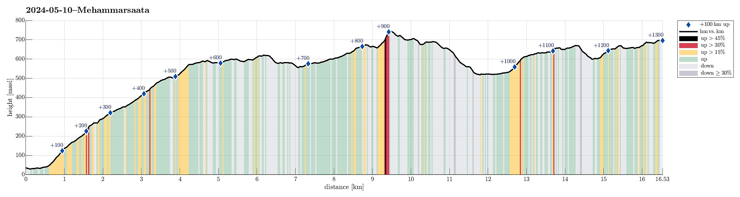
| Distance | 16.5km |
| Vertical meters | 1,301m |
| GPS |
|
| Ascents | Grønafjellet (623m) | 10.05.2024 |
|---|---|---|
| Fitjarhesten (678m) | 10.05.2024 | |
| Mehammarsåto (749m) | 10.05.2024 | |
| Visits of other PBEs | Kvelve (590m) | 10.05.2024 |
| Stovegolvet Turisthytte (695m) | 10.05.2024 | |
| Stovegolvet sikteskive (700m) | 10.05.2024 | |
| Tindaslottet (575m) | 10.05.2024 |
Trip Summary
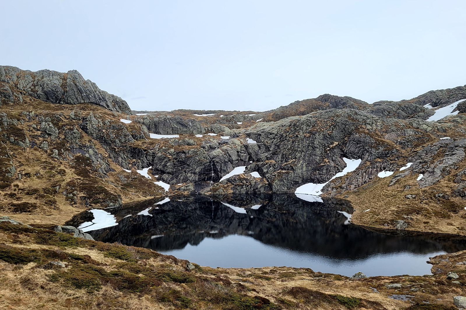
As part 1 of a two-days hike across Stord, we first took an early bus from Bergen southwards. The bus dropped us off near Vistvik (Vestvik?) quite a bit north on Stord. From Grønestølen, we then started our ascent into Hovlandsdalen, where Vistvikelva comes down. At almost 200 masl, we then followed a sign towards Tindane (turning left to get up the northern ridge of Tindane). We then followed the trail further up to Tindane (this trail is not used a lot, as it seems, but still easy to find -- at times, howover, the terrain is quite wet). Near Tindane, we then arrived at Tindaslottet (a small cabin, firmly protected by stones all-around). After a short break (it was not really warm enough for any longer break, and also we could not really enjoy a lot of great views due to low-hanging clouds), we then continued across Tindane into the direction of Grønafjellet. Since the trail from Tindaslottet surrounds Grønafjellet, we left the trail and continued between some small lakes to get to Grønafjellet. Since Grønafjellet does not really stand out from its surrounding and also the weather was not really clear, neither, we first walked a bit too far, before understanding that we were about to miss Grønafjellet on our right. Without much delay, however, we corrected our angles and included Grønefjellet nonetheless, passing by a nice little lake in its south. From Grønafjellet, we then headed towards Mehammarsåta, joining the main trail there a bit south of Grønafjellet. From there, it was then mostly following the main trail until we were quite close to Mehammarsåta, already. Still, we could not resist to not include Fitjar's hightest point, Fitjarhesten in the northwest of Mehammarsåta, even though this important location is rarely standing out of the surrounding landscape anyway (especially given the towering Mehammarsåta right next to it!). As we expected the weather conditions to be colder and windier on the top of Mehammarsåta, we ate some lunch on Fitjarhesten instead. We then crossed over Mehammarsåta, following the main trail further southwards. Near Stemmetjørna, we then descended into Store Tjørnadalen in order to get over to the other, southern side. Northwest of Martetjørna, we then ascended again until we had some nice views across Martetjørna. Following the trail, we basically surrounded Martetjørna towards Kudalen. Soon after, we arrived at a high point above Heio with great views southwards and southeastwards. After a short descent to the point, where trails from four directions meet (still above Heio), we first filled up our water bottles at a nice little waterfall, before then starting our final ascent of the day (to Stovegolvet). At Stovegolvet, we then arrived at the very nice cabin, where we then also stayed over night. Even though the weather was not all-fantastic, we still found ourselves highly satisfied with this nice hike across Stord! :-)
Photos
Selected photos are available as Google photo album.
Useful Resources
See also the related FB-page Hiking around Bergen, Norway.
Petter Bjørstad has a useful page about Mehammarsåta and also web page WestCoastPeaks.com provides useful information about Mehammarsåta.


User comments