
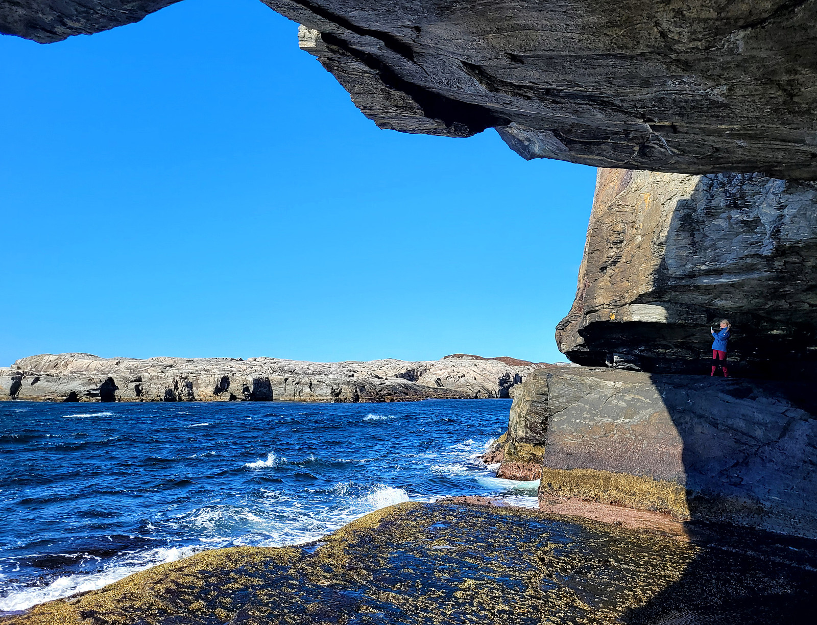
Bekhilderen at low tide (20.04.2024)

Written by HHauser (Helwig Hauser)

| Start point | Telavågvegen (40m) |
|---|---|
| Endpoint | Telavågvegen (40m) |
| Characteristic | Hillwalk |
| Duration | 3h 00min |
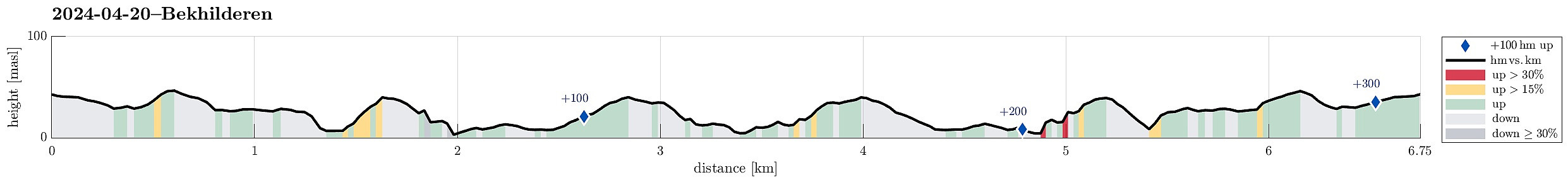
| Distance | 6.8km |
| Vertical meters | 309m |
| GPS |
|
| Visits of other PBEs | Bekhilderen (5m) | 20.04.2024 |
|---|
Note that this track has been created from memory, i.e., it was not recorded automatically.
Trip Summary
Planning our timing just right, we decided to visit Bekhilderen at low tide. We parked along Telavågvegen and followed first the road Håvarden. This brought us to the old mill at Selståvågen. From there, we followed the trail first to Grunnevågen and then further, on the other, southern side, to Bekhilderen. After having some good time there, we returned, basically following the same route "backwards". :-)
Photos
Selected photos are available as Google photo album.
Useful Resources
See also the related FB-page Hiking around Bergen, Norway.
Web page UT.no from the Norwegian Trekking Association recommends a similar hike.


User comments