
Dom (03.07.2023)

Written by hmsv1 (Hannah Vickers)
| Start point | Dom hut (2,967m) |
|---|---|
| Endpoint | Randa (1,424m) |
| Characteristic | Alpine trip |
| Duration | 13h 38min |
| Distance | 16.1km |
| Vertical meters | 2,010m |
| GPS |
|
| Ascents | Dom (4,545m) | 03.07.2023 |
|---|
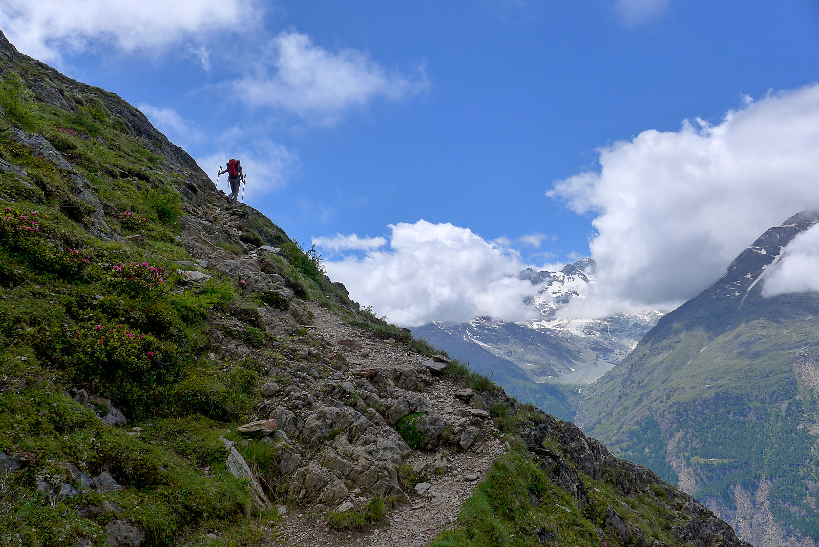
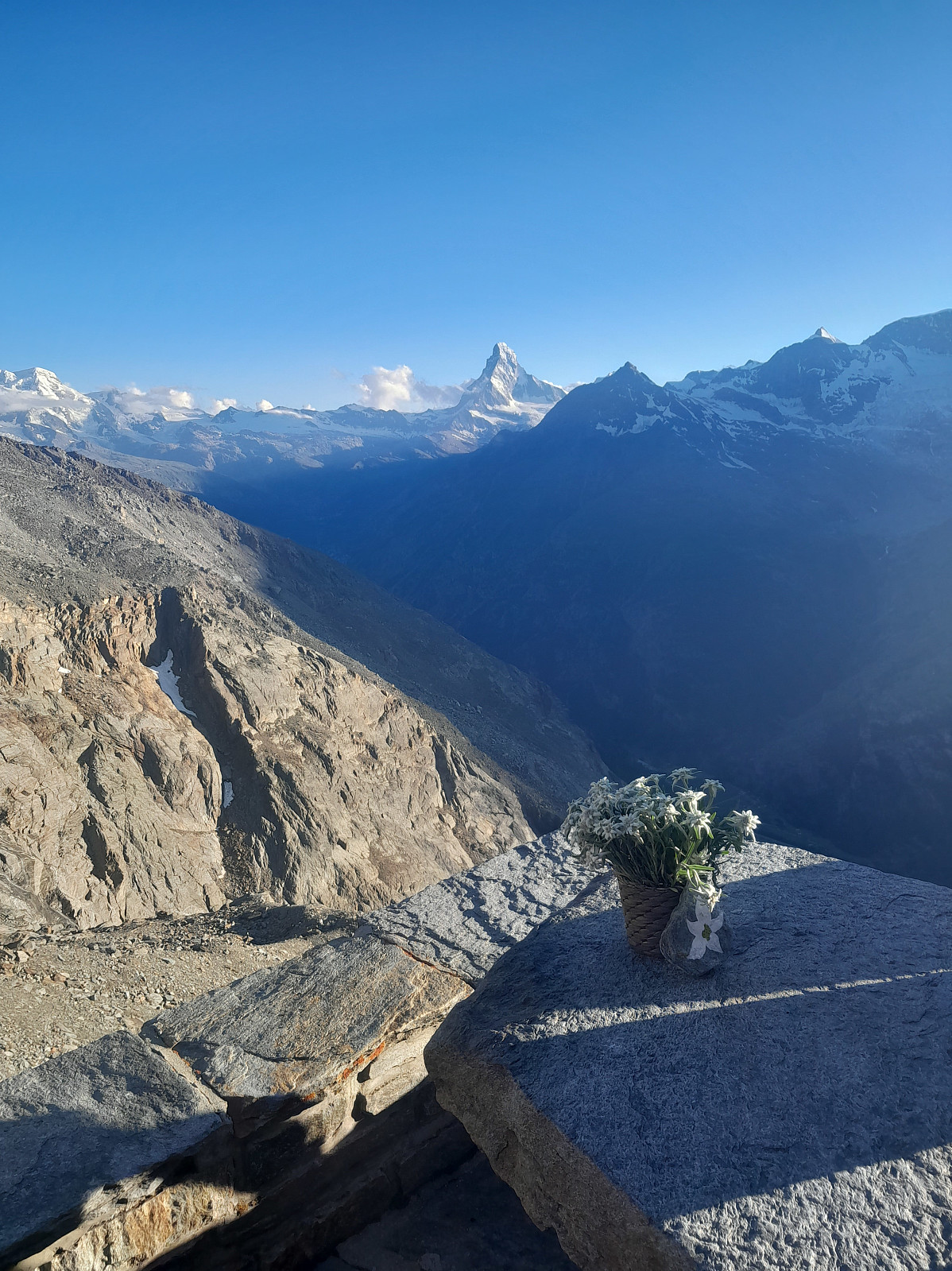
Following a couple of days of bad weather, it looked like we would be getting a couple of days of good weather again for the final week of the holiday. As I now only had two more summits to go to complete the 50 principal 4000m peaks of the Alps it was basically a toss up between the Dom and the Aiguille Blanche de Peuterey. I’d been following the weather forecast for the respective peaks rather closely and had come to the conclusion that the weather would be better further east at the start of the this final week, with apparently more sun and less wind forecasted for the Dom than on for example the Tour Ronde, which was the closest peak I could find to the Aiguille Blanche de Peuterey in the meteoblue database. I’d earlier hoped that the Taschhorn-Dom traverse would be a possibility this year as we’d only made it as far as the Täschhorn in 2022 because of too much wind, but due to the snow cover persisting for a bit longer this summer the traverse still looked too snowy, so it looked like the only options we had were to either do the easy plod up the normal route in the north flank or ascend via the Festigrat, the ridge that borders the west side of the Dom’s majestic north flank. Both routes started from the Dom hut in any case, which was a 1600m slog up from the valley. I phoned up the Dom hut (which had only just re-opened for the summer) and found out they had spare places for the sunday night we wanted to stay there, so that all worked out pretty well. We drove over from Evolene at around 8 on sunday morning, and began the walk up to the hut some time after 10am. Despite the cloud cover it was a warm morning in Randa. For the majority of the ascent up to the hut I was feeling pretty lethargic with tired legs, but some entertaining gossip with Tim made the final slog up to the hut pass by a bit quicker and it was only around 2.30pm when we arrived, giving us plenty of time to relax in the afternoon before dinner. This was my first visit to the Dom hut but I thought it was a pretty decent hut to stay at; spacious, clean toilets and washrooms and a nice dining area with good views across to the Matterhorn, Ober Gabelhorn, Zinalrothorn and Weisshorn on the opposite side of the valley. The clouds had persisted for most of the afternoon, but finally began to part while we were having dinner, revealing a very impressive looking north face of the Matterhorn.
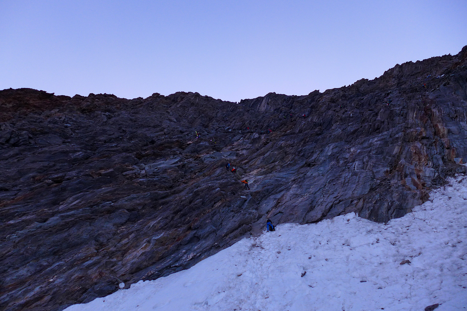
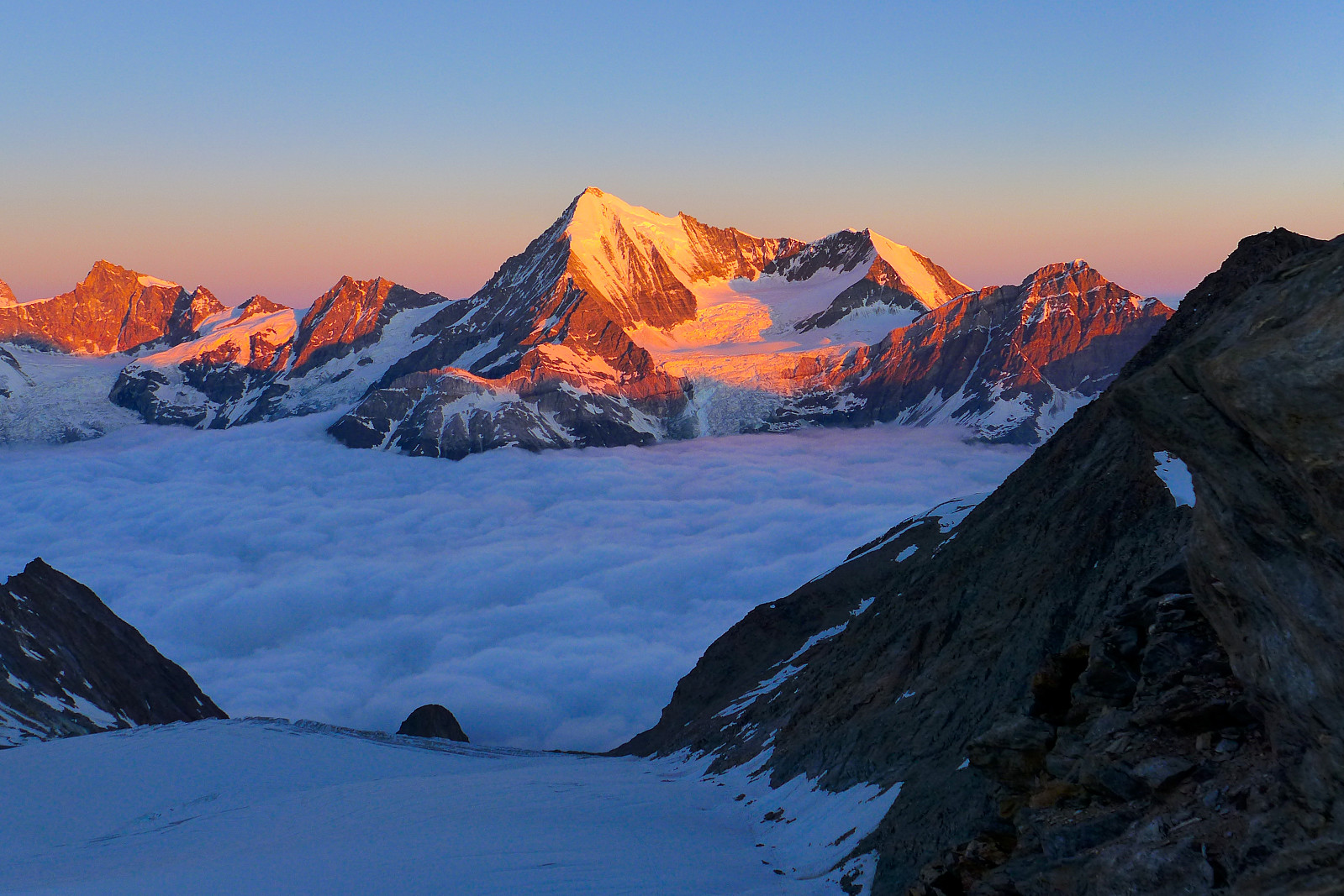
The breakfast was served at 3am, and with most people at the hut going in the same direction as us the boot room ended being a bit of a chaotic scene. In a rush to try and exit from the chaos I ended up busting the zip on the integrated gaiter on my right boot which was not particularly helpful. Fortunately the leg of my trouser sat quite snugly over the top of my boot, so it more or less held the gaiter in place so that the two sides weren’t flapping around for the rest of the day. From the hut the path ascends rather efficiently (another word for steeply) up a kind of moraine ridge and then over some rubble for the first 250m before meeting the Festigletscher at around 3200m. This first 250m felt like an insane amount of effort for some reason, and I was really even starting to doubt whether I’d even make it up to the Festijoch, where the Festigrat started – let alone to the top of the Dom. Somehow once we got onto the Festigletscher and plodded in a steady pace up the gently-angled snow slopes, I was not hating life so much and even began to believe reaching the Festijoch was an achieveable first goal for the day. It was already starting to get a little bit light by the time we approached the foot of the loose rock band beneath the Festijoch and we’d more or less caught everyone else up by this point as most teams seemed to be taking an eternity to get up it. The main consolation for having to wait was a nice sunrise over the Weisshorn on the other side of the valley. By the time other teams had moved out the way we ended up finding a slightly more direct line to the left of where everyone else was to try and avoid being in the line of fire from loose rocks being knocked around. It was easy scrambling, but not a place to take your time enjoying the view, even though that was what I actually wanted to do ;-)
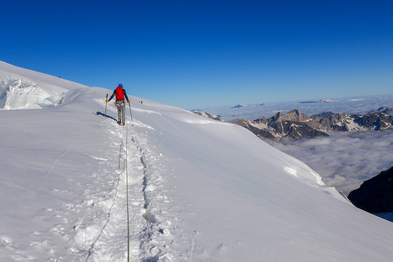
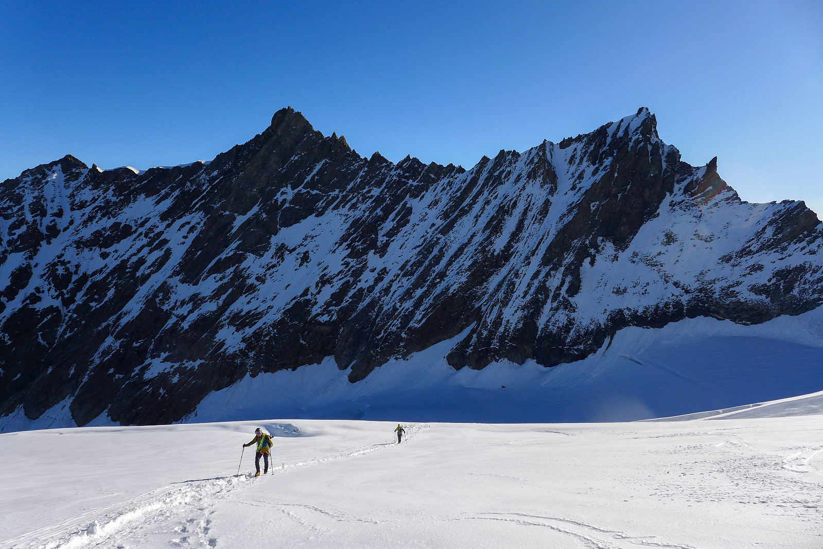
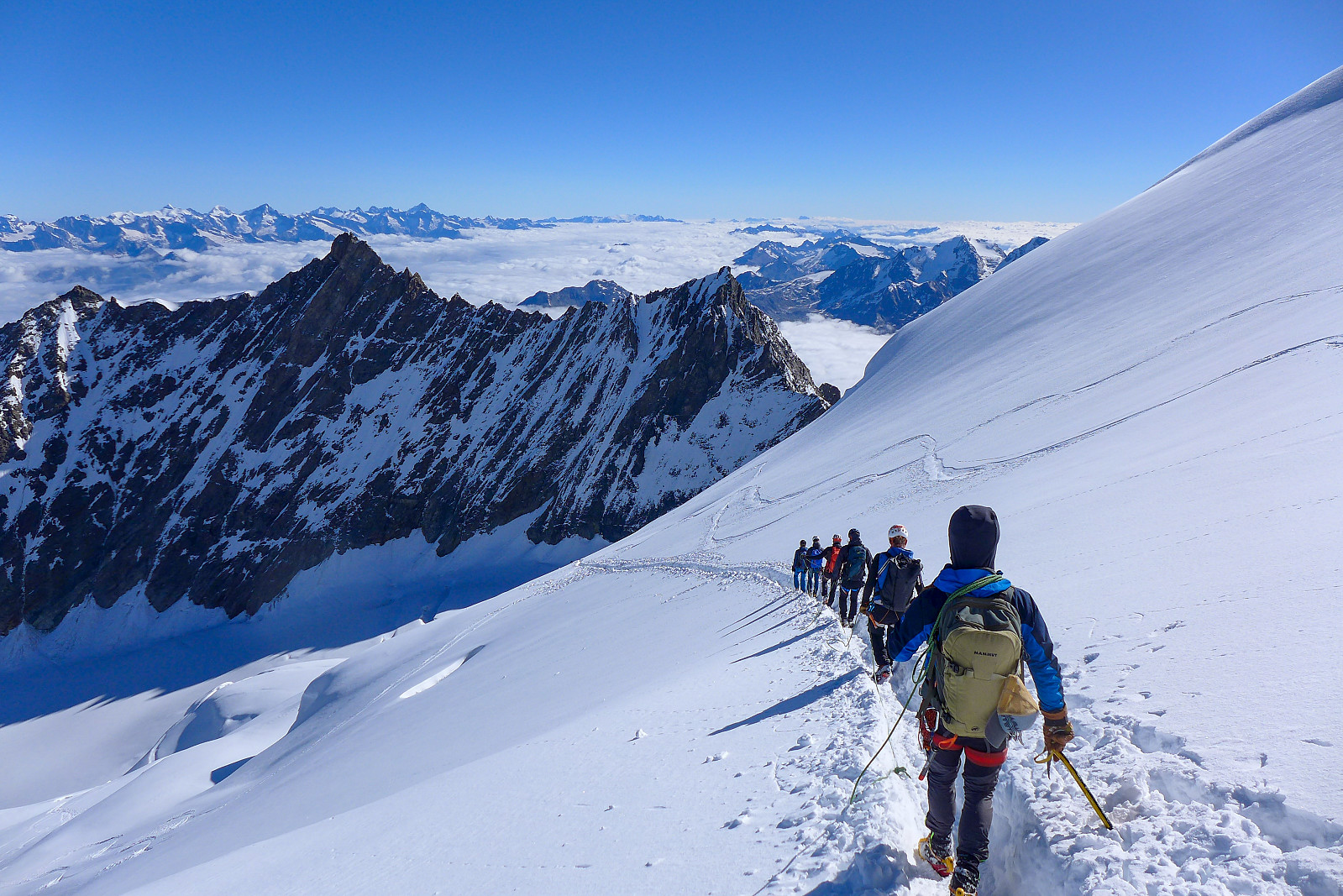
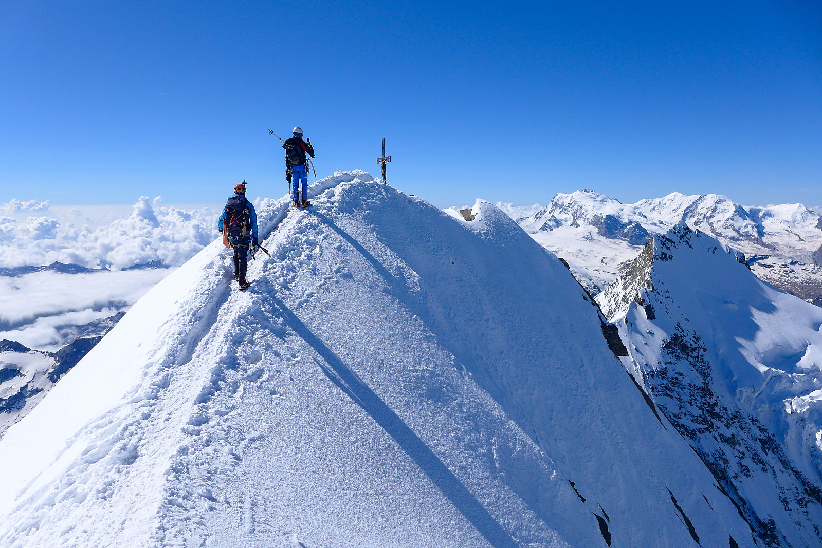
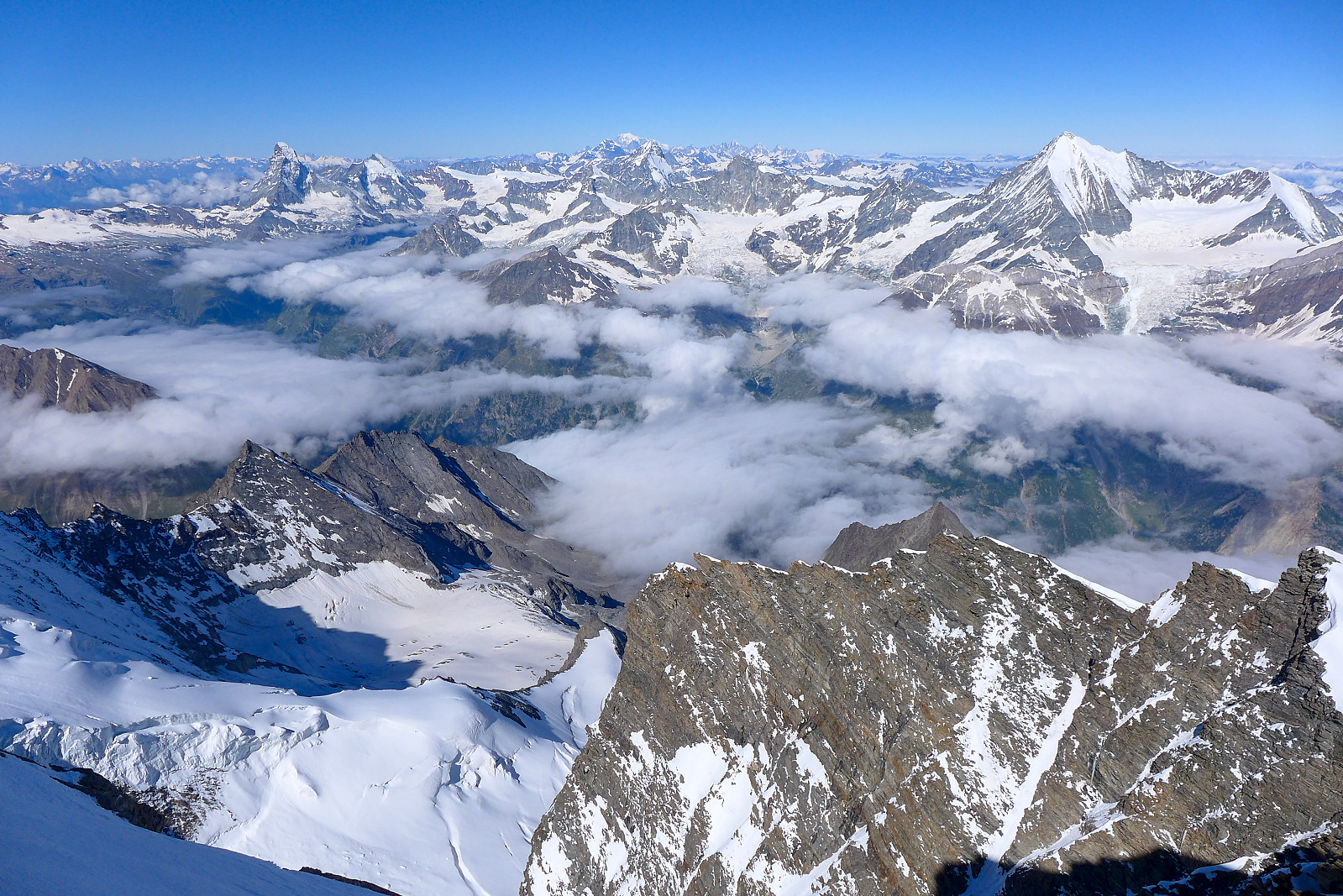
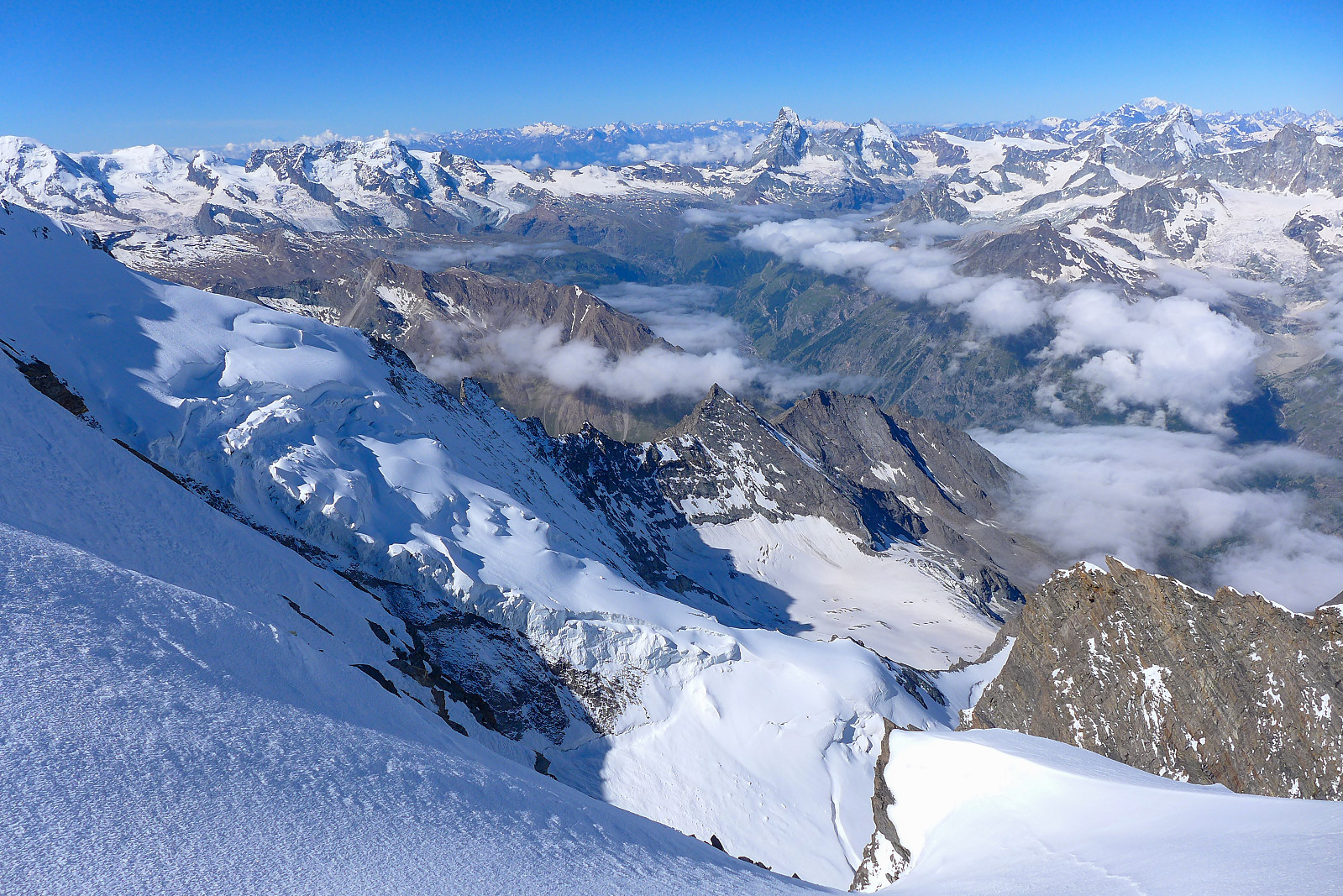
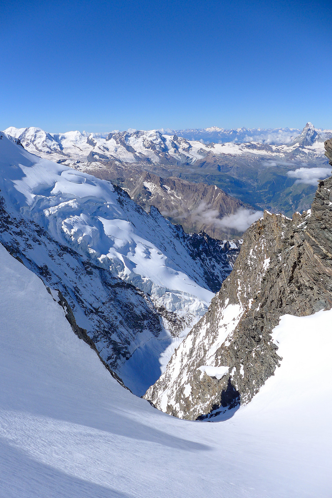
After sprinting past quite a few teams up to the Festijoch we took a short break and put crampons back on. Still feeling tired I felt like it probably wasn’t my day for romping up a steepish snow ridge and that the well-used track going up the normal route would give the best option, as it meant we could move in a steady, albeit slow pace. So instead of heading up the ridge to our right at the Festijoch we descended down to the glacier below and basically followed the track for another 900m. It was easy going on the glacier at first, passing by a few crevasses along the way and ascending gradually up to the northwest flank. Although a bit chilly in shadows it wasn’t all that long until we’d reached the sunshine, and we warmed up fairly rapidly! The route took the most logical line around the crevasses in the northwest flank, so even though it began close to the ridge linking the Dom to the Lenzspitze, the route eventually took a long traverse towards the right (west) side of the flank and continued upwards mostly on that side. As we ascended higher though, there were increasing amounts of new snow from the preceding days and the tracks was a little less firm. There were many times when I concluded that we were basically walking up a ski route which felt a bit wrong (there were a couple of people skiing up too, but not in the boot track) but I was nevertheless very grateful for the well trodden track made by everyone who’d been up there the day before. As we reached the start of the final 60m of elevation along the ridge up to the summit the view suddenly expanded and we could see across to the Taschhorn, Alphubel, Dufourspitze and all the other peaks at the southern end of the Zermatt valley, as well as those on the west side. More big steps in some steeper icy snow followed (I was still using hiking poles at this point) as well as alot of short pauses to give my burning tight quads a break... It was about 9.45am when we finally got to the summit and joined a bunch of other people who were sitting around and enjoying the beautiful monday morning.


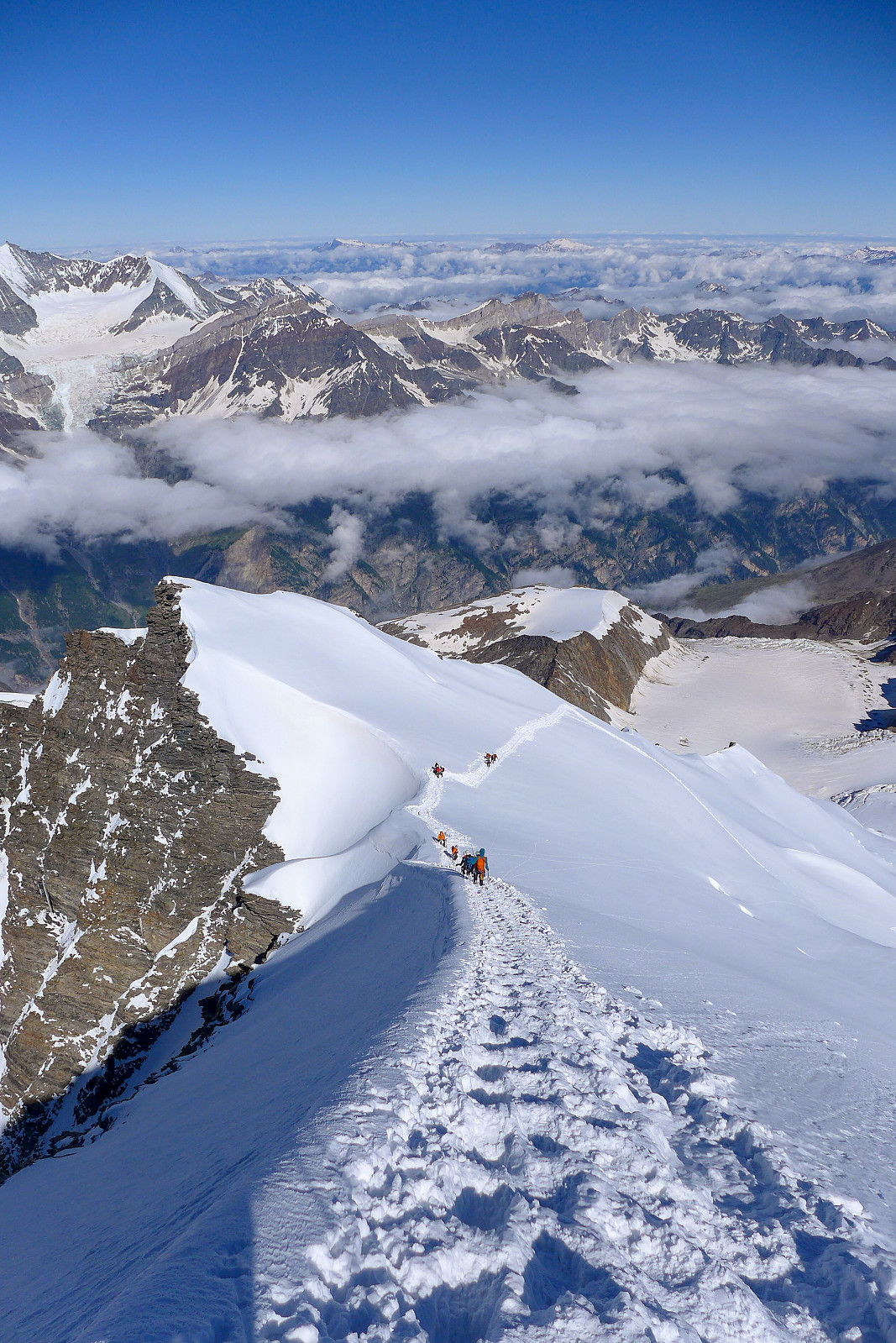
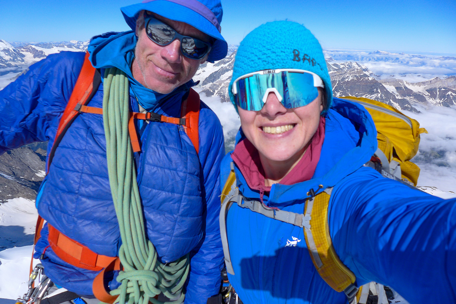
Had a nice chilled out 15 minutes taking pictures before reversing the route and plodding back down the track. Initially it was a pleasant temperature, but once back down to the foot of the north flank the heat of the sun got pretty intense and we took a longer break to have something to drink and take off jackets. The rest of the descent – down the Hohbarggletscher and across to the Festijoch – was fairly efficient but very warm. We scrambled back down from the Festijoch to the Festigletscher as quickly as possible, mostly to get out of the firing line of the other groups who we’d caught up and who were also now descending this loose rock band. It was a bit hurried and somewhat stressful, but once down on the glacier we put on crampons again and continued the efficient descent back down to the Dom hut. It had taken a little over 3 hours to descend from the summit, even with breaks along the way. After a longer break at the hut (maybe 45 minutes-ish?) eating some lunch, changing into shorts and trainers and repacking our rucksacks we started to make our way back down the path and the 1600m descent back down to Randa, which took some 2.5 hours. I’d kind of expected my knees to be sore after descending 3200 from the summit to the valley, but instead it was my toes that were really feeling quite sore once we’d reached the car park again! I don’t think I’ve ever been so happy to see my crocs :-)


User comments