
Borga in quite some snow (25.02.2023)

Written by HHauser (Helwig Hauser)

| Start point | Kvamsvegen (190m) |
|---|---|
| Endpoint | Kvamsvegen (190m) |
| Characteristic | Hike |
| Duration | 5h 00min |
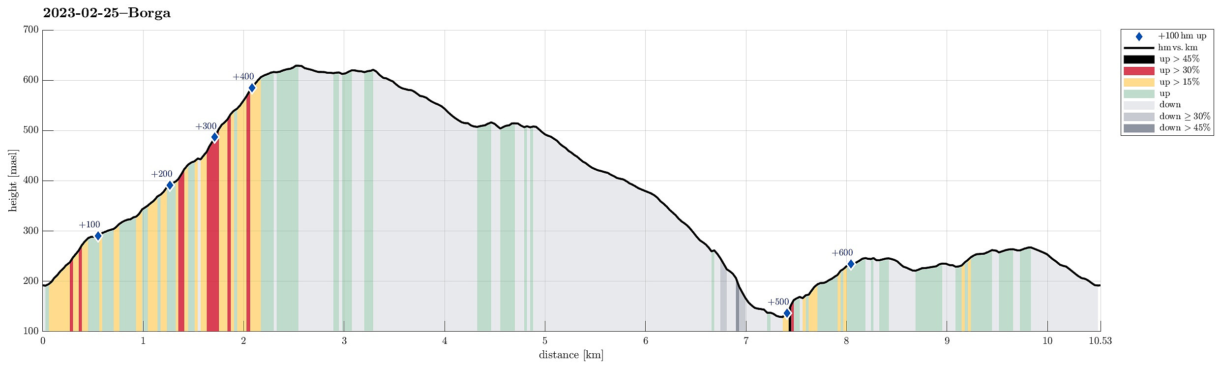
| Distance | 10.5km |
| Vertical meters | 688m |
| GPS |
|
| Ascents | Borga (634m) | 25.02.2023 |
|---|---|---|
| Såta (624m) | 25.02.2023 | |
| Såtbotshaugen (518m) | 25.02.2023 | |
| Visits of other PBEs | Gapahuk Kvamme Gard (293m) | 25.02.2023 |
| Kvamsvegen p-plass (190m) | 25.02.2023 |
Trip Summary
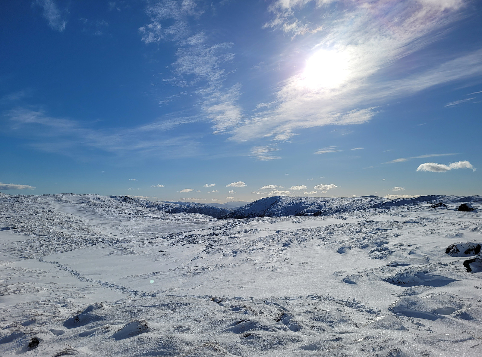
There was quite some snow to expect and since we still wished to hike, we aimed at choosing a route that would be possible to hike well, even without snoeshoes. Estimating that Borga should still be fine, we drove to the other side of Vidden and parked along Kvamsvegen near Austrestølane. From there, we first hiked up Sauhola, already stepping through a substantial layer of snow. Once up to Bjørndalen and back to the gravel road that also leads up here (offering a less steep, alternative route up), we turned left and crossed over the stream that continues down Sauhola. Now in a southward direction (towards Nedstaflåna), we started to surround Bjørndalen in its south with the goal to find a suitable route up to Borga in the southwest of Bjørndalen. At first, up to about 400masl, this ascent is easy and smooth (while quite wet, also). Then, we needed to decide, which direction offered the best continuation. Since the direct ascent towards Bjørndalssåta appeared too steep, especially with all the snow, we instead decided to get into Nordrebotn and further southwards over the little stream that comes down there. Apparently this is also the route that a trail is taking there (of course, no trail was to be seen under all the snow). Without seeing it first, of course, we then ascended mostly into the direction of Deilevatnet. Braking a new track up there through the partially deep snow was clearly a bit of a challenge! :-) Soon, however, we had ascended to the saddle between Såta in the north and Borga in the south. After quickly visiting Borga and enjoying the nice views from there, we then turned back and started our way back, where we had planned to include a longer detour through the north of Borga. After passing by Deilevatnet, we crossed over Såta and then started our descend towards the north of Borga. Avoiding the steepest sections between Såta and Nordhytten by descending a bit further eastwards, we nicely connected to Flatafjellet and from there to Såtbotshaugen. Following the ridge that extends further northwards into the direction of Svelihovden, we got onto the trail that leads further down towards Haugland. Our original goal had been to find the trail that then leads back to Høgaleitet in the east of Nova. Not seeing this trail, while crossing over it, we instead continued further down towards Kistebotn. Almost down at the road (Kvamsvegen), then, we got re-oriented. To get back to our car, we then chose to follow the ridge in the east of Kistebotn, leading us up to a little height north of Høgaleitet. From there, it was then to walk past Høgaleitet and Kvamsstølen to get back (the last stretch walking down the gravel road from Kvamsstølen). While one gets the impression that not so many choose Borga as their hiking goal, one should make a point that this hill indeed is very nice to hike, also offering very nice views! :-)
Photos
Selected photos are available as Google photo album.
Useful Resources
See also the related FB-page Hiking around Bergen, Norway.
Web page UT.no from the Norwegian Trekking Association recommends a similar hike up to Borga.


User comments