
Exploring Høvik (20.07.2022)

Written by HHauser (Helwig Hauser)

| Start point | Høvik (165m) |
|---|---|
| Endpoint | Høvik (165m) |
| Characteristic | Walk |
| Duration | 1h 00min |
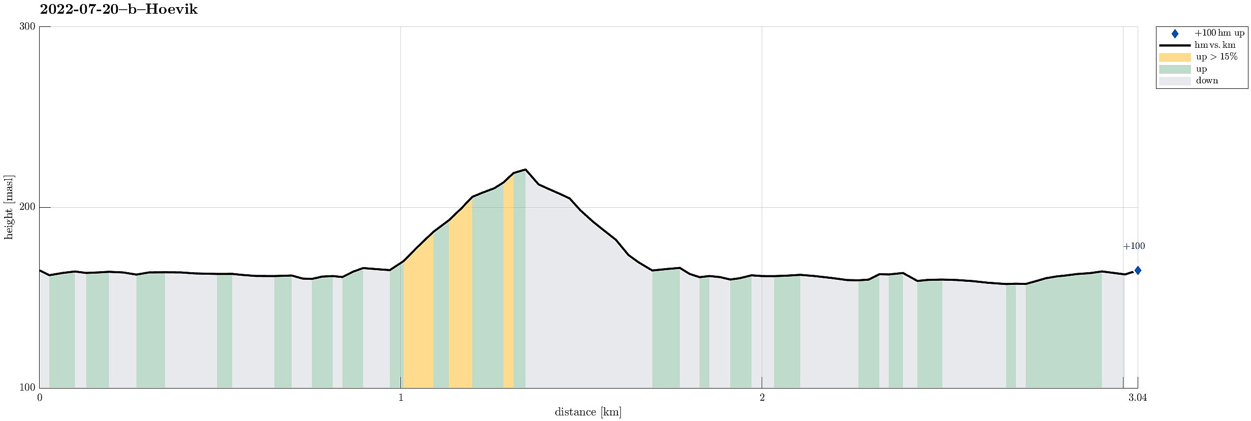
| Distance | 3.0km |
| Vertical meters | 95m |
| GPS |
|
Note that this track has been created from memory, i.e., it was not recorded automatically.
Trip Summary
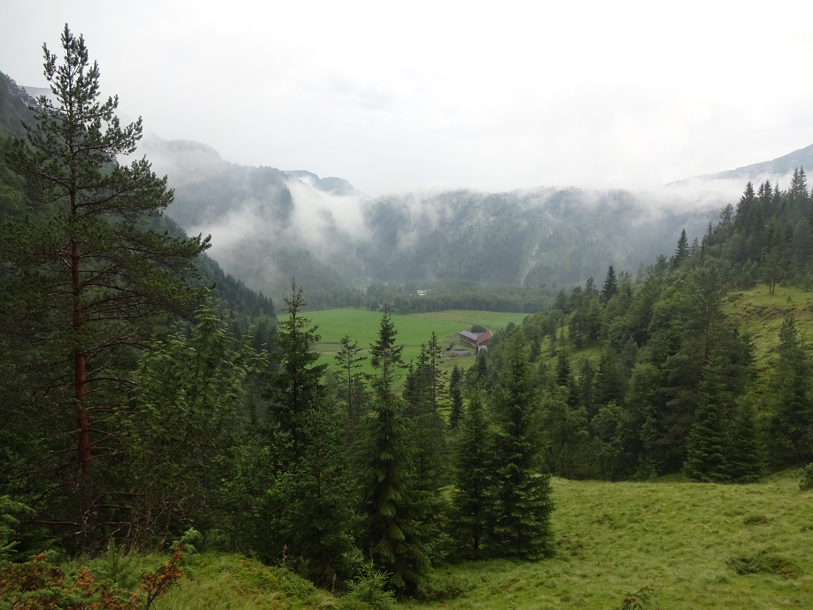
To get a bit of fresh air in the evening, we decided to explore Høvik in Eksingedalen. After first walking along the few roads in Høvik, we started a short ascent to Svedgjeli in northeasern direction (below Åsen), following a stretch of old Reitlevegen through Eksingedalen. From there, we then had some nice overview of Høvik. When walking back, we also explored the wide bend of the Ekso river (in the south of Høvik) that probably is responsible for the suffix of name Høvik.
Photos
Selected photos are available as Google photo album.
Useful Resources
See also the related FB-page Hiking around Bergen, Norway.
On the Web Archive, one can still find information about Reitlevegen.


User comments