
Søtefjellet from Hausdalen via Åsen (25.06.2022)

Written by HHauser (Helwig Hauser)

| Start point | Hausdalen (95m) |
|---|---|
| Endpoint | Hausdalsvegen (70m) |
| Characteristic | Hike |
| Duration | 4h 00min |
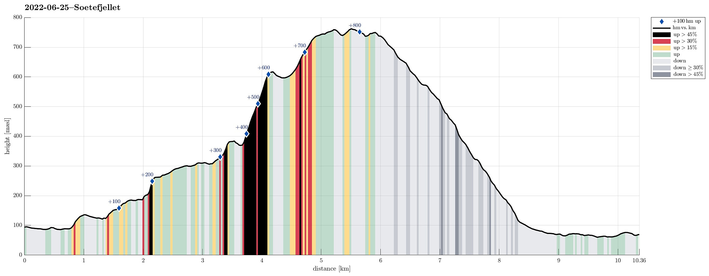
| Distance | 10.4km |
| Vertical meters | 859m |
| GPS |
|
| Ascents | Søtefjellet (767m) | 25.06.2022 |
|---|---|---|
| Søtefjellet NV (762m) | 25.06.2022 | |
| Åsen i Samdalen (389m) | 25.06.2022 | |
| Visits of other PBEs | Hausdalen parkering (94m) | 25.06.2022 |
| Åsen søyle (385m) | 25.06.2022 |
Trip Summary
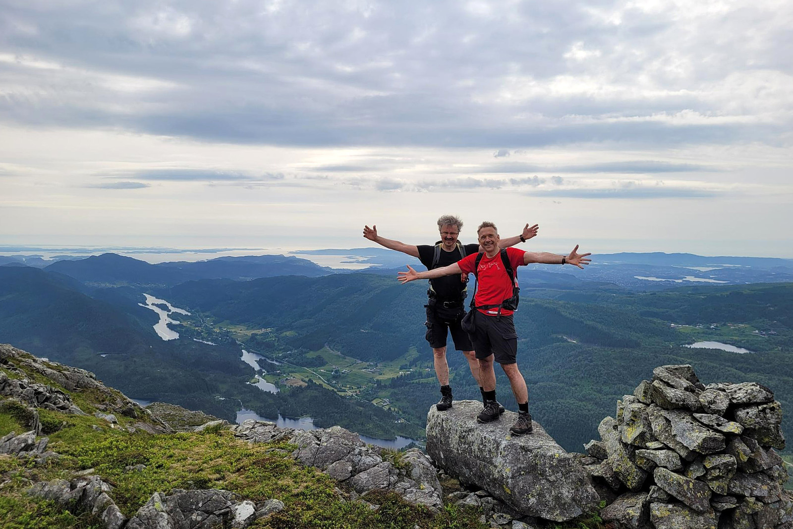
We exploited the situation of having two cars to cut short a few kilometers on the road through Samdalen. After passing by Kalandsvatnet along E39 in the south of Bergen, we turned left at Kalandseidet to continue further into Hausdalen. Right before coming to Tømmervika of Samdalsvatnet, we left one car where a forest road comes down to Hausdalsvegen. With the other car, we then continued all the way in to the end of Hausdalsvegen, where we parked at the parking spot. Given our plan to ascend Søtefjellet via Åsen, we had planned to cross Hausdalselva using a simple bridge at Hausdalen, just a few meters back along the "main road". Getting there, however, we found a sign that informed us that crossing over there was only possible with the consent of the land owner. Luckily, it was easy to meet one at the farm right across the street and we could continue as originally planned. On the other side of Hausdalselva, we first followed a simple field road before continuing upwards (in southwestern direction) over the grassy hillside just underneath Åsen. This brought us first to a small saddle (at about 135mosl) and then, on the other, southwestern side of this saddle, to another gravel road, leading up to Storalomtjørna at about 180mosl. After passing by this lake, we then found a spot to get up to the ridge that would then bring us to Åsen. This section (to get up to the ridge) was a bit steep and required the use of our hands once or twice. Instead of "short-cutting" there (to get up to the ridge), one also could continue further southwards to Bjørkhaugen and then turn around to get up to the ridge, quite likely avoiding any steeper section. Once on the ridge, connecting to Åsen (from there in the northeast) was then nice and easy. Ascending to the top of Åsen, traversing its western hillside, is then again a bit steep and one may find using their hands, again, to assist the ascent. From Åsen, even though it's only a comparably small hill right next to the much larger Søtefjellet, one still can enjoy some really nice views! :-) Next, we then started the actual ascent of Søtefjellet, first crossing over the small saddle in the southeast of Åsen. The mountain side up from there is then quite a bit steep, especially in the beginning, and finding a good route upwards is helpful (there are no trails there, just to be clear). Once at about 400mosl, the continuation gets a bit easier (while still steep). At about 600mosl, we came by the nice little lake in the north of Søtefjellet, enjoying a nice break there, also. From there, it's then relatively straight-forward to ascend the remaining height meters to get reach the actual top of Søtefjellet. In fact, one can argue that Søtefjellet has two tops and we visited them both. :-) To then get back down, we first needed to cross over, again, to the northwestern top of Søtefjellet. From there, it's then just down the southwestern ridge of Søtefjellet, following a trail, there, also, even though this trail is not always totally easy to find, especially not in the higher parts of this ridge (not a problem, though). This trail leads then down to Hisbotn and Ulvvatnet. From there, we then took the forest road out to the car that we had parked at its end. All in all, a really nice round (the ascent via Åsen, however, is possibly a bit steep for hikers, who prefer slightly more gentle slopes and trails).
Photos
Selected photos are available as Google photo album.
Useful Resources
See also the related FB-page Hiking around Bergen, Norway.
Petter Bjørstad has a useful page about Søtefjellet and also web page WestCoastPeaks.com provides useful information about Sveningen, Søtefjellet, Sauskolten, Rindafjellet, and Midtsæterfjellet.


User comments