
Sperrefjellet and Nordsjøløypen on Ytre Sula (13.07.2021)

Written by HHauser (Helwig Hauser)

| Start point | Sperrevatnet (20m) |
|---|---|
| Endpoint | Sperrevatnet (20m) |
| Characteristic | Hike |
| Duration | 4h 30min |
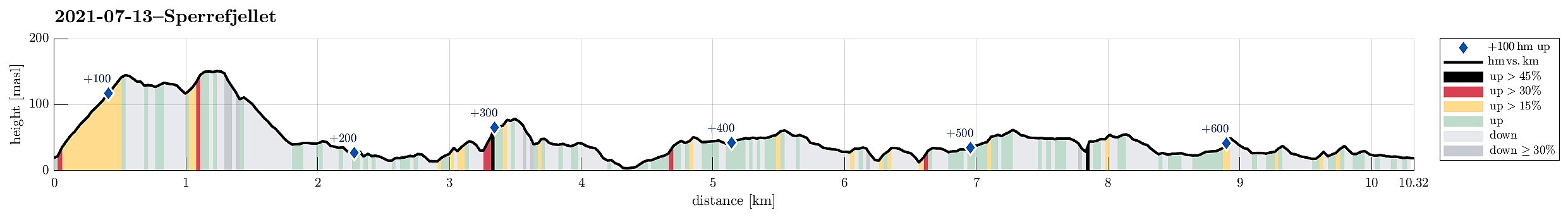
| Distance | 10.3km |
| Vertical meters | 650m |
| GPS |
|
| Ascents | Sperrefjellet (155m) | 13.07.2021 |
|---|
Trip Summary
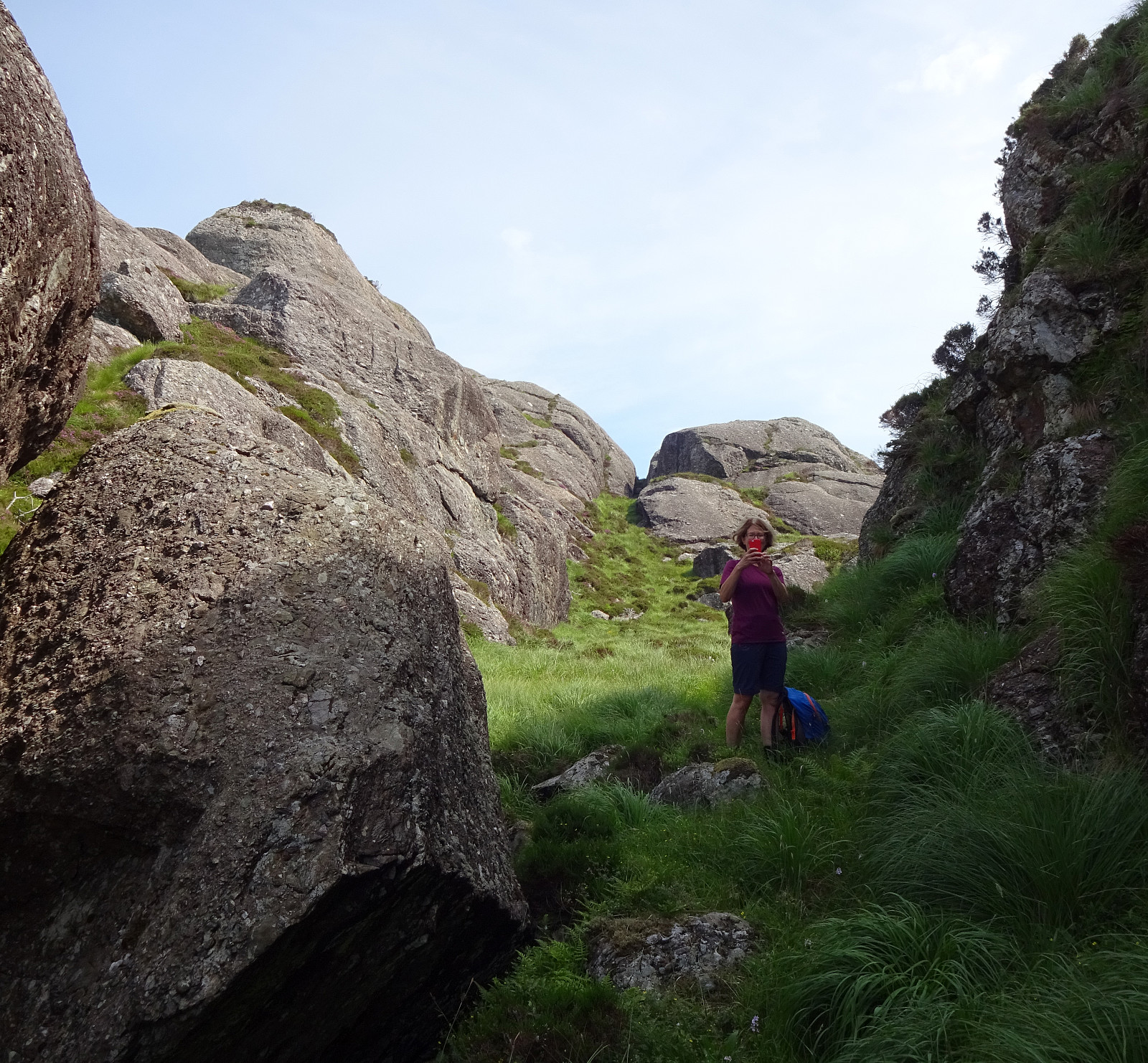
Staying in Solund for a few days, we also wished to explore Ytre Sula a little. We thus drove westwards from Hardbakke, using road 606. At the very end of this road, at Gjerdneset, we then took the ferry that brought us out to Ytre Sula (to Halldorsneset), crossing Ytre Steinsundet. After weighing several ideas against each other, we ended up with an attempt on Sperrefjellet (not far from Halldorsneset). About half a kilometer from Halldorsneset, we turned left at the T-junction, continuing (for only a short stretch) into the direction of Hjønnevåg. As soon as Sperrevatnet appeared on our left (in the south), we parked on the right, where also a sign marks the trail head for the beginning of this hike. The first section of this hike was then up to Ytre Heia (a little steep, but well-marked and easy to follow). Already this first little top (Ytre Heia) offers some very nice views! From there, it's then mostly a walk across the heights in order to get over to Sperrefjellet (not really much higher than Ytre Heia). Also from there, on Sperrefjellet, on can see far across the island world of Solund -- nice! The real portion of our hike, however, just got started when we left Sperrefjellet for the coastal landscape in its north and northwest! Still following a marked trail (as much as it can be called a trail, actually), we "dived" into a wild terrain of large rocks, a lot of up and down, and many places where progress was not exactly easy. Near Kroktjørna, we then connected to the North Sea Trail (Nordsjøløypen) that can bring you from Ytrøyna to Hjønnevåg (or the other way 'round, of course). Just a short stretch along this trail, we then got tempted by a sign to leave the trail and aim at "Britesteinen" (without, however, knowing in detail what "Britesteinen" would be, where to find it, etc.). This excursion brought us close to Torvågen (and Slumpen), but without any revelation regarding this Britesteinen! After some "fight" with the wild nature there, we eventually gave up, turning around and trying to reconnect with Nordsjøløypen, again. Once back on the trail, we continued along it, passing Torvågen in its south. The landscape there is really very impressive: rocks "everywhere", many large (up to 20m large, or more), often with vertical cliffs, leaving only very limited space for moving on. Every now and then, maybe much seldomer than expected for a trail that's entitled North Sea Trail, one also gets a view towards the sea, for example, when passing by Torvågen and Slumpen. In the south of Slumpen, actually, one ascents to about 80mosl to enjoy some wonderful views, also into the longer distance! From there, it's then back down and into the extensive area of rocks, narrow patches of green, and small lakes. After a while, one gets to another T-junction, where a side trail forks off to the north/northwest, providing a way to get out to Hellevikhammaren. Including this detour, we learned that this stretch, while all-in-all not bringing one really high about sea level, is characterized by an almost permanent alteration of up and down. This investment, however, is eventually rewarded by some nice views that one can enjoy at Hellevikhammaren (especially the views across Storsundet are nice there!). Once "done" with Hellevikhammaren, we then returned along the same trail, reconnecting with the North Sea Trail where we had left it. From there, it was then "more of the same" (now mostly in southern direction), until we got to Svartevatnet (and the road there). Once on the road, we "just" walked the road back to the parked car (this added a bit of further distance, but walking along the road was of course much more easy-going than in the quite wild coastal landscape along the Nordsjøløypen). Altogether, this hike was really very impressive -- not because the heights that one reaches, but because of the impressive, wild coastal landscape, requiring some dedicatd efforts to get through and across!
Photos
Selected photos are available as Google photo album.
Useful Resources
See also the related FB-page Hiking around Bergen, Norway.
Web page UT.no from the Norwegian Trekking Association recommends a hike along Nordsjøløypen (from Ytrøyna to Hjønnevåg).


User comments