
Kossdalssvingane (17.04.2021)

Written by HHauser (Helwig Hauser)

| Start point | Hosanger (15m) |
|---|---|
| Endpoint | Hosanger (15m) |
| Characteristic | Hillwalk |
| Duration | 3h 00min |
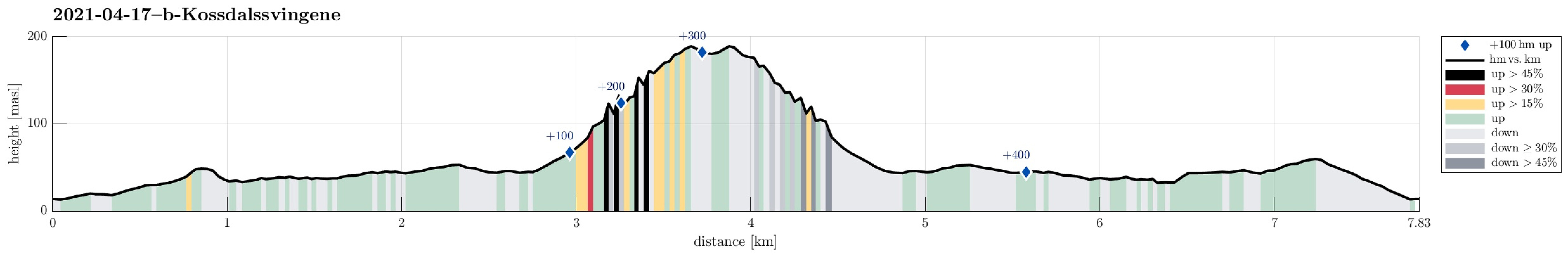
| Distance | 7.8km |
| Vertical meters | 450m |
| GPS |
|
| Visits of other PBEs | Kossdalssvingane (125m) | 17.04.2021 |
|---|
Trip Summary
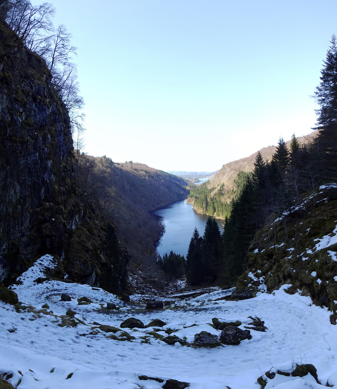
We drove to Osterøy (via the bridge from E16 in the east of Bergen), continuing first to Lonevåg and from there then to Hosanger. There, we parked maybe 200m from the main road, where Tveitavegen splits from Kossdalsvegen. We then walked into the valley (in southwards direction), following Kossdalsvegen (on the west-side of Kossdalen). This way, we passed by Holevatnet, first, before later crossing over to the east-side of the valley, passing by Kossdalsvatnet then on this side (always following the forest road into Kossdalen). While most of this walk is kind of level into Kossdalen, one eventually meets Kossdalssvingane at the southeastern end of Kossdalen. As an impressive historic construction, the road winds up about 150hm before reaching the saddle towards Svenheimsvegen. When turning around (or walking downwards), one can enjoy quite some nice views over Kossdalsvatnet from there! :-)
Useful Resources
See also the related FB-page Hiking around Bergen, Norway.


User comments