
Lyderhorn (28.11.2020)

Written by HHauser (Helwig Hauser)

| Start point | Lyderhornsveien (48m) |
|---|---|
| Endpoint | Lyderhornsveien (48m) |
| Characteristic | Hike |
| Duration | 1h 30min |
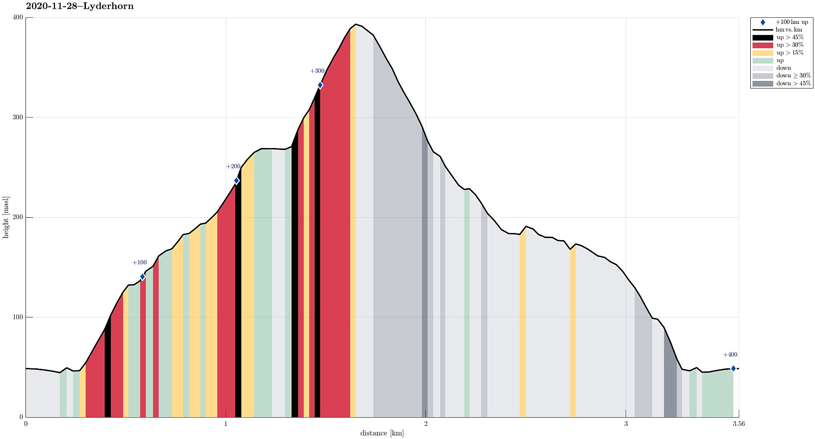
| Distance | 3.6km |
| Vertical meters | 394m |
| GPS |
|
| Ascents | Lyderhorn (396m) | 28.11.2020 |
|---|---|---|
| Visits of other PBEs | Lyderhornhytten (lokalitet) (396m) | 28.11.2020 |
| Små-Lyderhorn (273m) | 28.11.2020 |
Trip Summary
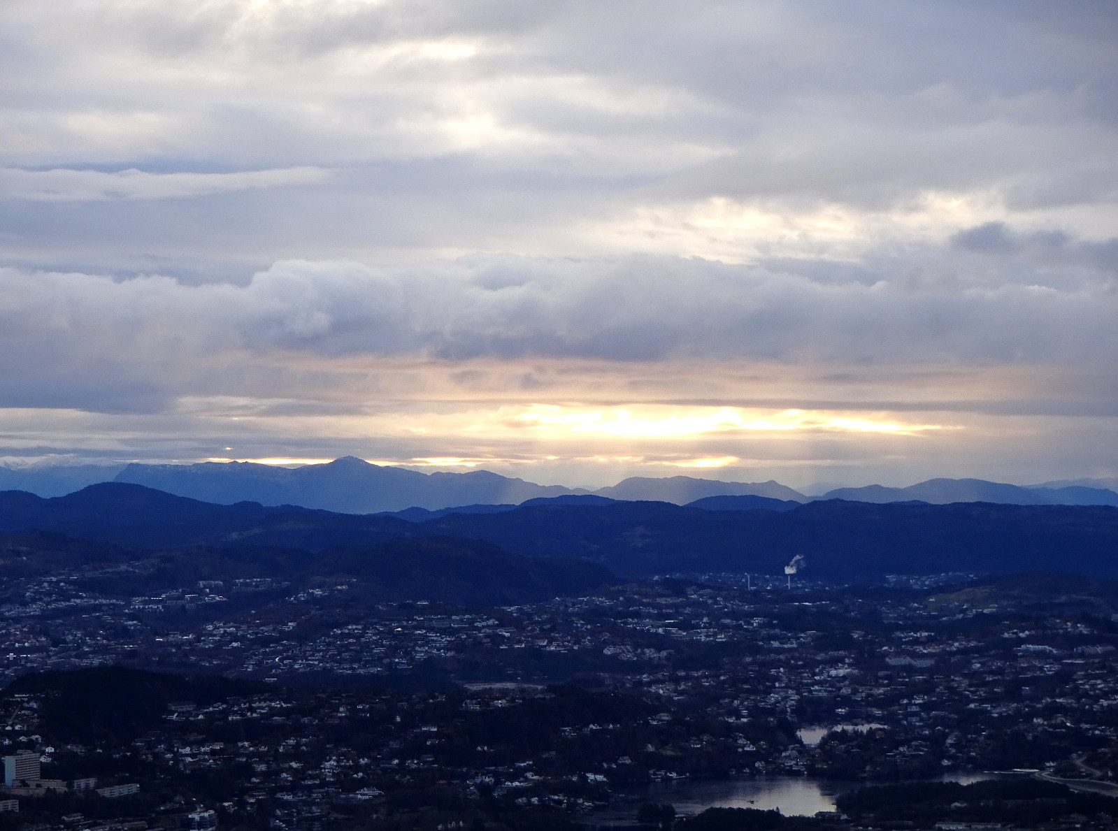
Aiming at using a relatively short morning period for which no rain was predicted, we decided to "just" ascent to Lyderhorn (when needing a good idea for a nice, near hike, Lyderhorn is a natural solution!). One question requiring a bit of extra-thinking, though, regards the choice of the route up (and down). While already driving towards Loddefjord, we discussed several options and landed on a new ascent from the southeast, i.e., where the highways join south of Liavatnet. We parked right next to Lyderhornsveien, north of Bjørndalstjørna, and walked the few meters to the place, where the highway 555 disappears into Lyderhorntunnelen right underneath. While leaving the road where a simple trail comes down from a saddle in the west, we did not follow this trail upwards, but decided to head more directly towards Lyderhorn. To do so, we ascended (quite steeply!) in northern direction first. The original idea was to find a small valley that comes down there (in southern direction). Instead, we ascended a little further east of this valley. At about 115mosl, we passed by a mast of a power line that extends around the lower heights of Lyderhorn there. From there, we continued further upwards (turning into northwestern direction, first, and then westwards). At about 200mosl, we then connected to the "main trail" that extends there southwards from Lyderhorn (and towards Skarpafjellet). Following this trail for a few meters further up, we decided (at about 225mosl then), where the trail bends right, leveling out for a short stretch, to again leave it and continue further upwards to Små-Lyderhorn in the north. From there, we then connected to the major trail, coming up from Olderdalen near Kjøkkelvikveien, just a few meters further north. The remaining ascent to Lyderhorn follows then this pretty much used (still quite steep!) "trail" (it's mostly up over the rocks). Shortly later, we arrived at the top of Lyderhorn, enjoying the great views in all directions for a moment (the wind was quite cold up there, so we were very motived to continue soon). Back down, we then chose the trail which leads southwards on a "secondary" north-south-oriented ridge, a bit further to the east of our ascent. At about 275mosl, this trail bends then back (westwards) and runs by the very point where we had left it earlier to ascend to Små-Lyderhorn. For a few meters, we walked down the trail that we had come up first. Instead of following a similar route down than what we had come up, we followed the trail, which surrounds some minor hills between Lyderhorn (in the north) and Skarpafjellet (in the south) on their western side. This trail eventually leads to this saddle at about 155mosl, east of Grøvledalen. From there, it's then just eastwards down to the road above the portal of Lyderhorntunnelen. Very satisfied, we returned to our car shortly afterwards. Good to get out! :-)
Photos
Selected photos are available as Google photo album.
Useful Resources
See also the related FB-page Hiking around Bergen, Norway.
Web page WestCoastPeaks.com provides useful information about Lyderhorn and Ørnafjellet
and also Petter Bjørstad has a page about Lyderhorn.
On Bergentopp 200 there is a page (in Norwegian) about Lyderhorn.


User comments