
Rundehaugen from Fjæreide (27.09.2020)

Written by HHauser (Helwig Hauser)

| Start point | Fjæreide (40m) |
|---|---|
| Endpoint | Fjæreide (40m) |
| Characteristic | Hillwalk |
| Duration | 4h 30min |
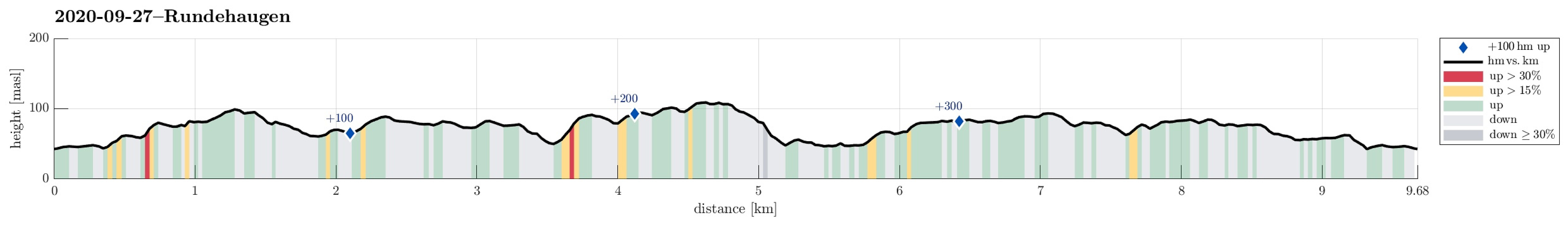
| Distance | 9.7km |
| Vertical meters | 390m |
| GPS |
|
| Ascents | Rundehaugen (112m) | 27.09.2020 |
|---|
Trip Summary
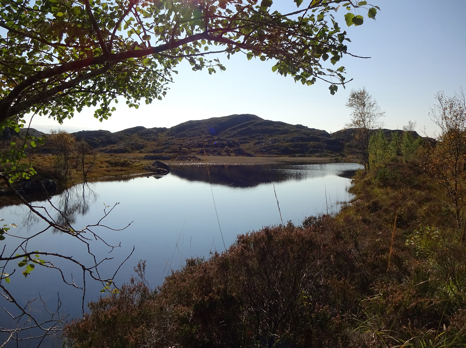
Since we expected the afternoon to be substantially cloudy, we decided to make a hike in the lowlands rather than up on some tops (and in the clouds). Since we had not yet explored this region in detail, we chose to start at Fjæreide (in the west of Knappskog on Sotra) and then aim for Rundehaugen (in the east of Skålvik). After driving along road 555 westwards to Sotra and then northwards (road 561), one comes to Knappskog. There, one can turn left (westwards, again) and follow a narrow road to Fjæreide, where there's ample space for parking next to the road (they may have had, or still have, plans to broaden this road, leaving quite a bit of not yet used space besides the road). At the southern-most point (in Fjæreide) the road crosses over a small valley in a large turn to the right. In this valley, where waters from Stemmevatnet (just a little further south there) run down towards Fjæreidpollen in the north, a trail starts (part of Nordsjøløypa) that first extends in the northwest of Stemmevatnet. Only half way along Stemmevatnet, however, we decided to leave the trail and ascend to the (limited) heights in the west of Stemmevatnet. This way, we also got to look down onto Fjæreidvatnet. Near Ørjebekkvatnet we then joined the trail for a short stretch, exploiting the convenient bridge over Brattstigdalen there! From Ørjebekkvatnet, we then followed "something like a trail" in southwestern direction (into the direction of Stokkane, passing by Slåttefjellet). Before this "trail" turns even more westwards (crossing between Fjæreidvatnet and Engesvatnet over to Kvernhusvegen), we left it, continuing without a trail in southwards direction (eventually towards Rundehaugen). In the east of Engesvatnet, the terrain gets a bit more rigged and one needs to look a little regarding suitable opportunities for proceeding further. After descending temporarily into a little valley, we thereafter arrived at Selstadfjellet. From there, with a few more downs and ups, we then continued to Rundehaugen rather swiftly. Rundehaugen, in the east of Skålvik and in the north of Ytsta Skålvikvatnet, is not very high, but still offers some nice views, especially towards the west (its western flank is basically a tall cliff). After enjoying a short break on Rundehaugen, we continued further southwards (and downwards), meeting a (very simple) trail that extends west-east into the direction of Insta Skålvikvatnet. Following this "trail", we arrived at Insta Skålvikvatnet a few minutes later. This lake (Insta Skålvikvatnet) is quite substantial in size and making a full round around it takes sure some significant time (a few hours, probably). For a while, we walked along the northern lake shore, before then changing to a higher route, leading northerwards (in the west of Svinhusdalen). This way, we had started our return to Fjæreide, walking mostly over some minor heights in the east of where we first had hiked southwards. South of Klovavatnet, we then made another transition a bit further to the east, crossing over some slightly higher vegetation (and a fence). In the northwest of Brakeidet, we then connected to a trail, again, which brought us right back to Stemmevatnet. From there, it was then only a few meters back to the car.
Photos
Selected photos are available as Google photo album.
Useful Resources
See also the related FB-page Hiking around Bergen, Norway.
Web page UT.no from the Norwegian Trekking Association recommends a short hike from Skålvik to the dam at Insta Skålvikvatnet.


User comments