
Nadelgrat (23.07.2020)

Written by hmsv1 (Hannah Vickers)
| Start point | Mischabel hut (3,307m) |
|---|---|
| Characteristic | Alpine climbing |
| Duration | 14h 05min |
| Distance | 18.7km |
| Vertical meters | 1,032m |
| GPS |
|
| Ascents | Dürrenhorn (4,035m) | 23.07.2020 |
|---|---|---|
| Hohberghorn (4,219m) | 23.07.2020 | |
| Stecknadelhorn (4,241m) | 23.07.2020 |
The northern Nadelgrat is made up of the Nadelhorn, Stecknadelhorn, Hohberghorn and Dirruhorn, the latter three which I had not yet climbed but of those three, only 2 are deemed to be principal 4000m peaks. Anyway, it was a traverse I’d had on my list to do and after numerous consultations with Martin Moran’s 4000m guidebook I had got the impression that the normal way to do it was from north to south, by ascending a couloir on the east side of the Dirrujoch between the Dirruhorn and Hohberghorn first and then continuing along the ridge southwards and descending the normal route on the Nadelhorn back to the Mischabel hut as a round trip. It turned out Tim had other ideas, which meant doing it as a one way traverse and ending up in the picturesque town of Grächen above the Zermatt valley and then using public transport to get back to Saas Fee.
Anyway, we’d spent the night in Saas Grund, checking forecasts again and making sure thursday was still going to have good weather - which it was, so that was reassuring. However, it had rained a lot tuesday night through to wednesday morning and once outside, we got a glimpse of the high peaks plastered in new snow above us. I was beginning to feel a bit dubious over whether the Nadelgrat was really a great backup plan after all. Nevertheless it was supposed to warm up during the day so we could hope that the ridge would dry out a bit and the snow would disappear, else it would mean having to traverse most of the 2km ridge in crampons, which would be pretty slow-going. It was worth giving it a go anyhow! So, after breakfast we made the short drive up to Saas Fee and left the car at another expensive car park before taking the Hannig lift up to around 2300m (which is free if you stay in the Saas valley and use the Saastal card which the accommodation provides). The air was still a bit moist from the morning rain but otherwise it was a fairly pleasant temperature and the sun was starting to shine through as we started the hike up to the Mischabel hut. I was looking forward to staying here again, as the hosts are a super friendly bunch of ladies and the hut has a fairly nice modern interior, plus the hike is pretty fun to do, with sections of via ferrata to follow. In total it was about 1000m of elevation gain and 5km to walk from the Hannig lift, taking around 3 hours with a break included, so we arrived early afternoon. I had had a great sleep down in the valley the previous night so didn’t have much need to take a nap in the afternoon, but since there was not much to do except for listen to music on my phone and re-check the weather forecast for a millionth time, it did start to feel like a very long afternoon by the time dinner was served around 6pm. Around this time we were also treated to quite an extraordinary downpour of rain which lasted well over an hour, and even though the rain itself wasn’t a worry I was kind of concerned about how much new snow was being plastered onto the route. We’d find out the next morning in any case!
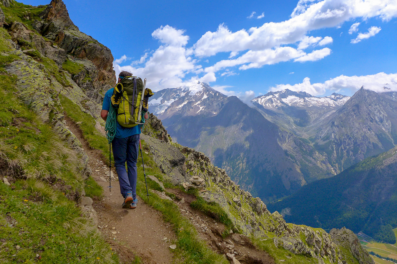

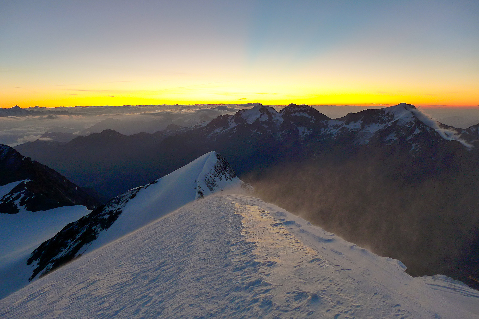
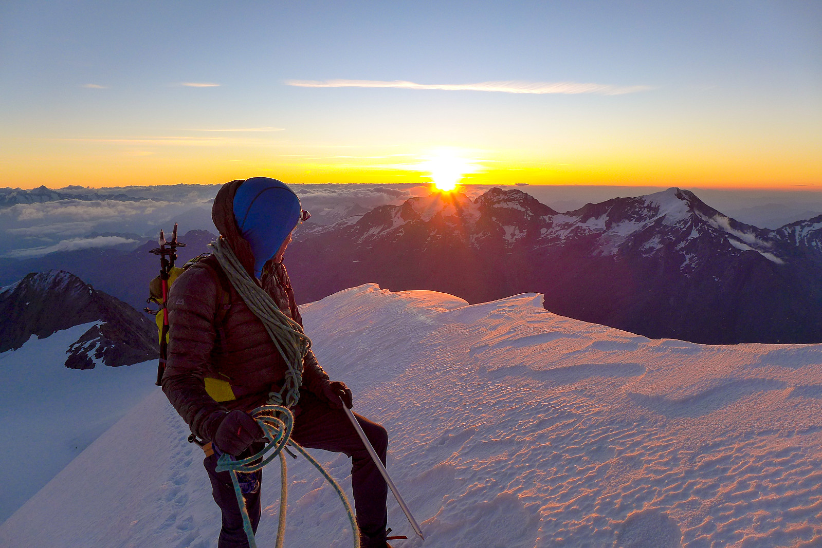
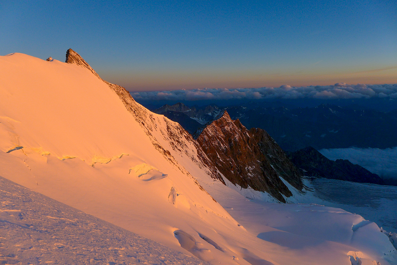
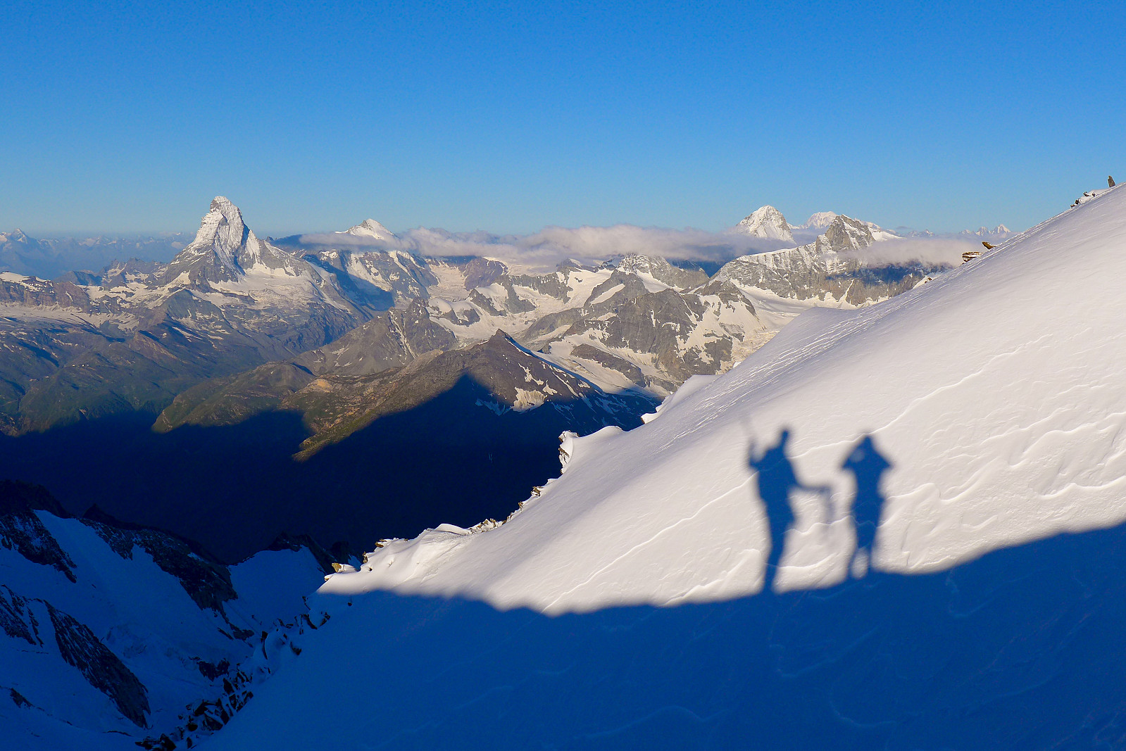
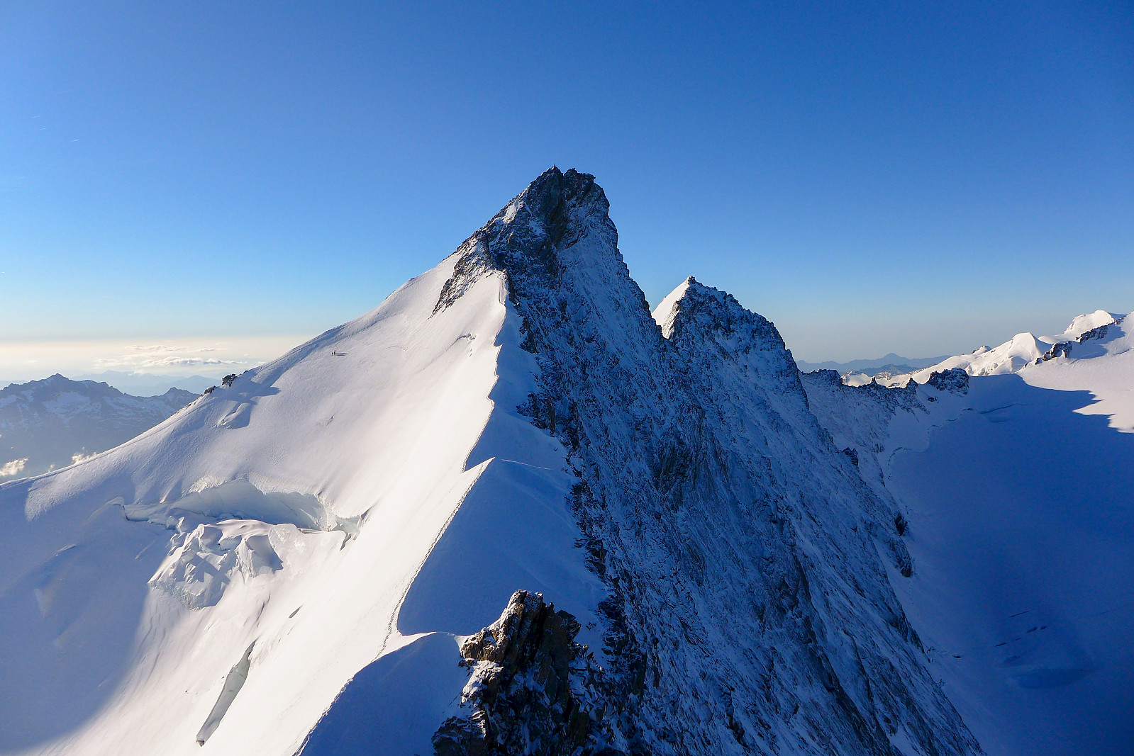
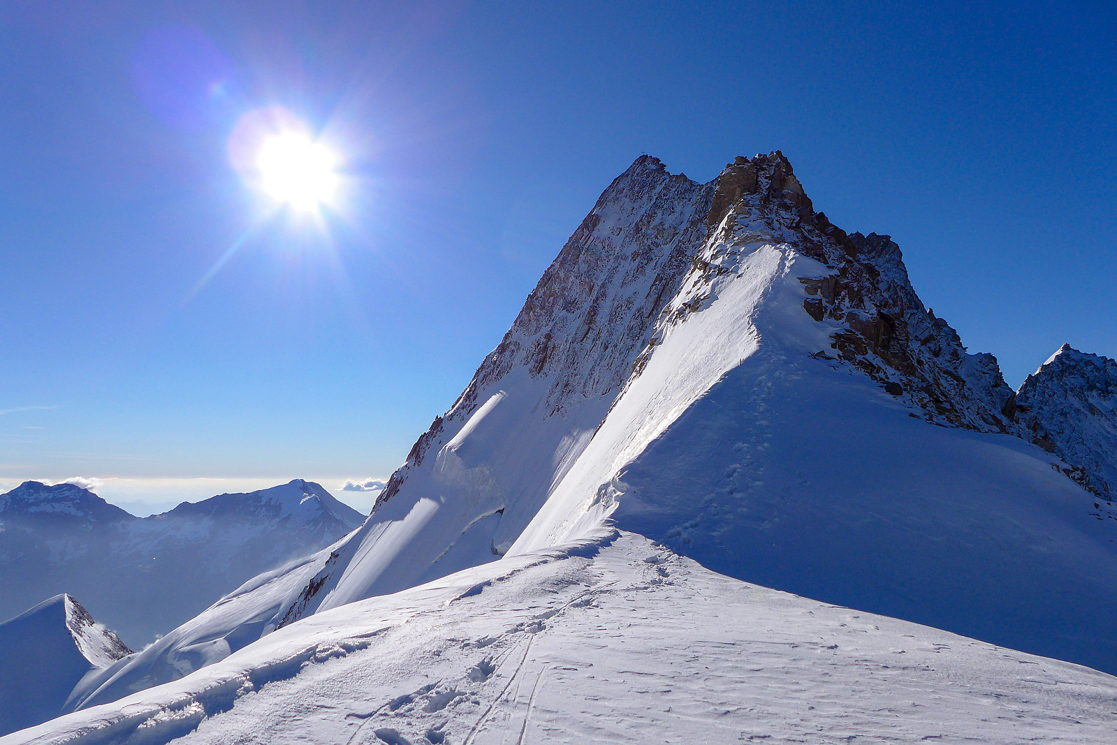
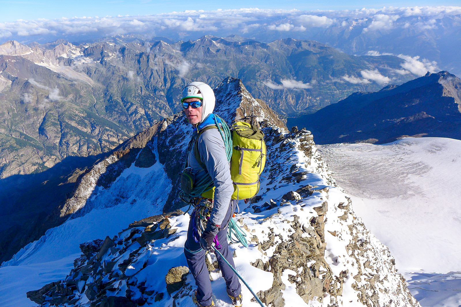
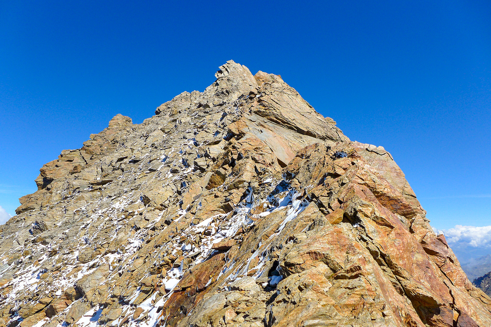
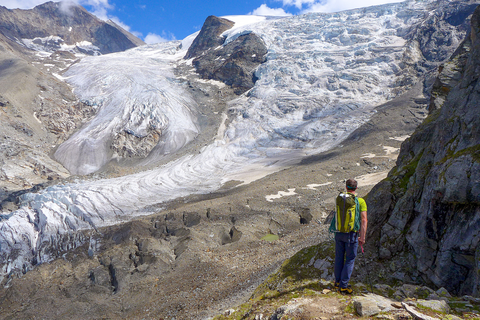
Breakfast was arranged for 2.30am. There weren’t many people in the dining room at this time, but a few were going to do the Lenzspitze - Nadelhorn traverse and we were the only ones planning to do the Nadelgrat. It would be a contrast to the busy SE ridge route on the Zinalrothorn! We left just after 3am with clear skies overhead, but also a bit of wind. But anyway, we hiked slowly up the steep path above the hut and after a short time paused at the edge of the Hohbalmgletscher to put on harness, helmet and crampons.... in more wind. As we crossed the glacier in a northwesterly direction to gain the Windjoch the northerly winds picked up and transported a fair amount of new snow onto the slopes below the col which made progress a bit slow, especially for Tim who was doing the trailbreaking. But after some time we eventually reached the col just as dawn was breaking and some orange hues began to light up the sky behind the Ulrichshorn in the east. The long trudge up the snow ridge toward the Nadelhorn was pretty cold in the bitter wind and it felt like a winters day in Tromsø at times. I was glad I hadn’t chosen to leave my mitts behind to save weight! The only consolation was a really beautiful sunrise behind us :-) Since we’d already done the Nadelhorn last year (coincidently: exactly the same dates last year as we were there this year) as part of the terrific Lenzspitze-Nadelhorn traverse, we bypassed the final 50m or so of the Nadelhorn summit and traversed across to the ridge crest just below the summit, where we were greeted to some wonderful views of the magnificent Dom north face and of course the unmissable Weisshorn across the valley, this year looking very weiss indeed.
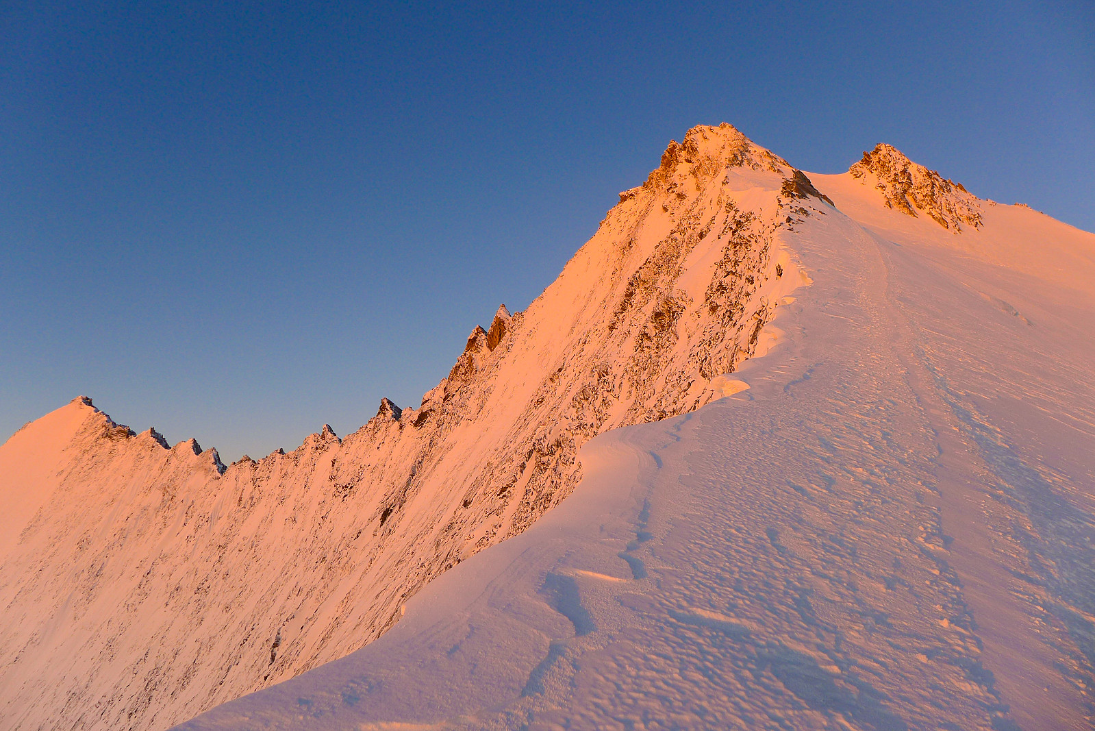
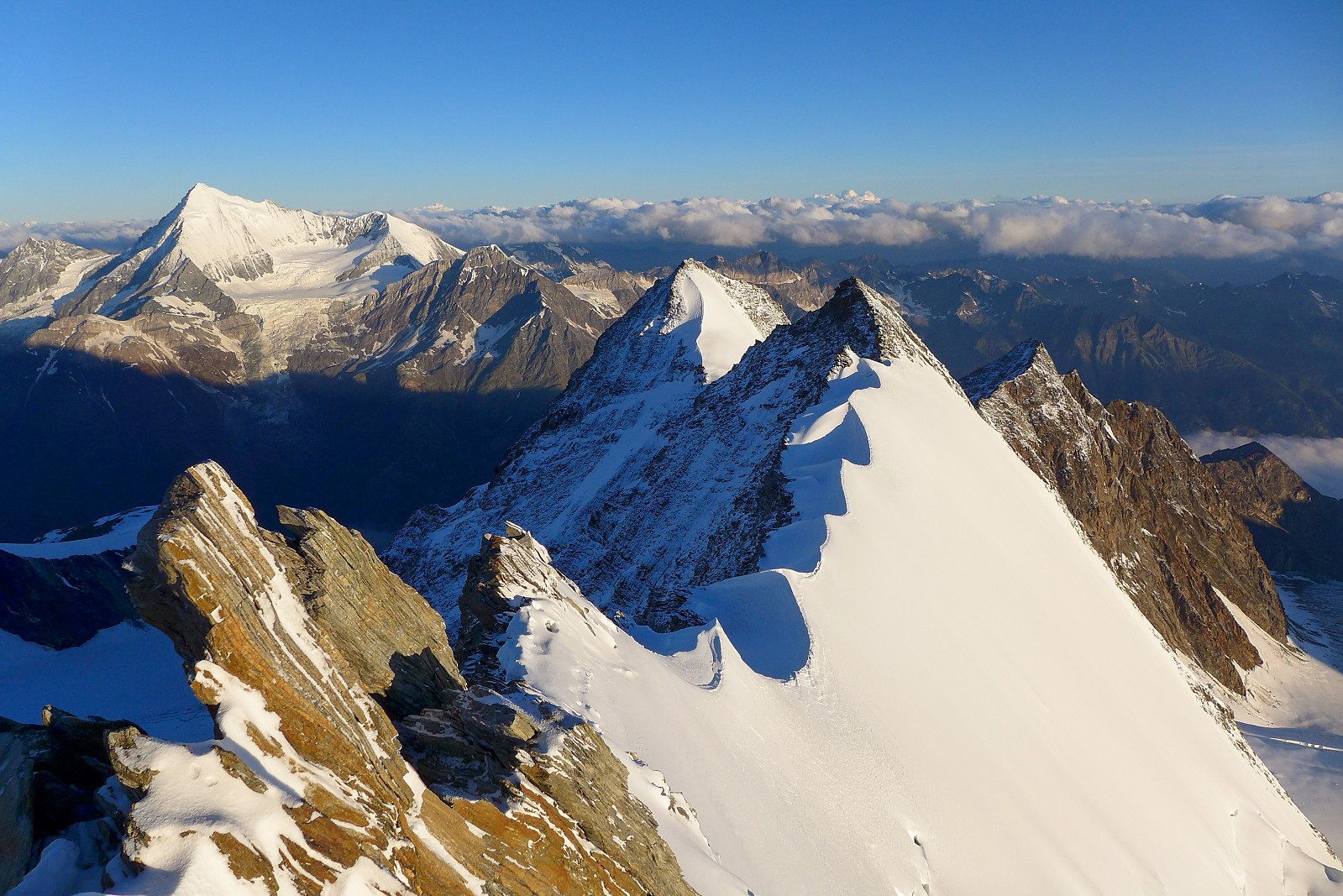
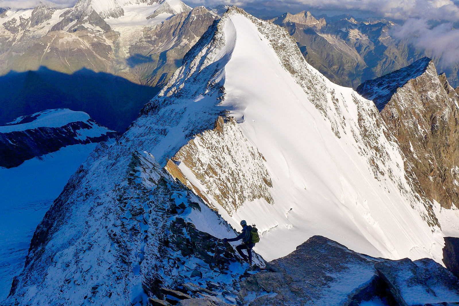
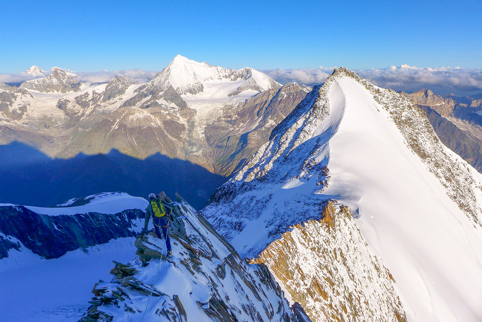
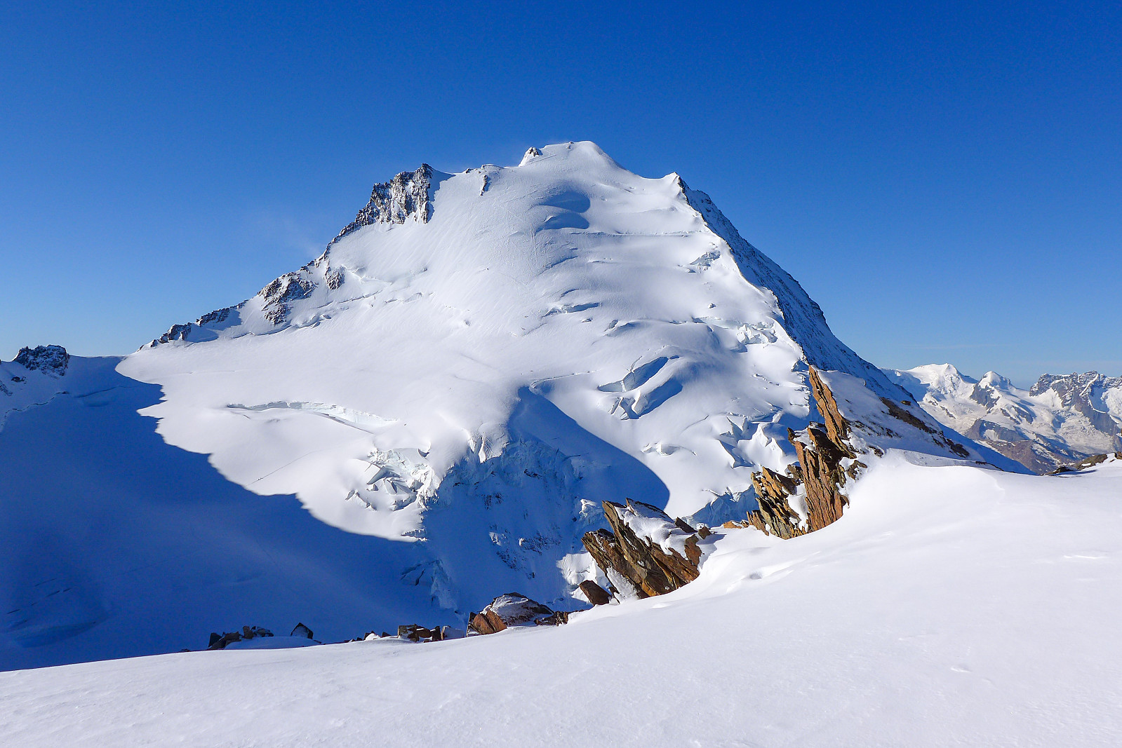
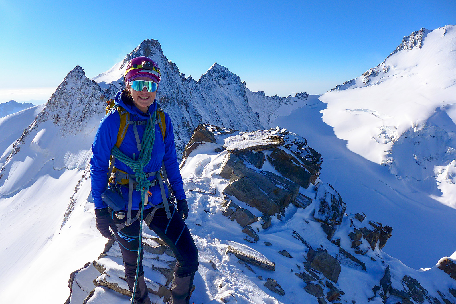
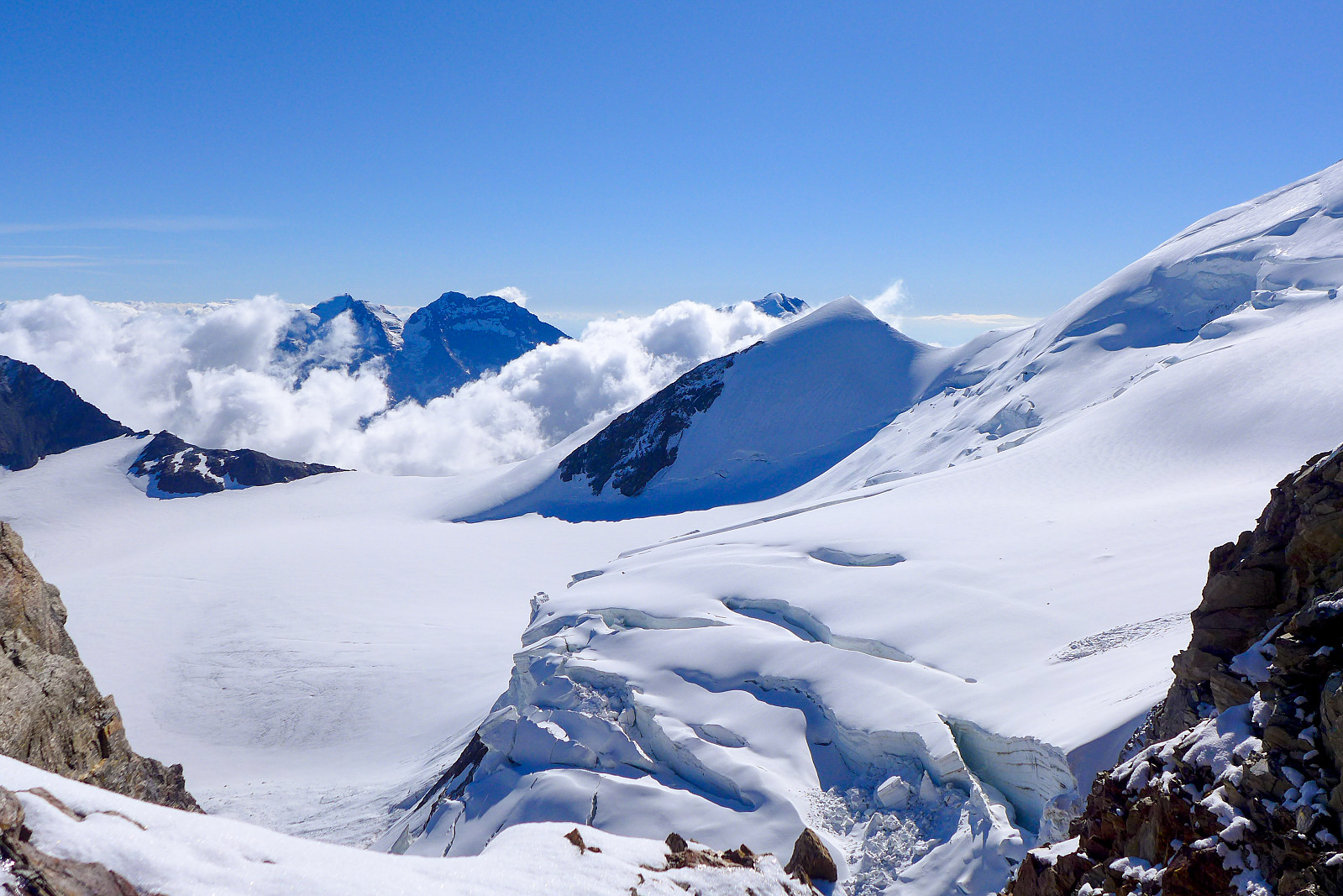
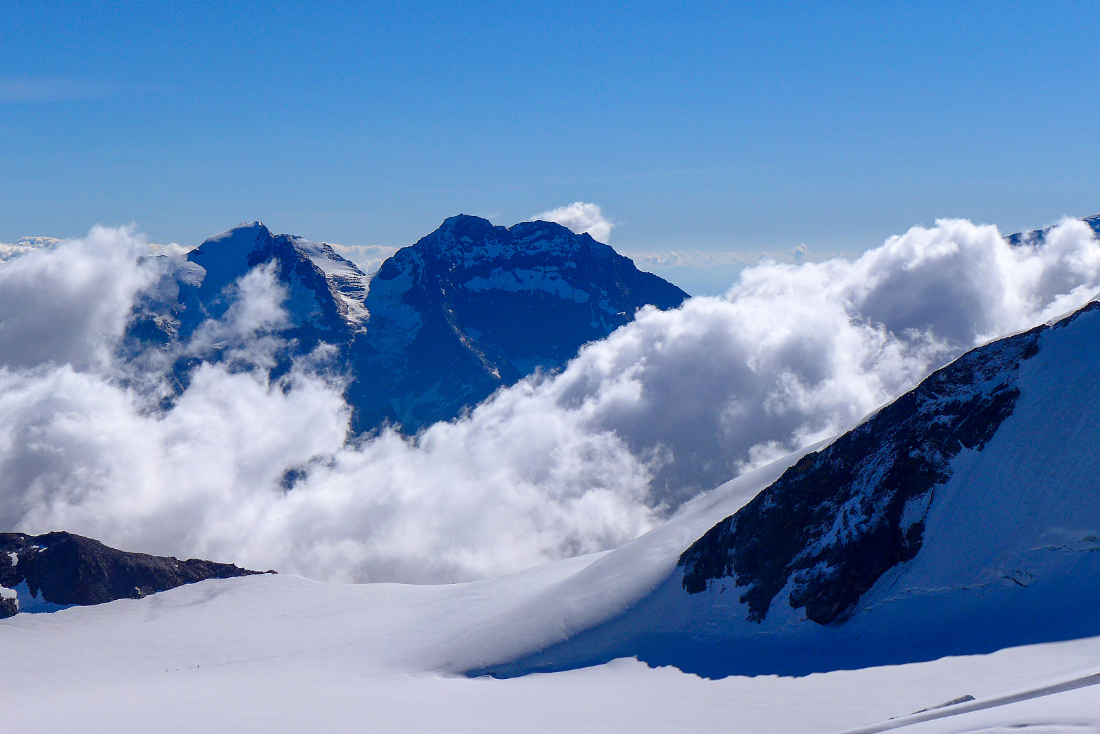
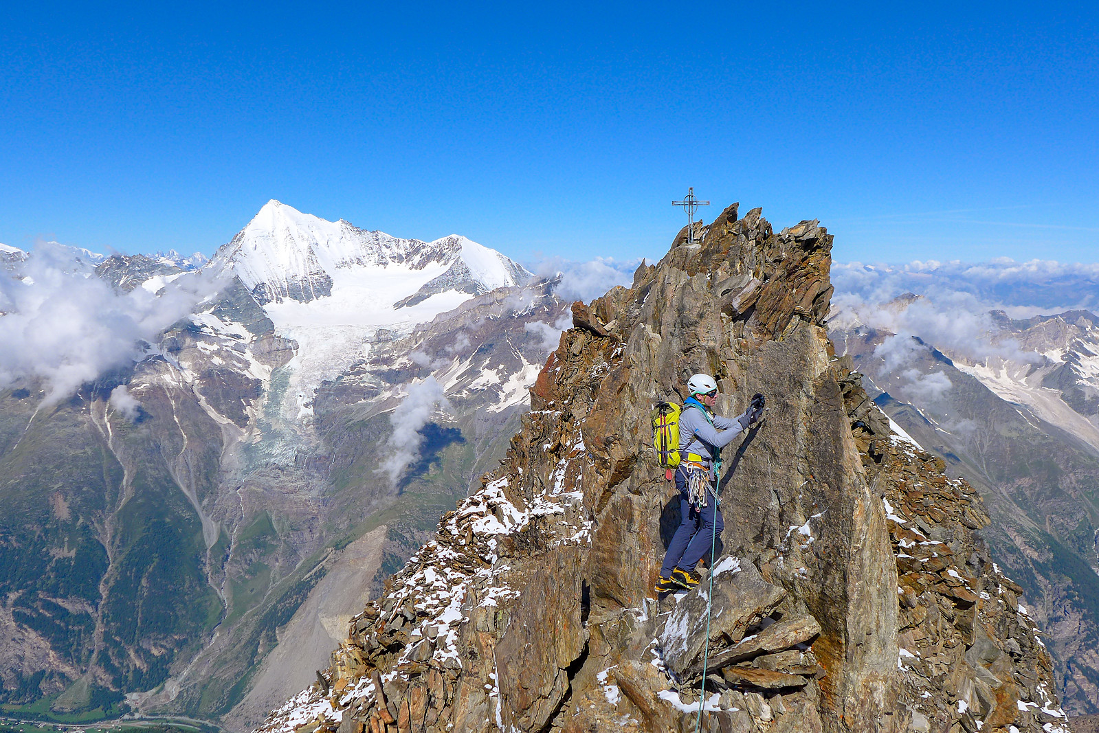
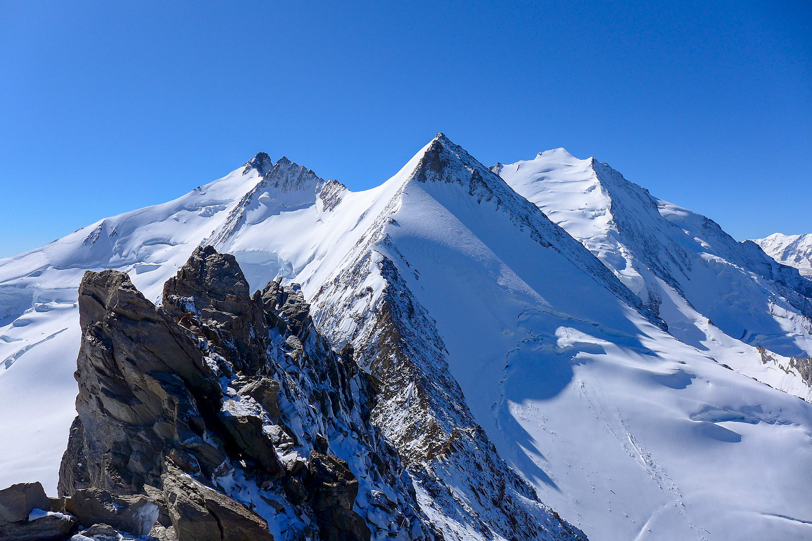
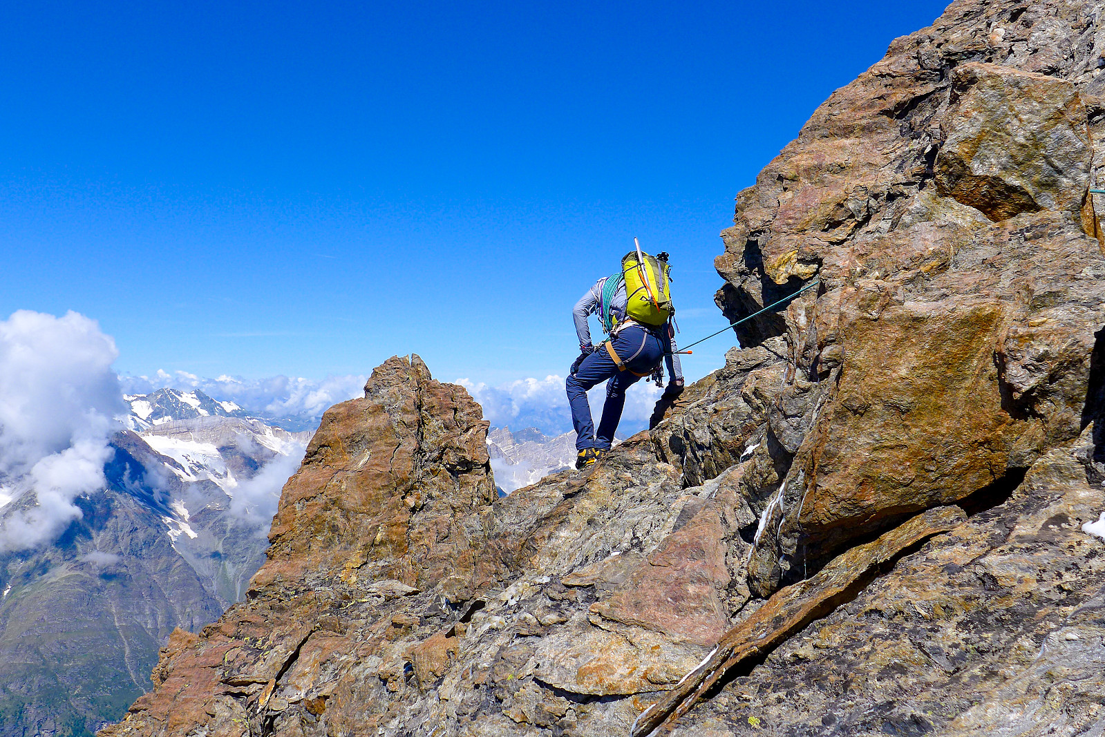
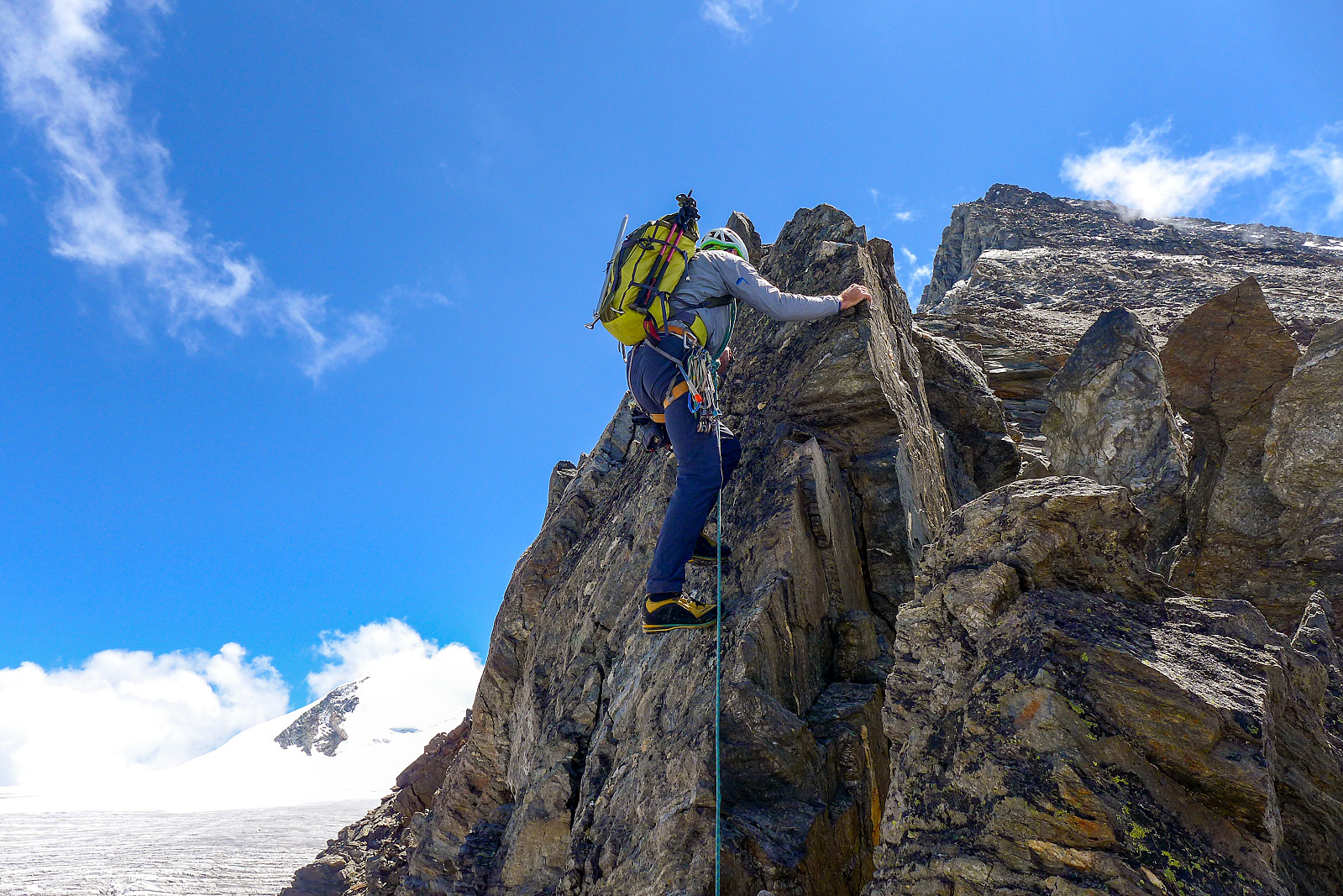
The start of the traverse began with some straightforward scrambling (though made somewhat more challenging to do while wearing a pair of thick mitts) and some downclimbing over slabs that had been newly-plastered in snow, which was a recurring theme for whole traverse. It was often hard to tell if the snow was just snow, or snow sitting on slabs, which the crampons of course don’t bite so well into..... A bit of down climbing was soon followed by a very aesthetic snow ridge and I had the honour of making first tracks across it this morning :-) The snow ridge culminated in a short section of scrambling to reach the summit of the Stecknadelhorn. Having had such an easy ascent to the top I was half expecting more of the same on the other side descending down to the Hohbergjoch. In reality it was actually a lot longer, a bit more airy and more snow-covered since we were for the most part traversing around the south-facing side which was still in the shade at this time of the morning. In any case there were some really cool photo opportunities as Tim led the way down and placed running protection for slightly more awkward ground. It was nice to emerge back into the sun at the Hohbergjoch, just less than 5 hours after leaving the hut. Here we took a new breakfast stop since there was not a breath of wind and it was nice and flat. The next bit of ascent up to the Hohberghorn was relatively straightforward anyway and involved only walking up an easy angled snow slope.
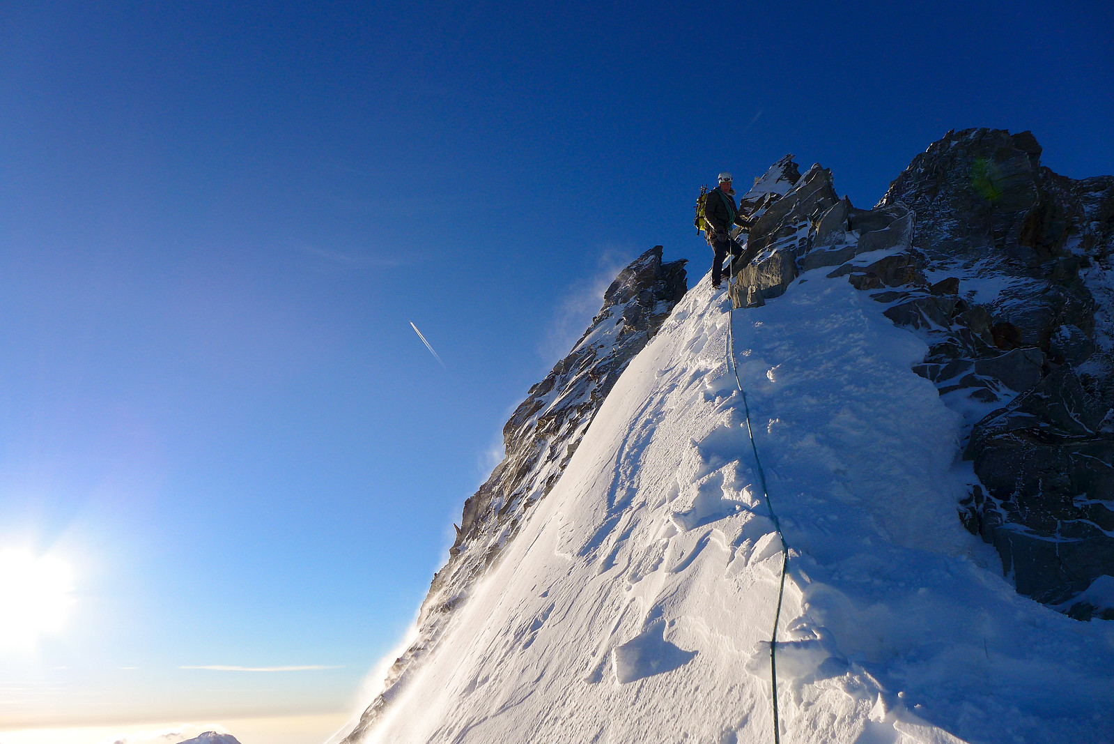
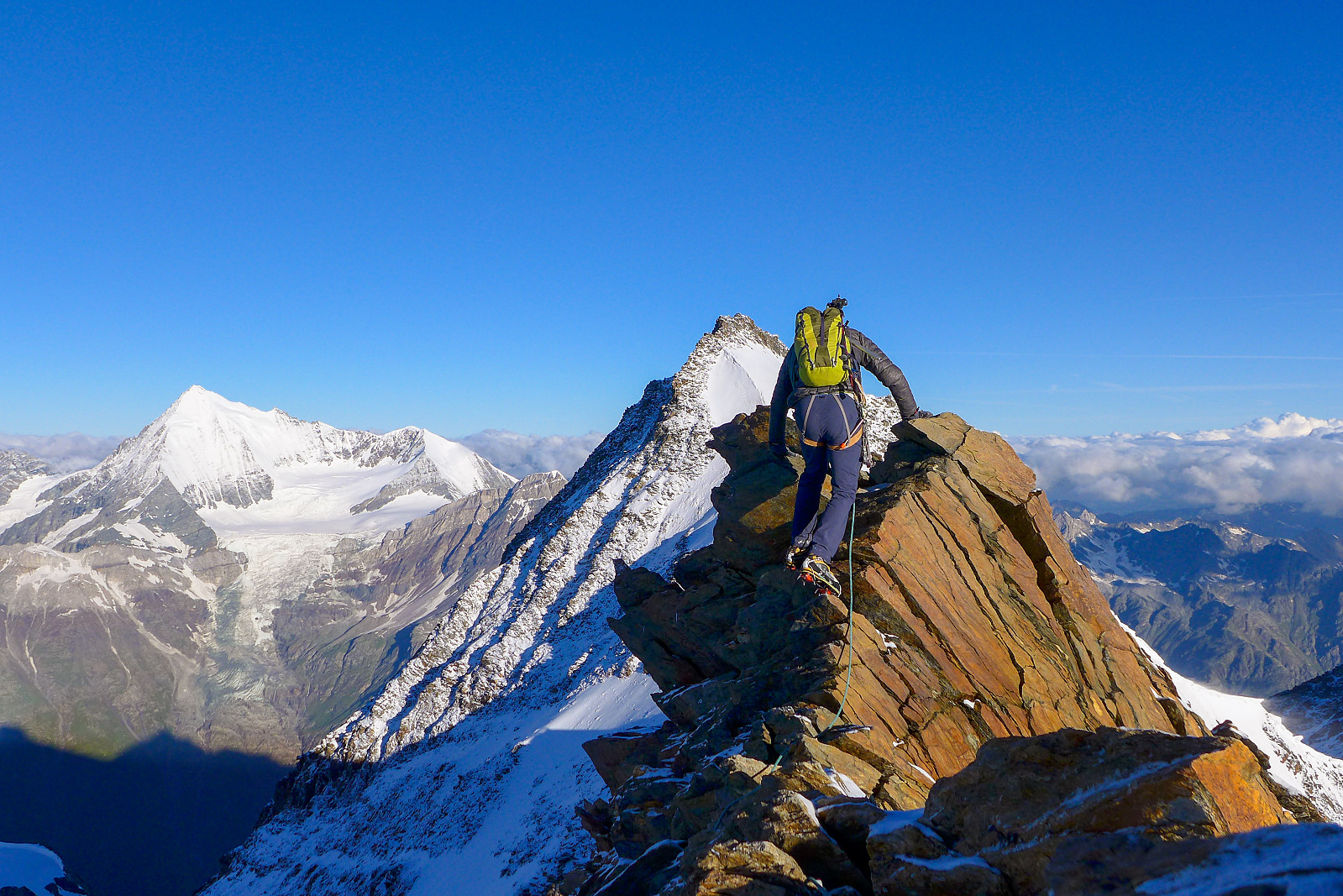
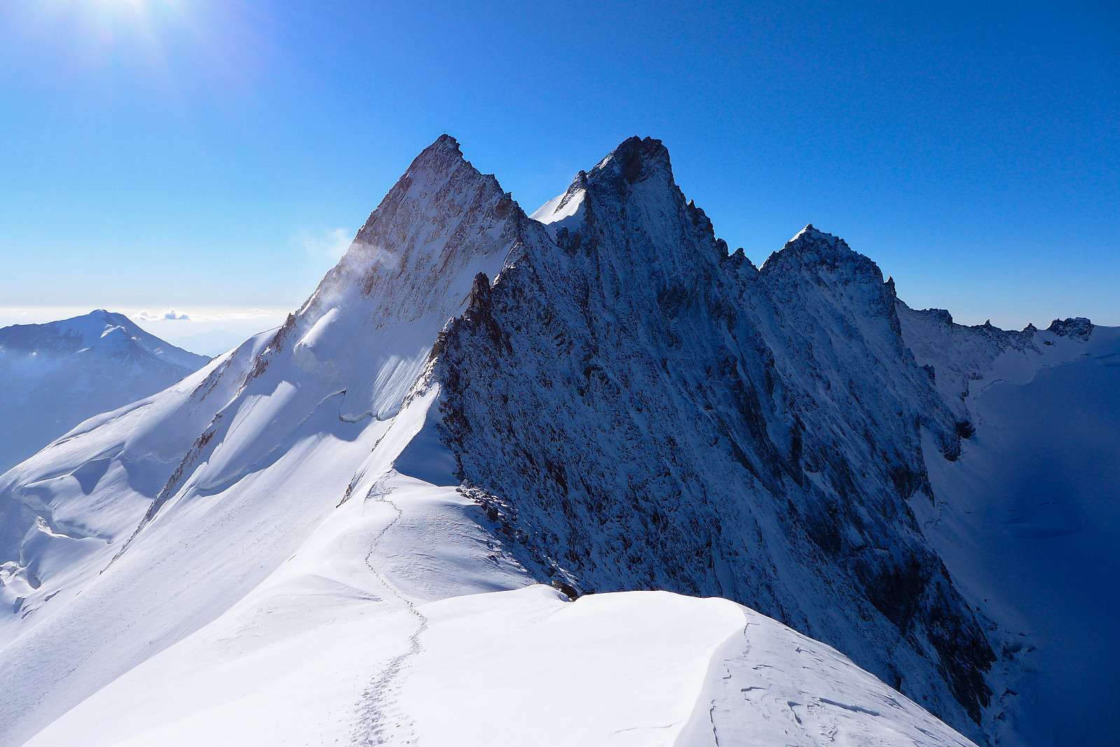
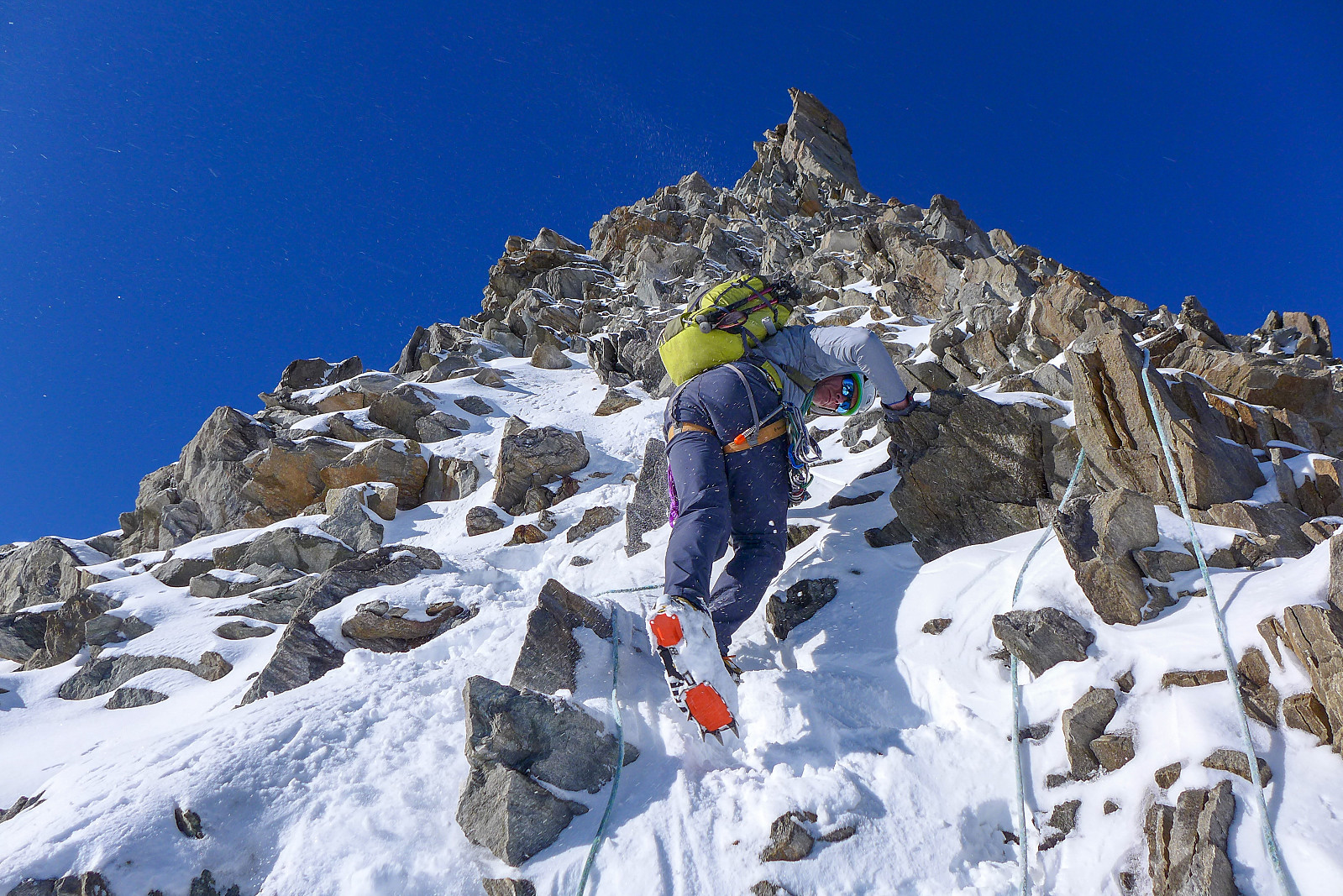
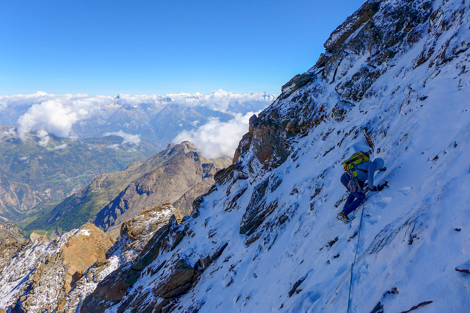
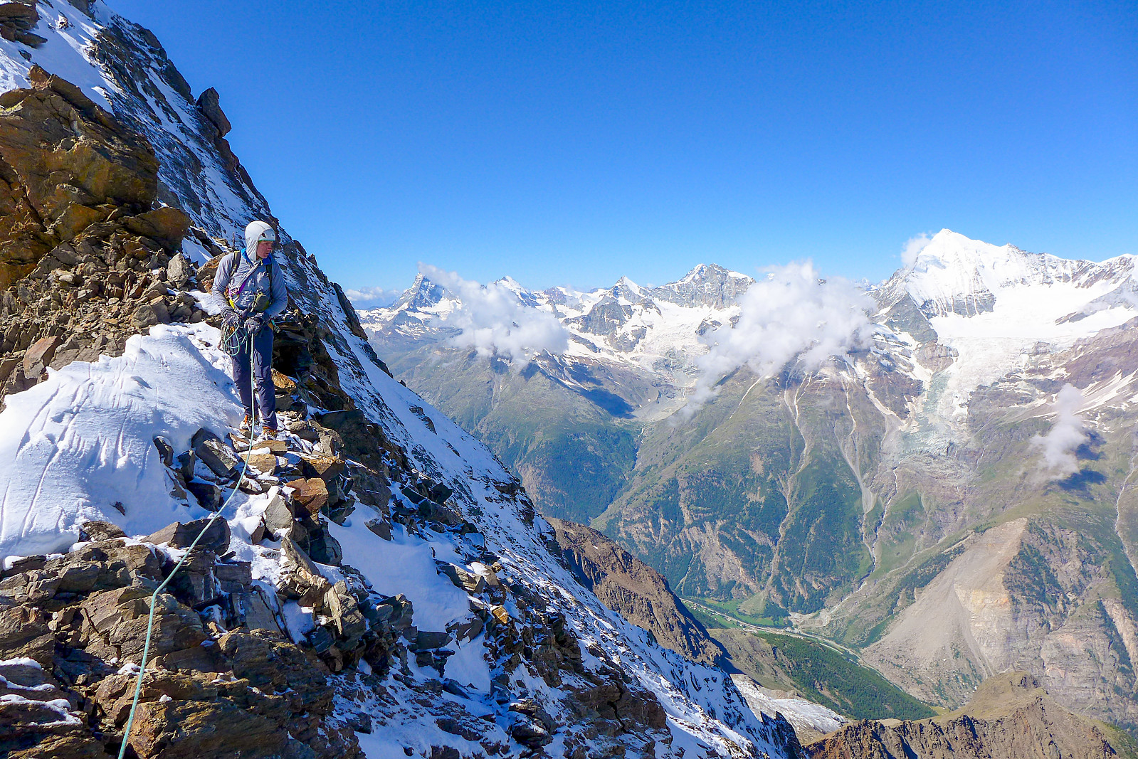
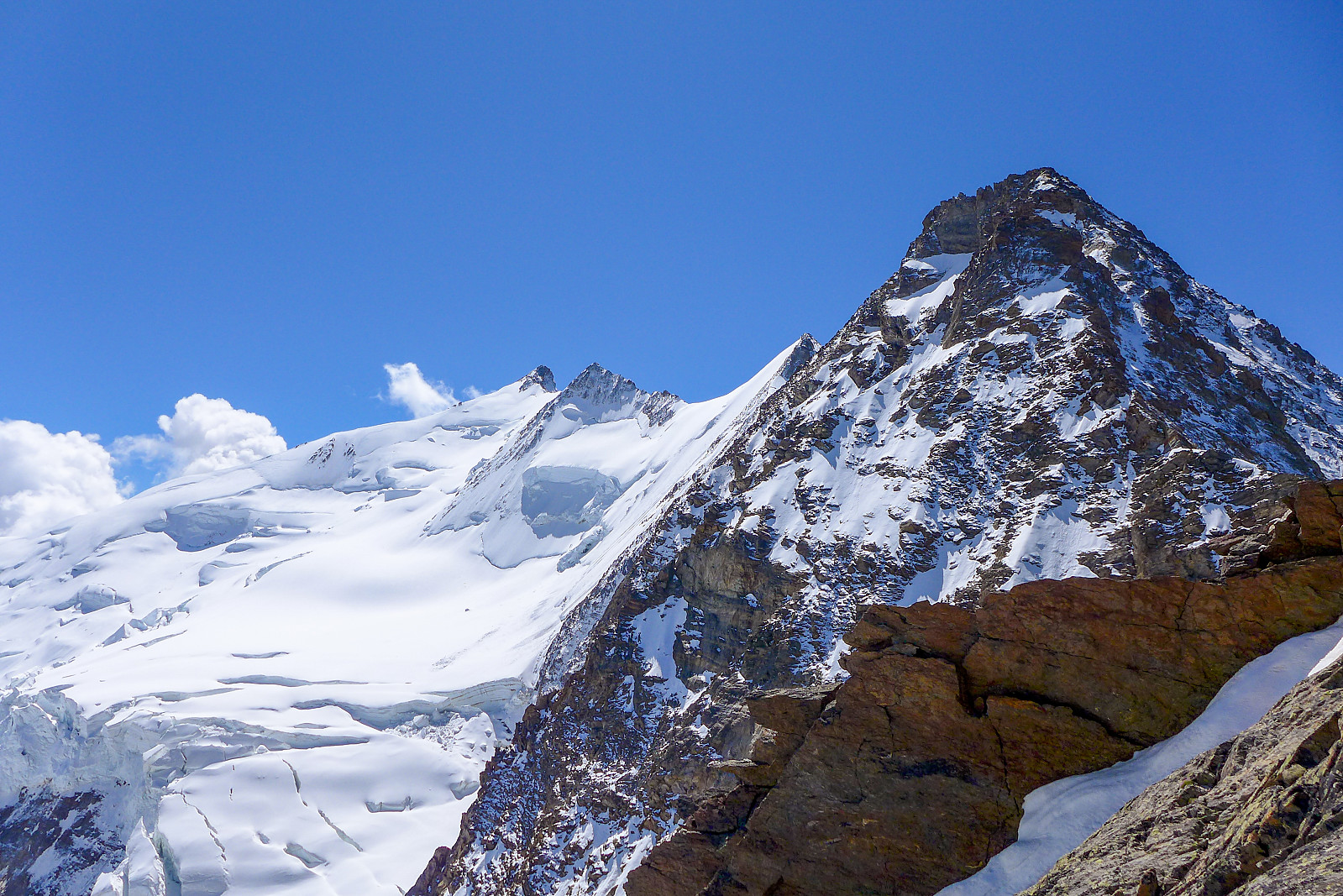
However, like the Stecknadelhorn, the descent down the other side had a different character, starting off with a steep scramble down some snow-covered rocks, then some easy snow before a final downclimb over some slabs which, facing northwest meant it was covered in ice and felt rather delicate to descend in crampons (and still wearing mitts)… Anyway, an hour or so after leaving the Hohbergjoch we were now safely at the Dirrujoch and only had some easy PD-graded ground to get us across to the Dirruhorn. It was nice and easy scrambling, and the first time we’d been able to enjoy it without crampons, but just before recahing the prominent summit cross an enormous bang resonated around us and startled me enough that I think I nearly lost my footing while crossing an exposed part of the summit ridge. Not entirely sure where it came from, but it definitely increased stress levels a bit prior to what was to be an involved descent down the loose rocks on the northwest ridge of the Dirruhorn!
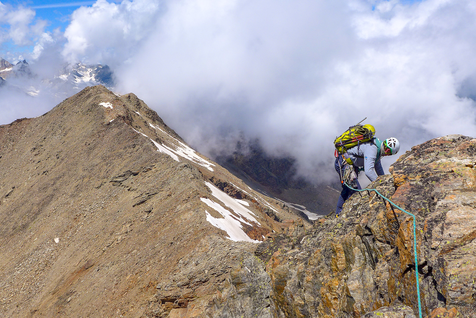
The cold northwest ridge was unsurprisingly still plastered in snow and having heard from Tim how loose the rocks were on the Dirruhorn I wasn’t totally looking forward to the descent. We were aiming for the Galenjoch, which was basically miles away; the distance between the Stecknadeljoch and the Dirruhorn was basically about the same as the Dirruhorn to the Galenjoch (ca. 2km) so we had the same amount of ground to cover as we had just done, but all downclimbing.... braced for a long, long descent (with absolutely zero abseils to lessen the effort!) I took the opportunity to have another caffeine-containing energy gel to make sure my brain was switched on for the journey down. Looking down at the route from the summit of the Dirruhorn toward the Galenjoch, you soon realise that it is really only halfway (7 hours from the Mischabel hut, and it was another 7 hours from the Dirruhorn to Grächen). Well, the next 3 ½ hours basically consisted of some careful downclimbing over steep loose ground, traversing snow-covered slabs, re-ascending to the summit of the Chli Dirruhorn (no crampons need fortunately) and then descending the even looser north side of the Chli Dirruhorn to finally arrive at the Galenjoch in the early afternoon, 10 ½ hours after leaving the hut. All things considered, I think the snow cover was kind of beneficial in places, and there was some exciting and exposed traverses over good consolidated snow along the way despite the fact that in other places the slabby sections were really not fun to downclimb in crampons. But one thing I was sure about was that it was a relief to have finally made it as far as the Galenjoch, now there was just an easy 1700m walk downhill right?


We spend a decent amount of time taking a break at the Galenjoch, not really for view appreciation reasons but mainly for eating, drinking and chilling out (mentally). I felt like the descent of that northwest ridge had required a lot of concentration, probably more than I had expected! Anyway, from the Galenjoch it was still a long way to go...first by following a rather vague kind of trail (marked with cairns here and there) straight down the mountainside, and then eventually meeting one of the marked paths used for ascending to the Bordier hut. But in any case, we still had what felt like miles of walking to do before reaching Grächen and it didn’t really help that I was running low on drink... With only drink and food on my mind I felt more motivated than ever to get back down to civilization as soon as possible! It was at least nice to be walking on a proper footpath again after having spent so many hours on an exposed ridge. The last and unexpected obstacle was a path diversion in the forests above Grächen, which was apparently due to a bridge being impassable (or something to that effect, my knowledge of German isn’t exactly that good). Not wanting to be deterred and led down to some other village, we ended up hurdling all the barriers and discovered that the bridge was indeed impassable but there was no water in the stream below it, so it was fine to cross the stream anyway and clamber back up the banks on the other side. With that part of what was becoming a long adventure done, there was only about 15 minutes more walking before we’d reached the outskirts of Grächen and an actual tarmac road. It had been a pretty terrific 14 hours, with a lot of activity and sights packed in! The final part of the day’s mission was to locate the bus stop/post office which turned out to be very conveniently located next to a Coop supermarket (where large bottles of drink and sandwiches were bought), and we had 15 minutes to spare before taking the next bus leaving for St. Niklaus.
Fourteen hours of incredible scenery, exciting ridgelines and varied ground with absolutely no one else around undoubtedly puts this traverse into one of my favourite outings in the Alps, even though there are many :-) Thanks to Tim for the seriously fantastic end to the first week of climbing!

| Start date | 23.07.2020 03:13 (UTC+01:00 DST) |
| End date | 23.07.2020 17:18 (UTC+01:00 DST) |
| Total Time | 14h 05min |
| Moving Time | 11h 03min |
| Stopped Time | 3h 01min |
| Overall Average | 1.3km/h |
| Moving Average | 1.7km/h |
| Distance | 18.7km |
| Vertical meters | 1,032m |


User comments