
Trekking an Extreme Variant of Romsdalseggen Mountain Ridge (18.07.2020)


Written by Solan (Atle Solholm)

| Start point | Venjedalssetra (376m) |
|---|---|
| Endpoint | Nebbaksla Parking (18m) |
| Characteristic | Alpine trip |
| Duration | 6h 47min |
| Distance | 16.9km |
| Vertical meters | 1,336m |
| GPS |
|
| Ascents | Blånebba (1,320m) | 18.07.2020 15:03 |
|---|---|---|
| Blånebba øst for (1,319m) | 18.07.2020 15:03 | |
| Holstind (1,078m) | 18.07.2020 15:03 | |
| Høgaksla (991m) | 18.07.2020 15:03 | |
| Litlefjellet (780m) | 18.07.2020 15:03 | |
| Mjølvafjellet (1,216m) | 18.07.2020 15:03 | |
| Nesaksla (731m) | 18.07.2020 15:03 | |
| Nesaksla øst (908m) | 18.07.2020 15:03 | |
| Steinfjellet (1,178m) | 18.07.2020 15:03 | |
| Visits of other PBEs | Nebba utsiktspunkt (85m) | 18.07.2020 15:03 |
| Nesaksla parkeringslomme (35m) | 18.07.2020 15:03 | |
| Ottarbu (708m) | 18.07.2020 15:03 | |
| Rampestreken (537m) | 18.07.2020 15:03 | |
| Venjedalssetra p-plass (380m) | 18.07.2020 15:03 |
I have previously trekked the mountain range called Romsdalseggen with my oldest son and a nephew of me. A link to my tour description of that hike is here: Blånebba og Romsdalseggen The text in that tour description is in Norwegian, but there are some pictures there, that will do even for an international audience. There have, however, been described three different routes called Romsdalseggen by the local tour operators in the Rauma Municipality: There's what they call Romsdalseggen Light. Then there's Romsdalseggen Regular. And finally, there's what has been referred to as Romsdalseggen Extreme.
![Image #3: View towards Mount Venjetind from the upper part of Venjedalen valley. The peak in front is Lille [i.e. Lesser] Venjetind, and behind it is Store [Greater] Venjetind.](https://images1.peakbook.org/images/14939/Solan_20201107_5fa6f7a6e563b.jpg?p=xtralarge)
The regular route follows the blue GPS-track on the map of Image#5, and is even the one described in my above mentioned tour description of July 14th 2018. The light route follows the regular route from the parking lot at Venjedalssetra up to about 840 m.a.m.s.l., and then follows the valley between the mountains Storhesten and Mjølvafjellet, before it ascends Mount Høgnosa [838 m.a.m.s.l.]. From Høgnosa the light route goes south to the North Peak of Mount Mjølvafjellet, and from there it joins the regular route down to the town of Åndalsnes. I have not marked out the light route on the map of Image #5, but a dotted line on the original map marks out part of it. The main point of the Romsdalseggen Light route is that it bypasses the most exposed part of the regular route, i.e. the notch between Mount Steinfjellet and Mount Mjølvafjellet (Images ## 25 & 26); and yet gives you the feeling of walking along an edge as you continue along the rest of the mountain ridge towards Åndalsnes.

Earlier, the Romsdalseggen Extreme Route was something the municipality as well as the local tour guides were actively advertising in order to attract mountaineers to the area, but after some rescue operations, they stopped doing that; realizing the route was attracting too many people with insufficient experience with such steep mountains. Anyway, my son Dag, who had trekked the Romsdalseggen Regular Route a number of times, as a guide for various friends and relatives of us; had at some point heard about the extreme route, and so he asked me if I would like to join him on such a hike, and I answered I would love to.
![Image #7: On top of Mount Litlefjellet [i.e. "The Small Mountain"]. Trollveggen [i.e. "The Troll Wall"], the highest vertical cliff in Europe is seen in the background.](https://images1.peakbook.org/images/14939/Solan_20201109_5fa878fc82ce6.jpg?p=xtralarge)
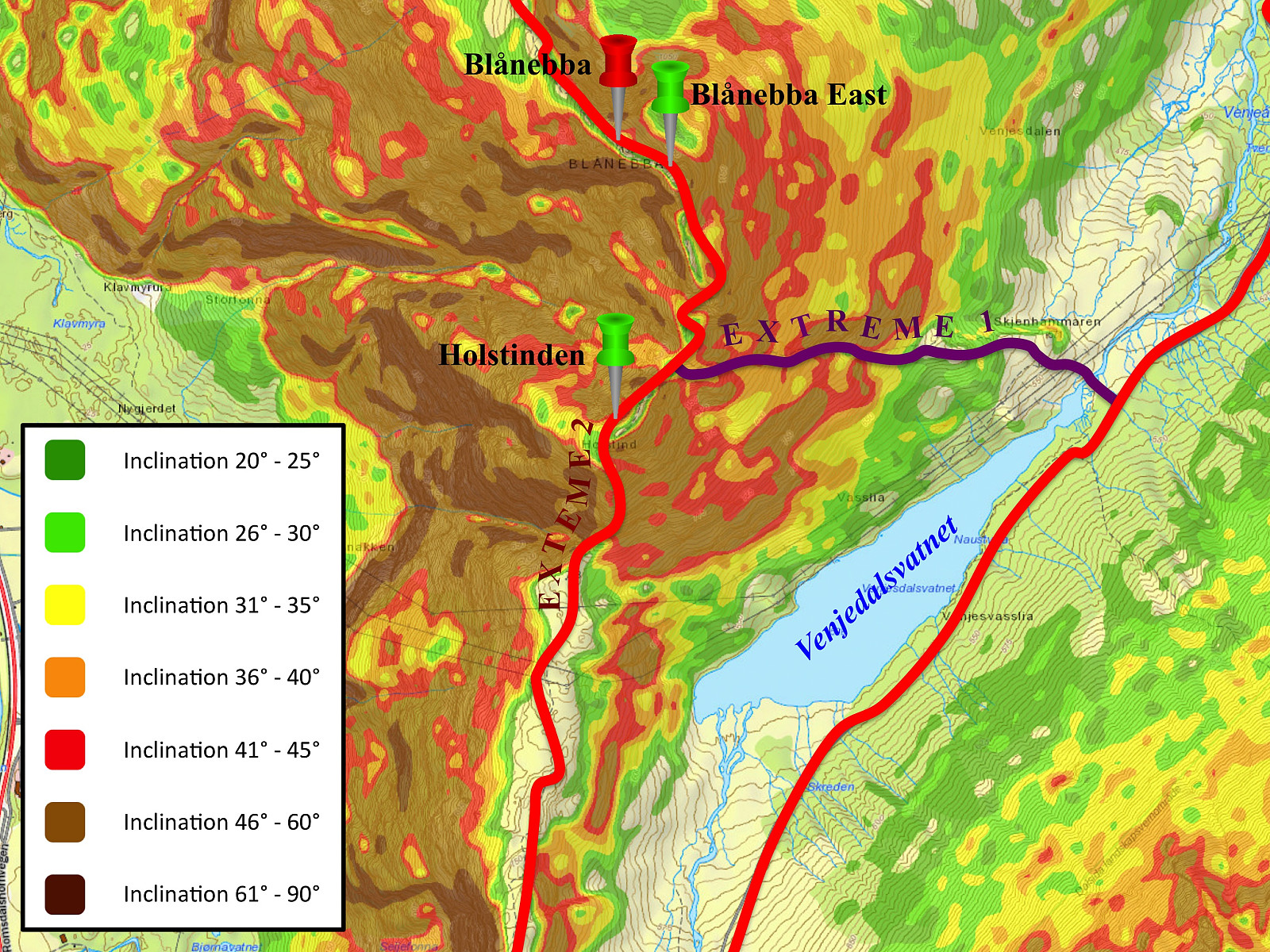
As we prepared for the hike by reading about it on the internet, we realized there were actually two different extreme routes. The originally described extreme route, marked out in purple in the map of Image #6, starts out from the northeast end of lake Venjedalsvatnet, and ascends along a chute up to the notch between Mount Holstinden and Mount Blånebba. But then we came across an alternative extreme route, described in a climber's magazine, where they recommended a route ascending from Mount Litlefjellet via Mount Holstinden to Mount Blånebba; and from the tour description as well as the map, this tour seemed to be even more spectacular than the originally described extreme route.
Driving to Åndalsnes by car takes about two hours from where we live. We parked our car just by the railway station, and then tried to find a cab that could take us to the valley called Venjedalen, from where a trek along Romsdalseggen usually starts. If you arrive at Åndalsnes in early morning during the tourist season, there's usually even a bus that you may take to get into this valley; but due to the Covid-19 lockdown there were no such bus this year, and moreover, we didn't get up that early this morning, hence our arrival in Åndalsnes would've been way too late for that bus anyway. After a few minutes we spotted a cab. Two other guys were already getting into it, but judging from their equipment, we figured they were probably mountain trekkers heading for the same destination as we were; so we run over to the cab, asked them; and were allowed to join them up to the parking lot in Venjedalen Valley. Afterwards, we realized it probably wasn't that wise to share a cab with strangers in the middle of the corona virus pandemic; but on the other hand, when four persons are shearing a cab, it's not much more expensive than the bus would've been.
![Image #11: View of the Rauma river valley, just as we're about to embark upon the climb up Mount Holstinden. [On this photo it seems too steep to be climbed without climbing gear, but the mountain is not this steep everywhere.] Mount Norafjellet is seen on the other side of the valley, and Mount Setnesfjellet is seen in the background.](https://images1.peakbook.org/images/14939/Solan_20201109_5fa8826d85066.jpg?p=xtralarge)
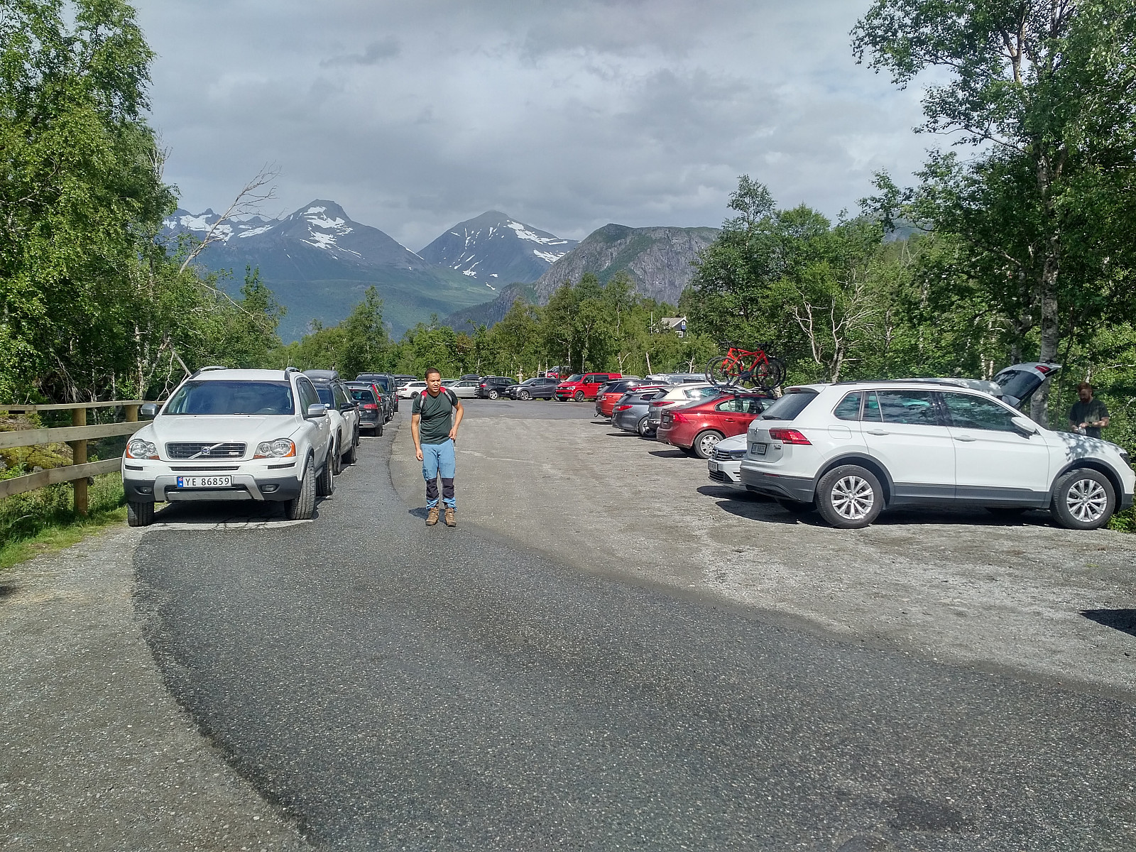
We were dropped off at Venjedalssetra Parking Lot (Image #1). The two other guys were just going there to pick up their car. They had trekked the regular route the previous day, and thereafter spent the night at a hotel in Åndalsnes. Our tour were actually to start from a point much higher up in the valley, but when we realized there was a nicely paved road all the way up there, we had already payed for the taxi; and so we just embarked upon walking. [I had for some reason been imagining that the road further up the valley was a poor old gravel road that the taxi driver would refuse to spoil his cab on, but there I proved to be wrong].
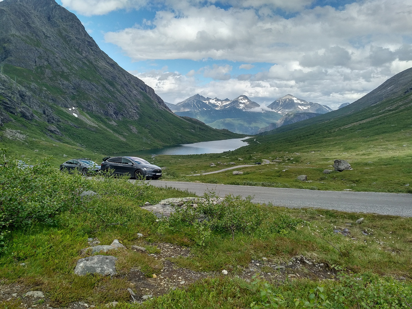
As we walked up towards the foot of Mount Litlefjellet, we had the majestic Mount Venjetind (Image #3) on our left side; and Mount Blånebba, which we were going to climb later on, to our right. Ahead of us we could see the renown Mount Romsdalshornet (Image #4) getting more and more majestic as we were approaching it; with Mount Litlefjellet just at the foot of it. Mount Romsdalshornet is of course another mountain that we would love to climb at some time, but that mountain is extremely steep; you have to use professional climbing equipment, and it's generally recommended that you do it along with a mountain guide at least the first time.
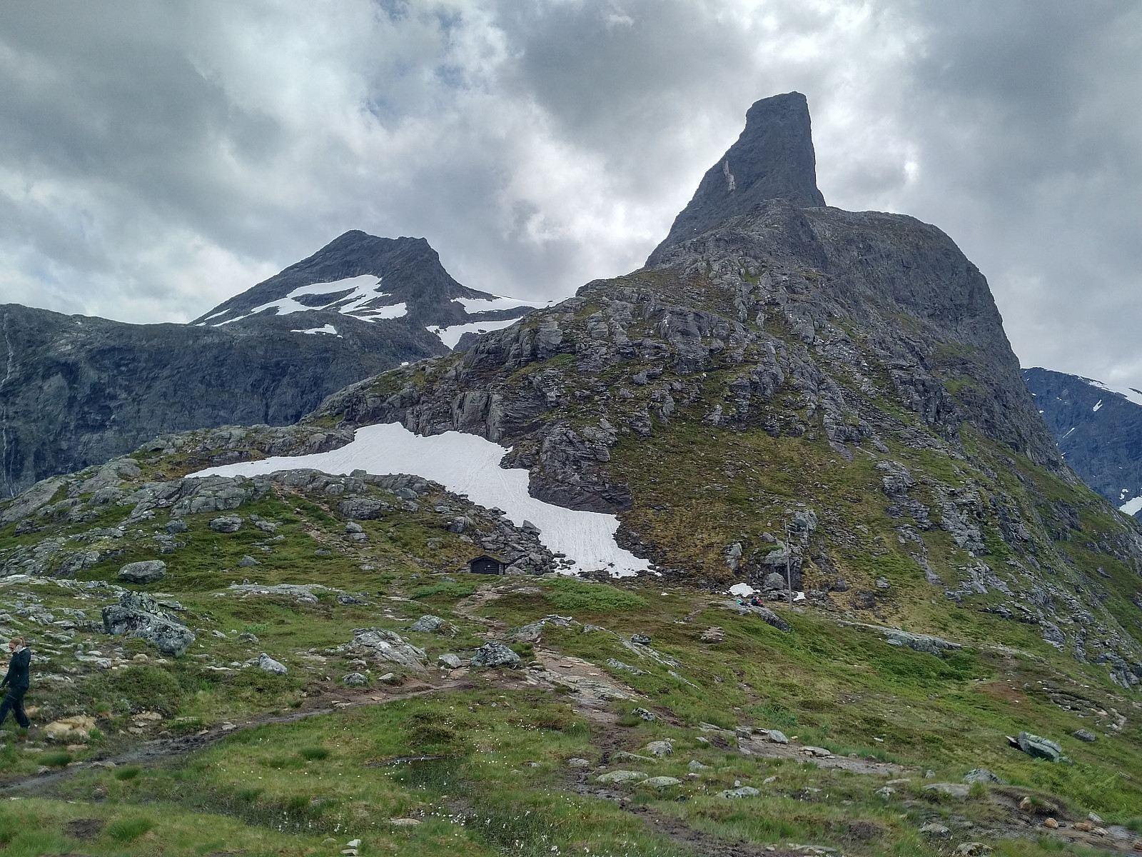
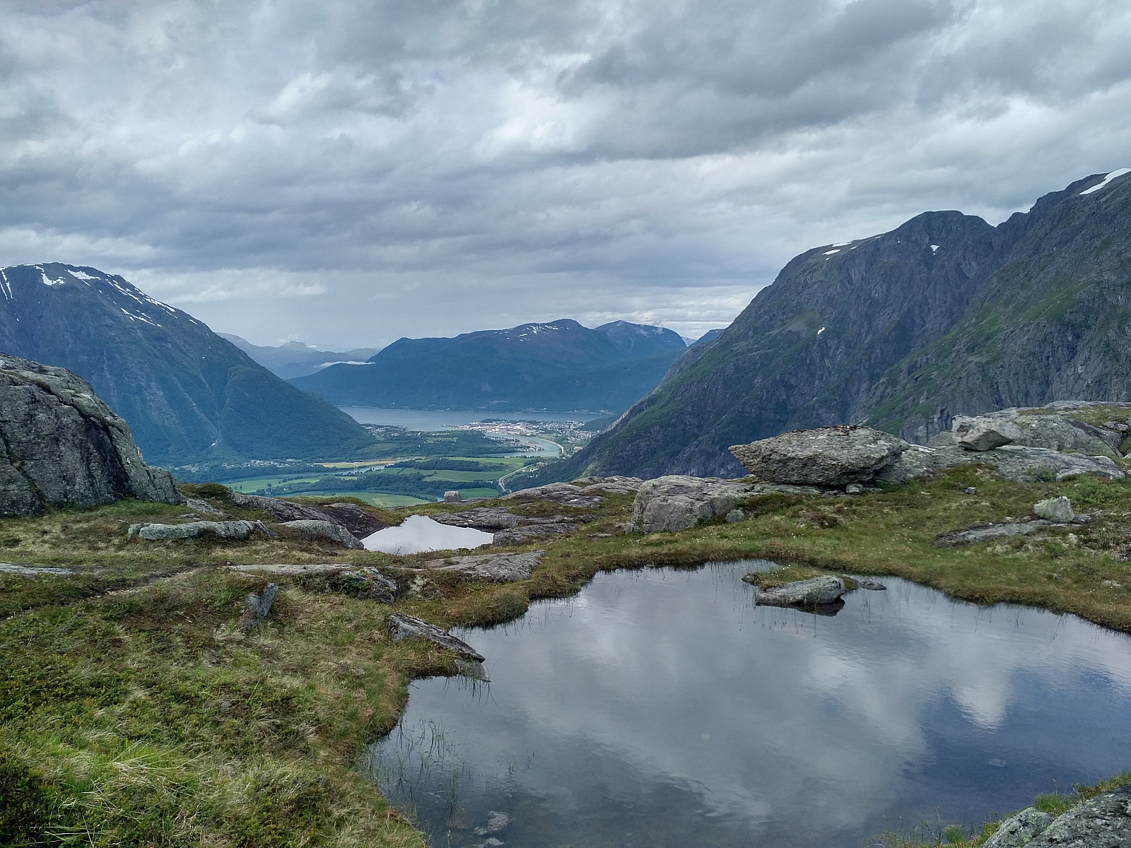
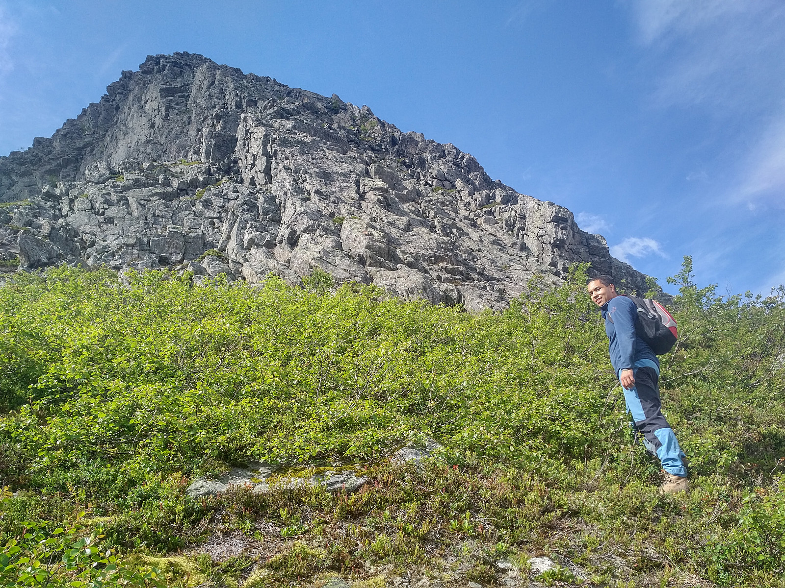
The walk up Venjedalen Valley, to the foot of Mount Litlefjellet took us 47 minutes, and then the climb up to the top of Mount Litlefjellet [i.e. "The Small Mountain"] took us another 12 minutes or so. Mount Litlefjellet [780 m.a.m.s.l.] is not really a mountain, but rather a knoll on the mountain ridge that connects Mount Blånebba with Mount Romsdalshornet (have a look at the maps, and you'll understand what I mean). The ridge has a broad open area, with some small ponds, one of the almost like a little lake (Images ## 7, 8 & 9); and the location is actually a cherished camping spot for mountain hikers. A lot of people pitch their tents on Mount Litlefjellet, and spend the night there; before they hike the Romsdalseggen mountain ridge the next morning. Surprisingly, however, only a few of them climb directly from Mount Litlefjellet up to Romsdalseggen along the route that we were going to follow; they actually rather tend to descend from Mount Litlefjellet after a good night's sleep, and then go all the way back down to Venjedalssetra, from where they hike the Romsdalseggen regular route (Image #5).

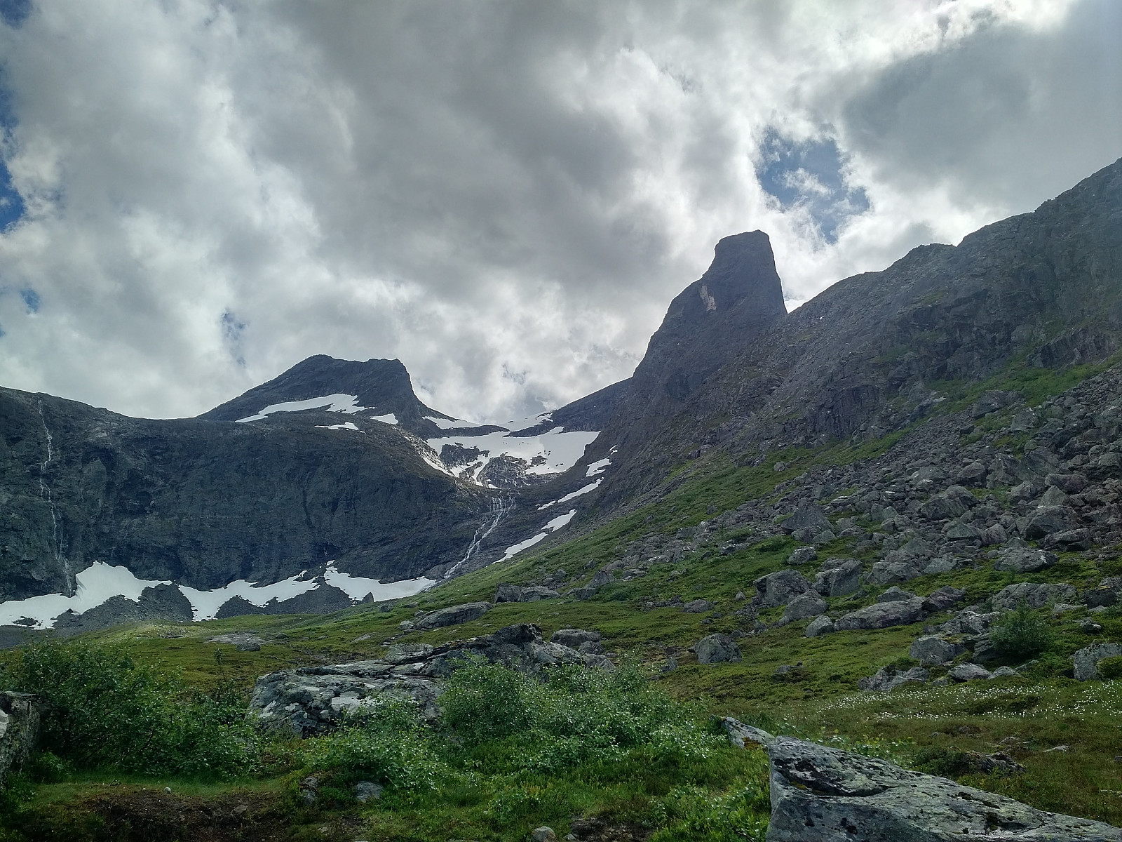
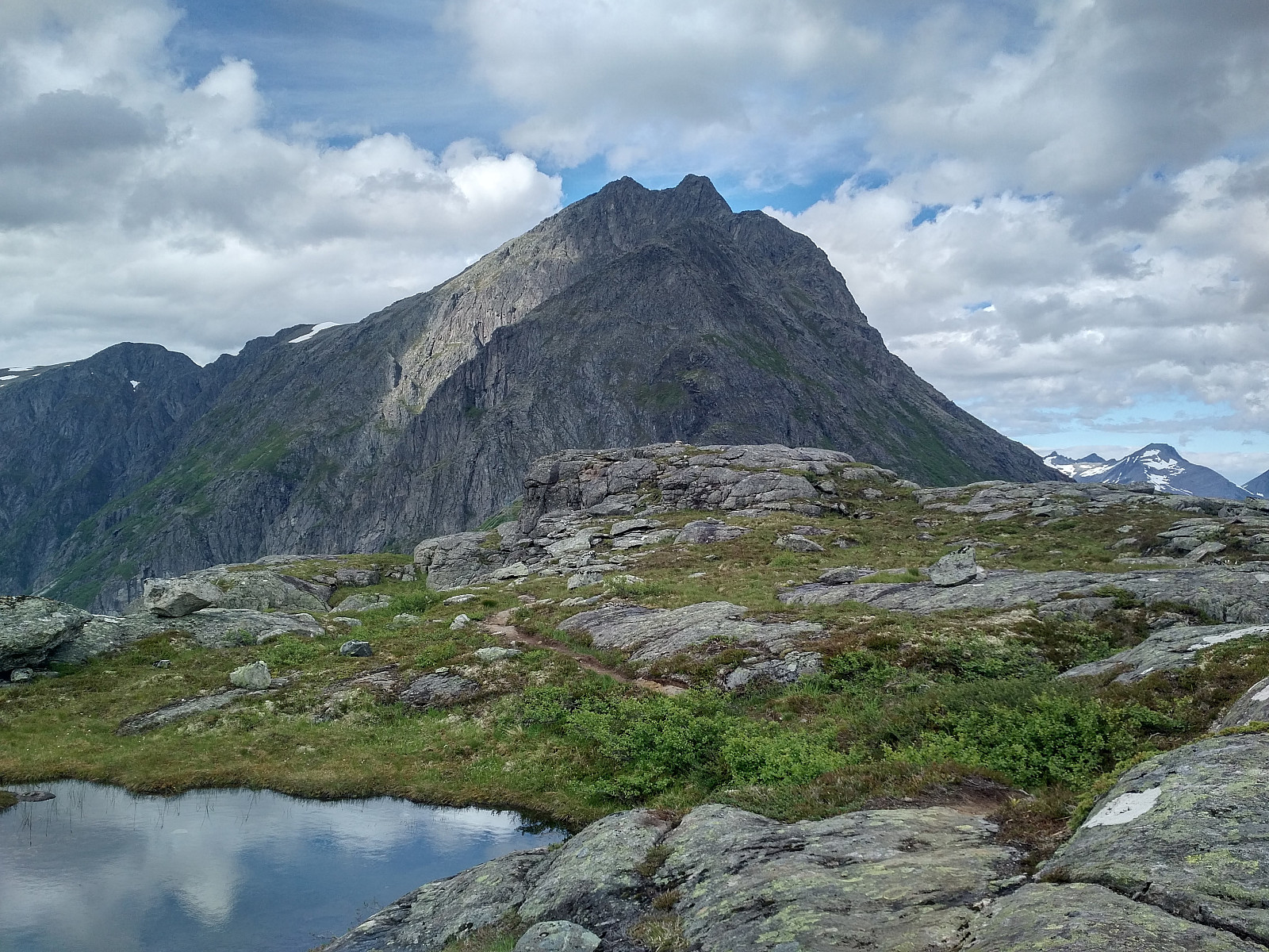
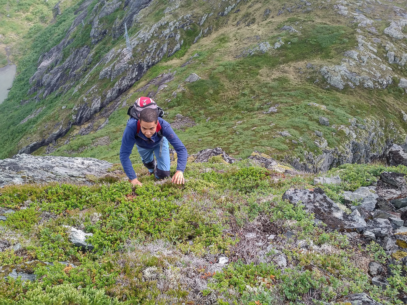
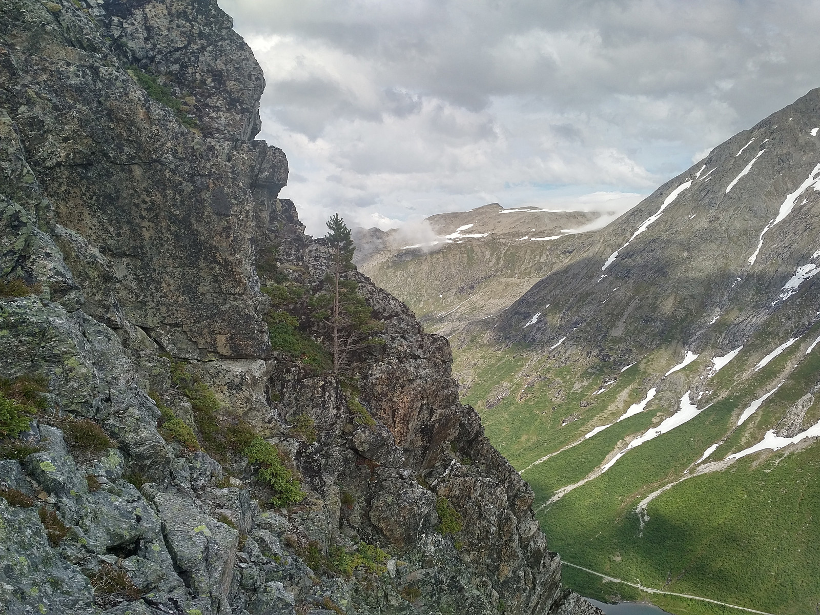
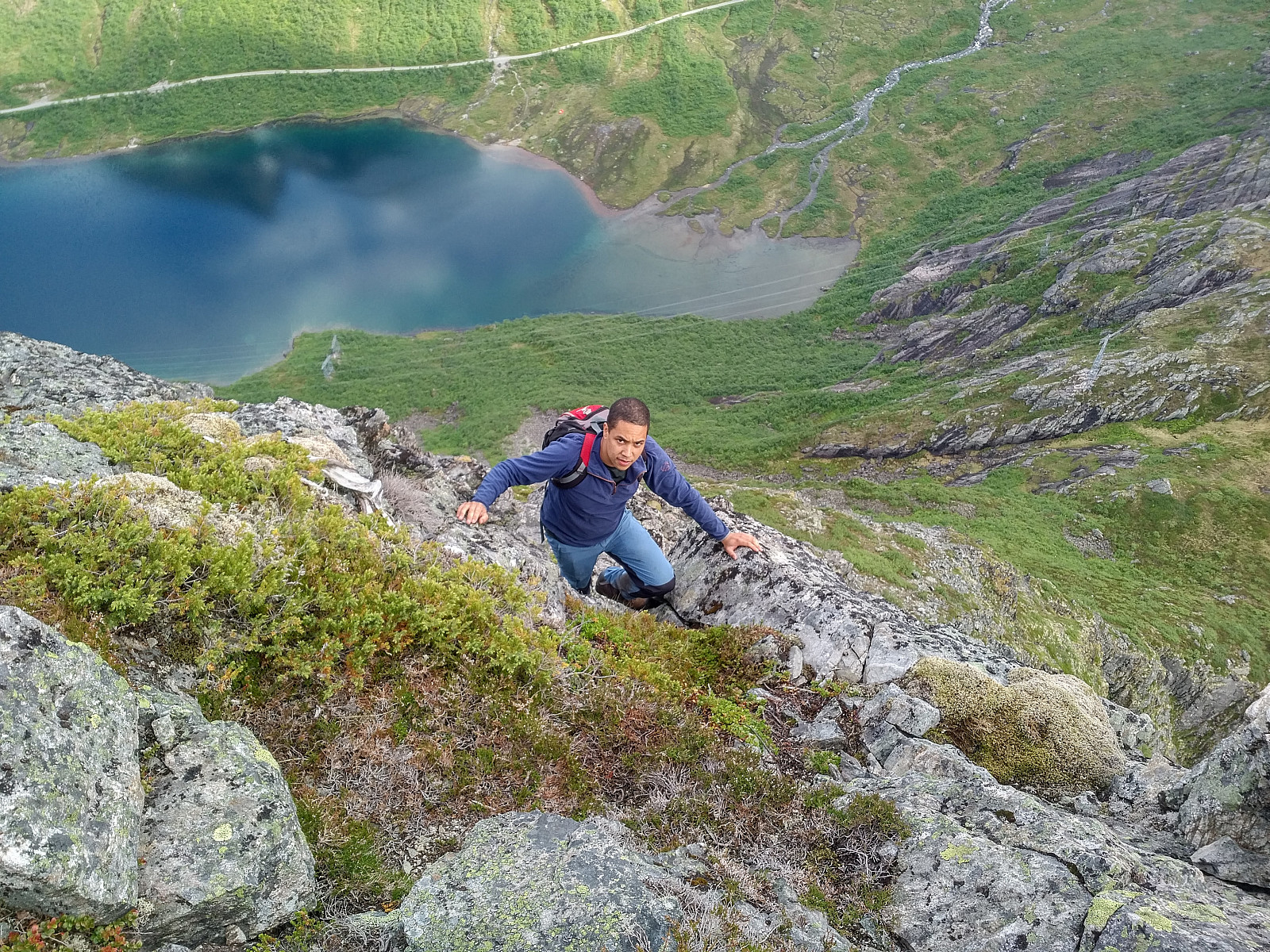
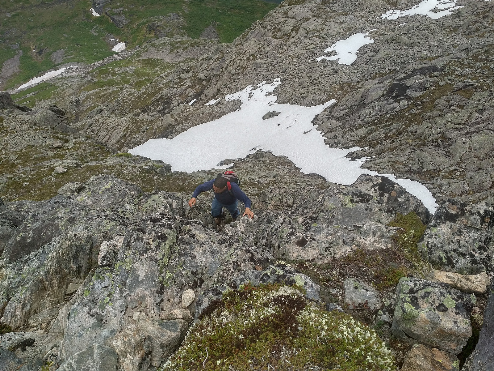
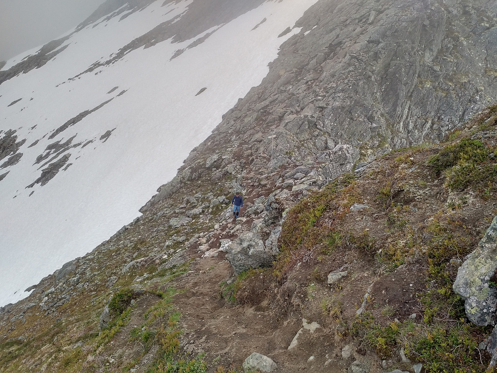
The west side of Mount Litlefjellet, i.e. the side that faces the Raumadalen Valley (Image #18), is very steep, but the top area is just a little bit bumpy or hilly, and otherwise rather flat; hence the walk over to the foot of Mount Holstinden (Image #10) takes only about 15 minutes. Now, up to this spot, this hike is quite straight forward. The challenging part of the hike starts once you embark upon climbing Mount Holstinden. This mountain is quite steep right there from the beginning, and on the left side of the route you have a vertical cliff (Images ##11 & 16) that is likely to mean imminent death if you fall down there. I wouldn’t recommend that you do this trek in foggy weather, therefore, as you need to see where you’re climbing. In the lower part of the ascent from Mount Litlefjellet to Mount Holstinden, there’s a lot of vegetation, like bushes and small trees. I generally like to hold onto cracks and protrusions in the mountain when I go climbing; but on this particular trek, there are places where the inclination isn’t that steep, and where I regard holding onto a bush or a tree as sufficient, as long as you pull and shake it a bit so as to “test it” before you let go of whatever you’re holding onto with the other hand.
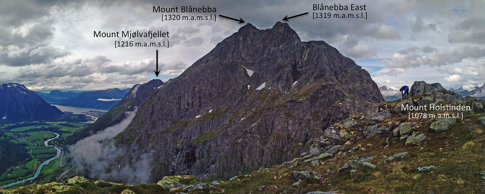
Higher up, the vegetation becomes scarcer (Image # 13), and from there you’ll be holding onto firm rock as you continue your climb upwards. As one may read from the color codes of the inclination map in image #6, this part of the route is quite steep (> 40° on the edge proper, and even steeper on both sides of it); but we managed to make our way up the steep mountainside (Images ## 12 & 15), and eventually reached the summit of Mount Holstinden [1078 m.a.m.s.l.] (Image #18). The climb up from Mount Litlefjellet to the summit of Mount Holstinden took us about 1 hour and 15 minutes. On top of Mount Holstinden we just had something to drink, before we continued towards the east peak of Mount Blånebba. As may be seen on Image #18, Blånebba is a twin peak mountain, with an eastern peak that is only about one meter lower than the main peak.
![Image #19: View from Mount Blånebba towards Mount Holstinden, that we just past. In the background is seen Mount Romsdalstinden, as well as the peaks flanking The Troll Wall Cliff [Norwegian: Trollveggen]](https://images1.peakbook.org/images/14939/Solan_20201117_5fb3ef8945edc.jpg?p=xtralarge)
From the summit of Mount Holstinden, you descend only about 55 elevation meters, before you start climbing again; now towards the east peak of Blånebba. The chute which has been described as another extreme route of Romsdalseggen ends right there in the notch between Mount Holstinden and Mount Blånebba (the chute is visible in the background of Image #20). As may be deciphered from the inclination map above (Image #6), the climb up this chute is actually quite steep; though the climb up the south side of Mount Holstinden [i.e. the one that we had just done, seems to be even steeper]. The first part of the climb from the notch towards Blånebba is not too challenging, but as you approach the summit of the east peak, the route becomes increasingly steep; and at one point probably even a little bit steeper than the climb up to Mount Holstinden (Image # 20). I'm aware that many would recommend the use of professional climbing equipment at this spot; but in dry weather it is even feasible to climb the spot without such equipment, provided you're experienced with such steep climbs.
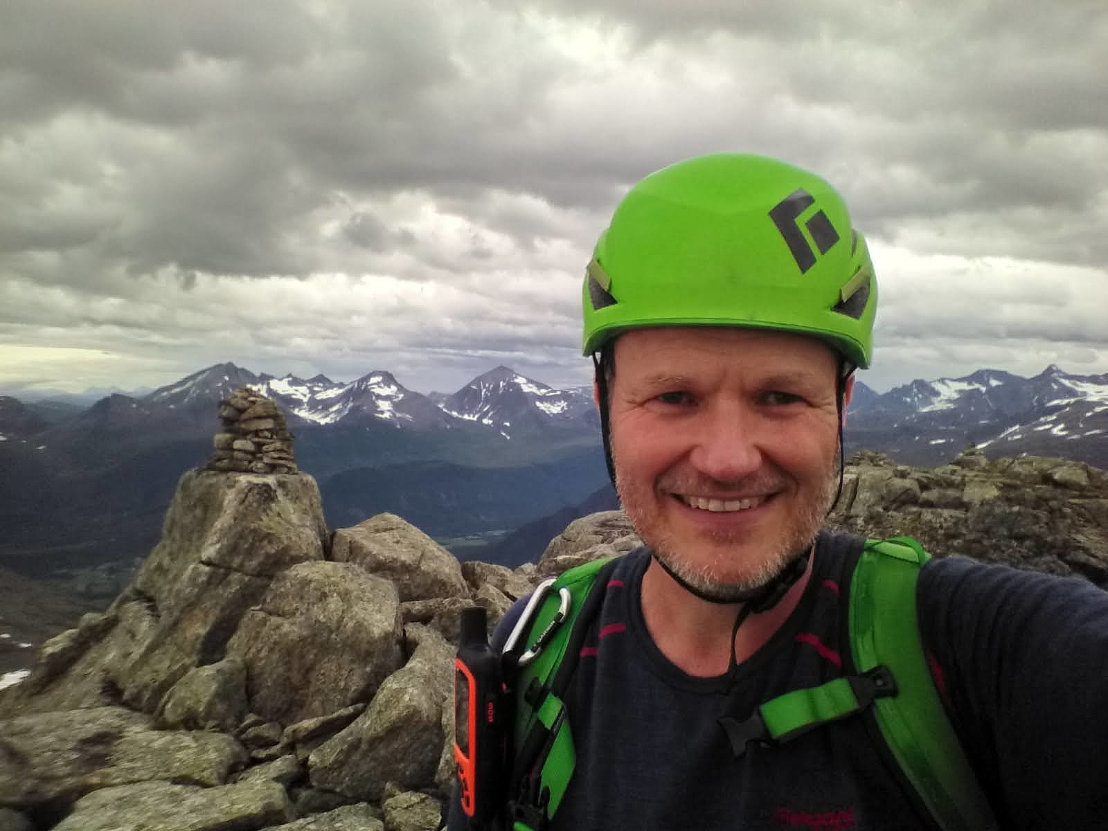
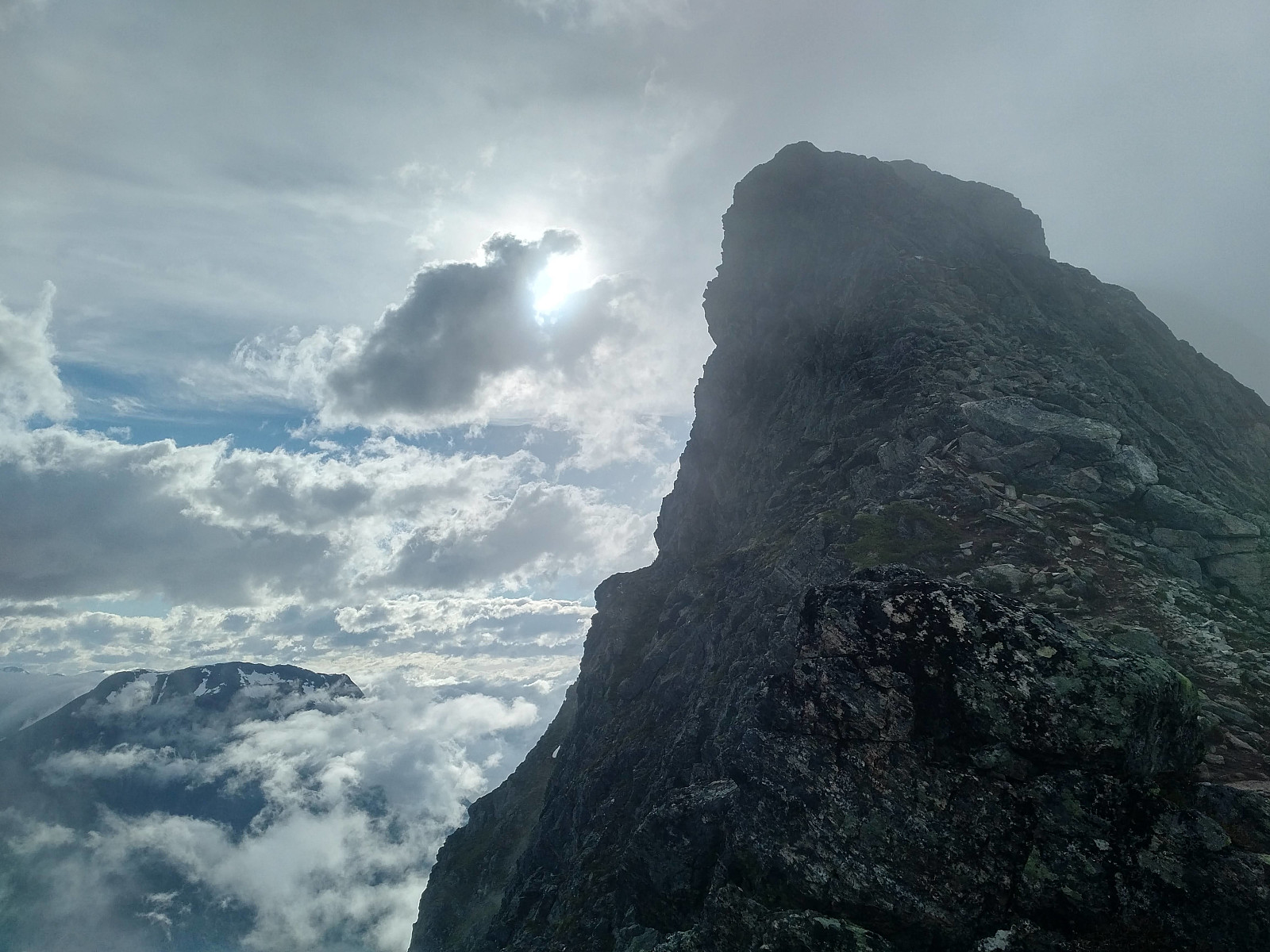
We reached the east peak of Mount Blånebba [1319 m.a.m.s.l.] 3 hours and 20 minutes after we had set out from Venjedalssetra parking lot, i.e. 2 hours and 5 minutes after we embarked on the steep climb up the south face of Mount Holstinden, and 1 hour after passing the summit of Mount Holstinden. The moment you reach this spot, you do get a very deep sense of joy and satisfaction, probably due to some kind of endorphin rush; since at this spot you're done with all the real climbing, and the rest of the trip is more like a regular mountain hike. Up there, we shot a lot of pictures, because the view was fabulous; and then we had something to eat and to drink before we continued on our journey. Next, we continued to the main peak of Mount Blånebba [1320 m.a.m.s.l.], from where we went on to Mount Steinfjellet [1178 m.a.m.s.l.].
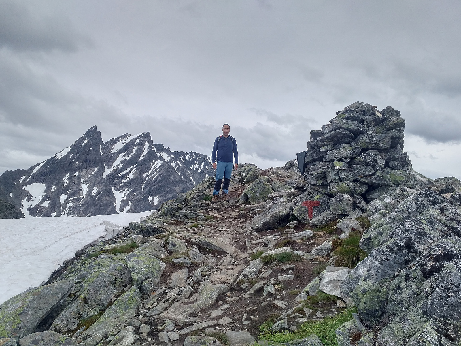
Despite having a name of its own, Mount Steinfjellet is not really a mountain, but merely a knoll on Mount Blånebba; or a prominence on the ridge between Mount Blånebba and Mount Mjølvafjellet, if you want. Nevertheless, Mount Steinfjellet [i.e. "The Stony Mountain"] is where the Romsdalseggen Extreme Route joins the Romsdalseggen Regular Route (Image #5); and from this point on, our tour was the one described by most people that have trekked the Romsdalseggen mountain range.
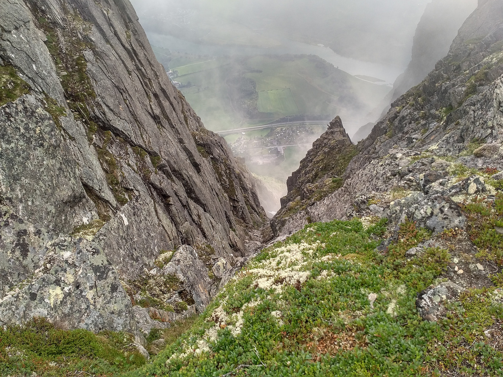
Between Mount Steinfjellet and Mount Mjølvafjellet there is a notch about 70 meters deep (when compared to the elevation of Mount Steinfjellet), and if you're an experienced hiker, I would say this notch (Images ##25 & 26) is the only really exposed part of the regular route, though it sure can't in anyway be compared to the extreme route that we had just completed. From the bottom of this notch, the climb up to the summit of Mount Mjølvafjellet is about 110 elevation meters, as Mount Mjølvafjellet is about 40 meters higher than Mount Steinfjellet. The hike from Mount Blånebba to Mount Mjølvafjellet took us about 55 minutes, and from Mount Steinfjellet it took us about 25 minutes to reach Mount Mjølvafjellet.
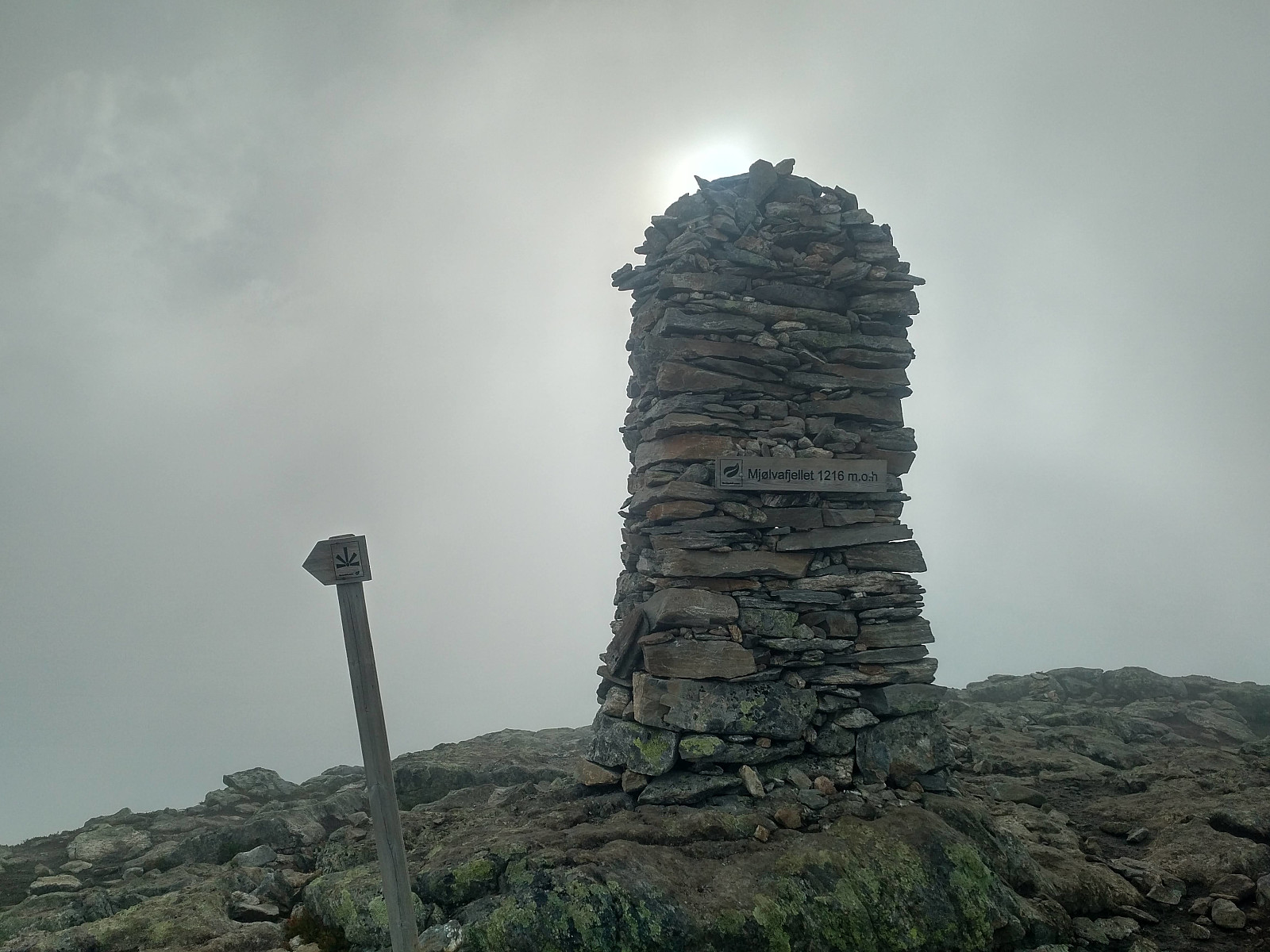
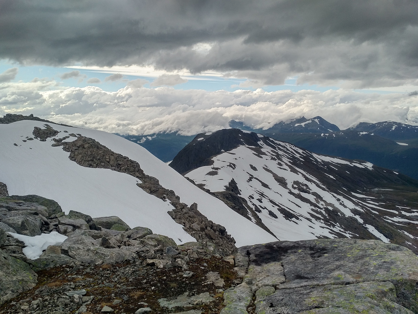
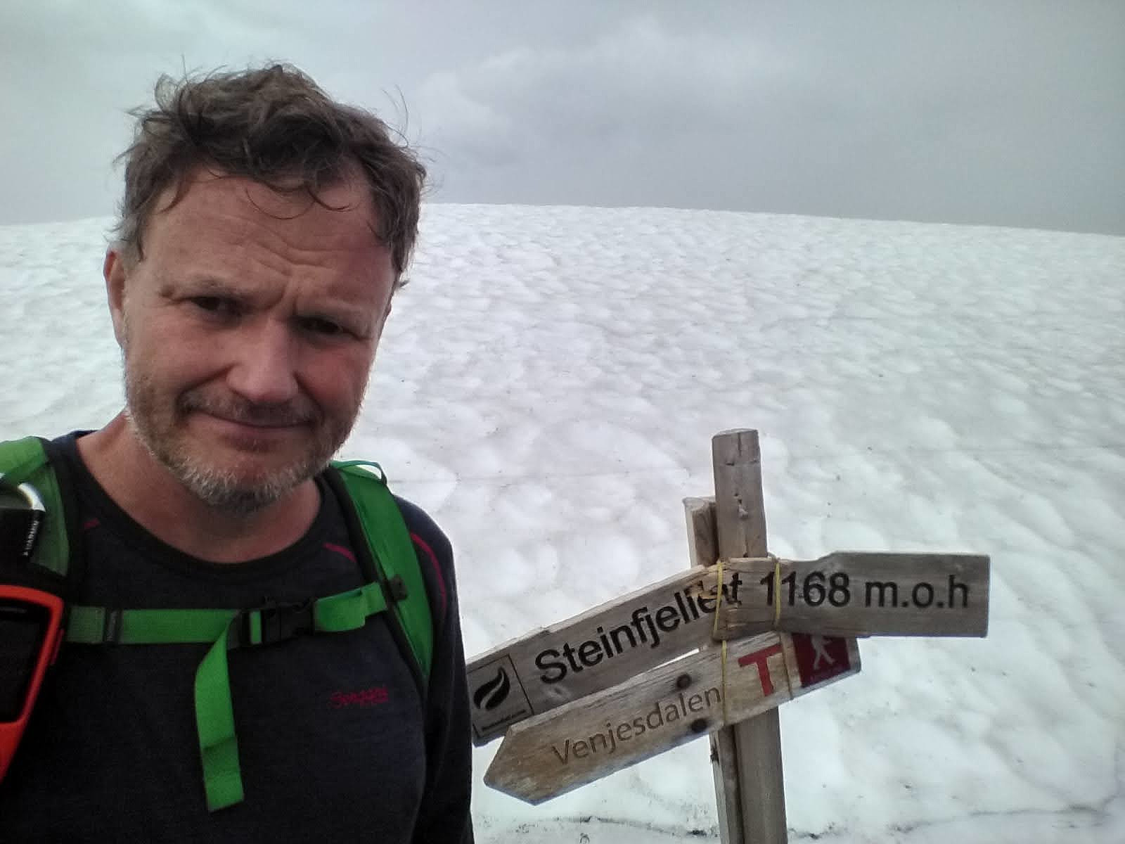
On top of Mount Mjølvafjellet we consumed the remaining food that we had brought with us, as well as most of what we had with us to drink. From here the route is mainly downhill. On our entire trip we hadn't met much people since we left Mount Litlefjellet, but here on Mount Mjølvafjellet we met a young couple that we came to talk with; and who asked us a lot about the mountains in the area. They were from a different part of Norway, but were genuinely interested in these mountains. After Mount Mjølvafjellet we continued towards the knolls of Høgaksla and Nesaksla (see map / Image #5). The ridge between Mount Mjølvafjellet and Høgaksla is again an edge-like mountain ridge (Image #30), and I believe this is the part of the mountain range that was originally termed Romsdalseggen [edge in Norwegian is egg, hence "Romsdalseggen" may be translated "The Edge of The Romsdal Valley"].
![Image #29: "Mjølvaskaret", the notch between Mount Mjølvafjellet and Mount Høgaksla. [m.o.h. is Norwegian for m.a.m.s.l.].](https://images1.peakbook.org/images/14939/Solan_20201117_5fb3ffe541957.jpg?p=xtralarge)
![Image #30: The part of the ridge originally termed "Romsdalseggen". This part of the ridge is common for all the Romsdalseggen routes [i.e. Extreme, Regular, and Light].](https://images1.peakbook.org/images/14939/Solan_20201117_5fb400904e95f.jpg?p=xtralarge)
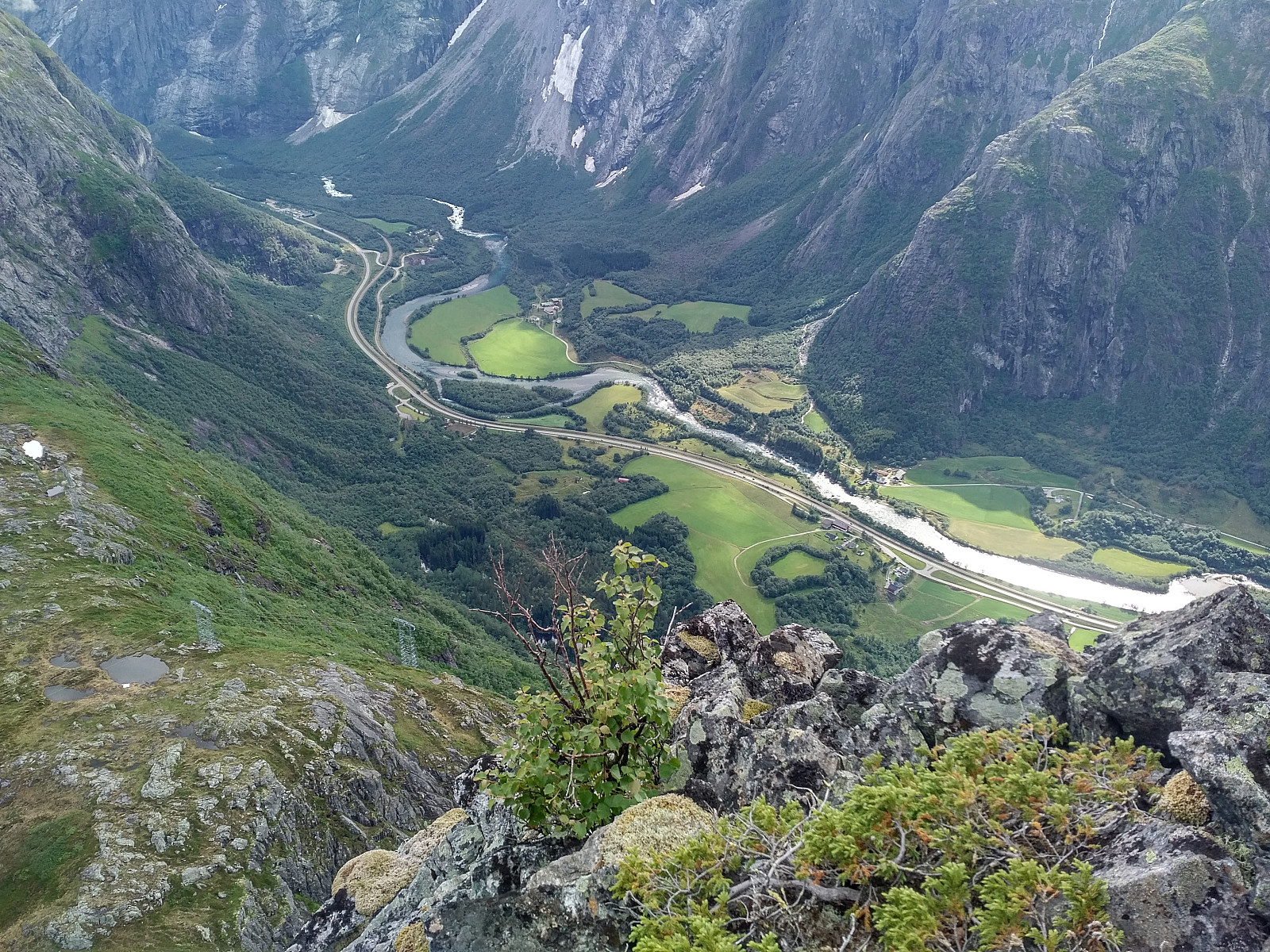
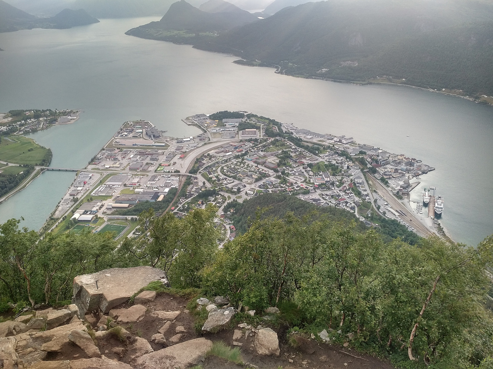
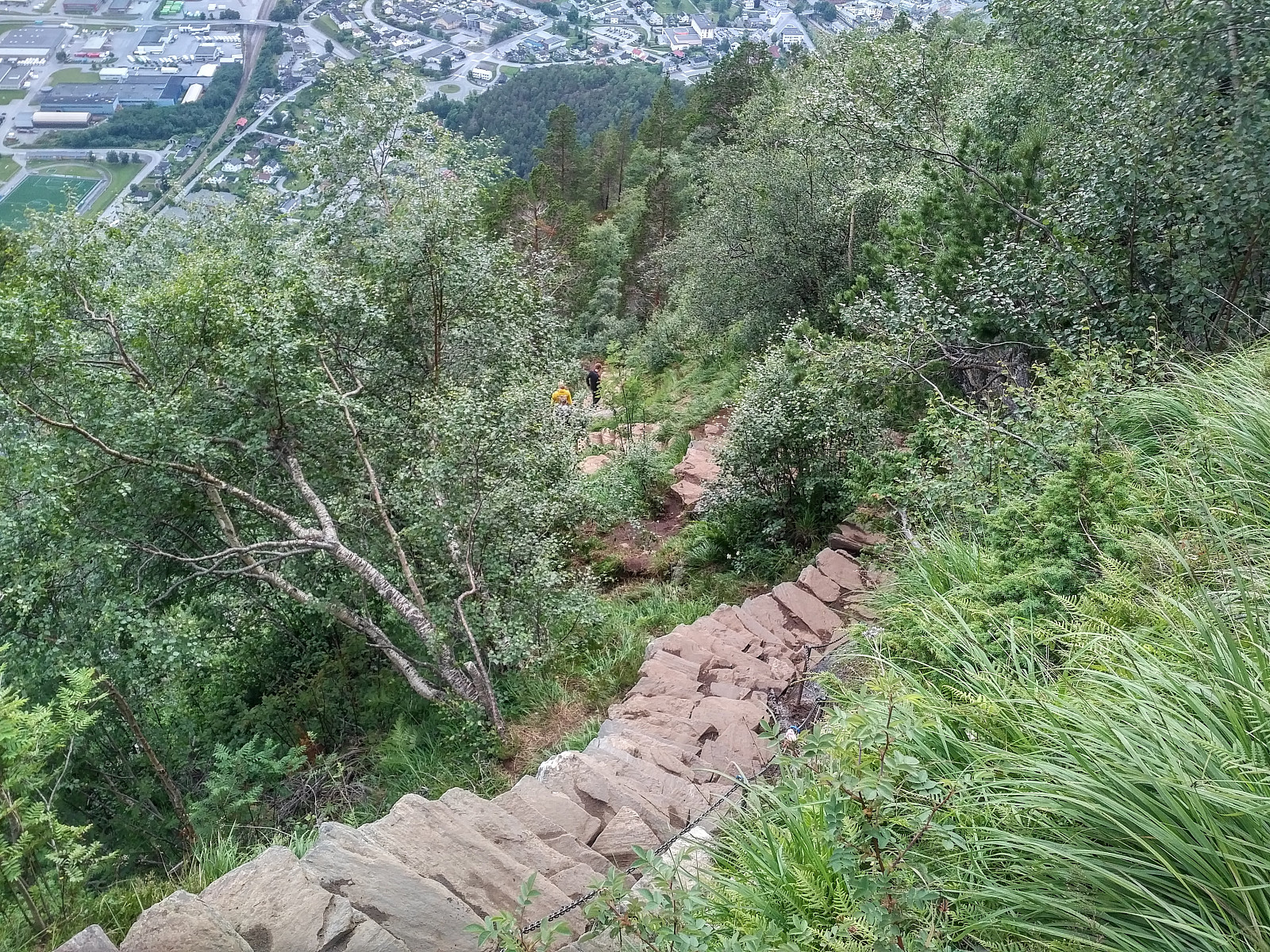
The descent from Nesaksla to the town of Åndalsnes is extremely beautiful (Image #33), with a number of viewpoints that are worth a short stop in order to admire the view. Quite a bit of the descent has been equipped with stone stairs (Image #34), as the trail down there usually becomes quite slippery whenever it's been raining; and there always tend to be a lot of tourists climbing from the town center up to Nesaksla in order to admire the view. As on previous occasions, we met a lot of people as we were descending along this part of our route; people eager to reach a viewpoint overlooking the town and the fjord, but no so eager to trek the entire length of on of the Romsdalseggen mountain routes. This was a special summer, however. During an ordinary summer, you would meet a lot of foreign tourists on Romsdalseggen and even more during the descent towards Åndalsnes. This year, however, the Covid-19 pandemic prevented most foreigners from entering our country, and most Norwegians from leaving the country; and so during this hike, the only tourists that we came across, were domestic tourists. [Due to privacy concerns, however, I've not included any photos of the camping people on Mount Litlefjellet, nor of all the people that we encountered during our descent towards Åndalsnes, but just photos of myself, my son, and the surrounding mountains].


User comments