
Brotavarden from Telavåg (14.03.2020)

Written by HHauser (Helwig Hauser)

| Start point | Telavåg (30m) |
|---|---|
| Endpoint | Telavåg (30m) |
| Characteristic | Hillwalk |
| Duration | 3h 30min |
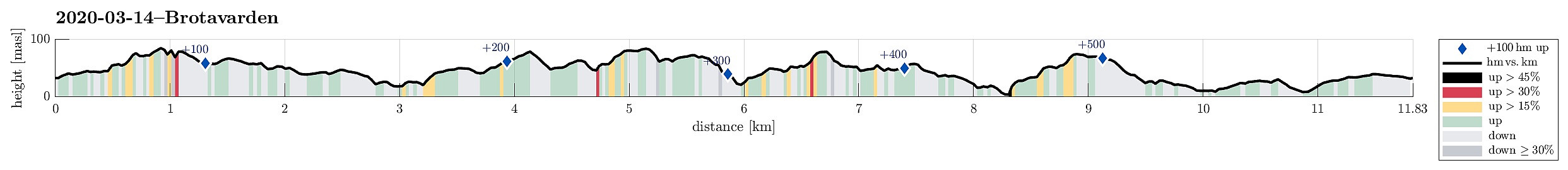
| Distance | 11.8km |
| Vertical meters | 578m |
| GPS |
|
| Ascents | Brotavarden (87m) | 14.03.2020 |
|---|---|---|
| Lynghovdo (80m) | 14.03.2020 | |
| Nipa (89m) | 14.03.2020 | |
| Nipa (81m) | 14.03.2020 | |
| Visits of other PBEs | Telavågvegen parkeringsplass (31m) | 14.03.2020 |
Trip Summary
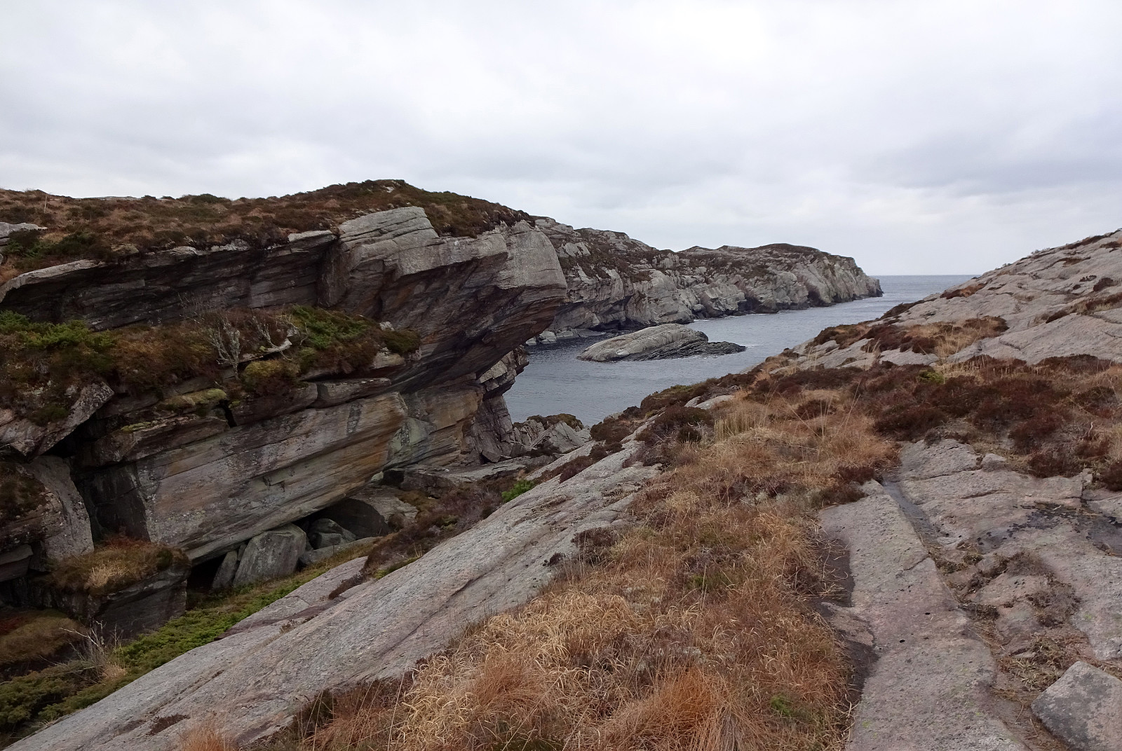
We really needed some fresh air (these times, you know) and since we were not really prepared for lots of snow and so, we decided to give the outer islands another try. After some consideration, Brotavarden was chosen as the hiking goal (with a start-point near Telavåg). We parked a few hundreds of meters before coming to Telavåg, near some soccer fields in the southeast of Telavåg. Just on the other side, we located the trail head and headed at once for our first intermediate goal, Nipa (in the east of Telavåg). Even though it's only a few meters up to the "top" of this cliff, one still has some nice views from there! Since winds were strong and temperatures were rather low, we did not stay there for any longer time, but continued (into the direction Brotavarden) immediately. The trail leads northwards from Nipa (up on the cliff) and in the west of Gåsavatnet. At Trollaneshaugen, one descends a bit, getting close to Søre Resavika (part of Litlekørelen). Only about 100m further north, one then crosses over some simple dam (from which Hjeltabekken springs down to Kørelen). On the other side, we were tempted to followed the marked trail upwards (and towards Heiane), instead of heading into the direction of Nordra Resavika. This trail lead us further northwards (in parallel to some slightly higher grounds in the west). It did not take long, before the temptation was big enough to leave the trail and head upwards to a little "top" southwest of Brotet. From there, one can find a minor trail that leads westwards (mostly, and after first descending to this little "top" in northern direction). Since Brotavarden was the main goal of this hike, however, we deviated from this minor trail and headed directly towards Brotavarden (quite OK, but no trail). At Brotavarden, we enjoyed some nice views (not at the least in northern direction), before we reconnected (near Liafjellet) with the trail that we had just left. Once back on this trail, we passed Søra Gullkjelda (in its south) in order to get closer to Nipa (another "Nipa"!). At the point, where the trail bends southwards, we then left this trail (once again) and headed for the "top" of Nipa. Also this excursion was quite easy to complete (but also here without any trail). From Nipa, we got back to the trail (more or less) on the same route that we had taken to Nipa. Back on the trail, we then headed for Nesvika and enjoyed the impressive and wild North Atlantic nature there. Once on the other (southern) side of Nesvika, and after ascending steeply through a narrow gully there, we turned left in order to connect to Lynghovdo. From there, it was then basically just a short hike back to Telavåg, passing by Krokavatnet, Kvernhaugen, and Kaldavatnet. From there, it was basically just back to the car along the road.
Photos
Selected photos are available as Google photo album.
Useful Resources
See also the related FB-page Hiking around Bergen, Norway.


User comments