
Gråsida from Gjelle to Hornaberg (08.09.2019)

Written by HHauser (Helwig Hauser)

| Start point | Gjelle (285m) |
|---|---|
| Endpoint | Hodnaberg parking (595m) |
| Characteristic | Hike |
| Duration | 6h 45min |
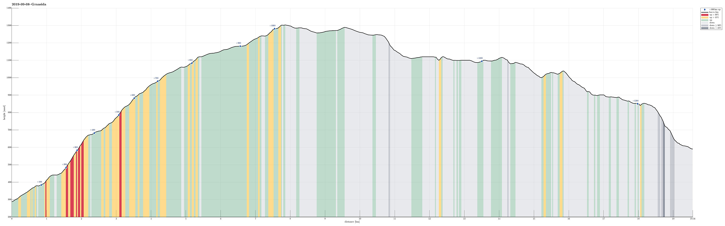
| Distance | 19.6km |
| Vertical meters | 1,211m |
| GPS |
|
| Ascents | Gråsidetoppen (1,309m) | 08.09.2019 |
|---|---|---|
| Visits of other PBEs | Hodnaberg p-plass (595m) | 08.09.2019 |
| Timaglaset (1,230m) | 08.09.2019 | |
| Torfinnsheim (893m) | 08.09.2019 |
Trip Summary
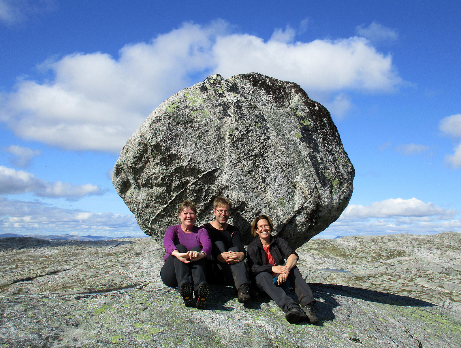
Expecting nice September weather, we planned for a slightly longer hike, crossing Gråsida near Voss from one side to the other. In order to arrange for this, we agreed to coordinate this hike with friends, who would do the same hike, but in the other direction. The idea was to then exchange car keys at the meeting point so that each party could pick up a car at the end of the hike and drive back to Bergen. Our direction meant to start at Gjelle (south of Vossavangen) and to cross Gråsida towards Hornaberget in Bergsdalen. According to the plan, our friends started at Hornaberget and aimed for Gjelle, where we had parked our car (we had first taken road #5394 from Vossavangen towards Gjernes, before then driving up Giljavegen until we parked at about 285mosl, where a gravel road starts into the direction of Florshaugen). After parking right next to Giljavegen, we started our hike by following this gravel road towards Florshaugen. Shortly after, before crossing over a little stream in the west of Florshaugen, we found the actual trail-head (to the left, leading in southern direction from the road). The trail is really well marked and completely straight-forward to find. It first leads upwards west of Hovden, before then following Tveitagrovi upwards to Roset at about 675mosl. This place (Roset) can be nice for a break, offering also some nice view down to Vossavangen. From there, the trail continues, first towards Rosetstølen, and then upwards in southwestern direction. At about 800mosl, one then passes the tree-line, ascending in western direction and next to a small but impressive cliff (on one left, southern side). At about 950mosl, one steps over to a flatter terrain, gently leading upwards into the direction of Sandfjellet (mostly in southern direction). Passing by a few nice little lakes, one gets to a point at about 1150mosl, where the "new trail" (via Gråsidetoppen) splits from the "old trail" (directly towards Timeglaset). Since we wished to include Gråsidetoppen, we continued along the "new trail". Shortly after, we arrived at Gråsidetoppen, which offers a nice view down to Voss and Vangsvatnet. After a short break at Gråsidetoppen, we continued in southwestern direction (towards Timeglaset). After a bit of further hiking, and at about 1280mosl, we reconnected with the "old trail" and not long after that we arrived at Timeglaset (a big rock that rests on a very small place, high above the valley). At Timeglaset, which is clearly worth visiting, we met our friends and we enjoyed a nice long break together. From there, we then continued along the marked trail (in northwestern direction), walking along (and eventually around) Torfinnsvatnet. After passing Kuslafjøra, the trail "finally" turned left and downwards. Shortly after, we arrived at Torfinnsheim (a cabin right next to Torfinnsvatnet). From Torfinnsheim it was then only a relatively short stretch down to Hornaberg.
Photos
Selected photos are available as Google photo album.
Useful Resources
See also the related FB-page Hiking around Bergen, Norway.
Web page UT.no from the Norwegian Trekking Association recommends the same hike, but from Hodnaberg to Gjelle.


User comments