
Narvtinden - English (24.08.2018)


Written by Skippy (Innika De Rosa)
| Start point | Mølnarodden (25m) |
|---|---|
| Endpoint | Mølnarodden (25m) |
| Characteristic | Hillwalk |
| Duration | 3h 30min |
| Distance | 8.0km |
| Vertical meters | 924m |
| GPS |
|
| Ascents | Narvtinden (688m) | 24.08.2018 |
|---|---|---|
| Narvtinden Østtoppen (677m) | 24.08.2018 | |
| Tekoppstetten (365m) | 24.08.2018 |
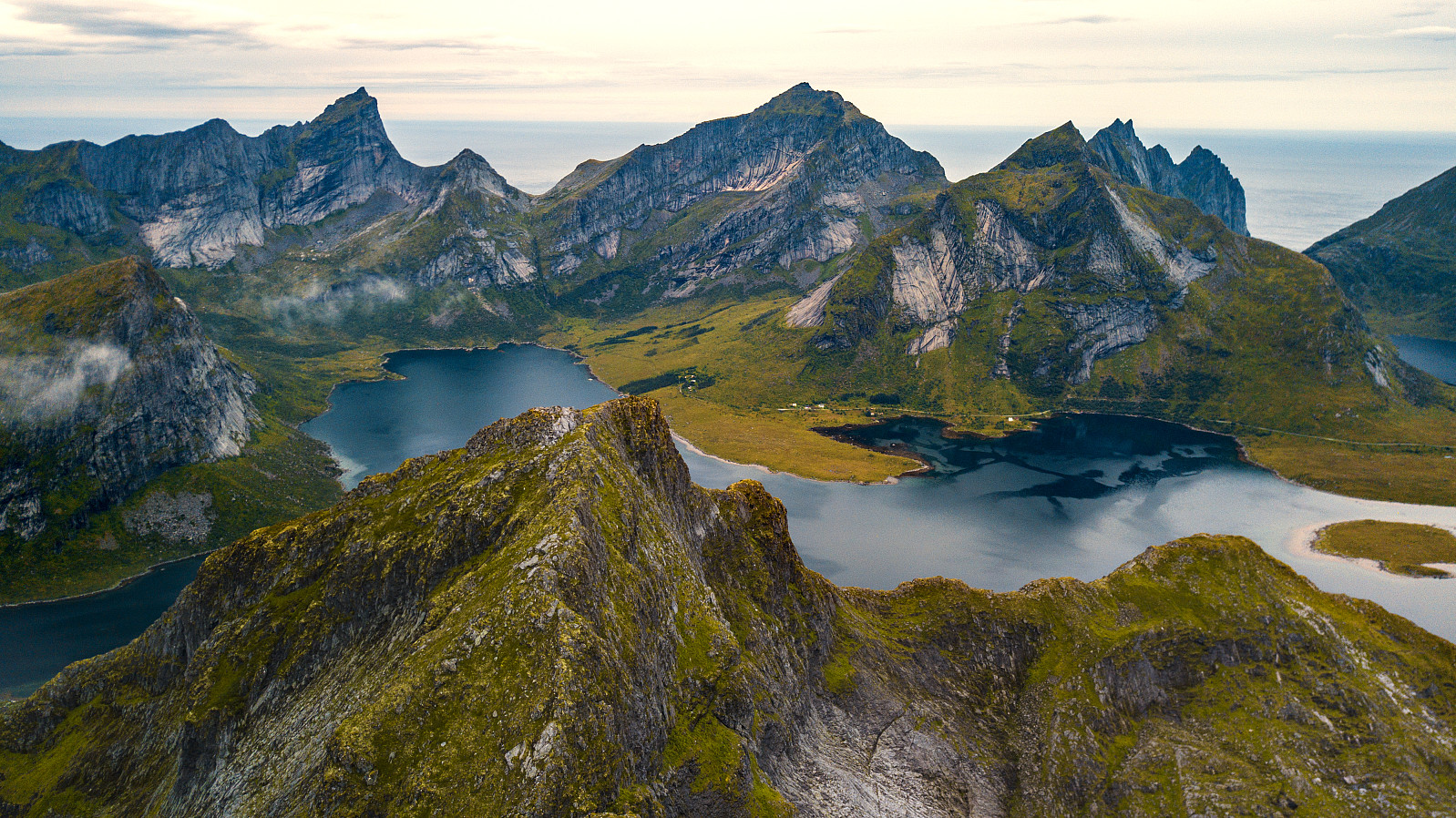
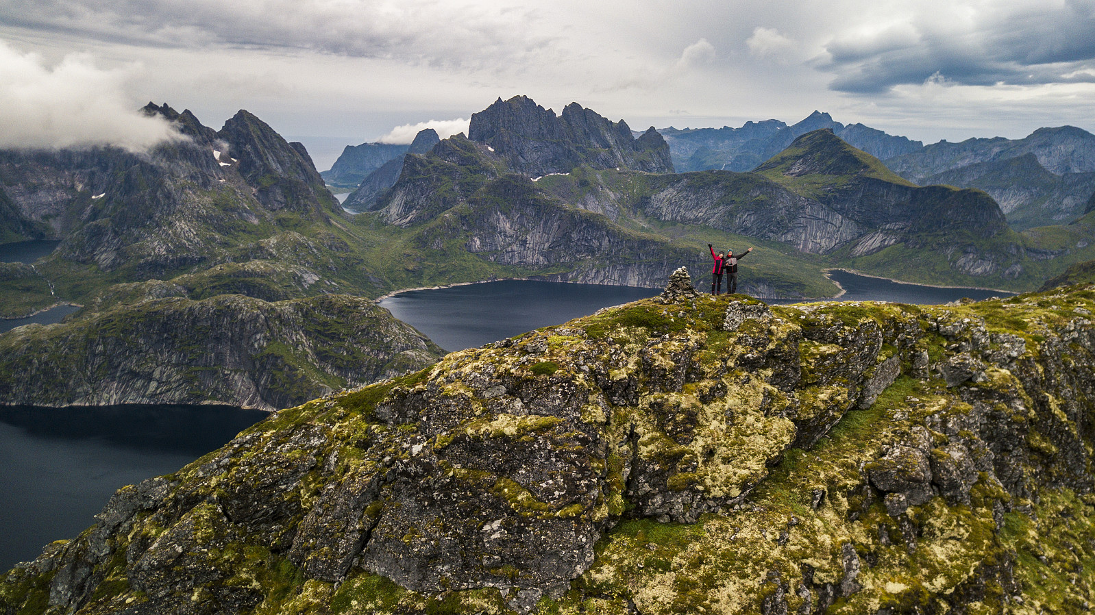
Another day of rainy weather in Lofoten, which meant a shorter and smaller trip. Narvtinden looks pretty cool from the road, so Paal decided he wanted to go.
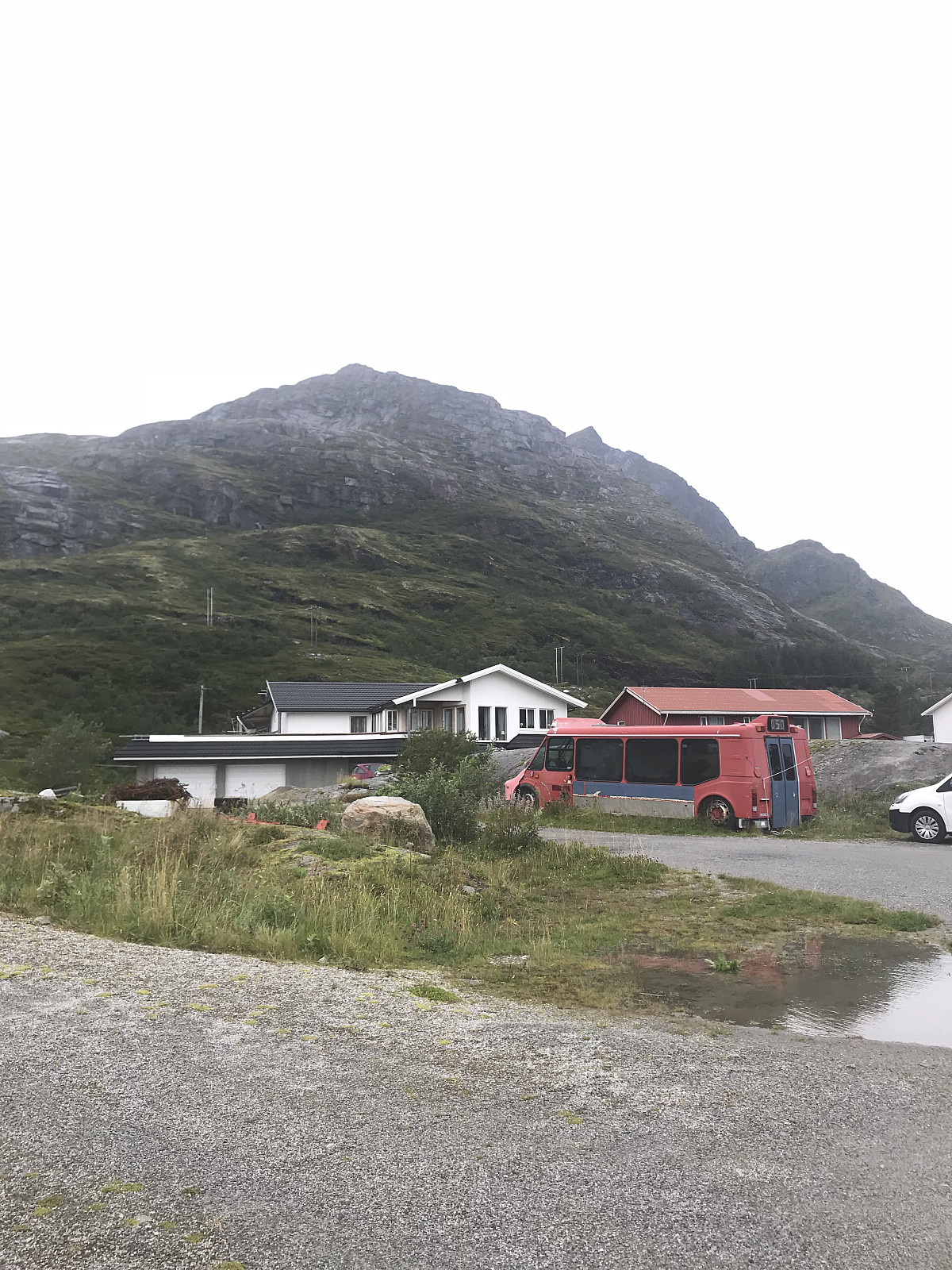
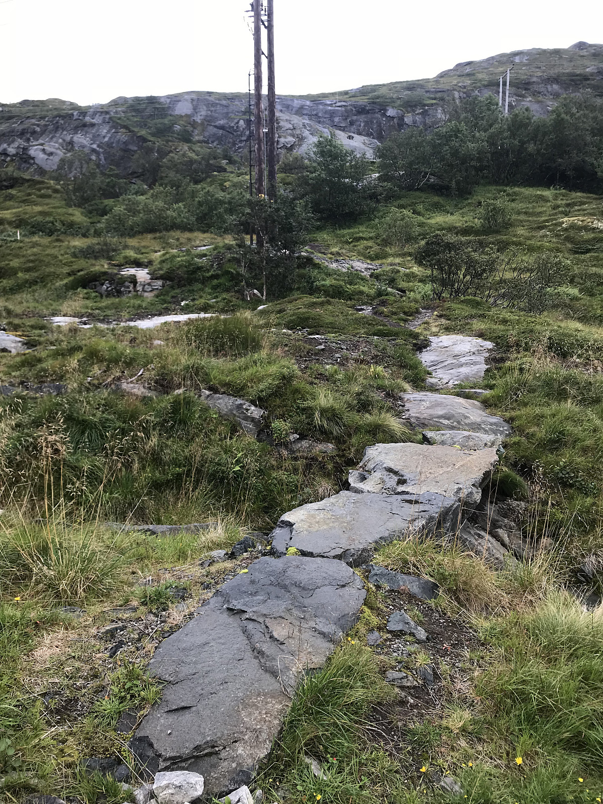
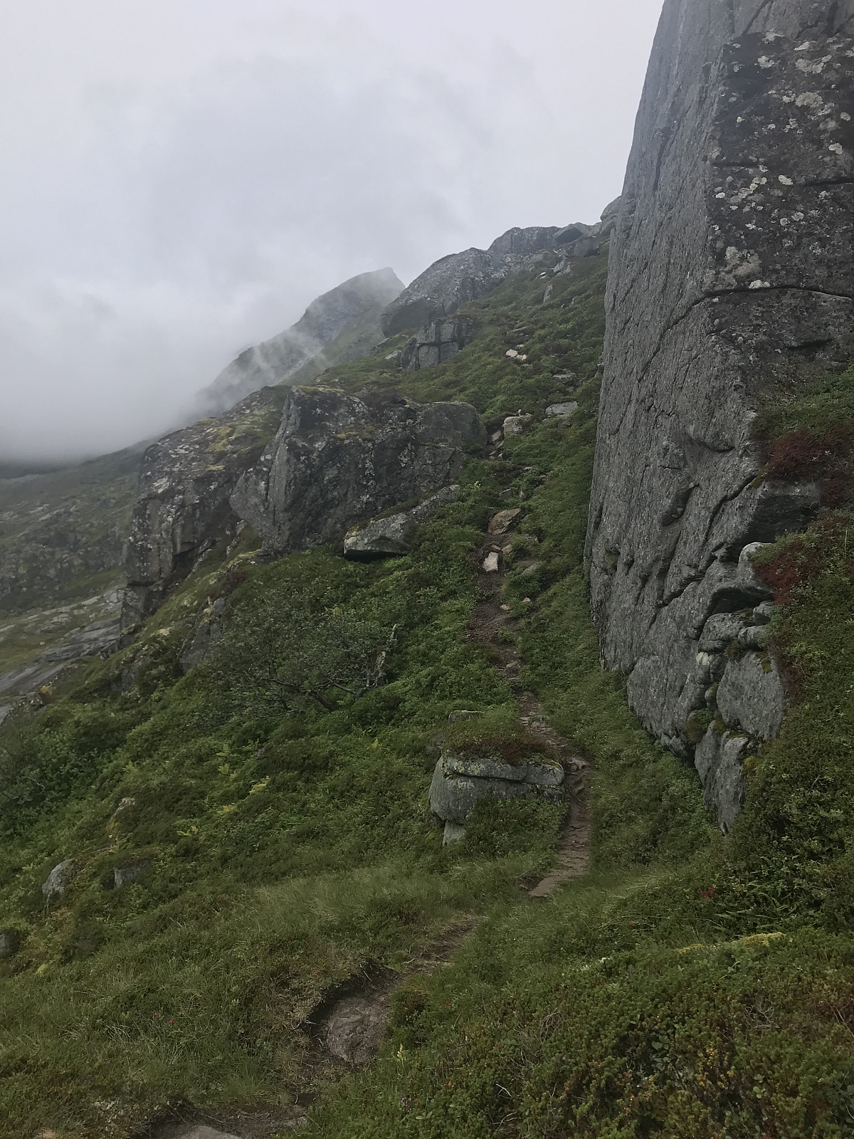
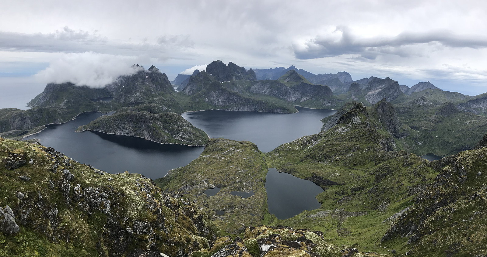
We parked behind a red Sammfunshus in Møllarodden and started heading up a gravel road. After 200m we took a right over a stone bridge and followed a nice, clear and easy to walk trail up the mountain. Lots of big Svaberg rocks which I like walking on. The path soon went to the left hand side of Tekoppstetten, where we got a clear view over to our goal. The path went down around 70m elevation before it started heading up the ridge. Still a really nice path to walk on, a few places with some small scrambling and soon we reached the østtoppen which was at 677m. We continued following the path along the ridge, losing about 30m elevation before the last climb to the top at 688m. Got an amazing view from the top in all directions! A lovely trip, it rained most of the way down but we were happy we got a few cloud free moments at the top.


User comments