
Visiting Die Wüste Mannersdorf (03.04.2005)

Written by HHauser (Helwig Hauser)

| Start point | Parking Die Wüste Mannersdorf (220m) |
|---|---|
| Endpoint | Parking Die Wüste Mannersdorf (220m) |
| Characteristic | Hike |
| Duration | 4h 00min |
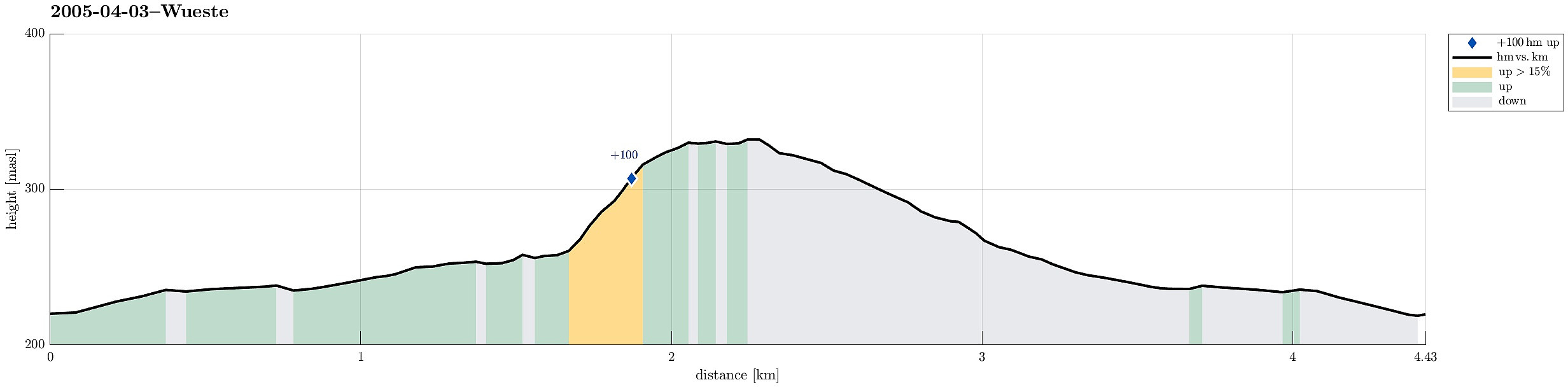
| Distance | 4.4km |
| Vertical meters | 129m |
| GPS |
|
| Visits of other PBEs | Ruine Scharfeneck (335m) | 03.04.2005 |
|---|
Trip Summary
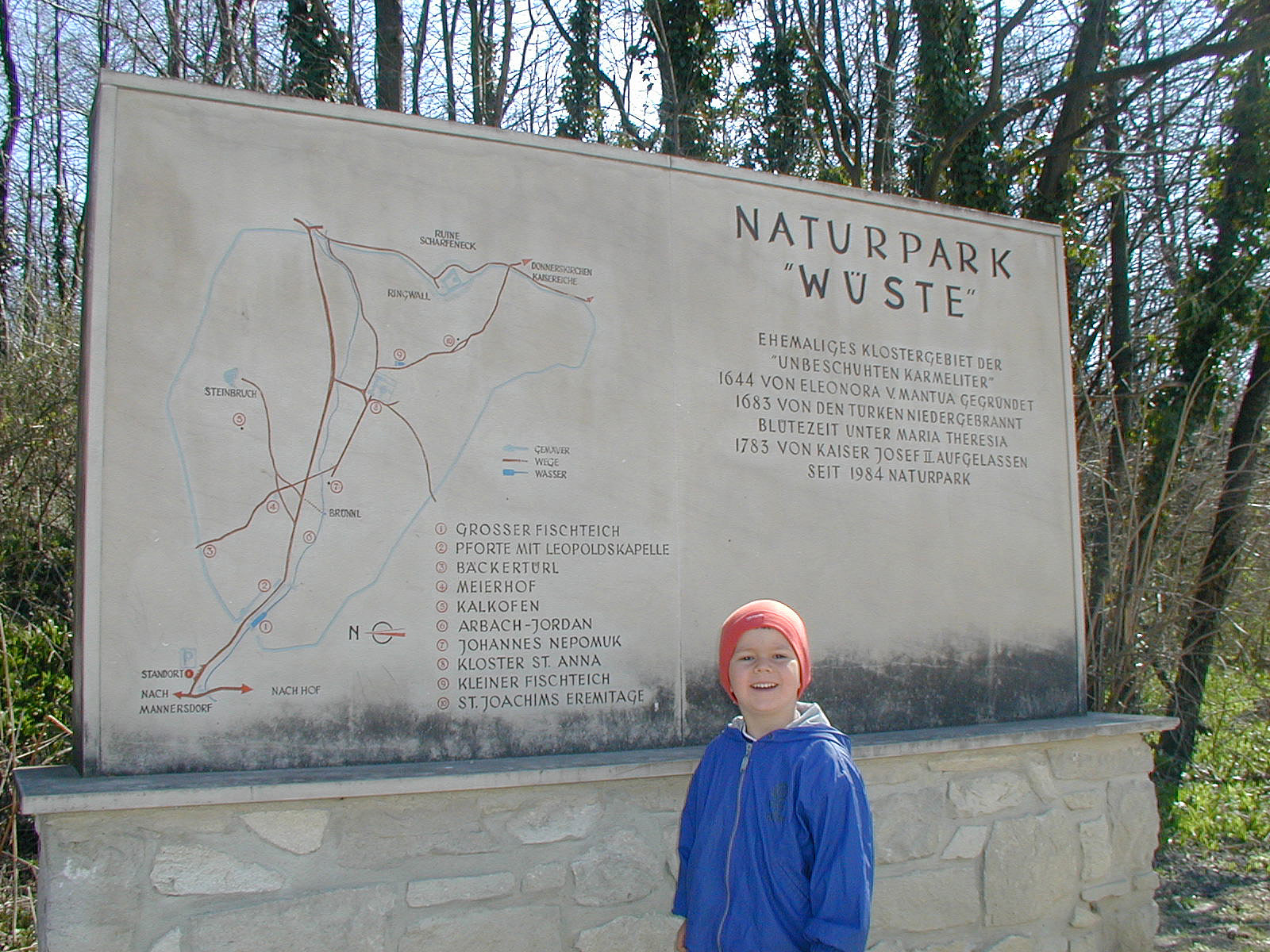
We took the car to the northwestern edge of Leithagebirge, between Mannersdorf and Hof am Leithaberge, where one find the entry point for the Wüste, a nice place to visit, in particular also with kids. We first walked into the area along the Arbach, finding the alley, which leads up to St. Anna in der Wüste, previously a monestary. After some good time there, we continued (again along the Arbach) to a point, from which we then ascended to Schlossberg with its impressive Ruine Scharfeneck on top. After exploring these ruins, we continued along the height in southern direction, before we turned right (back towards St. Anna). On the way back, we also came by the Joachim Eremitage. Eventually, we returned to the car, passing by St. Anna in der Wüste once again. This place, Die Wüste Mannersdorf, really is recommended as a nice excursion goal, also for an easy one-day trip from Vienna.
Useful Resources
More about the Wüste on their web page.
See also the related FB-page Hiking around Bergen, Norway.


User comments