
Winter excursion to Höllenstein (25.12.2006)

Written by HHauser (Helwig Hauser)

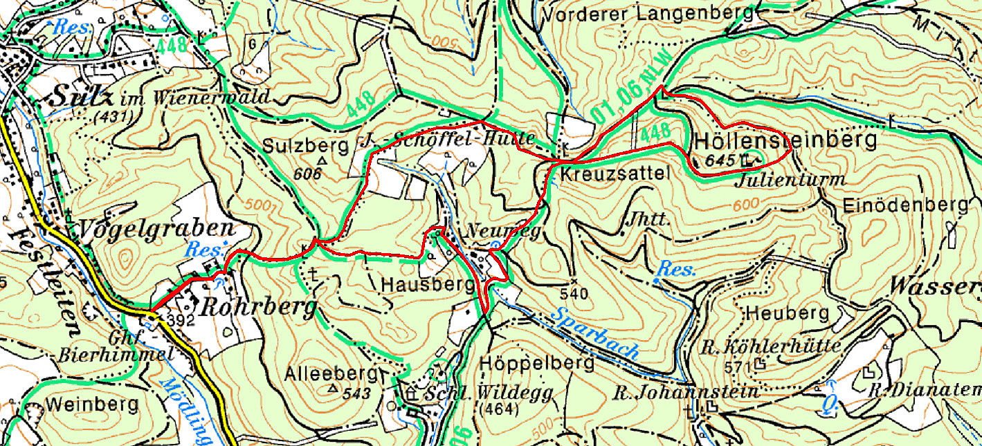
| Start point | Rohrberg (400m) |
|---|---|
| Endpoint | Rohrberg (400m) |
| Characteristic | Hillwalk |
| Duration | 3h 00min |
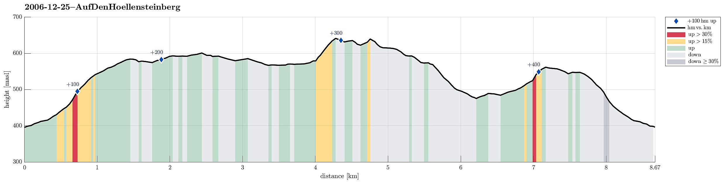
| Distance | 8.7km |
| Vertical meters | 420m |
| GPS |
|
| Ascents | Höllenstein (645m) | 25.12.2006 |
|---|
Trip Summary
This time, we started from Rohrberg and headed eastwards towards Höllensteinberg. In nice winter weather, we ascended to the heights around J.-Schöffel-Hütte and continued via Kreuzsattel towards Höllensteinberg. Instead of directly ascending to its top right away, we first surrounded it and got up to the top from the east. We then continued in western direction, making use of some simple sledges that we had brought along (this turned out to be way more dangerous than anticipated, due to the steep descent from Höllenstein!). After having returned to Kreuzsattel, we followed the Nordalpenweg down into the direction of Sittendorf/Wildegg. Once we were down to the Sparbach, we crossed it and ascended again (via Hausberg) into order to get over and back to Rohrberg.
Useful Resources
See also the related FB-page Hiking around Bergen, Norway.


User comments