
Biking across the Alps 2.3: Döllach-Taxenbach (14.08.1997)

Written by HHauser (Helwig Hauser)

| Start point | Döllach (1,090m) |
|---|---|
| Endpoint | Taxenbach (765m) |
| Characteristic | Bike trip |
| Duration | 11h 30min |
| Distance | 68.3km |
| Vertical meters | 2,402m |
| GPS |
|
| Visits of other PBEs | Kasereck (1,913m) | 14.08.1997 |
|---|---|---|
| Parking Fuscher Törl (2,428m) | 14.08.1997 | |
| Parking Hochtor S (2,504m) | 14.08.1997 |
Trip Summary
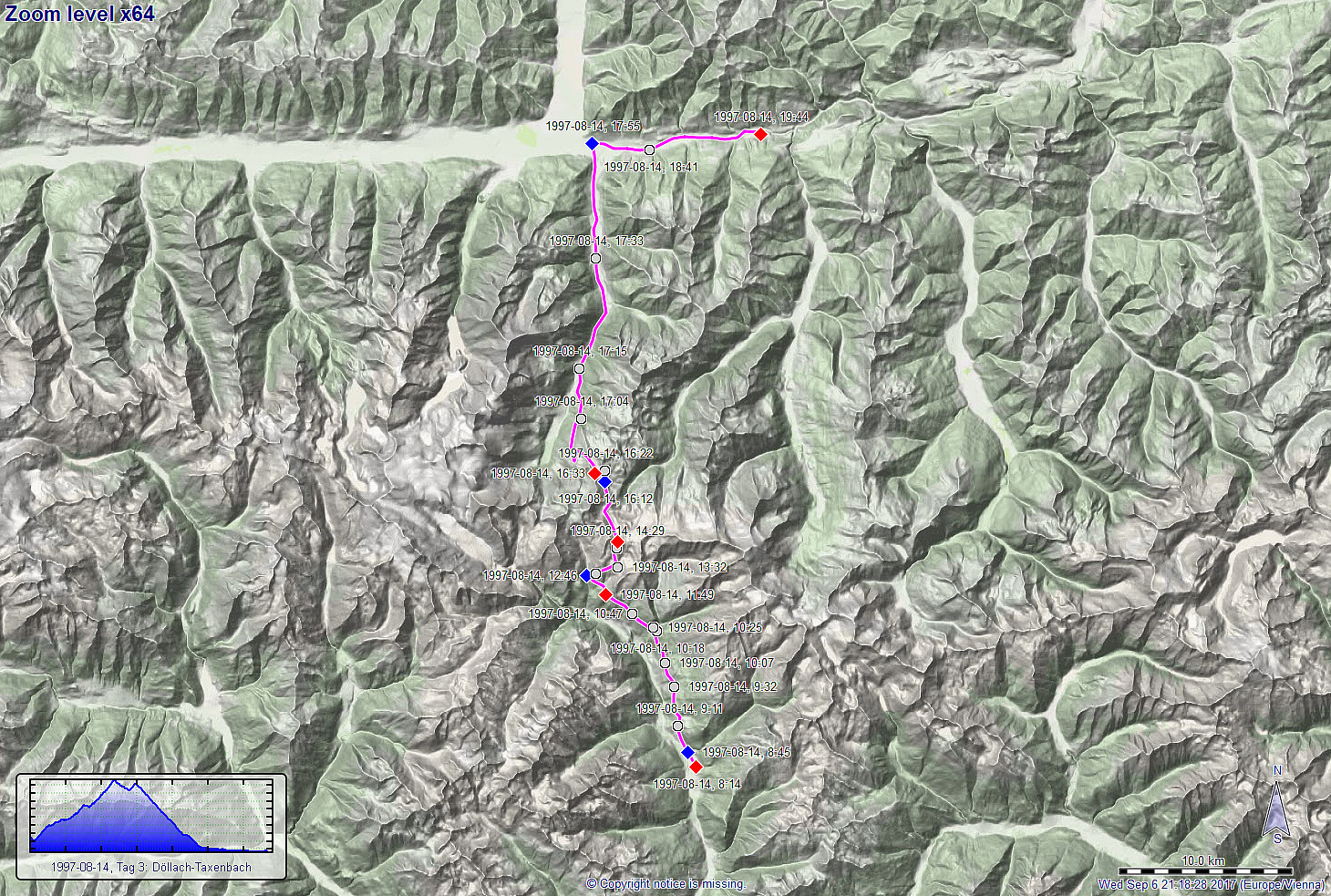
The third day of this multi-day bike trip across the Alps should be our big day, cycling the Glockner Hochalpenstrasse up to about 2500mosl! We started from Döllach and decided to take the Apriacher Höhenstrasse (on the eastern side of the valley and quite high up as compared to the lowest points in the valley, even though this meant to cut short a stretch through Heiligenblut, almost a must-see on this trip. Cycling high above the deep Möll-valley, however, provided us with great views already early in the morning and we enjoyed it already then very much! :-) After about 12km of cycling (and about +500hm up), we connected back to the main street, there coming up from Heiligenblut lying further west and down in the valley. With this, we were on this magnificent mountain road, the Glockner Hochalpenstrasse, which not only is a master piece of road engineering, but also a fantastic opportunity to get high up into the Alps with tremendous views in many directions! With breaks, etc., we it then took us about 4.5 hours to get up to the high-point (Hochtor, 2504mosl), i.e., another 1000hm up! What an amazing experience (very demanding, of course, especially, since we carried all our luggage with us, but then extraordinarily rewarding with fantastic views and an intense and wonderful mountain-experience). At Hochtor, after all, we did not break for long, since the temperatures were low and we wet from the long ascent. Thus, we continued right away through the tunnel at Hochtor and through the little ditch right after it, before we ascended to the second pass on this road, Fuschertörl (2428mosl). From there, we then started our long and exciting trip down into the valley of the Fuscherache. An important lesson learnt was that regular bikes are not built for velocities over 80km/h, getting unpleasantly unstable and difficult to handle. Clearly something that should be avoided, when risks are to be minimized. Once down at the bottom of the valley, the street became less steep, and biking out the long valley to Bruck an der Glocknerstrasse (already in the Salzach-valley then!), we nice and pleasant. Once in the Salzach-valley, we only continued for a few additional kilometers until we found a place for the night near Taxenbach. What a day?! Great! :-)
Tour Info
More details about the entire bike-trip are available via a separate web page.
Useful Resources
Route details about four longer bike rides in/near the Alps are summarized on a separate web page.
See also the related FB-page Hiking around Bergen, Norway.


User comments