
Gullaksdalen from Loddefjord (07.01.2017)

Written by HHauser (Helwig Hauser)

| Start point | Frieda Fasmers vei (55m) |
|---|---|
| Endpoint | Frieda Fasmers vei (55m) |
| Characteristic | Hike |
| Duration | 2h 00min |
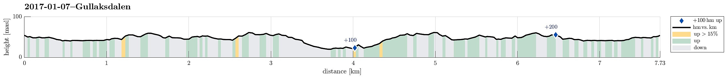
| Distance | 7.7km |
| Vertical meters | 225m |
| GPS |
|
| Visits of other PBEs | Gullaksdalen (23m) | 07.01.2017 |
|---|---|---|
| Gullaksgrind (22m) | 07.01.2017 | |
| Slettebakksmyren (42m) | 07.01.2017 | |
| Storemyren (32m) | 07.01.2017 |
Trip Summary
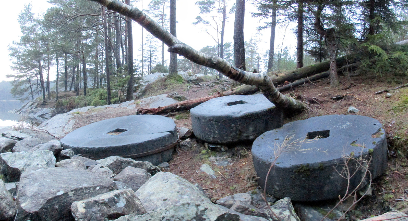
We parked in Frieda Fasmers vei, near Loddefjord, and started in parallel to the highway, rounding Storavatnet on its northern side. Where road 555 enters Harafjelltunnelen, we followed a major gravel road that turns southwards and leads to a place called Slettebakksmyra. There, at two points, other gravel roads depart from the one we took (at the first junction, we continued straight ahead and at the second, we turned left and upwards, following a sign to Gullaksdalen). We then continued on the gravel road until it ends. There, one can read about the history of Gullaksdalen. We then continued a few meters further, reaching a nice place with great view of Småvatnet. Only meters from there, we could see some of the historic ruins, which were described on the information board at the end of the gravel road. Since daylight was about to cease, we turned around there and walked back the samy road. All in all, this was a very enjoyable evening hike and that perfectly flat waters provided impressive sights! :-)
Photos
Selected photos are available as |Google photo album.
Useful Resources
See also the related FB-page Hiking around Bergen, Norway.
On web page Gullaksdalen detailed information about Gullaksdalen is provided.


User comments