
Ulriken via Isdalen (14.05.2016)

Written by HHauser (Helwig Hauser)

| Start point | Svartediket dam (65m) |
|---|---|
| Endpoint | Svartediket dam (65m) |
| Characteristic | Hillwalk |
| Duration | 3h 30min |
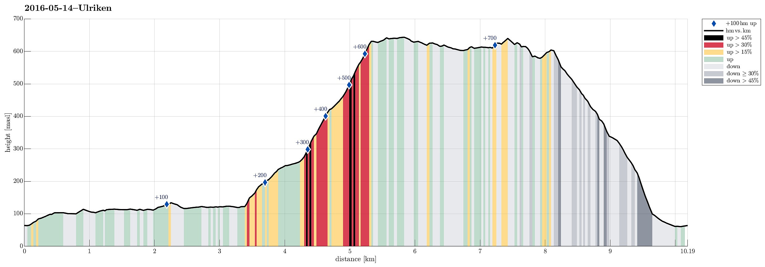
| Distance | 10.2km |
| Vertical meters | 768m |
| GPS |
|
| Ascents | Ulriken (643m) | 14.05.2016 |
|---|---|---|
| Ulriken Vest (607m) | 14.05.2016 | |
| Visits of other PBEs | Fort Williams (ruin), Ulriken (635m) | 14.05.2016 |
| Lappen p-plass (60m) | 14.05.2016 | |
| Nødkjelke ved Arken (605m) | 14.05.2016 | |
| Nødkjelke, Ulriken (586m) | 14.05.2016 | |
| Solhaugen søyle (107m) | 14.05.2016 | |
| Ulvehylet (611m) | 14.05.2016 | |
| Vardebu (619m) | 14.05.2016 |
Trip Summary
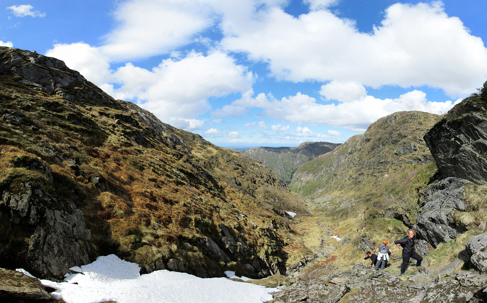
We parked right next to the big dam that holds Svartediket back and started walking along the northern side of Svartediket from there. Instead of following the main trail (up to the left) at the end of Svartediket, we continued along Tarlebøveien, crossing a small stream at the very back of the valley and turning right (in southern direction) there. Following the forrest road further, one starts to circle around Svartediket. After a short stretch, one comes to another small bridge, which crosses the stream that jumps down through Isdalen. Right there, not very well visible, though, one needs to turn left (steeply up) and find the trail that then continues through Isdalen. While the trail head (next to the bridge) is not easy to see, the path then becomes very well visible and easy to find. The hike up Isdalen is very nice with views towards Ulriken, also (not the very top of Ulriken, though). Half way up, one sees Høkerfossen to the right, while the path continues to the left and up into Trolldalen. Once one comes close to Vidden, the path flattens out a little. At Vidden, we followed the main tail towards Ulriken, but ascended to Ulrikstoppen before actually getting to the upper station of Ulriksbanen. From there, several different paths lead down towards Bergen. To return to Svartediket, one can first go along Langrinden, before turning right and then proceeding towards Bjørndalen. The lower end of Bjørndalen is then only meters away from the parking underneath the dam. So near to the city center of Bergen, Ulriken provides wonderful opportunities for hiking (and several quite different routes, too)---that's nice! :-)
Photos
Selected photos are available as Google photo album.
Useful Resources
See also the related FB-page Hiking around Bergen, Norway.
Web page WestCoastPeaks.com provides useful information about Haugavarden, Ulriken, Storfjellet, and Landåsfjellet
and also Petter Bjørstad has a useful page about Ulriken.
Web page UT.no from the Norwegian Trekking Association recommends a similar hike up via Isdalen.


User comments