
Reppadalen (28.07.2012)

Written by HHauser (Helwig Hauser)

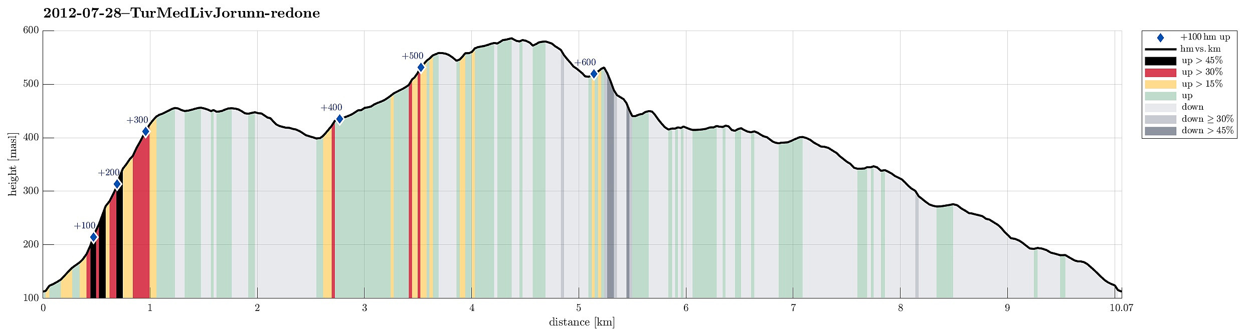
| Start point | Arna (115m) |
|---|---|
| Endpoint | Arna (115m) |
| Characteristic | Hillwalk |
| Duration | 4h 00min |
| Distance | 10.1km |
| Vertical meters | 682m |
| GPS |
|
| Ascents | Storhaugen (567m) | 28.07.2012 |
|---|---|---|
| Ådnanipa (456m) | 28.07.2012 | |
| Åsheimsvarden (459m) | 28.07.2012 | |
| Visits of other PBEs | Einhovden (272m) | 28.07.2012 |

Note that this track has been created a posteriori, i.e., from memory, not automatically recorded.
Trip Summary
Very nice hike to Reppadalen! :-)
Photos
Selected photos are available as Google+ photo album.


User comments