
Orrehaugane (27.12.2014)

Written by HHauser (Helwig Hauser)

| Start point | Nattlandsfjellet (225m) |
|---|---|
| Endpoint | Nattlandsfjellet (225m) |
| Characteristic | Hillwalk |
| Duration | 1h 45min |
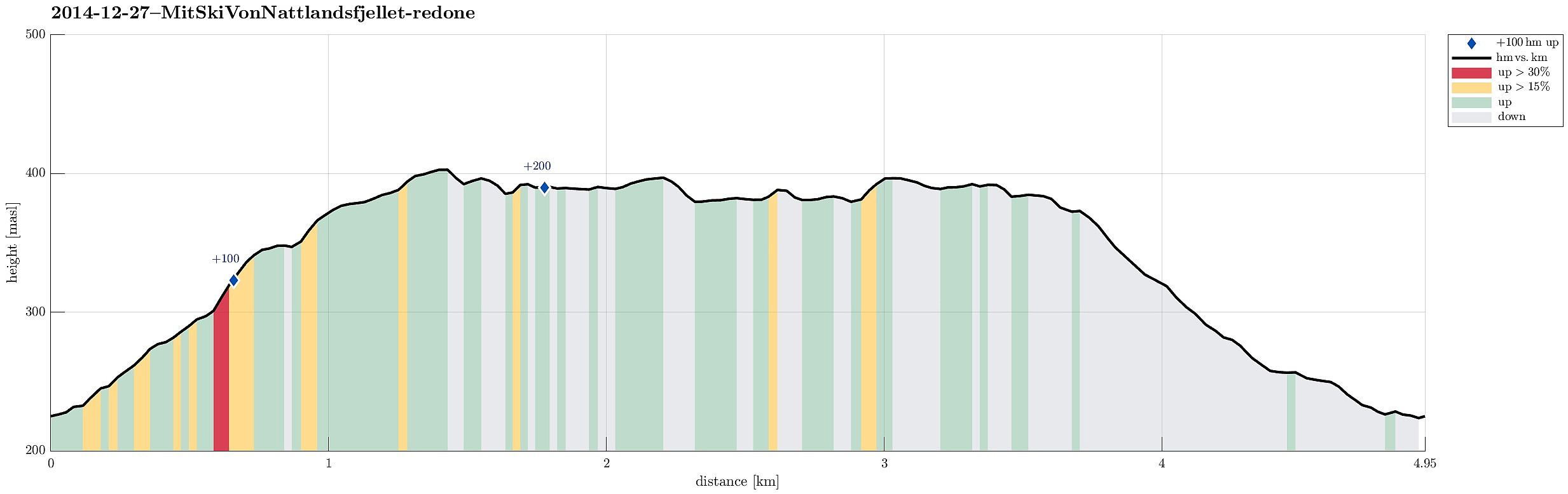
| Distance | 4.9km |
| Vertical meters | 267m |
| GPS |
|
| Ascents | Orrehaugane (415m) | 27.12.2014 |
|---|---|---|
| Visits of other PBEs | Midt i Bergen (380m) | 27.12.2014 |
| Berlehytten (ruin) (378m) | 27.12.2014 | |
| Bryterhytten (tuft) (399m) | 27.12.2014 | |
| Fjellro (tuft) (387m) | 27.12.2014 | |
| Fjelly (ruin), Landåsfjellet (325m) | 27.12.2014 | |
| Helgely (264m) | 27.12.2014 | |
| Klippen (tuft) (395m) | 27.12.2014 | |
| Nordre Nattlandsfjellet p-plass (230m) | 27.12.2014 |
Note that this track has been created a posteriori, i.e., from memory, not automatically recorded.
Trip Summary
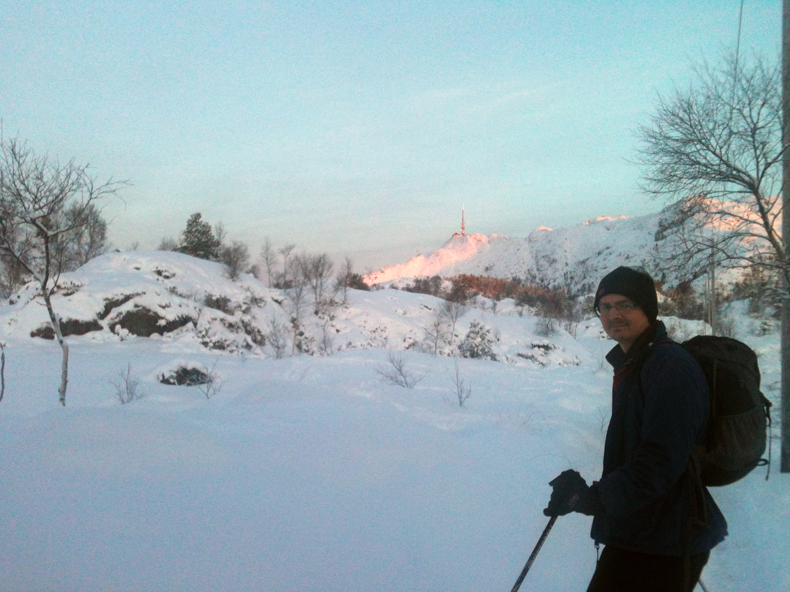
Starting from Nattlandsfjellet, we first hiked up to Orrehaugane, mostly carrying our skies. Then, when meeting the main trail (also up from Nattlandsfjellet), we continued mostly on skies (also back to Nattlandsfjellet on the main trail).
Useful Resources
Web page WestCoastPeaks.com provides useful information about Haugavarden, Ulriken, Storfjellet, and Landåsfjellet
and also Petter Bjørstad has a useful page about Ulriken.


User comments