
Jogging around Sælenvatnet (30.12.2012)

Written by HHauser (Helwig Hauser)

| Start point | Einerhaugen (45m) |
|---|---|
| Endpoint | Einerhaugen (45m) |
| Characteristic | Jogging |
| Duration | 1h 00min |
| Distance | 8.5km |
| Vertical meters | 286m |
| GPS |
|
| Visits of other PBEs | Bøneshallen p-plass (110m) | 30.12.2012 |
|---|
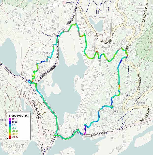
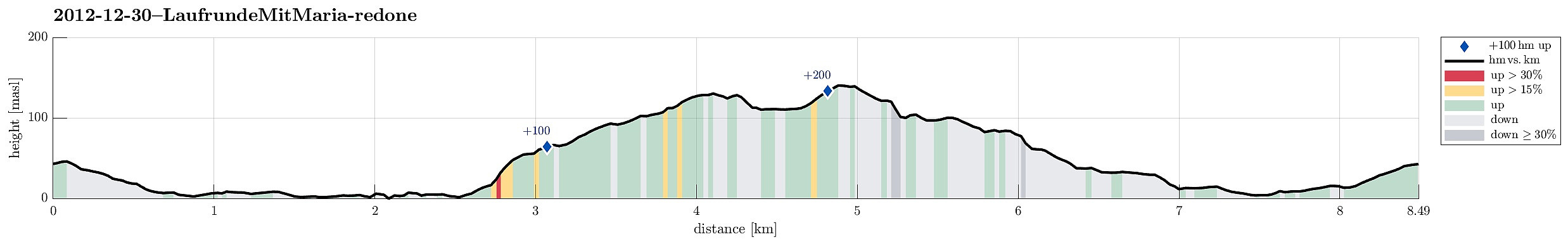
Note that this track has been created a posteriori, i.e., from memory, not automatically recorded.
Trip Summary
End-of-the-year jogging around Sælenvatnet. :-)


User comments